|
Sanday, Orkney
Sanday (, ) is one of the inhabited islands of Orkney that lies off the north coast of mainland Scotland. With an area of , it is the third largest of the Orkney Islands.Haswell-Smith (2004) p. 334. The main centres of population are Lady Village and Kettletoft. Sanday can be reached by Orkney Ferries or by plane ( Sanday Airport) from Kirkwall on the Orkney Mainland. On Sanday, an on-demand public minibus service allows connecting to the ferry. Etymology The Picts were the pre-Norse inhabitants of Sanday but very few placenames remain from this period. The Norse named the island or because of the predominance of sandy beaches and this became "Sanday" during the Scots- and English-speaking periods. The similarly named Sandoy is in the Faroe Islands. Many names of places and natural features derive from Old Norse. According to Dorward (1995), the placename ''Kettletoft'' means ' Kettil's croft' although ''toft'' in this context may mean 'abandoned site of house' from the ... [...More Info...] [...Related Items...] OR: [Wikipedia] [Google] [Baidu] |
Kettletoft
Kettletoft is a settlement on the island of Sanday, Orkney, Sanday in Orkney, Scotland. The B roads in Zone 9 of the Great Britain numbering scheme, B9068 road runs from Kettletoft to Scar, Orkney, Scar and the B9069 from Kettletoft to Northwall. Kettletoft pier, including the slipway, is a List of listed buildings in Cross And Burness, Orkney, B listed building and was inscribed on 16 September 1999. Notes Villages in Orkney Sanday, Orkney {{Orkney-geo-stub ... [...More Info...] [...Related Items...] OR: [Wikipedia] [Google] [Baidu] |
Eday
Eday (, ) is one of the islands of Orkney, which are located to the north of the Scottish mainland. One of the North Isles, Eday is about from the Orkney Mainland. With an area of , it is the ninth-largest island of the archipelago. The bedrock of the island is Old Red Sandstone, which is exposed along the sea-cliffs. There are various well-preserved Neolithic tombs, as well as evidence of Bronze Age settlement and the remains of a Norse-era castle. During the period of Scottish rule the substantial property of Carrick House was developed at Calfsound, which became a burgh for a short period. During the British era many agricultural improvements were introduced, although there has been a substantial decline in the population since the mid-nineteenth century. In the twenty-first century the Eday Partnership has had success in promoting the island's economy. Local placenames reflect the diverse linguistic heritage and the landscapes of the island and its surrounding seas attr ... [...More Info...] [...Related Items...] OR: [Wikipedia] [Google] [Baidu] |
Special Protection Area
A special protection area (SPA) is a designation under the European Union Directive on the Conservation of Wild Birds. Under the Directive, Member States of the European Union (EU) have a duty to safeguard the habitats of migratory birds and certain particularly threatened birds. Together with special areas of conservation (SACs), the SPAs form a network of protected sites across the EU, called Natura 2000. Each SPA has an EU code – for example the North Norfolk Coast SPA has the code ''UK9009031''. In the United Kingdom As at 21 September 2006, there were 252 classified SPAs and 12 proposed SPAs in England, Scotland, Wales and Northern Ireland. The Conservation (Natural Habitats etc.) Regulations 1994 implement the terms of the Directive in Scotland, England and Wales. In Great Britain, SPAs (and SACs) designated on land or in the intertidal area are normally also notified as Sites of Special Scientific Interest (SSSIs), and in Northern Ireland as Areas of Special Scientif ... [...More Info...] [...Related Items...] OR: [Wikipedia] [Google] [Baidu] |
SSSI
A Site of Special Scientific Interest (SSSI) in Great Britain, or an Area of Special Scientific Interest (ASSI) in the Isle of Man and Northern Ireland, is a conservation designation denoting a protected area in the United Kingdom and Isle of Man. SSSI/ASSIs are the basic building block of site-based nature conservation legislation and most other legal nature/geological conservation designations in the United Kingdom are based upon them, including national nature reserves, Ramsar sites, Special Protection Areas, and Special Areas of Conservation. The acronym "SSSI" is often pronounced "triple-S I". Selection and conservation Sites notified for their biological interest are known as Biological SSSIs (or ASSIs), and those notified for geological or physiographic interest are Geological SSSIs (or ASSIs). Sites may be divided into management units, with some areas including units that are noted for both biological and geological interest. Biological Biological SSSI/ASSIs ma ... [...More Info...] [...Related Items...] OR: [Wikipedia] [Google] [Baidu] |
Eurasian Otter
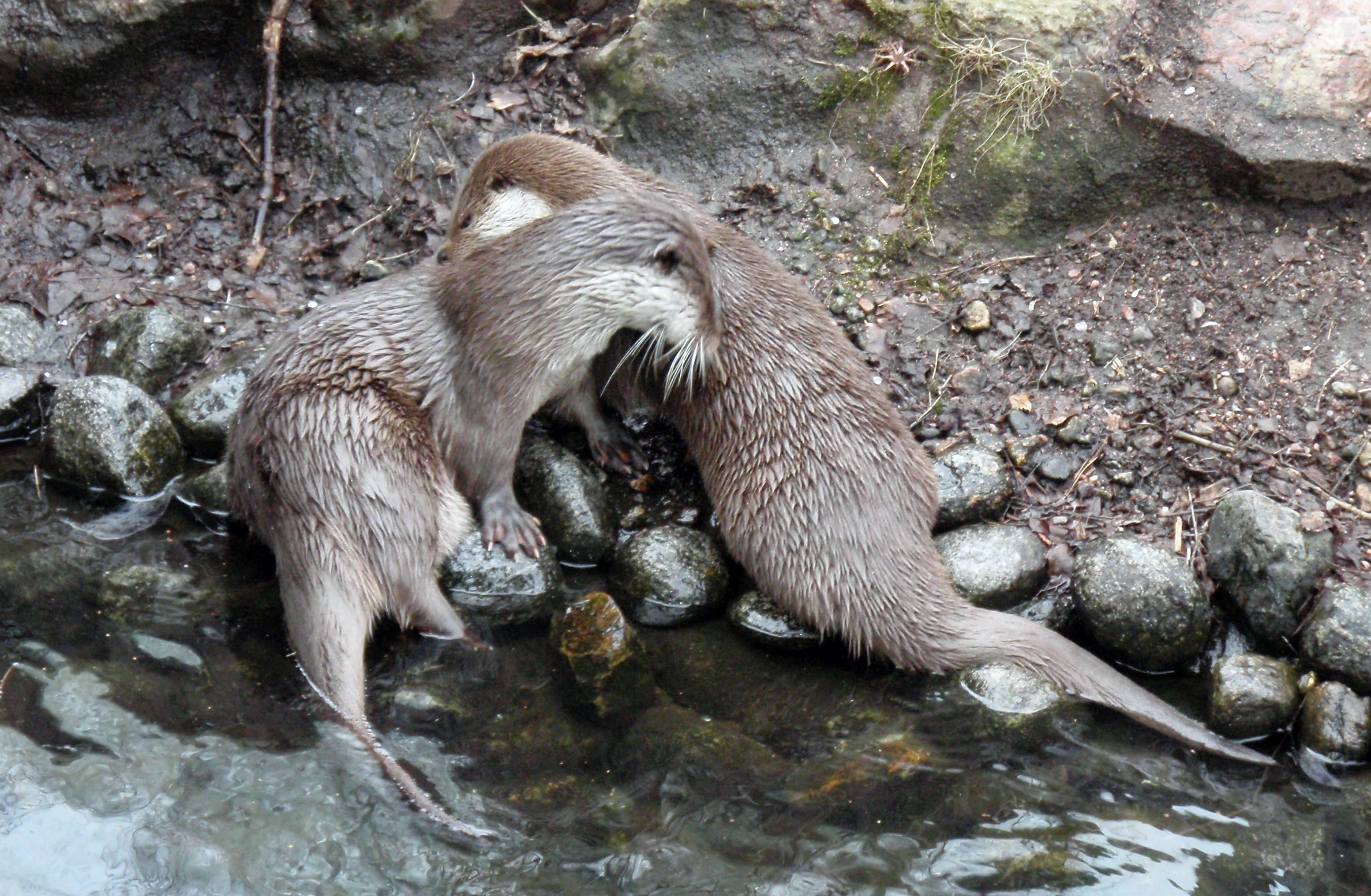
The Eurasian otter (''Lutra lutra''), also known as the European otter, Eurasian river otter, European river otter, common otter, and Old World otter, is a semiaquatic mammal native to Eurasia and the Maghreb. The most widely distributed member of the otter subfamily (Lutrinae) of the Mustelidae, weasel family (Mustelidae), it is found in the waterways and coasts of Europe, many parts of Asia, and parts of northern Africa. The Eurasian otter has a diet mainly of fish, and is strongly territorial. It is endangered in some parts of its range, but is recovering in others. Description The Eurasian otter is a typical species of the otter subfamily. Brown above and cream below, these long, slender creatures are well-equipped for their aquatic habits. Their bones show osteosclerosis, increasing their density to reduce buoyancy. This otter differs from the North American river otter by its shorter neck, broader visage, the greater space between the ears and its longer tail. However, the ... [...More Info...] [...Related Items...] OR: [Wikipedia] [Google] [Baidu] |
Seal (mammal)
Pinnipeds (pronounced ), commonly known as seals, are a widely distributed and diverse clade of carnivorous, fin-footed, semiaquatic, mostly marine mammals. They comprise the extant families Odobenidae (whose only living member is the walrus), Otariidae (the eared seals: sea lions and fur seals), and Phocidae (the earless seals, or true seals), with 34 extant species and more than 50 extinct species described from fossils. While seals were historically thought to have descended from two ancestral lines, molecular evidence supports them as a monophyletic group (descended from one ancestor). Pinnipeds belong to the suborder Caniformia of the order Carnivora; their closest living relatives are musteloids (weasels, raccoons, skunks and red pandas), having diverged about 50 million years ago. Seals range in size from the and Baikal seal to the and southern elephant seal. Several species exhibit sexual dimorphism. They have streamlined bodies and four limbs that ar ... [...More Info...] [...Related Items...] OR: [Wikipedia] [Google] [Baidu] |
Ramsar Convention
The Ramsar Convention on Wetlands of International Importance Especially as Waterfowl Habitat is an international treaty for the conservation and sustainable use of Ramsar site, Ramsar sites (wetlands). It is also known as the Convention on Wetlands. It is named after the city of Ramsar, Mazandaran, Ramsar in Iran, where the convention was signed in 1971. Every three years, representatives of the contracting parties meet as the Ramsar Convention#Conference of the Contracting Parties, Conference of the Contracting Parties (COP), the policy-making organ of the wetland conservation, convention which adopts decisions (site designations, resolutions and recommendations) to administer the work of the convention and improve the way in which the parties are able to implement its objectives. In 2022, COP15 was held in Montreal, Canada. List of wetlands of international importance The list of wetlands of international importance included 2,531 Ramsar site, Ramsar sites in Februa ... [...More Info...] [...Related Items...] OR: [Wikipedia] [Google] [Baidu] |
Devonian
The Devonian ( ) is a period (geology), geologic period and system (stratigraphy), system of the Paleozoic era (geology), era during the Phanerozoic eon (geology), eon, spanning 60.3 million years from the end of the preceding Silurian period at million years ago (Megaannum, Ma), to the beginning of the succeeding Carboniferous period at Ma. It is the fourth period of both the Paleozoic and the Phanerozoic. It is named after Devon, South West England, where rocks from this period were first studied. The first significant evolutionary radiation of history of life#Colonization of land, life on land occurred during the Devonian, as free-spore, sporing land plants (pteridophytes) began to spread across dry land, forming extensive coal forests which covered the continents. By the middle of the Devonian, several groups of vascular plants had evolved leaf, leaves and true roots, and by the end of the period the first seed-bearing plants (Pteridospermatophyta, pteridospermatophyt ... [...More Info...] [...Related Items...] OR: [Wikipedia] [Google] [Baidu] |
Agricultural
Agriculture encompasses crop and livestock production, aquaculture, and forestry for food and non-food products. Agriculture was a key factor in the rise of sedentary human civilization, whereby farming of domesticated species created food surpluses that enabled people to live in the cities. While humans started gathering grains at least 105,000 years ago, nascent farmers only began planting them around 11,500 years ago. Sheep, goats, pigs, and cattle were domesticated around 10,000 years ago. Plants were independently cultivated in at least 11 regions of the world. In the 20th century, industrial agriculture based on large-scale monocultures came to dominate agricultural output. , small farms produce about one-third of the world's food, but large farms are prevalent. The largest 1% of farms in the world are greater than and operate more than 70% of the world's farmland. Nearly 40% of agricultural land is found on farms larger than . However, five of every six farms ... [...More Info...] [...Related Items...] OR: [Wikipedia] [Google] [Baidu] |
Ice Age
An ice age is a long period of reduction in the temperature of Earth's surface and atmosphere, resulting in the presence or expansion of continental and polar ice sheets and alpine glaciers. Earth's climate alternates between ice ages, and greenhouse periods during which there are no glaciers on the planet. Earth is currently in the ice age called Quaternary glaciation. Individual pulses of cold climate within an ice age are termed '' glacial periods'' (''glacials, glaciations, glacial stages, stadials, stades'', or colloquially, ''ice ages''), and intermittent warm periods within an ice age are called '' interglacials'' or ''interstadials''. In glaciology, the term ''ice age'' is defined by the presence of extensive ice sheets in the northern and southern hemispheres. By this definition, the current Holocene epoch is an interglacial period of an ice age. The accumulation of anthropogenic greenhouse gases is projected to delay the next glacial period. History of research ... [...More Info...] [...Related Items...] OR: [Wikipedia] [Google] [Baidu] |
Tombolo
A tombolo is a sandy or shingle isthmus. It is a deposition landform by which an island becomes attached to the mainland by a narrow piece of land such as a spit or bar. Once attached, the island is then known as a tied island. The word ''tombolo'' is from the Italian ', meaning 'pillow' or 'cushion', and sometimes translated incorrectly as '' ayre'' (an ayre is a shingle beach of any kind). Several islands tied together by bars which rise above the water level are called a tombolo cluster. Two or more tombolos may form an enclosure (called a lagoon) that can eventually fill with sediment. Formation The shoreline moves toward the island (or detached breakwater) owing to the accretion of sand in the lee of the island, where wave energy and longshore drift are reduced and therefore deposition of sand occurs. Wave diffraction and refraction True tombolos are formed by wave refraction and diffraction. As waves near an island, they are slowed by the shallow water surroundi ... [...More Info...] [...Related Items...] OR: [Wikipedia] [Google] [Baidu] |
Tied Island
A tied island or land-tied island is a landform consisting of an island that is connected to the mainland or another island only by a tombolo, which is a spit of beach materials connected to land at both ends. St Ninian's Isle in the Shetland Islands off the north coast of Scotland is an example: it was once an island but is now linked to the mainland. Other examples include Maury Island, Washington in Puget Sound, Coronado, California, and Nahant, Massachusetts in the United States; Paraguana Peninsula in Venezuela; Barrenjoey, New South Wales and Wedge Island, Western Australia; Paratutae Island in New Zealand; Mount Hakodate in Japan, Howth Head in Ireland; Davaar Island, Campbeltown, Scotland; Chefoo island in Yantai, China; and Cheung Chau in Hong Kong. The Isle of Portland, in England, is also described as a tied island, but geographers now believe that Chesil Beach, which connects the island to the mainland, is a barrier beach that has moved eastwards, ra ... [...More Info...] [...Related Items...] OR: [Wikipedia] [Google] [Baidu] |


