|
San Nicolás, Guerrero
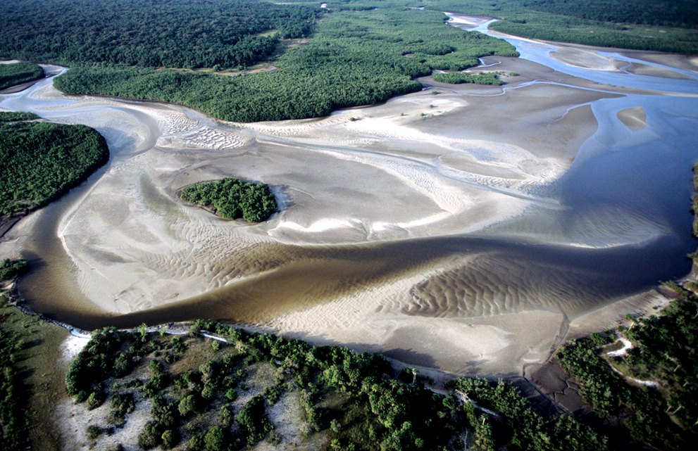
San Nicolás is a municipality in the Mexican state of Guerrero. It is located southeast of the state capital of Chilpancingo. It is named after its patron saint, Nicholas of Tolentino. Its creation from the municipality of Cuajinicuilapa was approved in 2021 and went into force on 21 May 2022. Geography The municipality of San Nicolás is located in the Costa Chica region of southeastern Guerrero. It borders the municipality of Cuajinicuilapa in Guerrero to the west, north, and east, the Oaxacan municipality of Santiago Tapextla to the southeast, and the Pacific Ocean to the southwest. The municipality covers an area of . The municipality's Pacific coast serves as a critical nesting area for the leatherback turtle and is protected as the Ramsar site Playa Tortuguera Tierra Colorada. San Nicolás has a subhumid temperate climate with rain in the summer. Average temperatures range between , and average annual precipitation ranges between . History The municipality of San Nic ... [...More Info...] [...Related Items...] OR: [Wikipedia] [Google] [Baidu] |
Municipalities Of Mexico
Municipalities () are the administrative divisions under the List of states of Mexico, states of Mexico according to the Constitution of Mexico, constitution. Municipalities are considered as the second-level administrative divisions by the Federal government of Mexico, federal government. However, some state regulations have designed intrastate regions to administer their own municipalities. Municipalities are further divided into Localities of Mexico, localities in the structural hierarchy of administrative divisions of Mexico. As of December 2024, there are 2,462 municipalities in Mexico. In Mexico, municipalities should not be confused with cities (). Cities are Localities of Mexico, locality-level divisions that are administered by the municipality. Although some List of cities in Mexico, larger cities are consolidated with its own municipality and form a single level of governance. In addition, the 16 Boroughs of Mexico City, boroughs of Mexico City are considered municipali ... [...More Info...] [...Related Items...] OR: [Wikipedia] [Google] [Baidu] |
Oaxaca
Oaxaca, officially the Free and Sovereign State of Oaxaca, is one of the 32 states that compose the political divisions of Mexico, Federative Entities of the Mexico, United Mexican States. It is divided into municipalities of Oaxaca, 570 municipalities, of which 418 (almost three quarters) are governed by the system of (customs and traditions) with recognized local forms of self-governance. Its capital city is Oaxaca City, Oaxaca de Juárez. Oaxaca is in southern Mexico. It is bordered by the states of Guerrero to the west, Puebla to the northwest, Veracruz to the north, and Chiapas to the east. To the south, Oaxaca has a significant coastline on the Pacific Ocean. The state is best known for #Indigenous peoples, its indigenous peoples and cultures. The most numerous and best known are the Zapotec peoples, Zapotecs and the Mixtecs, but 16 are officially recognized. These cultures have survived better than most others in Mexico due to the state's rugged and isolating terrain. M ... [...More Info...] [...Related Items...] OR: [Wikipedia] [Google] [Baidu] |
Encomienda
The ''encomienda'' () was a Spanish Labour (human activity), labour system that rewarded Conquistador, conquerors with the labour of conquered non-Christian peoples. In theory, the conquerors provided the labourers with benefits, including military protection and education. In practice, the conquered were subject to conditions that closely resembled instances of forced labour and slavery. The ''encomienda'' was first established in Spain following the Christian Reconquista, and it was applied on a much larger scale during the Spanish colonization of the Americas and the Spanish East Indies. Conquered peoples were considered vassals of the Spanish monarch. The Crown awarded an ''encomienda'' as a grant to a particular individual. In the conquest era of the early sixteenth century, the grants were considered a monopoly on the labour of particular groups of indigenous peoples, held in perpetuity by the grant holder, called the ''encomendero''; starting from the New Laws of 1542, t ... [...More Info...] [...Related Items...] OR: [Wikipedia] [Google] [Baidu] |
Pedro De Alvarado
Pedro de Alvarado (; 1485 – 4 July 1541) was a Spanish conquistador, ''conquistador'', ''adelantado,'' governor and Captaincy General of Guatemala, captain general of Guatemala.Lovell, Lutz and Swezey 1984, p. 461. He participated in the conquest of Cuba, in Juan de Grijalva's exploration of the coasts of the Yucatán Peninsula and the Gulf of Mexico, and in the conquest of the Aztec Empire led by Hernán Cortés. He is considered the conquistador of much of Central America, including Guatemala, Honduras, El Salvador, and parts of Nicaragua. While a great warrior like Cortes and other conquistadors, Alvarado developed a reputation for greed and cruelty like many conquistadors, and was accused of various crimes and abuses by natives and Spaniards alike. In 1541, while attempting to quell a native revolt, Alvarado was accidentally crushed by a horse, dying a few days later. Character and appearance file:Pedro de Alvarado (Tomás Povedano).jpg, 200px, 1906 portrait of Alvara ... [...More Info...] [...Related Items...] OR: [Wikipedia] [Google] [Baidu] |
Mexica Empire
The Aztec Empire, also known as the Triple Alliance (, �jéːʃkaːn̥ t͡ɬaʔtoːˈlóːjaːn̥ or the Tenochca Empire, was an alliance of three Nahua city-states: , , and . These three city-states ruled that area in and around the Valley of Mexico from 1428 until the combined forces of the Spanish and their native allies who ruled under defeated them in 1521. Its people and civil society are historiographically referred to as the ''Aztecs'' or the ''Culhua-Mexica''. The alliance was formed from the victorious factions of a civil war fought between the city of and its former tributary provinces. Despite the initial conception of the empire as an alliance of three self-governed city-states, the capital became dominant militarily. By the time the Spanish arrived in 1519, the lands of the alliance were effectively ruled from , while other partners of the alliance had taken subsidiary roles. The alliance waged wars of conquest and expanded after its formation. The allian ... [...More Info...] [...Related Items...] OR: [Wikipedia] [Google] [Baidu] |
Tututepec
Tututepec (Mixtec languages, Mixtec: ''Yucu Dzaa'') is a Mesoamerica, Mesoamerican archaeological site. It is located in the lower Río Verde (Oaxaca), Río Verde valley on the coast of Mesoamerican geography#Oaxaca, Oaxaca. The city was the capital of a tributary Mixtec empire during the Mesoamerican chronology, Late Postclassic period (ca. 12th to early 16th centuries). At its largest extent the site covered some 21.85 km2, and its political influence extended over an area of more than 25,000 km² of the neighbouring territory covering many towns and cultures. Today, the site is occupied by the contemporary settlement of Villa de Tututepec de Melchor Ocampo, in the Mexican state of Oaxaca. Etymology Tututepec is a Nahuatl name meaning "Bird Hill," while in Mixtec the city is called Yucu Dzaa meaning "Hill of the Bird." In Aztec script, Aztec and Mixtec writing, Mixtec scripts, the city's glyph is drawn differently but both scripts represent the city with a bird on a ... [...More Info...] [...Related Items...] OR: [Wikipedia] [Google] [Baidu] |
Mixtec Languages
The Mixtec () languages belong to the Mixtecan group of the Oto-Manguean language family. Mixtec is spoken in Mexico and is closely related to Trique and Cuicatec. The varieties of Mixtec are spoken by over half a million people.2000 census; the numbers are based on the number of the total population for each group and the percentages of speakers given on the website of the Comisión Nacional para el Desarrollo de los Pueblos Indígenas, http://www.cdi.gob.mx/index.php?id_seccion=660, accessed 28 July 2008). Identifying how many Mixtec languages there are in this complex dialect continuum poses challenges at the level of linguistic theory. Depending on the criteria for distinguishing dialects from languages, there may be as few as a dozen or as many as fifty-three Mixtec languages. Language name The name "Mixteco" is a Nahuatl exonym, from ''mixtecatl'', from ''mixtli'' ("cloud") + ''-catl'' ("inhabitant of place of"). Speakers of Mixtec use an expression (which varies b ... [...More Info...] [...Related Items...] OR: [Wikipedia] [Google] [Baidu] |
Subhumid Temperate Climate
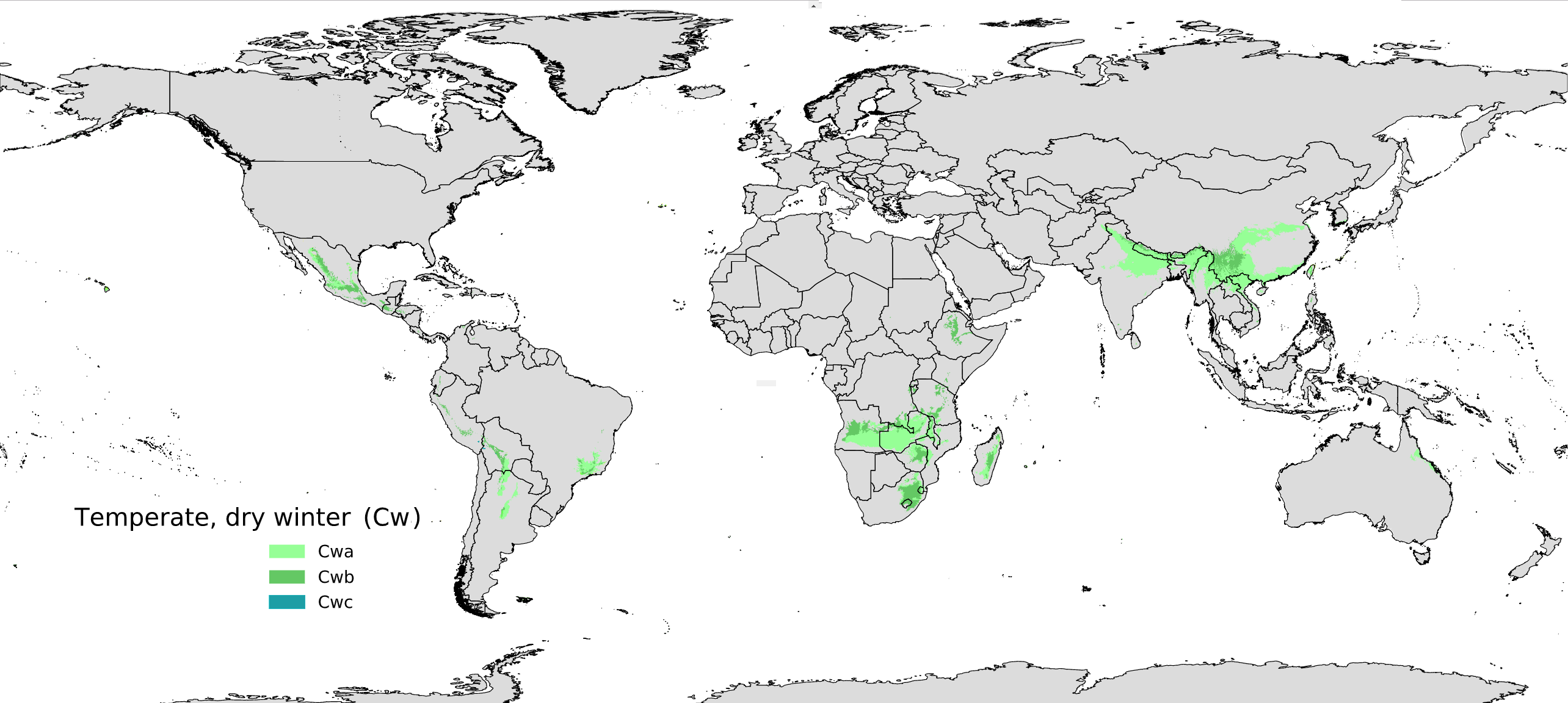
The subhumid temperate climate also called monsoon temperate climate, is a temperate climate sub-type with monsoon influence, that is a climate with dry winter and wet summer. Although the terms ''subhumid temperate climate'' and ''monsoon temperate climate'' are not officially used in the Köppen climate classification, climates of this type may fall under the Cw classification for dry winters. Sub-types Monsoon subtropical climate A Monsoon subtropical climate, officially classified as a Subhumid subtropical climate or Monsoon-influenced humid subtropical climate under the Köppen classification ''(Cwa)'', has a hot summer. Extensively present in South and Southeast Asia, mainly India, Myanmar, and Nepal and Southern Africa, Zambia and Angola; it can also be found in South America, isolated zones of Bolivia, Brazil and Argentina. It also occurs in parts of tropical highlands of São Paulo (state), São Paulo state, Mato Grosso do Sul and near the Andean highland in northwest ... [...More Info...] [...Related Items...] OR: [Wikipedia] [Google] [Baidu] |
Ramsar Convention
The Ramsar Convention on Wetlands of International Importance Especially as Waterfowl Habitat is an international treaty for the conservation and sustainable use of Ramsar site, Ramsar sites (wetlands). It is also known as the Convention on Wetlands. It is named after the city of Ramsar, Mazandaran, Ramsar in Iran, where the convention was signed in 1971. Every three years, representatives of the contracting parties meet as the Ramsar Convention#Conference of the Contracting Parties, Conference of the Contracting Parties (COP), the policy-making organ of the wetland conservation, convention which adopts decisions (site designations, resolutions and recommendations) to administer the work of the convention and improve the way in which the parties are able to implement its objectives. In 2022, COP15 was held in Montreal, Canada. List of wetlands of international importance The list of wetlands of international importance included 2,531 Ramsar site, Ramsar sites in Februa ... [...More Info...] [...Related Items...] OR: [Wikipedia] [Google] [Baidu] |
Playa Tortuguera Tierra Colorada
Playa (plural playas) may refer to: Landforms * Endorheic basin, also known as a sink, alkali flat or sabkha, a desert basin with no outlet which periodically fills with water to form a temporary lake * Dry lake, often called a ''playa'' in the southwestern United States Populated places United States * Playas, New Mexico, an unincorporated community in New Mexico * Playa, Añasco, Puerto Rico, a barrio in the municipality of Añasco, Puerto Rico * Playa, Guayanilla, Puerto Rico, a barrio in the municipality of Guayanilla, Puerto Rico * Playa, Ponce, Puerto Rico, a barrio of Ponce, Puerto Rico * Playa, Santa Isabel, Puerto Rico, a barrio in the municipality of Santa Isabel, Puerto Rico * Playa, Yabucoa, Puerto Rico, a barrio in the municipality of Yabucoa, Puerto Rico Mexico * Playa del Carmen, a resort city in the state of Quintana Roo Cuba * Playa, Havana, one of the 15 municipalities of the City of Havana, Cuba Ecuador * Playas Canton, Ecuador ** Playas, Ecuador, the admi ... [...More Info...] [...Related Items...] OR: [Wikipedia] [Google] [Baidu] |
Ramsar Site
A Ramsar site is a wetland site designated to be of international importance under the Ramsar Convention,8 ha (O) *** Permanent 8 ha (P) *** Seasonal Intermittent < 8 ha(Ts) ** es on inorganic soils: *** Permanent (herb dominated) (Tp) *** Permanent / Seasonal / Intermittent (shrub dominated)(W) *** Permanent / Seasonal / Intermittent (tree dominated) (Xf) *** Seasonal/intermittent (herb dominated) (Ts) ** Marshes on soils: *** Permanent (non-forested)(U) *** Permanent (forested)(Xp) ** Marshes on inorganic or peat soils: *** Marshes on inorganic or peat soils / High altitude (alpine) (Va) *** Marshes on inorganic or peat soils / Tundra (Vt) * Saline, [...More Info...] [...Related Items...] OR: [Wikipedia] [Google] [Baidu] |


