|
San Bartolomé Milpas Altas
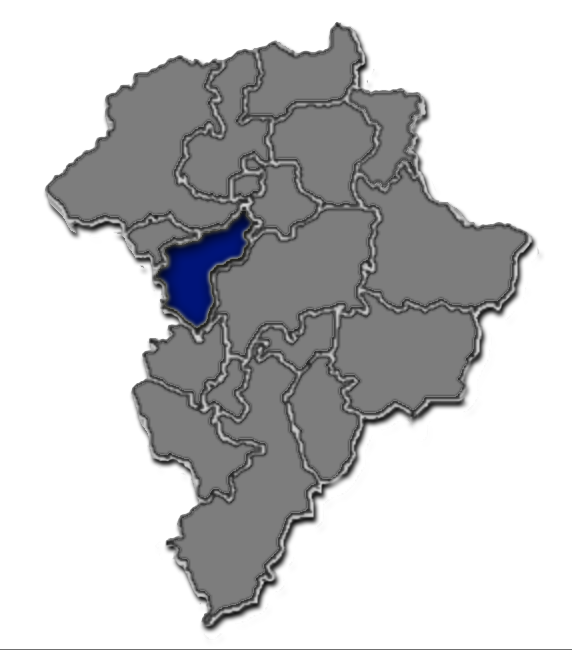
San Bartolomé Milpas Altas is a town and municipality in the Guatemalan department of Sacatepéquez. History In the 1540s, bishop Francisco Marroquín split the ecclesiastical administration of the central valley of Guatemala between the Order of Preachers and the Franciscans, assigning Sumpango's curato to the former. In 1638, the Dominicans separated their large doctrines in groups revolving around six convents: Ecclesiastic historian Domingo Juarros wrote that in 1754, by virtue of a royal order of the borbon reforms of king Carlos III all curatos and doctrines of the regular clergy were moved on to the secular clergy. Climate San Bartolomé Milpas Altas has temperate climate (Köppen: ''Cwb''). See also * * * List of places in Guatemala This is a list of places in Guatemala. List of most populous cities in Guatemala Population data up to number 30 is based on the 2018 census. Ancient cities and important ruins * Cancuén * Dos Pilas * El ... [...More Info...] [...Related Items...] OR: [Wikipedia] [Google] [Baidu] |
Municipalities Of Guatemala
The Departments of Guatemala, departments of the Guatemala, Republic of Guatemala are divided into 340 municipality, municipalities (). The municipalities are listed below, by department. Department capitals are written in bold. Alta Verapaz Baja Verapaz Chimaltenango Chiquimula El Progreso Escuintla Guatemala Huehuetenango Izabal Jalapa Jutiapa Petén Quetzaltenango Quiché Retalhuleu Sacatepéquez San Marcos Santa Rosa Sololá Suchitepéquez Totonicapán Zacapa References {{DEFAULTSORT:Municipalities Of Guatemala Municipalities of Guatemala, Subdivisions of Guatemala Lists of administrative divisions, Guatemala, Municipalities Administrative divisions in North America, Guatemala 2 Second-level administrative divisions by country, Municipalities, Guatemala Guatemala geography-related lists ... [...More Info...] [...Related Items...] OR: [Wikipedia] [Google] [Baidu] |
San Pedro Sacatepéquez, Guatemala
San Pedro Sacatepéquez () is a town, with a population of 36,932 (2018 census), and a municipality in the Guatemala department of Guatemala. According to the 1998 edition of ''The Columbia Gazetteer of the World'', its elevation is 6,890 ft (2,100 m) and it is a market center. Its economy is based on manufacturing, including tile making and textiles, and agriculture, including the cultivation of corn, black beans, and vegetables. Doctrine of Order of Preachers After the conquest, the Spanish crown focused on the Catholic indoctrination of the natives. Human settlements founded by royal missionaries in the New World were called "Indian doctrines" or simply "doctrines". Originally, friars had only temporary missions: teach the Catholic faith to the natives, and then transfer the settlements to secular parishes, just like the ones that existed in Spain at the time; the friars were supposed to teach Spanish and Catholicism to the natives. And when the natives were ready, th ... [...More Info...] [...Related Items...] OR: [Wikipedia] [Google] [Baidu] |
Tactic (municipality)
Tactic () is a town and a municipality in the Guatemalan department of Alta Verapaz. It is situated at 1,465 m above sea level. The municipality has a population of 38,052 and covers an area of 102 km². At the 2018 census, the population of the Tactic town was 15,213. Population of cities & towns in Guatemala The languages spoken in Tactic are predominantly Spanish, Poqomchiʼ, and Q'eqchi'. History Pre-Hispanic era Before Columbus, there were only ceremonial centers in the ...[...More Info...] [...Related Items...] OR: [Wikipedia] [Google] [Baidu] |
San Cristóbal Verapaz
San Cristóbal Verapaz () is a town, with a population of 20,961 (2018 census), and a Municipalities of Guatemala, municipality (population 68,819 at 2018 census) in the Guatemalan department of Alta Verapaz. It is located approximately 29 km from Cobán, the capital of Alta Verapaz and about 210 km from Guatemala City. San Cristóbal belongs to the Pokimchi' linguistic area. Its main income source is the «Cobán» shoe factory, which specializes in industrial rubber boots, which are sold both locally and internationally. History Franja Transversal del Norte The Northern Transversal Strip was officially created during the government of General Carlos Arana Osorio in 1970, by Legislative Decree 60-70, for agricultural development. The decree literally said: "It is of public interest and national emergency, the establishment of Agrarian Development Zones in the area included within the municipalities: San Ana Huista, San Antonio Huista, Nentón, Jacaltenango, San Mat ... [...More Info...] [...Related Items...] OR: [Wikipedia] [Google] [Baidu] |
San Juan Chamelco
San Juan Chamelco is a town and a municipality in the Guatemalan department of Alta Verapaz. The municipality is situated at 1,350 metres above sea level and covers an area of 228 km2. The annual festival is on June 24. At the 2018 census, the population of the municipality was 57,456 and that of the town of San Juan Chamelco was 13,264. Population of cities & towns in Guatemala Alta Verapaz is known for its diverse geography, including mountains, forests, and rivers. San Juan Chamelco, like many other municipalities in the region, is likely characterized by a mix of indigenous and mestizo populations. Climate San Juan Chamelco has ( |
Cobán
Cobán (), fully Santo Domingo de Cobán, is the capital of the department of Alta Verapaz in central Guatemala. It also serves as the administrative center for the surrounding Cobán municipality. It is located 219 km from Guatemala City. As of the 2018 census, the population of the city of Cobán was 212,047 and that of the municipality was 212,421. Cobán lies at an altitude of above sea level and covers a total area of 1,974 km2. It is located at the center of a major coffee-growing area. Etymology The name "Cobán" comes from Q'eqchi', meaning "between clouds," "the city in the clouds," "foggy place," or "cloudy place". History Order of Preachers in the Vera Paz Between 1530 and 1531, captain on his way to Ciudad Real accidentally discovered the lagoon and hill of . People of that place had historically traded with all the people that the Spaniards had conquered, so, knowing what was coming, they sought refuge in the jungle. The Spaniards tried in vain to c ... [...More Info...] [...Related Items...] OR: [Wikipedia] [Google] [Baidu] |
Mixco
Mixco () is a city and municipality in the Guatemala department of Guatemala. It is next to the main Guatemala City municipality and has become part of the Guatemala City Metropolitan Area. Most of Mixco is separated from the City by canyons, for which a multitude of bridges have been created. It is the second largest city in Guatemala after Guatemala City, with a population of 475,777. Ciudad San Cristóbal is located within Mixco. Administrative division The municipality is divided into zones with residential neighborhoods, villages, settlements and the municipal capital. Due to its close proximity to Guatemala City, several villages were turned into residential neighborhoods. From the residential neighborhoods is excluded "La Florida", which separated from Mixco to join Guatemala City in 1958. Mayors Universities * UruralG * UPANA * USAC * URL Sports Deportivo Mixco football club play in the Guatemalan second division. They have been playing their home g ... [...More Info...] [...Related Items...] OR: [Wikipedia] [Google] [Baidu] |
Amatitlán
Amatitlán () is a town, with a population of 98,176 (2018 census), Population of cities & towns in Guatemala and a municipality in the Guatemala department of . History Monastery and doctrine of Order of Preachers  After the conquest, the Spanish crown focused on the Catholic indoctrination of the natives. Human settlements founded by royal missionaries ...
[...More Info...] [...Related Items...] OR: [Wikipedia] [Google] [Baidu] |
Antigua Guatemala
Antigua Guatemala (), commonly known as Antigua or La Antigua, is a city in the Guatemalan Highlands, central highlands of Guatemala. The city was the capital of the Captaincy General of Guatemala from 1543 through 1773, with much of its Baroque-influenced architecture and layout dating from that period. These characteristics had it designated as a UNESCO World Heritage Site in 1979. Antigua Guatemala serves as the capital of the homonymous municipality and the Sacatepéquez Department. Population The city had a peak population of some 65,000 in the 1770s; the bulk of the population moved away in the late 18th century after the 1773 Guatemala earthquake. Despite significant population growth in the late 20th century, the city had only reached half that number by the 1990s. At the time of the 2007 census, the city had 34,685 inhabitants. History ''Antigua Guatemala'' means "Old Guatemala" and was the third capital of Guatemala, formerly called "Santiago de los Caballeros ... [...More Info...] [...Related Items...] OR: [Wikipedia] [Google] [Baidu] |
San Lucas Sacatepéquez
San Lucas Sacatepéquez () is a town, with a population of 20,723 (2018 census), Population of cities & towns in Guatemala and a in the n department of Sacatepéquez. History Doctrine of Order of Preachers [...More Info...] [...Related Items...] OR: [Wikipedia] [Google] [Baidu] |
Escuintla, Escuintla
Escuintla () is an industrial city in Guatemala, its land extension is 4,384 km2, and it is nationally known for its sugar agribusiness. Its capital is a municipality with the same name. Citizens celebrate from December 6 to 9 with a small fair in honor to The Immaculate Conception. In 2002 the city had a population of 86,678. It is located on the border of the central highlands and the Pacific coastal plain. Etymology Many of the names of the municipalities of Guatemala consist of one of two things: the name of a catholic saint to worship the day the city was founded or a description with Náhuatl roots. These influences are due to the troops in command of Pedro de Alvarado who invaded the region in 1520. These troops were composed of Spanish soldiers and indigenous Tlaxcaltecs. The name Escuintla, comes from the indigenous language nahuatl «Itzcuintlán», which is a word composed of two words: · «Itzcuintli»: means "dog" · «tlan»: means "near" ... [...More Info...] [...Related Items...] OR: [Wikipedia] [Google] [Baidu] |


