|
Saltsjön
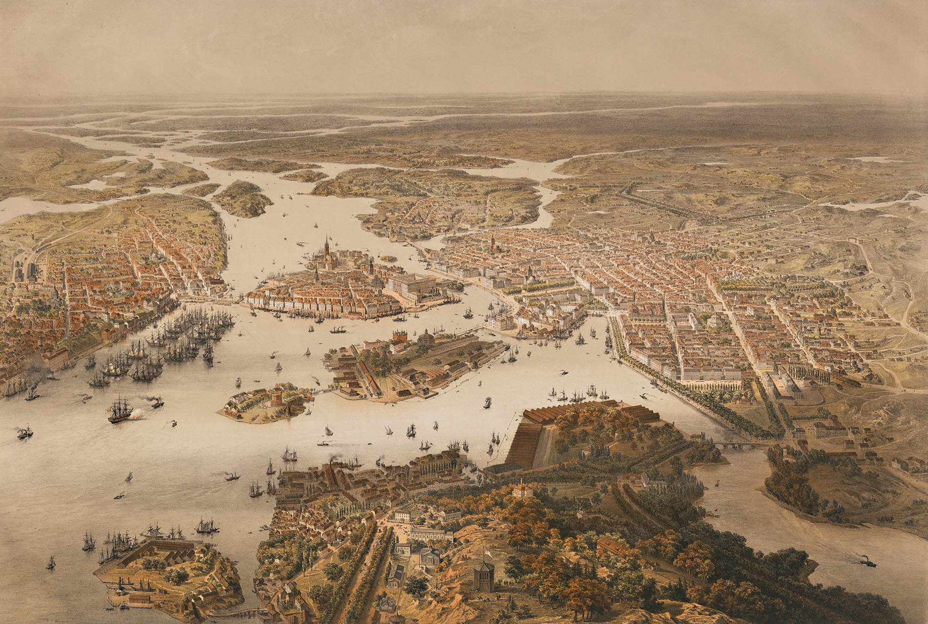
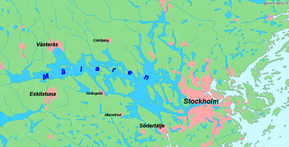
Saltsjön is a bay of the Baltic Sea that extends from Stockholm archipelago to the inner city of Stockholm. Its innermost part reaches the eastern shore of Gamla stan at Skeppsbrokajen. It is navigable for large craft and the major ferry lines to and from Stockholm pass through it. Saltsjön is connected to Lake Mälaren through Norrström, through Karl Johanslussen at Slussen, and through and Hammarbyleden. ''Saltsjö'' or ''Saltsjön'' may also denote other parts of the Baltic in the Stockholm region, as opposed to Mälaren or inland lakes. The word appears as part of place names such as Saltsjöbaden Saltsjöbaden is a locality in Nacka Municipality, Stockholm County, Sweden with 9,491 inhabitants in 2010. It is on the Baltic Sea coast, deep in the Stockholm Archipelago. History Saltsjöbaden () was developed as a resort by Knut Agathon W ..., Saltsjö-Boo or which are not related to Saltsjön proper. References {{DEFAULTSORT:Saltsjon Nacka Municipality Ba ... [...More Info...] [...Related Items...] OR: [Wikipedia] [Google] [Baidu] |
Hammarbyleden
Hammarbyleden is an artificial waterway in Stockholm which connects Lake Mälaren with Saltsjön, the westernmost bay of the Baltic Sea. The waterway is located along the southern edge of Södermalm, one of Stockholm's many islands. The waterway is composed mostly of interconnected natural bodies of water, which were expanded and dredged in the late-1910s and 1920s; the waterway was opened in 1929. A water lock was constructed as part of the project to account for the water level variation between Lake Mälaren and the Baltic Sea. Route The waterway begins at Liljeholmsviken (near the eastern edge of Lake Mälaren) where it flows east into Årstaviken. At the eastern end of Årstaviken is the water lock, called , which lowers the water level from Årstaviken into Hammarby Sjö Hammarby sjö ( Swedish: "Lake Hammarby") is a watercourse in central Stockholm, Sweden. Separating Stockholm City Centre from South Stockholm, or, more locally, Norra Hammarbyhamnen on eastern Söd ... [...More Info...] [...Related Items...] OR: [Wikipedia] [Google] [Baidu] |
Skeppsbrokajen
Skeppsbrokajen ( Swedish: "Ship's Bridge's Quay") is a quay in central Stockholm, Sweden. Passing along Skeppsbron, it forms the east waterfront of the old town Gamla stan. History Skeppsbrokajen was preceded by a medieval quay called ''Koggabron'' (" Cog bridge") located a hundred metres inland from the present quay and only stretching along the southern part of the shore. During the 1630s, the work on the foundations of the present quay were begun, probably initiated by King Gustavus Adolphus. While the present name came into use during the period 1640–1700, the quay itself was not completed until 1854 when the area around Slussen was developed in connection to the construction of the lock of Nils Ericson. While the quay is still frequently used by ships, including international cruisers and locally well-known ships: a couple of old steamships, such as SS Blidösund (1911) and SS Saltsjön (1925); and some somewhat less genuine, such as MS Teaterskeppet, ("The Theatre Ship ... [...More Info...] [...Related Items...] OR: [Wikipedia] [Google] [Baidu] |
Norrström
Norrström is one of the shortest rivers in Europe in central Stockholm. It connects Lake Mälaren with the Baltic Sea. It runs from Riddarfjärden, north of Gamla stan, to Stockholms ström (the western part of Saltsjön). Two islands lie within it, Strömsborg and Helgeandsholmen. It is one of two natural waterways between Mälaren and the Baltic sea, the other being Söderström south of Gamla stan. Norrström is crossed by Centralbron and the adjacent pedestrian bridge, Vasabron, Riksbron north of Helgeandsholmen which continues into Riksgatan and Stallbron south of the island, Norrbro crossing Helgeandsholmen, and Strömbron. While the majority of the river flows north of Helgeandsholmen, a small controlled portion known as the runs south of the island, between it and Gamla stan. As the water level of Mälaren is usually higher than that of the Baltic, the current normally runs from west to east. Norrström is not navigable for traffic between Mälaren and the Ba ... [...More Info...] [...Related Items...] OR: [Wikipedia] [Google] [Baidu] |
Karl Johanslussen
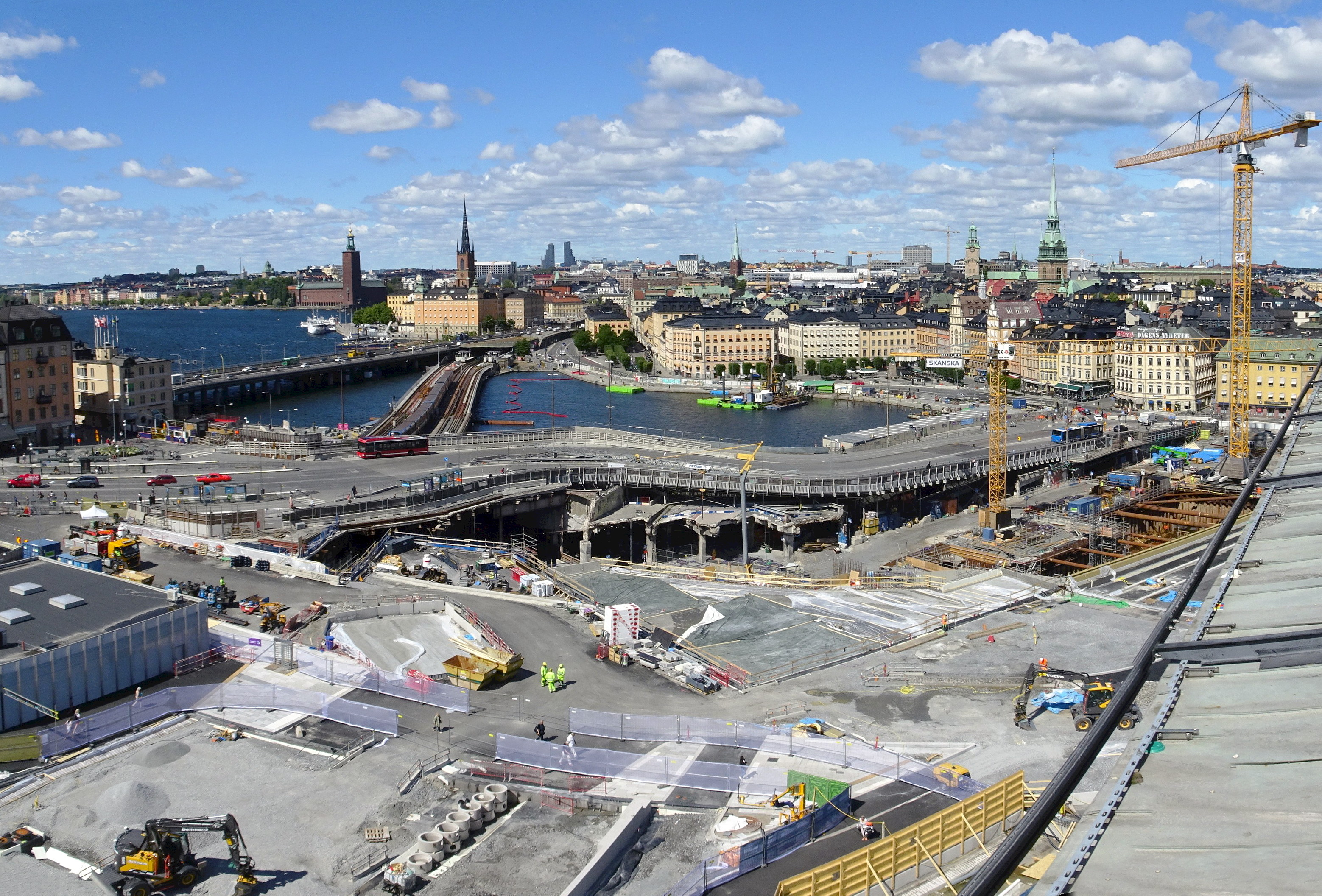
Karl Johansslussen ("Lock of Charles John") is a lock and a sluice, along the Söderström river connecting and controlling the flood discharge between Riddarfjärden, the easternmost part of Lake Mälaren, and Saltsjön, the section of the Baltic Sea reaching into central Stockholm, Sweden. The lock is 75 metres long, 10 metres wide and 3.90 metres deep. The maximum height is 3.8 metres. The lock is closed from 2016 to 2021 due to large reconstruction works in the area. Before World War I, few of the steam ships in the harbor of Stockholm were larger than 500 tonnes, and the previous lock thus largely sufficient. While commercial traffic was relocated to Hammarbyleden passing south of Södermalm in 1926–1929, the present lock, completed in 1935, was still used by some 3,000 commercial vessels in the 1970s, and log rafts passed through the canal until the 1950s. Its main function is however to allow passage for pleasure boats and sightseeing boats. Construction Like th ... [...More Info...] [...Related Items...] OR: [Wikipedia] [Google] [Baidu] |
Baltic Sea
The Baltic Sea is an arm of the Atlantic Ocean that is enclosed by the countries of Denmark, Estonia, Finland, Germany, Latvia, Lithuania, Poland, Russia, Sweden, and the North European Plain, North and Central European Plain regions. It is the world's largest brackish water basin. The sea stretches from 53°N to 66°N latitude and from 10°E to 30°E longitude. It is a Continental shelf#Shelf seas, shelf sea and marginal sea of the Atlantic with limited water exchange between the two, making it an inland sea. The Baltic Sea drains through the Danish straits into the Kattegat by way of the Øresund, Great Belt and Little Belt. It includes the Gulf of Bothnia (divided into the Bothnian Bay and the Bothnian Sea), the Gulf of Finland, the Gulf of Riga and the Bay of Gdańsk. The "Baltic Proper" is bordered on its northern edge, at latitude 60°N, by Åland and the Gulf of Bothnia, on its northeastern edge by the Gulf of Finland, on its eastern edge by the Gulf of Riga, and in the ... [...More Info...] [...Related Items...] OR: [Wikipedia] [Google] [Baidu] |
Stockholm Archipelago
The Stockholm Archipelago () is the largest archipelago in Sweden, and the second-largest archipelago in the Baltic Sea (the largest being the Archipelago Sea across the Baltic in Finland). Part of the archipelago has been designated as a Ramsar site since 1989. Stockholm Archipelago has been found to have slightly over 24,000 islands, islets and skerries and covers approximately 1,700 km² of which approximately 530 km² is land. There are around 10,000 permanent residences and 50,000 holiday homes in the archipelago. Residents are found on all the larger islands closest to the coast that have fixed bridges or ferry connections with road ferries, such as Vaxholm, Ingarö, Värmdö, Yxlan, Blidö, Ljusterö and Väddö, but also on many of the larger islands farther out from the coast, as Ingmarsö, Möja, Runmarö, Nämdö, Ornö and Utö, which are served by passenger ships with fixed itineraries. Water The water has a pH value of 7.0 (neutral) or slightly lowe ... [...More Info...] [...Related Items...] OR: [Wikipedia] [Google] [Baidu] |
Stockholm
Stockholm (; ) is the Capital city, capital and List of urban areas in Sweden by population, most populous city of Sweden, as well as the List of urban areas in the Nordic countries, largest urban area in the Nordic countries. Approximately 1 million people live in the Stockholm Municipality, municipality, with 1.6 million in the Stockholm urban area, urban area, and 2.5 million in the Metropolitan Stockholm, metropolitan area. The city stretches across fourteen islands where Mälaren, Lake Mälaren flows into the Baltic Sea. Outside the city to the east, and along the coast, is the island chain of the Stockholm archipelago. The area has been settled since the Stone Age, in the 6th millennium BC, and was founded as a city in 1252 by Swedish statesman Birger Jarl. The city serves as the county seat of Stockholm County. Stockholm is the cultural, media, political, and economic centre of Sweden. The Stockholm region alone accounts for over a third of the country's Gros ... [...More Info...] [...Related Items...] OR: [Wikipedia] [Google] [Baidu] |
Gamla Stan
Gamla Stan (, "The Old Town"), until 1980 officially Staden mellan broarna ("The Town between the Bridges"), is the old town of Stockholm, Sweden. Gamla Stan consists primarily of the island Stadsholmen. Gamla Stan includes the surrounding islets Riddarholmen, Helgeandsholmen and Strömsborg. It has a population of approximately 3,000. Gamla Stan has played a prominent role in the history of Swedish architecture, with many of Sweden's most renowned architects shaping the area; these include figures such as Nicodemus Tessin and Carl Hårleman, who worked on the Stockholm Palace, still located in the area. Other notable buildings in the old town include Tessin Palace, the Stockholm Stock Exchange Building, Bonde Palace (seat of the Swedish Supreme Court) and the House of Nobility; the last of these buildings hosted the parliament for many years. Overview The town dates back to the 13th century, and consists of medieval alleyways, cobbled streets, and archaic archit ... [...More Info...] [...Related Items...] OR: [Wikipedia] [Google] [Baidu] |
Mälaren
Mälaren ( , , or ), historically referred to as Lake Malar in English, is the third-largest freshwater lake in Sweden (after Vänern and Vättern). Its area is and its greatest depth is 64 m (210 ft). Mälaren spans from east to west. The lake drains, from south-west to north-east, into the Baltic Sea through its natural outlets Norrström and Söderström (as it flows around Stadsholmen island) and through the artificial Södertälje Canal and Hammarbyleden waterway. The easternmost bay of Mälaren, in central Stockholm, is called Riddarfjärden. The lake is located in Svealand and bounded by the provinces of Uppland, Södermanland and Västmanland. The two largest islands in Mälaren are Selaön () and Svartsjölandet (). Mälaren is low-lying and mostly relatively shallow. Being a quite narrow and shallow lake, Mälaren has bridge crossings between Eskilstuna and Västerås with two crossings on the western end at Kvicksund and three separate bridges between St ... [...More Info...] [...Related Items...] OR: [Wikipedia] [Google] [Baidu] |
Slussen
Slussen (') is an area in Stockholm, Sweden, located at the northern edge of Södermalm, adjacent to Gamla stan. It is known for its locks system between Lake Mälaren and the Baltic Sea, as well as its historic role as a major transport interchange. The Slussen area includes the Slussen metro station and Saltsjöbanan terminus, and a bus terminal. The boundary between Uppland and Södermanland runs through the area. History : Slussen has been a vital crossing point in Stockholm for centuries, linking southern roads with the waterways connecting Lake Mälaren to the Baltic Sea. Over time, the area has undergone significant transformations. Early History The first lock at Slussen, known as Queen Christina's Lock, was inaugurated in 1642. It was replaced in 1755 by Christopher Polhem's Lock. Nils Ericson's Lock, built in 1850, followed, allowing ships to traverse the area more efficiently. The final major lock, Karl Johan's Lock, was inaugurated in 1935 as part of th ... [...More Info...] [...Related Items...] OR: [Wikipedia] [Google] [Baidu] |
Saltsjöbaden
Saltsjöbaden is a locality in Nacka Municipality, Stockholm County, Sweden with 9,491 inhabitants in 2010. It is on the Baltic Sea coast, deep in the Stockholm Archipelago. History Saltsjöbaden () was developed as a resort by Knut Agathon Wallenberg, a member of the wealthy and influential Wallenberg family, from farmland which he bought in 1891 through a newly created railway company. Saltsjöbaden was an independent municipality from 1909 to 1970. In 1971 it was reintegrated into Nacka Municipality. The local railway ( Saltsjöbanan), built by Wallenberg and completed in 1893, connects Saltsjöbaden with Stockholm, with its terminus at Slussen. The railway was taken over by Storstockholms Lokaltrafik in the late 1960s and integrated in the Stockholm public transport system. Two luxurious hotels (1893) and a sanatorium were built, designed by architect Erik Josephson. The parish church, Uppenbarelsekyrkan (the "Church of the Epiphany"), was built in 1910–13 and desi ... [...More Info...] [...Related Items...] OR: [Wikipedia] [Google] [Baidu] |


