|
SEEP2D
SEEP2D is a 2D seepage analysis program written by Dr. Fred Tracy of the United States Army Corps of Engineers. The program is used to analyze water seepage, typically through dams and levees or under sheet piles. "The model is internationally known in the engineering community as a model for complicated seepage analysis of dams and levees." It has been shown to have acceptable accuracy compared with experimental results. Features SEEP2D has the following features: * Steady-state * 2D profiles (XZ) * Finite-element unstructured mesh * Confined or unconfined models * Automatic mesh truncation on phreatic surface (optional) * Flow modeling in both saturated and unsaturated regions (optional) * Support for nonhomogeneous and anisotropic soil conditions * Output of total head, flow vectors * Output of everything necessary to create a flownet Related software * GMS - has a pre and post processor for SEEP2D. * UTEXAS The University of Texas at Austin (UT Austin, UT, ... [...More Info...] [...Related Items...] OR: [Wikipedia] [Google] [Baidu] |
GMS (software)
GMS (Groundwater Modeling System) is water modeling application for building and simulating groundwater models from Aquaveo. It features 2D and 3D geostatistics, stratigraphic modeling and a unique conceptual model approach. Currently supported models include MODFLOW, MODPATH, MT3DMS, RT3D, FEMWATER, SEEP2D, and UTEXAS. Version 6 introduced the use of XMDF (eXtensible Model Data Format), which is a compatible extension of HDF5. The purpose of this is to allow internal storage and management of data in a single HDF file, rather than using many flat files. History GMS was initially developed in the late 1980s and early 1990s on Unix workstations by the Engineering Computer Graphics Laboratory at Brigham Young University. The development of GMS was funded primarily by The United States Army Corps of Engineers and was known—until version 4.0, released in late 1999—as the ''Department of Defense Groundwater Modeling System'', or ''DoD GMS''. It was ported to Microsoft Windows ... [...More Info...] [...Related Items...] OR: [Wikipedia] [Google] [Baidu] |
Microsoft Windows
Windows is a group of several Proprietary software, proprietary graphical user interface, graphical operating system families developed and marketed by Microsoft. Each family caters to a certain sector of the computing industry. For example, Windows NT for consumers, Windows Server for servers, and Windows IoT for embedded systems. Defunct Windows families include Windows 9x, Windows Mobile, and Windows Phone. The first version of Windows was released on November 20, 1985, as a graphical operating system shell for MS-DOS in response to the growing interest in graphical user interfaces (GUIs). Windows is the most popular desktop operating system in the world, with Usage share of operating systems, 75% market share , according to StatCounter. However, Windows is not the most used operating system when including both mobile and desktop OSes, due to Android (operating system), Android's massive growth. , the most recent version of Windows is Windows 11 for consumer Personal compu ... [...More Info...] [...Related Items...] OR: [Wikipedia] [Google] [Baidu] |
Flownet
A flow net is a graphical representation of two-dimensional steady-state groundwater flow through aquifers. Construction of a flow net is often used for solving groundwater flow problems where the geometry makes analytical solutions impractical. The method is often used in civil engineering, hydrogeology or soil mechanics as a first check for problems of flow under hydraulic structures like dams or sheet pile walls. As such, a grid obtained by drawing a series of equipotential lines is called a flow net. The flow net is an important tool in analysing two-dimensional irrotational flow problems. Flow net technique is a graphical representation method. Basic method The method consists of filling the flow area with stream and equipotential lines, which are everywhere perpendicular to each other, making a curvilinear grid. Typically there are two surfaces (boundaries) which are at constant values of potential or hydraulic head (upstream and downstream ends), and the other surfaces are ... [...More Info...] [...Related Items...] OR: [Wikipedia] [Google] [Baidu] |
Freeware
Freeware is software, most often proprietary, that is distributed at no monetary cost to the end user. There is no agreed-upon set of rights, license, or EULA that defines ''freeware'' unambiguously; every publisher defines its own rules for the freeware it offers. For instance, modification, redistribution by third parties, and reverse engineering are permitted by some publishers but prohibited by others. Unlike with free and open-source software, which are also often distributed free of charge, the source code for freeware is typically not made available. Freeware may be intended to benefit its producer by, for example, encouraging sales of a more capable version, as in the freemium and shareware business models. History The term ''freeware'' was coined in 1982 by Andrew Fluegelman, who wanted to sell PC-Talk, the communications application he had created, outside of commercial distribution channels. Fluegelman distributed the program via a process now termed '' share ... [...More Info...] [...Related Items...] OR: [Wikipedia] [Google] [Baidu] |
United States Army Corps Of Engineers
, colors = , anniversaries = 16 June (Organization Day) , battles = , battles_label = Wars , website = , commander1 = Lieutenant general (United States), LTG Scott A. Spellmon , commander1_label = List of United States Army Corps of Engineers Chiefs of Engineers, Chief of Engineers and Commanding General of the U.S. Army Corps of Engineers , commander2 = Major general (United States), MG]Richard J. Heitkamp, commander2_label = Deputy Chief of Engineers and Deputy Commanding General , commander3 = Major general (United States), MGKimberly M. Colloton, commander3_label = Deputy Commanding General for Military and International Operations , commander4 = Major general (United States), MG]William H. Graham, commander4_label = Deputy Command ... [...More Info...] [...Related Items...] OR: [Wikipedia] [Google] [Baidu] |
Dams
A dam is a barrier that stops or restricts the flow of surface water or underground streams. Reservoirs created by dams not only suppress floods but also provide water for activities such as irrigation, human consumption, industrial use, aquaculture, and navigability. Hydropower is often used in conjunction with dams to generate electricity. A dam can also be used to collect or store water which can be evenly distributed between locations. Dams generally serve the primary purpose of retaining water, while other structures such as floodgates or levees (also known as dikes) are used to manage or prevent water flow into specific land regions. The earliest known dam is the Jawa Dam in Jordan, dating to 3,000 BC. The word ''dam'' can be traced back to Middle English, and before that, from Middle Dutch, as seen in the names of many old cities, such as Amsterdam and Rotterdam. History Ancient dams Early dam building took place in Mesopotamia and the Middle East. Da ... [...More Info...] [...Related Items...] OR: [Wikipedia] [Google] [Baidu] |
Levees
A levee (), dike (American English), dyke (Commonwealth English), embankment, floodbank, or stop bank is a structure that is usually earthen and that often runs parallel to the course of a river in its floodplain or along low-lying coastlines. The purpose of a levee is to keep the course of rivers from changing and to protect against flooding of the area adjoining the river or coast. Levees can be naturally occurring ridge structures that form next to the bank of a river, or be an artificially constructed fill or wall that regulates water levels. Ancient civilizations in the Indus Valley, ancient Egypt, Mesopotamia and China all built levees. Today, levees can be found around the world, and failures of levees due to erosion or other causes can be major disasters. Etymology Speakers of American English (notably in the Midwest and Deep South) use the word ''levee'', from the French word (from the feminine past participle of the French verb , 'to raise'). It originated ... [...More Info...] [...Related Items...] OR: [Wikipedia] [Google] [Baidu] |
Sheet Pile
Retaining walls are relatively rigid walls used for supporting soil laterally so that it can be retained at different levels on the two sides. Retaining walls are structures designed to restrain soil to a slope that it would not naturally keep to (typically a steep, near-vertical or vertical slope). They are used to bound soils between two different elevations often in areas of terrain possessing undesirable slopes or in areas where the landscape needs to be shaped severely and engineered for more specific purposes like hillside farming or roadway overpasses. A retaining wall that retains soil on the backside and water on the frontside is called a seawall or a bulkhead. Definition A wall for holding in place a mass of earth or the like, as at the edge of a terrace or excavation. A retaining wall is a structure designed and constructed to resist the lateral pressure of soil, when there is a desired change in ground elevation that exceeds the angle of repose of the soil. A basement ... [...More Info...] [...Related Items...] OR: [Wikipedia] [Google] [Baidu] |
Brigham Young University
Brigham Young University (BYU, sometimes referred to colloquially as The Y) is a private research university in Provo, Utah. It was founded in 1875 by religious leader Brigham Young and is sponsored by the Church of Jesus Christ of Latter-day Saints (LDS Church). BYU offers a variety of academic programs including those in the liberal arts, engineering, agriculture, management, physical and mathematical sciences, nursing, and law. It has 186 undergraduate majors, 64 master's programs, and 26 doctoral programs. It is broadly organized into 11 colleges or schools at its main Provo campus, with some colleges and divisions defining their own admission standards. The university also administers two satellite campuses, one in Jerusalem and one in Salt Lake City, while its parent organization the Church Educational System (CES) sponsors sister schools in Hawaii and Idaho. The university is accredited by the Northwest Commission on Colleges and Universities. Almost all BYU student ... [...More Info...] [...Related Items...] OR: [Wikipedia] [Google] [Baidu] |
Finite Element Analysis
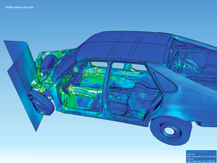
The finite element method (FEM) is a popular method for numerically solving differential equations arising in engineering and mathematical modeling. Typical problem areas of interest include the traditional fields of structural analysis, heat transfer, fluid flow, mass transport, and electromagnetic potential. The FEM is a general numerical method for solving partial differential equations in two or three space variables (i.e., some boundary value problems). To solve a problem, the FEM subdivides a large system into smaller, simpler parts that are called finite elements. This is achieved by a particular space discretization in the space dimensions, which is implemented by the construction of a mesh of the object: the numerical domain for the solution, which has a finite number of points. The finite element method formulation of a boundary value problem finally results in a system of algebraic equations. The method approximates the unknown function over the domain. The simple ... [...More Info...] [...Related Items...] OR: [Wikipedia] [Google] [Baidu] |
Flownet
A flow net is a graphical representation of two-dimensional steady-state groundwater flow through aquifers. Construction of a flow net is often used for solving groundwater flow problems where the geometry makes analytical solutions impractical. The method is often used in civil engineering, hydrogeology or soil mechanics as a first check for problems of flow under hydraulic structures like dams or sheet pile walls. As such, a grid obtained by drawing a series of equipotential lines is called a flow net. The flow net is an important tool in analysing two-dimensional irrotational flow problems. Flow net technique is a graphical representation method. Basic method The method consists of filling the flow area with stream and equipotential lines, which are everywhere perpendicular to each other, making a curvilinear grid. Typically there are two surfaces (boundaries) which are at constant values of potential or hydraulic head (upstream and downstream ends), and the other surfaces are ... [...More Info...] [...Related Items...] OR: [Wikipedia] [Google] [Baidu] |
SEEP2D Dam1 600px
A seep or flush is a moist or wet place where water, usually groundwater, reaches the earth's surface from an underground aquifer. Description Seeps are usually not of sufficient volume to be flowing beyond their immediate above-ground location. They are part of the limnology-geomorphology system. Like a higher volume spring, the water is only from underground sources. Seeps mostly occur in lower elevation areas because water runs downhill, but can happen higher up if the groundwater present is abundant enough. Along with natural seeps, man made seeps can occur by digging anywhere where there is wet ground. This method can be useful for survival purposes and helps the local wildlife by adding another water source to the area. Seeps often form a puddle, and are important for small wildlife, bird, and butterfly habitat and moisture needs. When they support mud-puddling many butterfly (''Lepidoptera'') species can obtain nutrients such as salts and amino acids, including ... [...More Info...] [...Related Items...] OR: [Wikipedia] [Google] [Baidu] |


