|
Rokkō Island Line
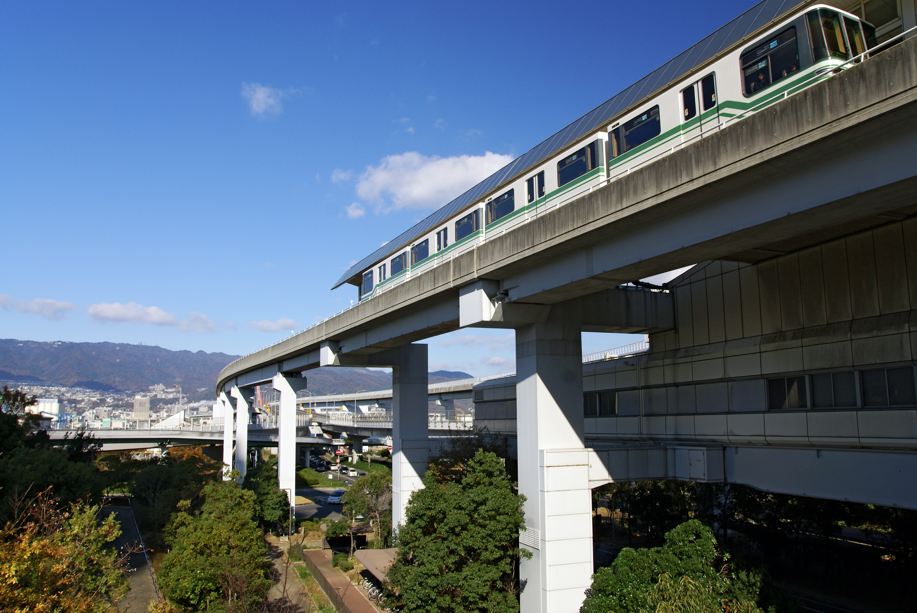
The , commonly known as is an automated guideway transit system in Kobe, Japan. Upon its opening on February 21, 1990, it became the second AGT line operated by Kobe New Transit. The line connects the man-made Rokkō Island to Sumiyoshi Station on the JR Kobe Line. Stations Rolling stock *Kobe New Transit 3000 series (since 2018) *Kobe New Transit 1000 series (from 1990 until 2023) See also *Port Island Line The , commonly known as is an urban automated guideway transit (AGT) system in Kobe, Japan, operated by Kobe New Transit. Opened in 1981, the Port Liner was the world's first driverless urban transit system, a few years ahead of the VAL system ... External links Kobe New Transit {{DEFAULTSORT:Rokko Island Line People mover systems in Japan Rail transport in Hyōgo Prefecture Transport in Kobe Railway lines opened in 1990 1990 establishments in Japan ... [...More Info...] [...Related Items...] OR: [Wikipedia] [Google] [Baidu] |
Hyōgo Prefecture
is a prefecture of Japan located in the Kansai region of Honshu. Hyōgo Prefecture has a population of 5,469,762 () and has a geographic area of . Hyōgo Prefecture borders Kyoto Prefecture to the east, Osaka Prefecture to the southeast, and Okayama Prefecture and Tottori Prefecture to the west. Kōbe is the capital and largest city of Hyōgo Prefecture, and the seventh-largest city in Japan, with other major cities including Himeji, Nishinomiya, and Amagasaki. Hyōgo Prefecture's mainland stretches from the Sea of Japan to the Seto Inland Sea, where Awaji Island and a small archipelago of islands belonging to the prefecture are located. Hyōgo Prefecture is a major economic center, transportation hub, and tourist destination in western Japan, with 20% of the prefecture's land area designated as Natural Parks. Hyōgo Prefecture forms part of the Keihanshin metropolitan area, the second-most-populated urban region in Japan after the Greater Tokyo area and one of the worl ... [...More Info...] [...Related Items...] OR: [Wikipedia] [Google] [Baidu] |
Transport In Kobe
Transport in the Keihanshin metropolitan region is much like that of Tokyo: it includes public and private rail and highway networks; airports for international, domestic, and general aviation; buses; motorcycle delivery services, walking, bicycling, and commercial shipping. The nexus is in the central part of Osaka, though Kobe and Kyoto are major centers in their own right. Every part of Keihanshin has rail or road transport services. The sea and air transport is available from a limited number of ports for the general public. Public transport within Keihanshin is dominated by an extensive public system, beginning with an urban rail network second only to that of Greater Tokyo, consisting of over seventy railway lines of surface trains and subways run by numerous operators; buses, monorails, and trams support the primary rail network. Over 13 million people use the public transit system daily as their primary means of travel. Like Tokyo, walking and bicycling are much more commo ... [...More Info...] [...Related Items...] OR: [Wikipedia] [Google] [Baidu] |
Rail Transport In Hyōgo Prefecture
Rail or rails may refer to: Rail transport *Rail transport and related matters * Rail (rail transport) or railway lines, the running surface of a railway Arts and media Film * ''Rails'' (film), a 1929 Italian film by Mario Camerini * ''Rail'' (1967 film), a film by Geoffrey Jones for British Transport Films *''Mirattu'' or ''Rail'', a Tamil-language film and its Telugu dub Magazines * ''Rail'' (magazine), a British rail transport periodical * ''Rails'' (magazine), a former New Zealand based rail transport periodical Other arts * The Rails, a British folk-rock band * Rail (theater) or batten, a pipe from which lighting, scenery, or curtains are hung Technology *Rails framework or Ruby on Rails, a web application framework *Rail system (firearms), a mounting system for firearm attachments *Front engine dragster *Runway alignment indicator lights, a configuration of an approach lighting system *Rule Augmented Interconnect Layout, a specification for expressing guidelines for pri ... [...More Info...] [...Related Items...] OR: [Wikipedia] [Google] [Baidu] |
People Mover Systems In Japan
A person ( : people) is a being that has certain capacities or attributes such as reason, morality, consciousness or self-consciousness, and being a part of a culturally established form of social relations such as kinship, ownership of property, or legal responsibility. The defining features of personhood and, consequently, what makes a person count as a person, differ widely among cultures and contexts. In addition to the question of personhood, of what makes a being count as a person to begin with, there are further questions about personal identity and self: both about what makes any particular person that particular person instead of another, and about what makes a person at one time the same person as they were or will be at another time despite any intervening changes. The plural form "people" is often used to refer to an entire nation or ethnic group (as in "a people"), and this was the original meaning of the word; it subsequently acquired its use as a plural form of p ... [...More Info...] [...Related Items...] OR: [Wikipedia] [Google] [Baidu] |
Port Island Line
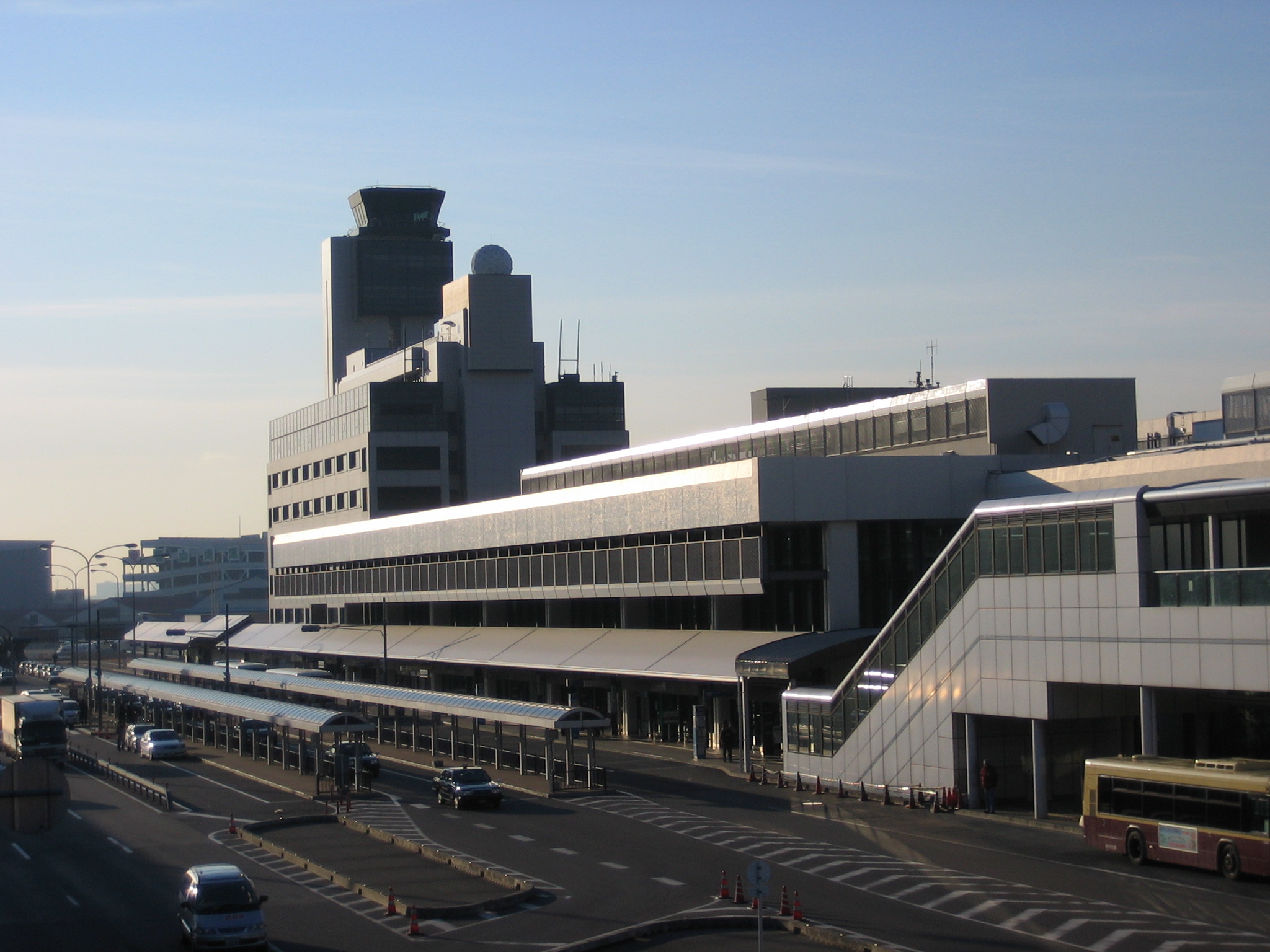
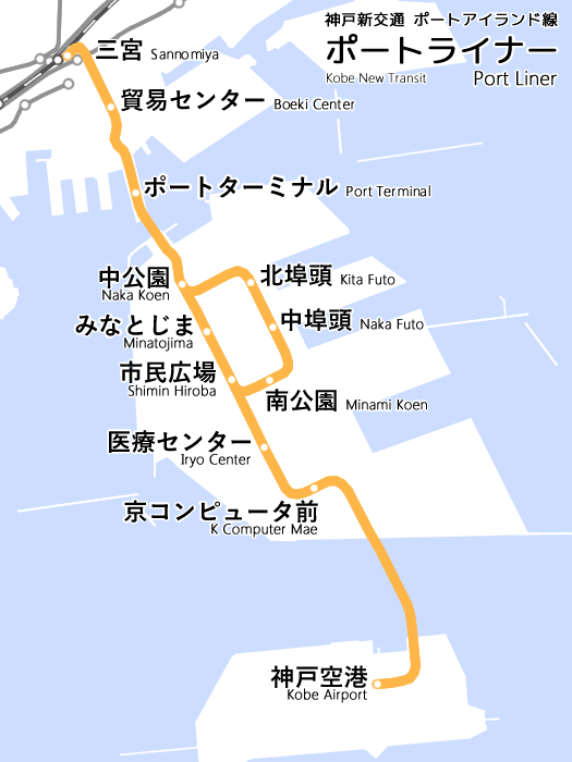
The , commonly known as is an urban automated guideway transit (AGT) system in Kobe, Japan, operated by Kobe New Transit. Opened in 1981, the Port Liner was the world's first driverless urban transit system, a few years ahead of the VAL system used on the Lille Metro, which opened in 1983. The initial system linked Sannomiya Station, Kobe's main transit hub, to the man-made Port Island, covering a distance of 6.4 km with 9 stations. On February 2, 2006, the line was extended by 4.3 km to the new Kobe Airport, built on an artificial island near Port Island. Route As the map indicates, the present system consists of one straight line, originating at Sannomiya Station and terminating at Kobe Airport Station, and a loop attached to the middle of the straight line. The stations on the former are numbered with prefix "P" and on the latter (except those shared with the former) are with prefix "PL". Originally, before the 2006 extension to the airport, the loop section wa ... [...More Info...] [...Related Items...] OR: [Wikipedia] [Google] [Baidu] |
Kobe New Transit 1000 Series
Kobe ( , ; officially , ) is the capital city of Hyōgo Prefecture Japan. With a population around 1.5 million, Kobe is Japan's seventh-largest city and the third-largest port city after Tokyo and Yokohama. It is located in Kansai region, which makes up the southern side of the main island of Honshū, on the north shore of Osaka Bay. It is part of the Keihanshin metropolitan area along with Osaka and Kyoto. The Kobe city centre is located about west of Osaka and southwest of Kyoto. The earliest written records regarding the region come from the '' Nihon Shoki'', which describes the founding of the Ikuta Shrine by Empress Jingū in AD 201.Ikuta Shrine official website – "History of Ikuta Shrine" (Japanese) [...More Info...] [...Related Items...] OR: [Wikipedia] [Google] [Baidu] |
Kobe New Transit 3000 Series
Kobe ( , ; officially , ) is the capital city of Hyōgo Prefecture Japan. With a population around 1.5 million, Kobe is Japan's seventh-largest city and the third-largest port city after Tokyo and Yokohama. It is located in Kansai region, which makes up the southern side of the main island of Honshū, on the north shore of Osaka Bay. It is part of the Keihanshin metropolitan area along with Osaka and Kyoto. The Kobe city centre is located about west of Osaka and southwest of Kyoto. The earliest written records regarding the region come from the '' Nihon Shoki'', which describes the founding of the Ikuta Shrine by Empress Jingū in AD 201.Ikuta Shrine official website – "History of Ikuta Shrine" (Japanese) [...More Info...] [...Related Items...] OR: [Wikipedia] [Google] [Baidu] |
Hanshin Main Line
{{BS-map , title=Route map , title-bg=orangered , title-color=white , collapsible=yes , collapse=yes , map= {{BS, , , Lines are of Hanshin unless noted, } {{BS5, , hBHF, , , tBHF, , , {{STN, Osaka/{{STN, Kitashinchi} {{BS5, , hSTR, exKBHFa, tKACCa, tSTR, 0.0, {{STN, Umeda, connections are shown below} {{BS5, STR+r, hSTR, exSTR, O3=extSTRc2, etABZg3, tSTR, , , } {{BS5, STR, hSTR, exABZg+1xu, tSTR, O4=extSTRc4, tSTR, O5=POINTERg@fq, , , JR-W: JR Tōzai Line} {{BS5, KRZh, hABZgr, exSTR, tSTR, tSTR, , , JR-W: Tōkaidō Line} {{BS5, STR, hSTR, exSTR, tSTR, tSTR, , , ( JR Kobe Line, JR Takarazuka Line)} {{BS5, STR, hSTR, exBHF, tSTR, tSTR, , ''Deiribashi'', abandoned in 1949} {{BS5, STR, hSTR, exBHF, tACC, tSTR, 1.1, {{STN, Fukushima, Osaka (Hanshin), } {{BS5, BUE, hBHF, exSTR, O3=tSTRc2, tSTR3, O4=tSTRc2, tSTR3, , , Fukushima (JR West)} {{BS5, hSTRa, hSTR, xABZg+1u, tSTR+1, O4=tSTRc4, tSTR+1, O5=tSTRc4, , , Keihan: Nakanoshima Line} {{BS5, hSTR, hSTR, STR, tBHF, tKBHF ... [...More Info...] [...Related Items...] OR: [Wikipedia] [Google] [Baidu] |
Number Prefix Hanshin Railway
A number is a mathematical object used to count, measure, and label. The original examples are the natural numbers 1, 2, 3, 4, and so forth. Numbers can be represented in language with number words. More universally, individual numbers can be represented by symbols, called ''numerals''; for example, "5" is a numeral that represents the number five. As only a relatively small number of symbols can be memorized, basic numerals are commonly organized in a numeral system, which is an organized way to represent any number. The most common numeral system is the Hindu–Arabic numeral system, which allows for the representation of any number using a combination of ten fundamental numeric symbols, called digits. In addition to their use in counting and measuring, numerals are often used for labels (as with telephone numbers), for ordering (as with serial numbers), and for codes (as with ISBNs). In common usage, a ''numeral'' is not clearly distinguished from the ''number'' that it ... [...More Info...] [...Related Items...] OR: [Wikipedia] [Google] [Baidu] |
Higashinada-ku, Kobe
is one of 9 wards of Kobe, Japan. It has an area of 30.36 km², and a population of 212,111 (2012). South of the Hanshin Main Line, it is also home to some notable sake brewing areas, including Uozaki and Mikage. Transportation Railways *JR Kobe Line ( Sumiyoshi - Settsu Motoyama - Konan-Yamate) *Hankyu Kobe Line ( Mikage - Okamoto) *Hanshin Main Line ( Ishiyagawa - Mikage - Sumiyoshi - Uozaki - Ōgi - Fukae) * Rokko Liner Roads *Hanshin Expressway 3 - Kobe Route, 5 - Wangan Route * Route 2, Route 43, Route 171 Sea *Port of Kobe The Port of Kobe is a Japanese maritime port in Kobe, Hyōgo in the Keihanshin area, backgrounded by the Hanshin Industrial Region. Located at a foothill of the range of Mount Rokkō, flat lands are limited and constructions of artificial isla ... ( Rokko Island) Education Universities: * Kobe International University on Rokko Island * Konan University * Konan Women's University Public high schools: * Rokko Island High Schoo ... [...More Info...] [...Related Items...] OR: [Wikipedia] [Google] [Baidu] |


_1938.jpg)


