|
Roihuvuori
Roihuvuori ( sv, Kasberget, or ''Roihis'' and ''Roihika'', literal translation ''Blaze Mountain'') is a ''quarter'', part of Herttoniemi neighbourhood in Helsinki, Finland. The population of Roihuvuori is approximately 8,000 and its area is 1.47 km². There is a church, two schools, shops and restaurants in Roihuvuori. There is also a water tower, Japanese style garden, playground Tuhkimo and Kirsikkapuisto where a Hanami is the Japanese traditional custom of enjoying the transient beauty of flowers; in this case almost always refer to those of the or, less frequently, trees. From the end of March to early May, cherry trees bloom all over Japan, and around ... festival is held. Each street in Roihuvuori was named after fairy tales, with the exception being Roihuvuori's main street (Roihuvuorentie). For example, Lumikintie is "Snow White Street" and Tuhkimotie is "Cinderella Street". Image:Japanilaistyylinenpuutarha 3.jpg, Japanese style garden Image:Lehto.JPG, An ald ... [...More Info...] [...Related Items...] OR: [Wikipedia] [Google] [Baidu] |
Herttoniemi
Herttoniemi ( sv, Hertonäs) is an East Helsinki Subdivisions of Helsinki#Neighbourhoods, neighbourhood and a suburb of Helsinki, the Finland, Finnish capital. Geography Located about east of the city centre, Herttoniemi can be reached by the Helsinki Metro in 10 minutes, or by road via the Itäväylä arterial road (Finnish regional road no. 170) running from the inner city area through the eastern suburbs. Herttoniemi comprises four distinct areas: *Länsi-Herttoniemi (West Herttoniemi) *Roihuvuori, formerly Itä-Herttoniemi (East Herttoniemi) *Herttoniemenranta (Herttoniemi Harbour) *Herttoniemi industrial area History Herttoniemi has been inhabited for a long time. One of Helsinki's Bronze Age graves has been found near the Herttoniemi metro station. Some Finnish place names have also survived in Herttoniemi, which testify that Tavastians have used the area and inhabited it before Sweden, Swedes Swedish colonization of Finland, colonized Uusimaa. In the light of place name ... [...More Info...] [...Related Items...] OR: [Wikipedia] [Google] [Baidu] |
Kirsikkapuisto
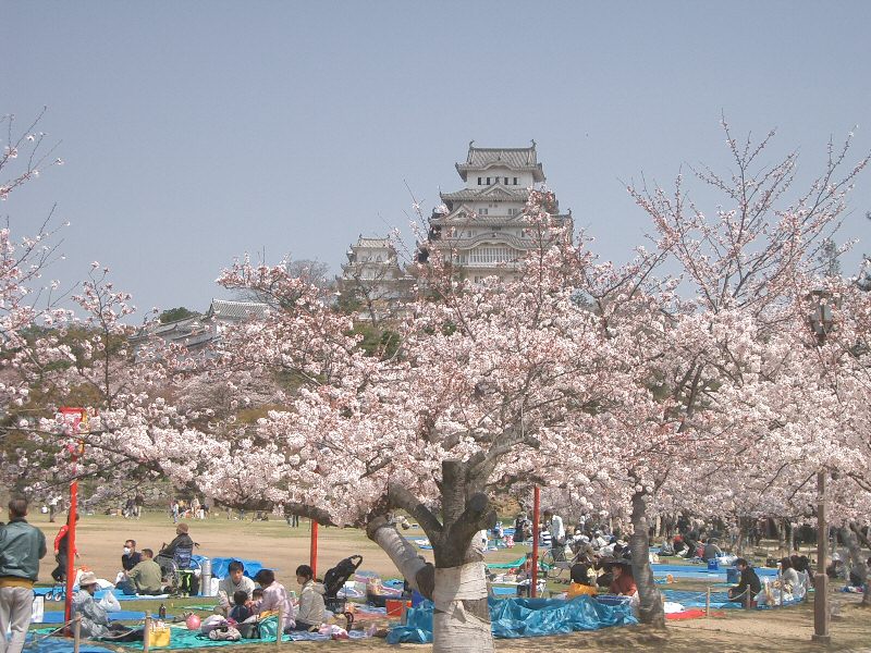
Kirsikkapuisto (English: ''Cherry Tree Park'', sv, Körsbärsträdsparken) opened in 2007 in the Roihuvuori district of Helsinki, and is part of the Roihuvuori green area. The southern area has a fenced off dog park. In the dog park are wooden statues of dogs and a tree with a cat in it. The city department that maintains these statues has now closed and the statues are being removed as they deteriorate. There are about 150 Cherry trees in the park that were planted following sponsorship from the Japanese community in Helsinki. In the Spring the Japanese festival of Hanami is the Japanese traditional custom of enjoying the transient beauty of flowers; in this case almost always refer to those of the or, less frequently, trees. From the end of March to early May, cherry trees bloom all over Japan, and around ... is celebrated when the trees blossom. References {{Helsinki Cityscape Roihuvuori Parks in Helsinki ... [...More Info...] [...Related Items...] OR: [Wikipedia] [Google] [Baidu] |
Playground Tuhkimo
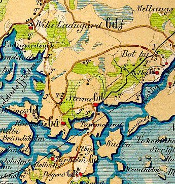
Playground Tuhkimo (''Leikkipuisto Tuhkimo'' in Finnish, ''Lekparken Askungen'' in Swedish) is a public, free of charge park at Roihuvuori district in Helsinki, Finland. General The playground is located in a valley between two Metamorphic rocks. From the rocks of the area can clearly be seen the tracks of the ice age. In the 19th century the area belonged to a tenant farmer called ''Kiilatorppa'' from Herttoniemi estate. A map from 1936 showed that this area was just a field. Kartta Roihuvuoren alueesta vuodelta 1936 The Park's name, ''Tuhkimo'' comes from the fairy tale Cinderella (Tuhkimo in Finnish). The park has been particularly popular with families. The playground is surrounded by Roihuvuori forest A forest is an area of land dominated by trees. Hundreds of definitions of forest are used throughout the world, incorporating factors such as tree density, tree height, land use, legal standing, and ecological function. The United Nations' ...s, but in the south ... [...More Info...] [...Related Items...] OR: [Wikipedia] [Google] [Baidu] |
Tammisalo
Tammisalo () is a neighbourhood (number 44) and an island in eastern part of Helsinki, Finland. The population of Tammisalo is approximately 2,200 and its area is . The nearest districts are Herttoniemi, Roihuvuori and Laajasalo. In the Viking Vikings ; non, víkingr is the modern name given to seafaring people originally from Scandinavia (present-day Denmark, Norway and Sweden), who from the late 8th to the late 11th centuries raided, pirated, traded and se ... era the coastal waterway from Sweden to Arab world went between Tammisalo and the continent along Porolahti bay. A particularly remarkable building in the low-rise suburb of Tammisalo is the 5-storey house called Tammelund, designed by architect Antti Rantanen (1935), which in terms of its proportions and number of windows (over 100), is regarded as a "miniature skyscraper". Tammisalo is also renowned for housing projects designed by famous modernist architect Timo Penttilä. Ne ... [...More Info...] [...Related Items...] OR: [Wikipedia] [Google] [Baidu] |
Subdivisions Of Helsinki
The city of Helsinki, the capital of Finland, can be divided into various sorts of subdivisions. Helsinki is divided into three major areas: Helsinki Downtown ( fi, Helsingin kantakaupunki, sv, Helsingfors innerstad), North Helsinki ( fi, Pohjois-Helsinki, sv, Norra Helsingfors) and East Helsinki ( fi, Itä-Helsinki, sv, Östra Helsingfors). The subdivisions include neighbourhoods, districts, major districts and postal code areas. The plethora of different official ways to divide the city is a source of some confusion to the inhabitants, as different kinds of subdivisions often share similar or identical names. Neighbourhoods Helsinki consists of 60 neighbourhoods (''kaupunginosa'' in Finnish; ''stadsdel'' in Swedish). The division into neighbourhoods is the official division created by the city council and used for city planning and other similar purposes. Most of the neighbourhoods have existed since the 19th century as numbered parts of the city, and official names were ... [...More Info...] [...Related Items...] OR: [Wikipedia] [Google] [Baidu] |
Itäkeskus
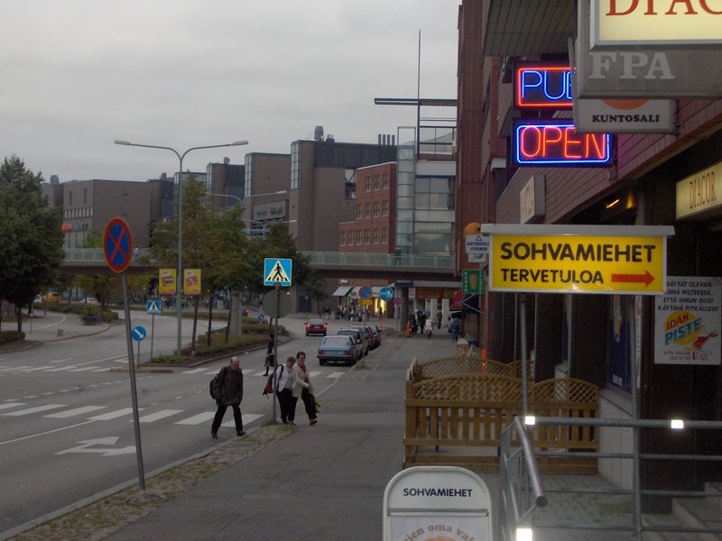
Itäkeskus ( sv, Östra centrum, literal translation ''East center'') is a ''quarter'' in the neighbourhood of Vartiokylä (as of the 1980s) in Helsinki, Finland. The district's main attraction is the largest covered-in shopping mall in the Nordic countries, Itis, which make Itäkeskus as the most significant commercial center of East Helsinki. The district has a station on the Helsinki Metro (Itäkeskus metro station), whose eastern entrance at the Tallinnanaukio square leads to the shopping centre. Itäkeskus has the eastern terminus of bus lines 500 and 550; the western terminus of line 500 is Munkkivuori and line 550 is Espoo's Westend bus station. Construction of the Jokeri light rail, which replaces bus line 550, began in 2019 and traffic is scheduled to begin in 2024. The most important road connection to the Helsinki central from Itäkeskus runs along Itäväylä. At the end of 2018, 38.1 per cent of Itäkeskus' residents had a foreign background. [...More Info...] [...Related Items...] OR: [Wikipedia] [Google] [Baidu] |
Marjaniemi
Marjaniemi ( sv, Marudd) is a seaside residential area in eastern Helsinki, Finland, with a population of approximately 2,000. Administratively it forms a quarter in the neighbourhood of Vartiokylä. Marjaniemi is a sought-after neighborhood, and the real estate prices rank among the highest in the city. Politics Results of the 2011 Finnish parliamentary election in Marjaniemi: *National Coalition Party 41.7% *Social Democratic Party 18.0% *True Finns 12.2% *Green League 9.5% * Left Alliance 6.6% *Swedish People's Party 4.6% * Centre Party 3.7% *Christian Democrats __NOTOC__ Christian democratic parties are political parties that seek to apply Christian principles to public policy. The underlying Christian democracy movement emerged in 19th-century Europe, largely under the influence of Catholic social ... 1.9% External links * Quarters of Helsinki {{SouthernFinland-geo-stub ... [...More Info...] [...Related Items...] OR: [Wikipedia] [Google] [Baidu] |
Hanami
is the Japanese traditional custom of enjoying the transient beauty of flowers; in this case almost always refer to those of the or, less frequently, trees. From the end of March to early May, cherry trees bloom all over Japan, and around the first of February on the island of Okinawa. The is announced each year by the Japan Meteorological Agency, and is watched carefully by those planning ''hanami'' as the blossoms only last a week or two. In modern-day Japan, ''hanami'' mostly consists of having an outdoor party beneath the sakura during daytime or at night. In some contexts the Sino-Japanese term is used instead, particularly for festivals. ''Hanami'' at night is called . In many places such as Ueno Park temporary paper lanterns are hung for the purpose of ''yozakura''. On the island of Okinawa, decorative electric lanterns are hung in the trees for evening enjoyment, such as on the trees ascending Mt. Yae, near Motobu Town, or at the Nakijin Castle. A more ancien ... [...More Info...] [...Related Items...] OR: [Wikipedia] [Google] [Baidu] |
Herttoniemenranta
Herttoniemenranta (Finnish), Hertonäs strand (Swedish) is a southeastern neighborhood of Helsinki, Finland Finland ( fi, Suomi ; sv, Finland ), officially the Republic of Finland (; ), is a Nordic country in Northern Europe. It shares land borders with Sweden to the northwest, Norway to the north, and Russia to the east, with the Gulf of B .... Herttoniemenranta is part of Herttoniemi and it was built in the late 1990s and early 2000s. {{coord, 60, 11, 26, N, 25, 02, 02, E, source:kolossus-fiwiki, display=title Herttoniemi ... [...More Info...] [...Related Items...] OR: [Wikipedia] [Google] [Baidu] |
Regions Of Finland
Finland is divided into 19 regions ( fi, maakunta; sv, landskap)., smn, eennâmkodde, and sms, mäddkåʹdd. The regions are governed by regional councils that serve as forums of cooperation for the Municipalities of Finland, municipalities of each region. The councils are composed of delegates from the municipal councils. The main tasks of regional councils are regional planning, development of enterprises, and education. Between 2004 and 2012 the regional council of Kainuu was elected via popular elections as part of an experimental regional administration. In 2022 new Wellbeing services counties of Finland, wellbeing services counties were established as part of a health care and social services reform. The wellbeing services counties follow the regional borders, and are governed by directly elected county councils. Åland One region, Åland, has a special status and has a much higher degree of autonomy than the others, with its own Parliament of Åland, Parliament and ... [...More Info...] [...Related Items...] OR: [Wikipedia] [Google] [Baidu] |
Postal Codes In Finland ...
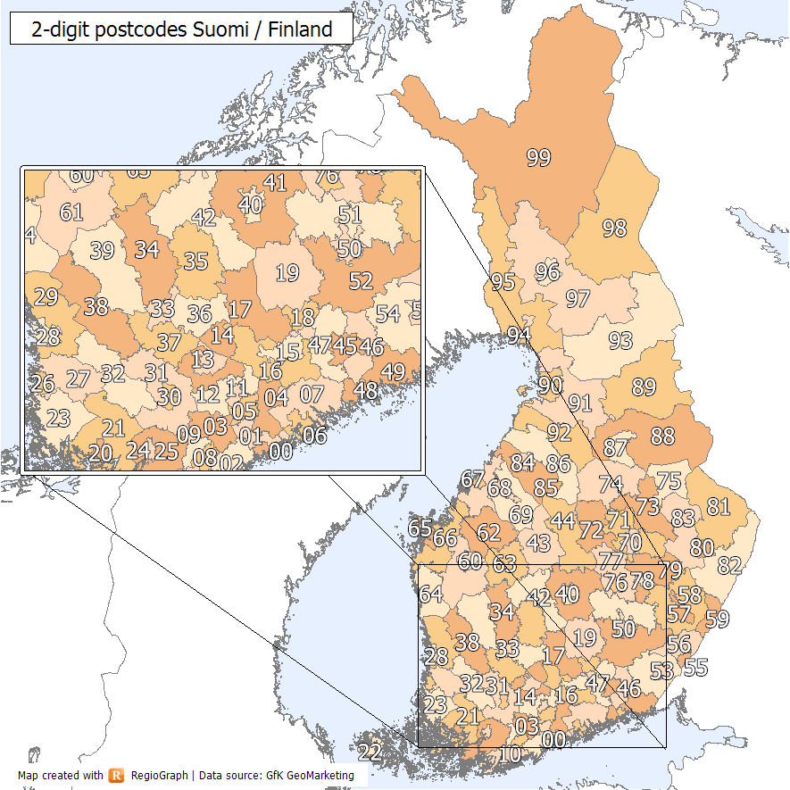
Finland has used five-digit numeric postal codes since the 1970s. The first and second digits designate the general area of the municipality of the address, while the last three designate a smaller region within that larger area. The numeric postal code is usually accompanied by a written name for the smaller region. Corporations receiving large amounts of mail may have their own postal codes, also consisting of a five-digit numeric code and the name of the company. A special postal code 99999 is used for the residence of the Finnish Joulupukki, Korvatunturi. Notes References * {{Finland-stub Finland Finland ( fi, Suomi ; sv, Finland ), officially the Republic of Finland (; ), is a Nordic country in Northern Europe. It shares land borders with Sweden to the northwest, Norway to the north, and Russia to the east, with the Gulf of B ... [...More Info...] [...Related Items...] OR: [Wikipedia] [Google] [Baidu] |
Roihupelto
Roihupelto (; sv, Kasåkern, literal translation ''Blaze Field'') is a neighborhood in eastern Helsinki, Finland Finland ( fi, Suomi ; sv, Finland ), officially the Republic of Finland (; ), is a Nordic country in Northern Europe. It shares land borders with Sweden to the northwest, Norway to the north, and Russia to the east, with the Gulf of B .... It was previously called Roihupellon teollisuusalue (''Kasåkers industriområde'', ''Roihupelto industrial area''). It is a largely industrial area with few inhabitants. Vartiokylä {{Helsinki ... [...More Info...] [...Related Items...] OR: [Wikipedia] [Google] [Baidu] |


