|
Reutte District
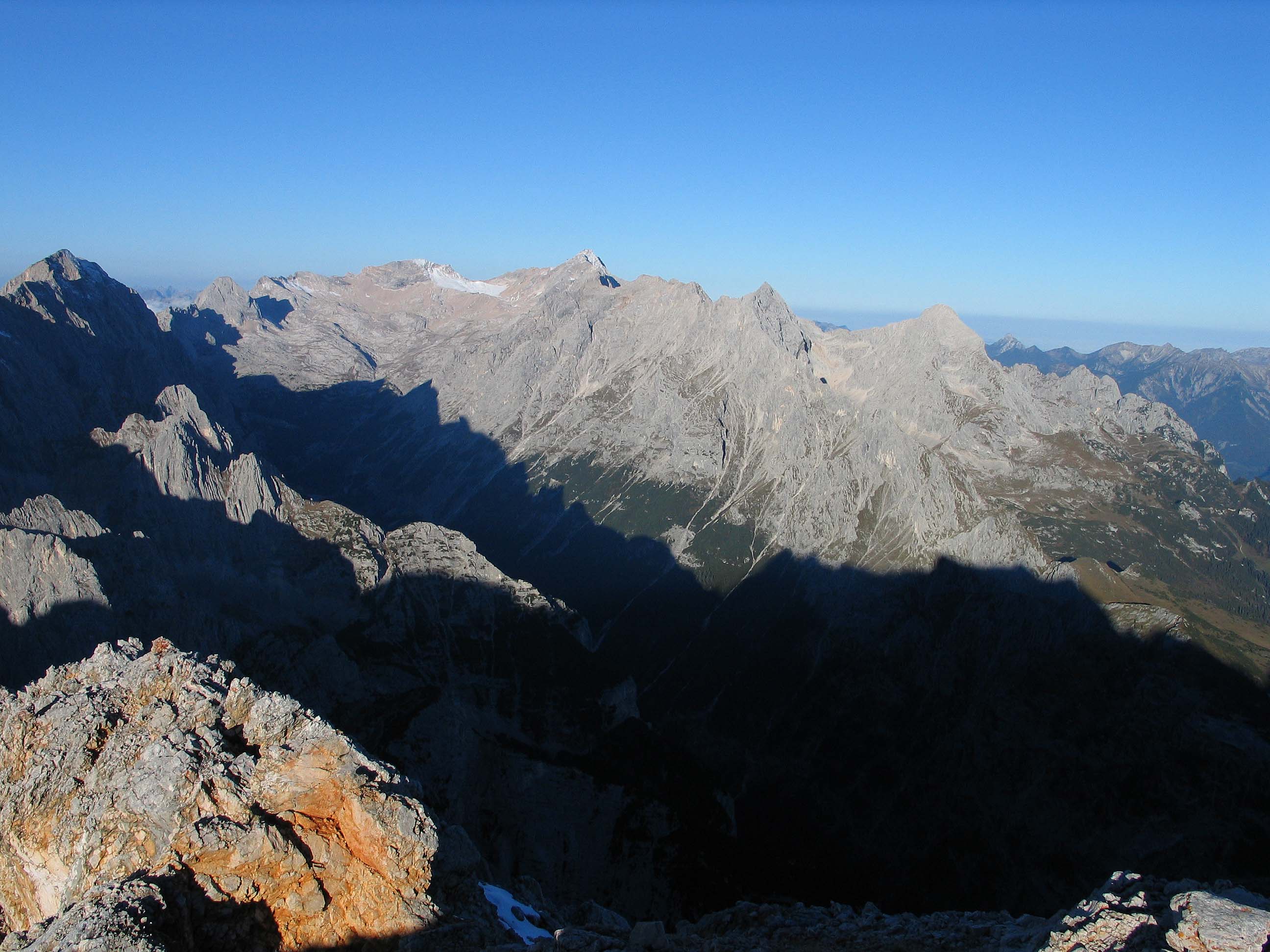
The is an administrative district () in Tyrol, Austria. It borders Bavaria (Germany) in the north, the districts Imst and Landeck in the south, and Bregenz and Bludenz (both in Vorarlberg) in the west. The district is also referred to as . The district is , with a population of 31,758 (January 1, 2012), and population density of . Administrative center is Reutte. Geography The district comprises the valleys of the Lech, the Tannheimer Tal, and the so-called Zwischentoren between Reutte and Fern Pass. Mountain ranges in the district include parts of the Lechtal Alps, Wetterstein Mountains, Allgäu Alps and Tannheim Mountains. Prominent lakes include Plansee, Heiterwanger See, Haldensee, and Vilsalpsee. Administrative divisions The 37 municipalities of the district: * Bach (687) * Berwang (585) * Biberwier (632) * Bichlbach (795) * Breitenwang (1,532) * Ehenbichl (810) * Ehrwald (2,581) * Elbigenalp (863) * Elmen (375) * Forchach (296) * Grän (580) * Gramais ... [...More Info...] [...Related Items...] OR: [Wikipedia] [Google] [Baidu] |
Districts Of Austria
A district (german: Bezirk) is a second-level division of the executive arm of the Austrian government. District offices are the primary point of contact between resident and state for most acts of government that exceed municipal purview: marriage licenses, driver licenses, passports, assembly permits, hunting permits, or dealings with public health officers for example all involve interaction with the district administrative authority (). Austrian constitutional law distinguishes two types of district administrative authority: *district commissions (), district administrative authorities that exist as stand-alone bureaus; *statutory cities ( or ), cities that have been vested with district administration functions in addition to their municipal responsibilities, i.e. district administrative authorities that only exist as a secondary role filled by something that primarily is a city (marked in the table with an asterisk (*). As of 2017, there are 94 districts, of which 79 are d ... [...More Info...] [...Related Items...] OR: [Wikipedia] [Google] [Baidu] |
Reutte
Reutte (; Swabian: ) is a market town in the Austrian state of Tyrol. It is the administrative center of the Reutte district (''Districts of Austria''). Reutte is located on the Lech, and has a population of 6704 (as of 2018). Neighbouring municipalities Adjacent municipalities and villages are: Breitenwang, Ehenbichl, Lechaschau and Pflach. History Reutte is located on the Via Claudia Augusta, a Roman road leading from Italy to Germany. The Tyrolean Salt Road from Hall in Tirol to Lake Constance crossed the entire district of Außerfern. Reutte (then Reuti) was declared a market town by Sigmund on June 5 1489. This was confirmed later by Maximilian I who also added some further rights. The people of Reutte commemorate this with an annual festival on the first Saturday in August. From 1692 the painter Paul Zeiller had a workshop in Reutte that later became an art school. His son, Johann Jakob Zeiller and adopted son, Franz Anton Zeiller, both received their firs ... [...More Info...] [...Related Items...] OR: [Wikipedia] [Google] [Baidu] |
Municipality (Austria)
In the Republic of Austria, the municipality ( de , Gemeinde, sometimes also ) is the administrative division encompassing a single village, town, or city. The municipality has corporate status and local self-government on the basis of parliamentary-style representative democracy: a municipal council () elected through a form of party-list system enacts municipal laws, a municipal executive board () and a mayor (, fem. ) appointed by the council are in charge of municipal administration. Austria is currently (January 1, 2020) partitioned into 2,095 municipalities, ranging in population from about fifty (the village of Gramais in Tyrol) to almost two million (the city of Vienna). There is no unincorporated territory in Austria. Basics The existence of municipalities and their role as carriers of the right to self-administration are guaranteed by the Austrian constitution ( B-VG Art. 116 (1)). The constitution means for municipalities to be autonomous () in any matter that a ... [...More Info...] [...Related Items...] OR: [Wikipedia] [Google] [Baidu] |
Vilsalpsee
Vilsalpsee is a lake of Tyrol, Austria Austria, , bar, Östareich officially the Republic of Austria, is a country in the southern part of Central Europe, lying in the Eastern Alps. It is a federation of nine states, one of which is the capital, Vienna, the most populous .... Lakes of Tyrol (state) Reutte District {{Tyrol-geo-stub ... [...More Info...] [...Related Items...] OR: [Wikipedia] [Google] [Baidu] |
Haldensee
Haldensee is a lake of Tyrol, Austria Austria, , bar, Östareich officially the Republic of Austria, is a country in the southern part of Central Europe, lying in the Eastern Alps. It is a federation of nine states, one of which is the capital, Vienna, the most populous .... It is located on an altitude of 1124 m ü. A. in the Tannheimer Tal (Tannheim Valley) between Grän and Nesselwängle and has a size of . See also * Lakes of Tyrol (state) {{Tyrol-geo-stub ... [...More Info...] [...Related Items...] OR: [Wikipedia] [Google] [Baidu] |
Heiterwanger See
Lake Heiterwang is a lake in the Tirol, Austria Austria, , bar, Östareich officially the Republic of Austria, is a country in the southern part of Central Europe, lying in the Eastern Alps. It is a federation of nine states, one of which is the capital, Vienna, the most populous ..., located at . Its surface is approximately 1.37 km² and its maximum depth is 61 metres. It is well-known Heiterwanger See is good for fishing. Kaiser Maximilian I of Austria often fished here. Lakes of Tyrol (state) Ammergau Alps {{Tyrol-geo-stub ... [...More Info...] [...Related Items...] OR: [Wikipedia] [Google] [Baidu] |
Plansee
Plansee is a lake in Reutte District, Tyrol, Austria, located at . Its surface is approximately 2.87 km² and its maximum depth is 78 metres. It lies on Austrian Federal Highway B 179, which crosses the Ammersattel into Germany. History Plansee and Heiterwanger See are probably the remains of an Ice Age meltwater reservoir that once covered the entire Zwischentoren ( de:Zwischentoren) area up to the Ehrwald Basin ( de:Ehrwalder Becken). The lake is first mentioned in a border description of the diocese of Freising from the years 1073/78 as Planse, other early names include; Please , Plense and Plase. The Tyrolean princes and the Steingaden monastery held the fishing rights on the Plansee, as the Stams monastery in the 15th century through gift or acquisition. Duke Siegmund and his successor, Emperor Maximilian I, tried to get their hands on the best fishing waters in the country. Lake Achen from the Georgenberg monastery, and the Plansee from the Stams monastery. I ... [...More Info...] [...Related Items...] OR: [Wikipedia] [Google] [Baidu] |
Tannheim Mountains
The Tannheim Mountains''Utrata Fachwörterbuch: Geographie - Englisch-Deutsch/Deutsch-Englisch'' by Jürgen Utrata (2014). Retrieved 10 Apr 2014. (german: Tannheimer Berge) are a sub-group of the in the Bavarian-Tyrolean border region. Their name is derived from the village of in the |
Allgäu Alps
The Allgäu Alps (german: Allgäuer Alpen) are a mountain range in the Northern Limestone Alps, located in Bavaria and Baden-Württemberg in Germany and Tyrol and Vorarlberg in Austria. The range lies directly east of Lake Constance. Character The mountain range is characterised by an unusual variety of rock formations and consequently a rich tapestry of landscapes, in particular, the steep " grass mountains" (''Grasberge'') of the Allgäu Alps with gradients of up to 70°. Its flora is amongst the most varied in the whole Alpine region and its accessibility by lifts and paths is outstanding. The mountain paths (''Höhenwege'') running from hut to hut are well known and hikers can spend seven to ten days walking in the mountains without descending to inhabited valleys. Thanks to its location on the northern edge of the Alps, the region has relatively high precipitation and is the rainiest in Germany. In winter the Allgäu Alps – at least in the higher regions – are comp ... [...More Info...] [...Related Items...] OR: [Wikipedia] [Google] [Baidu] |
Wetterstein Mountains
The Wetterstein mountains (german: Wettersteingebirge), colloquially called Wetterstein, is a mountain group in the Northern Limestone Alps within the Eastern Alps. It is a comparatively compact range located between Garmisch-Partenkirchen, Mittenwald, Seefeld in Tirol and Ehrwald along the border between Germany (Bavaria) and Austria (Tyrol). Zugspitze, the highest peak is at the same time the highest mountain in Germany. The Wetterstein mountains are an ideal region for mountaineers and climbers. Mountain walkers sometimes need to allow for significant differences in elevation. The proximity of the range to the south German centres of population, the scenic landscape and its good network of cable cars and lifts mean that the mountains are heavily frequented by tourists for most of the year. There are, however, places in the Wetterstein that are rarely or never visited by people. Neighbouring ranges The Wetterstein borders on the following other mountain rang ... [...More Info...] [...Related Items...] OR: [Wikipedia] [Google] [Baidu] |
Lechtal Alps
The Lechtal Alps (german: Lechtaler Alpen) are a mountain-range in western Austria, and part of the greater Northern Limestone Alps range. Named for the river Lech which drains them north-ward into Germany, the Lechtal Alps occupy the Austrian states of Tyrol and Vorarlberg and are known for their diverse rock structure. The Lechtal Alps are surrounded by the Ötztal Alps, Samnaun Alps and Verwall Alps (south) and the Allgäu Alps (north). Peaks * Parseierspitze, * Dawinkopf, * Südlicher Schwarzer Kopf, * Gatschkopf, * Bocksgartenspitze, *Holzgauer Wetterspitze, * Oberer Bocksgartenkopf, *Vorderseespitze, * Freispitze, * Eisenspitze, *Große Schlenkerspitze, *Fallenbacherspitze The Fallenbacherspitze (also: Fallenbacher Spitze, Fallenbacher-Spitze) in the Austrian state of Tyrol is a 2,723-metre-high rock summit in the Lechtal Alps. Due to its remoteness and lack of signed routes, the mountain is not climbed very often. ..., External links * Mountai ... [...More Info...] [...Related Items...] OR: [Wikipedia] [Google] [Baidu] |
Fern Pass
Fern Pass (elevation 1212 m) is a mountain pass in the Tyrolean Alps in Austria. It is located between the Lechtal Alps on the west and the Mieming Mountains on the east. The highest peak in Germany, the Zugspitze is only 13.5 km away to the northeast. The pass lies between the Grubigstein (2233 m) on the northwest, the Wannig (2493 m) on the southeast, and the Loreakopf (2471 m) on the west. History The pass was created when a huge mountain slide (actually the collapse of an entire mountain, with an estimated volume of 1 km3; the third-largest mountain slide ever in the eastern Alps) filled part of the valley to a height of 300–400 meters, distributing its boulders up to 16 km away. While it was initially believed that this had happened at least 12,000 years B.P. as a consequence of the strong temperature increase and intense run-off after the end of the last deglaciation, pollen analysis performed as early as 1940 had already indicated an age of not much m ... [...More Info...] [...Related Items...] OR: [Wikipedia] [Google] [Baidu] |


