|
Roag, Skye
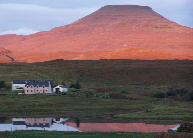
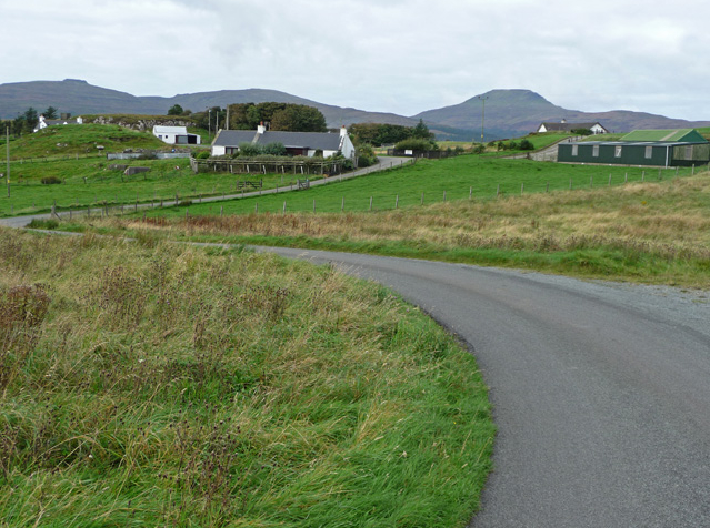
Roag (), meaning noisy place or 'deer bay' in Old Norse, Norse, is a small remote scattered hamlet on the north west shore of Pool Roag in the west of the Duirinish, Skye, Duirinish peninsula. Located on the Isle of Skye, Scottish Highlands, it is in the Scotland, Scottish council area of Highland Council area, Highland. The villages of Heribost approximately northeast, Orbost, Highland, Orbost lying less than southeast of Roag, and Ardraog lying closer to the shore are considered part of Roag. Harlosh lies on the other side of Loch Vatten. Roag also overlooks the sea lochs Loch Na Faolinn and Loch Bracadale. There are about 27 houses in Roag.  Populated places in the Isle of Skye
{{SkyeLochalsh-geo-stub ...
[...More Info...] [...Related Items...] OR: [Wikipedia] [Google] [Baidu] |
Highland (council Area)
Highland (, ; ) is a council areas of Scotland, council area in the Scottish Highlands and is the largest local government area in both Scotland and the United Kingdom. It was the 7th most populous council area in Scotland at the United Kingdom Census 2011, 2011 census. It has land borders with the council areas of Aberdeenshire, Argyll and Bute, Moray and Perth and Kinross. The wider upland area of the Scottish Highlands after which the council area is named extends beyond the Highland council area into all the neighbouring council areas plus Angus, Scotland, Angus and Stirling (council area), Stirling. The Highland Council is based in Inverness, the area's largest settlement. The area is generally sparsely populated, with much of the inland area being mountainous with numerous lochs. The area includes Ben Nevis, the highest mountain in the British Isles. Most of the area's towns lie close to the eastern coasts. Off the west coast of the mainland the council area includes some ... [...More Info...] [...Related Items...] OR: [Wikipedia] [Google] [Baidu] |
Dunvegan
Dunvegan () is a village on the Isle of Skye in Scotland. It is famous for Dunvegan Castle, seat of the chiefs of Clan MacLeod. Dunvegan is within the parish of Duirinish, Skye, Duirinish. In 2011, it had a population of 386. Name In ''The Norse Influence on Gaelic Scotland'' (1910), George Henderson suggests that the name ''Dùn Bheagain'' derives from Old Gaelic ''Dùn Bheccáin'' ([the] fort of Beccán), Beccán being a Gaelic personal name. ''Dùn Bheagain'' would not mean 'little fort' as this would be ''Dùn Beag'' in Scottish Gaelic, Gaelic. Geography Dunvegan sits on the shores of the large Loch Dunvegan, and the Old School Restaurant in the village is noted for its fish, caught freshly from the loch itself. Dunvegan is situated at the junction of the A850 road (Great Britain), A850 and the A863 road (Great Britain), A863. The B884 road also has a junction with the A863, at the eastern end of Dunvegan. Demography Dunvegan's permanent population is declining. However, n ... [...More Info...] [...Related Items...] OR: [Wikipedia] [Google] [Baidu] |
Old Norse
Old Norse, also referred to as Old Nordic or Old Scandinavian, was a stage of development of North Germanic languages, North Germanic dialects before their final divergence into separate Nordic languages. Old Norse was spoken by inhabitants of Scandinavia and their Viking expansion, overseas settlements and chronologically coincides with the Viking Age, the Christianization of Scandinavia, and the consolidation of Scandinavian kingdoms from about the 8th to the 15th centuries. The Proto-Norse language developed into Old Norse by the 8th century, and Old Norse began to develop into the modern North Germanic languages in the mid- to late 14th century, ending the language phase known as Old Norse. These dates, however, are not precise, since written Old Norse is found well into the 15th century. Old Norse was divided into three dialects: Old West Norse (Old West Nordic, often referred to as ''Old Norse''), Old East Norse (Old East Nordic), and Old Gutnish. Old West Norse and O ... [...More Info...] [...Related Items...] OR: [Wikipedia] [Google] [Baidu] |
Pool Roag
Pool may refer to: Bodies of water * Swimming pool, usually an artificial structure containing a large body of water intended for swimming * Reflecting pool, a shallow pool designed to reflect a structure and its surroundings * Tide pool, a rocky pool on an ocean shore that remains filled with seawater when the tide goes out * Salt pannes and pools, a water-retaining depression located within salt and brackish marshes * Plunge pool, a small, deep body of water * Stream pool, a quiet slow-moving portion of a stream * Spent fuel pool, a storage facility for used fuel rods from a nuclear reactor * Vernal pools, seasonal pools of water that provide habitat for distinctive plants and animals. Sports and gambling * Pool (cards), the common pot for stakes or the stakes themselves in card games * Pool (dominoes), the stock or boneyard in dominoes * Pool (cue sports), a group of games played on a pool table * Pool (poker) or pot (poker), money wagered during a single hand of poker * Po ... [...More Info...] [...Related Items...] OR: [Wikipedia] [Google] [Baidu] |
Duirinish, Skye
Duirinish () is a peninsula and civil parish on the island of Skye in Scotland. It is situated in the north west between Loch Dunvegan and Loch Bracadale. Geography Skye's shape defies description: W. H. Murray wrote that "Skye is long, but what might be its breadth is beyond the ingenuity of man to state". Malcolm Slesser suggested that its shape "sticks out of the west coast of northern Scotland like a lobster's claw ready to snap at the fish bone of Harris and Lewis", which would make Duirinish one of the claws. The peninsula's main peaks are Healabhal Mhòr and Healabhal Bheag, which reach and respectively, and are better known as MacLeod's Tables. They lie in the centre of the peninsula and their distinctive shapes are visible throughout much of north west Skye. Dunvegan Head marks the north end of the peninsula and Idrigill Point the south. The west coast is now uninhabited and offshore there are only a few small islets: An Dubh Sgeir, An Stac and MacLeod's Ma ... [...More Info...] [...Related Items...] OR: [Wikipedia] [Google] [Baidu] |
Isle Of Skye
The Isle of Skye, or simply Skye, is the largest and northernmost of the major islands in the Inner Hebrides of Scotland. The island's peninsulas radiate from a mountainous hub dominated by the Cuillin, the rocky slopes of which provide some of the most dramatic mountain scenery in the country.#Slesser70, Slesser (1981) p. 19. Although has been suggested to describe a winged shape, no definitive agreement exists as to the name's origin."Gaelic Culture" . VisitScotland. Retrieved 5 January 2013. The island has been occupied since the Mesolithic period, and over its history has been occupied at various times by Celtic tribes including the Picts and the Gaels, Scandinavian Vikings, and most notably the powerful integrated Norse-Gaels clans of Clan MacLeod, MacLeod and Clan Donald, MacDonald. The island was considered to be under ... [...More Info...] [...Related Items...] OR: [Wikipedia] [Google] [Baidu] |
Scottish Highlands
The Highlands (; , ) is a historical region of Scotland. Culturally, the Highlands and the Scottish Lowlands, Lowlands diverged from the Late Middle Ages into the modern period, when Scots language, Lowland Scots language replaced Scottish Gaelic throughout most of the Lowlands. The term is also used for the area north and west of the Highland Boundary Fault, although the exact boundaries are not clearly defined, particularly to the east. The Great Glen divides the Grampian Mountains to the southeast from the Northwest Highlands. The Scottish Gaelic name of ' literally means "the place of the Gaels" and traditionally, from a Gaelic-speaking point of view, includes both the Western Isles and the Highlands. The area is very sparsely populated, with many mountain ranges dominating the region, and includes the highest mountain in the British Isles, Ben Nevis. During the 18th and early 19th centuries the population of the Highlands rose to around 300,000, but from c. 1841 and for th ... [...More Info...] [...Related Items...] OR: [Wikipedia] [Google] [Baidu] |
Scotland
Scotland is a Countries of the United Kingdom, country that is part of the United Kingdom. It contains nearly one-third of the United Kingdom's land area, consisting of the northern part of the island of Great Britain and more than 790 adjacent Islands of Scotland, islands, principally in the archipelagos of the Hebrides and the Northern Isles. To the south-east, Scotland has its Anglo-Scottish border, only land border, which is long and shared with England; the country is surrounded by the Atlantic Ocean to the north and west, the North Sea to the north-east and east, and the Irish Sea to the south. The population in 2022 was 5,439,842. Edinburgh is the capital and Glasgow is the most populous of the cities of Scotland. The Kingdom of Scotland emerged as an independent sovereign state in the 9th century. In 1603, James VI succeeded to the thrones of Kingdom of England, England and Kingdom of Ireland, Ireland, forming a personal union of the Union of the Crowns, three kingdo ... [...More Info...] [...Related Items...] OR: [Wikipedia] [Google] [Baidu] |
Highland Council Area
Highland (, ; ) is a council areas of Scotland, council area in the Scottish Highlands and is the largest local government area in both Scotland and the United Kingdom. It was the 7th most populous council area in Scotland at the United Kingdom Census 2011, 2011 census. It has land borders with the council areas of Aberdeenshire, Argyll and Bute, Moray and Perth and Kinross. The wider upland area of the Scottish Highlands after which the council area is named extends beyond the Highland council area into all the neighbouring council areas plus Angus, Scotland, Angus and Stirling (council area), Stirling. The Highland Council is based in Inverness, the area's largest settlement. The area is generally sparsely populated, with much of the inland area being mountainous with numerous lochs. The area includes Ben Nevis, the highest mountain in the British Isles. Most of the area's towns lie close to the eastern coasts. Off the west coast of the mainland the council area includes some ... [...More Info...] [...Related Items...] OR: [Wikipedia] [Google] [Baidu] |
Harlosh
Harlosh () is a settlement on the island of Skye off the west coast of Scotland. The settlement is on a peninsula of the same name. Situated at the end of a narrow peninsula between Lochs Caroy and Bharcasaig (both of which are arms of Loch Bracadale), Harlosh is some from the village of Dunvegan. Harlosh Island and Tarner Island lie just offshore, with Wiay some distant to the south. The name "Harlosh" is of Old Norse origin and may refer to a river mouth, although the meaning is not clear. The ruins of Dun Feorlig broch are just to the north east along the shores of Loch Caroy. This Iron Age structure has an external diameter of and there is little trace of the building except for part of the foundation course. It sits on an elevated rock separated from the surrounding area by a deep hollow that was probably excavated. Dun Reil is a structure of a similar antiquity to the south of Harlosh beyond Camus Ban. The premises of the Isle of Skye Fudge Company are located in Ha ... [...More Info...] [...Related Items...] OR: [Wikipedia] [Google] [Baidu] |


