|
Riverhead, Kent
Riverhead is a northern village part of the urban area of Sevenoaks in the district of the same name in Kent, England and is also a civil parish. The parish had a population in 2001 of 1821, increasing to 2,634 at the 2011 Census. The parish stretches from Chipstead Lake and the River Darent in the north through the hamlet of Dibden and A21 to Mill Bank Wood in the south. History The origin of the name of the village may lie in the Saxon word 'rither' meaning hill or deriving from the word meaning 'cattle landing place'. Riverhead was an early settlement, part of the Codsheath Hundred. The settlement grew in size during Saxon times as traffic on the pilgrim routes between Canterbury and Winchester increased. The prosperity of the village during Georgian times is indicated by the high proportion of households that had to pay Hearth Tax on their properties, and although the village was of modest size, it was surrounded by several major country estates such as Chipstead Place, ... [...More Info...] [...Related Items...] OR: [Wikipedia] [Google] [Baidu] |
Sevenoaks (district)
Sevenoaks is a local government district in west Kent, England. Its council is based in the town of Sevenoaks. The district was formed on 1 April 1974 by the merger of Sevenoaks Urban District, Sevenoaks Rural District and part of Dartford Rural District. Geography The area is approximately evenly divided between buildings and infrastructure on the one hand and woodland or agricultural fields on the other. It contains the upper valley of the River Darenth and some headwaters of the River Eden. The vast majority of the district is covered by the Metropolitan Green Belt. In terms of districts, it borders Dartford to the north, Gravesham to the northeast, Tonbridge and Malling to the east, briefly Tunbridge Wells to the southeast. It also borders two which, equal to it, do not have borough status, the Wealden district of East Sussex to the south and the Tandridge district of Surrey to the southwest. It borders the London Boroughs of Bromley and Bexley to the northwest. ... [...More Info...] [...Related Items...] OR: [Wikipedia] [Google] [Baidu] |
Bathstore
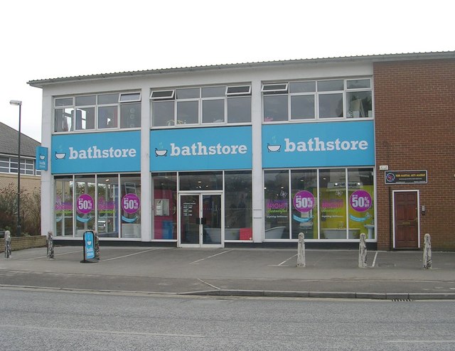
Bathstore.com Ltd., (also known as bathstore) is the largest specialist bathroom retailer in the United Kingdom. History Bathstore was originally started in the beginning of the 1990s by Patrick Riley and Nico de Beer, with the idea to bring quality design led bathrooms into a wider retail arena. The company published one catalogue that contained all its products for the complete bathroom, with real retail prices. The ethos was to focus on the home owner, rather than the trade buyer. In June 2014, bathstore was sold as part of a management buy out led by chief executive In June 2003, bathstore was acquired by in the United Kingdom. Mr Watson announced plans to sell off Bathstore in November 2017. It launched its first television advertising campaign in December 2006. In November 2007, its television advertisements used CGI technology for the first time, incorporating water animation to bring life and movement to the products being showcased. These advertisements were voiced ... [...More Info...] [...Related Items...] OR: [Wikipedia] [Google] [Baidu] |
Otford
Otford is a village and civil parish in the Sevenoaks District of Kent, England. It lies on the River Darent, north of Sevenoaks. Otford's four churches are the Anglican Church of St Bartholomew in the village centre, the Otford Methodist Church, the Most Holy Trinity Roman Catholic Church, and the Otford Evangelical Church. By the village pond, also a roundabout, there are pubs, cafes and shops. The village has three schools, Otford Primary School, St Michael's Prep School, and Russell House. History Otford's earliest history and archaeology shows occupation for at least 3,000 years. Occupants have included Iron Age farmers, Romans, archbishops and royalty, and events have included two battles. The etymology of the village name is disputed: an article in the ''Kent and Sussex Courier'' claims that Otford is a contraction of ''Ottansford'', meaning the ford of Otta, a local man of importance. Roman Otford A Roman villa in what is now Otford was abandoned during the 4th centu ... [...More Info...] [...Related Items...] OR: [Wikipedia] [Google] [Baidu] |
Eynsford
Eynsford ( or ) is a village and civil parish in the Sevenoaks District of Kent, England. It is located south east of Swanley, south of Dartford. The village including its farmland and woods occupies the northern half of the triangle formed by three motorways in west Kent barring its very northernmost part which is Farningham. This area is undulating and has a large minority of woodland. In the south of the parish is Lullingstone, much of which was owned for many centuries by the large, late medieval Lullingstone Castle, whereas other parts of the village were owned by Eynsford Castle, which is older. Well before the founding of the Kingdom of England, Lullingstone Roman villa was founded in this part of the parish, which is open to the public today. The Darent Valley Path takes in a cross-section of the area. The village Eynsford is first mentioned in writing in 864, as "Egenes homme". The derivation is unclear, but one possibility is that it represents "Ægen's river-m ... [...More Info...] [...Related Items...] OR: [Wikipedia] [Google] [Baidu] |
Dunton Green
Dunton Green is a small village and civil parish in the Sevenoaks District of Kent, England. It lies in the valley of the River Darent, north of the town of Sevenoaks. Dunton Green is designated as being part of the Kent Downs area of outstanding natural beauty, due to its proximity to the North Downs. The original ecclesiastical church parish of Dunton Green was part of Otford parish. The former parish church was dedicated to St John the Divine. From at least the 17th century, Dunton Green was a centre for making bricks and tiles. In 1862, the ''Dunton Green Brick, Tile and Pottery Works'' was established: a large concern with clayholes or pits, kilns and an engine house. While clay was being dug for, many fossils were discovered. Places of worship St John the Divine's Church, the Anglican parish church, was designed by M.T. Potter and built in 1889–90 using local bricks. It was declared redundant in 1987 after congregations declined, and is now in commercial use. The vi ... [...More Info...] [...Related Items...] OR: [Wikipedia] [Google] [Baidu] |
Shoreham, Kent
Shoreham is a village and civil parish in the Sevenoaks District of Kent, England. It is located 5.2 miles north of Sevenoaks. The probable derivation of the name is ''estate at the foot of a steep slope''. Steep slope was from the Saxon word ''scor''. pronounced ''shor'', but written ''sore'' by Norman scribes. The village of Shoreham contains three traditional independent pubs: The Samuel Palmer (formally Ye Olde George Inn), The King's Arms and the Crown; with The Rising Sun in nearby Twitton. History The Darent valley was one of the major areas of Stone Age settlement; Shoreham is not mentioned in the Domesday Book. In 1668, cricket was mentioned in a court case as being played at Shoreham, one of the sport's earliest references. It was also known as a smuggling area. Moreover, Shoreham was the most bombed village in the United Kingdom during the Second World War because the Army took over several manor houses for operational use. Papermaking was once a local indust ... [...More Info...] [...Related Items...] OR: [Wikipedia] [Google] [Baidu] |
Chevening, Kent
Chevening () is a village and civil parish in the Sevenoaks District of Kent, England. It was the location for the world's earliest known organised cricket match. The parish is located to the north west of Sevenoaks on the southern slopes of the North Downs. The parish is a small one, being in length and wide. It had a population of 3,092 at the 2011 Census. Apart from the village the remaining area is rural. Chevening House is located here. The Pilgrims' Way crosses the parish. Close to Chevening, the path of Harold Godwinson's army en route to the Battle of Hastings in 1066, heading south along what is now Chipstead Lane, crosses William the Conqueror's route after the battle towards London along the Pilgrim's Way. The village of Chevening is also small. It stands on the upper reaches of the River Darent. The village lies very close to the M25 motorway. Parish Church The parish church is dedicated to St Botolph. It is within the diocese of Rochester, and the deanery of ... [...More Info...] [...Related Items...] OR: [Wikipedia] [Google] [Baidu] |
Knockholt
Knockholt is a village and civil parish in the Sevenoaks District of Kent, England. It is located north west of Sevenoaks & south of Orpington, adjacent to the Kent border with Greater London. The village is mostly a ribbon development, surrounded by fields that are a part of the Green Belt. There is mixed arable farming. It is in a hilly, rural location, on the top of the dip slope of the North Downs, and has views over London. The village name, originally Nockholt, is one of many villages in England with a derivation from oak trees, most a strong departure from today's spelling of oak such as Aike. History The village's name is derived from the Anglo-Saxon ''āc-holt'' meaning " oak copse", to which the final -n of the late Old English dative definite article "ðen" ("the") was accreted. The spelling with initial K- is a relatively recent one. Knockholt was included in Orpington Urban District in 1934. When Greater London was created in 1965, as part of Orpington UD, Kno ... [...More Info...] [...Related Items...] OR: [Wikipedia] [Google] [Baidu] |
Halstead, Kent
Halstead is a village and civil parish in the Sevenoaks District of Kent, England. It is located 4.7 miles south east of Orpington & 6.1 miles north west of Sevenoaks, adjacent to the Kent border with Greater London. The population of the civil parish at the 2011 census was 1,607. The name Halstead is derived from the Old English ''hald'' (refuge, shelter) and ''stede'' (site, place), meaning 'safe place' or 'place of refuge'. The parish church is dedicated to St Margaret. Halstead Community Primary School is located in the village. Botanist and photographer Anne Atkins lived since 1841 to her death at Halstead Place, were she is buried. Author Edith Nesbit spent some of her adolescence in Halstead during the 1870s and her book ''The Railway Children'' is thought to be based on her time living in a house, Halstead Hall, whose garden is about a mile and a half from the railway line. The parish is adjacent to Fort Halstead, a government defence research centre that is thought t ... [...More Info...] [...Related Items...] OR: [Wikipedia] [Google] [Baidu] |
Greensand Ridge
The Greensand Ridge, also known as the Wealden Greensand is an extensive, prominent, often wooded, mixed greensand/sandstone escarpment in south-east England. Forming part of the Weald, a former dense forest in Sussex, Surrey and Kent, it runs to and from the East Sussex coast, wrapping around the High Weald and Low Weald. It reaches its highest elevation, , at Leith Hill in Surrey—the second highest point in south-east England, while another hill in its range, Blackdown, is the highest point in Sussex at . The eastern end of the ridge forms the northern boundary of Romney Marsh. About 51 per cent of the Wealden Greensand is protected as the South Downs National Park, Kent Downs Area of Outstanding Natural Beauty and Surrey Hills Area of Outstanding Natural Beauty. Geology and soils Geological history The Greensand Ridge, formed of Lower Greensand, much of which is sandstone and where hardest is locally termed Bargate stone, is a remnant of the Weald dome, par ... [...More Info...] [...Related Items...] OR: [Wikipedia] [Google] [Baidu] |
Montreal Park
Montreal Park is a development in Sevenoaks in Kent which was formerly the home of Lord Amherst, Commander-in-Chief of the Forces. It was named after his conquest of Montreal in 1760. History In 1764 Lord Amherst returned home after his military successes during the Seven Years' War and commissioned a large house at Sevenoaks in Kent built in the Palladian style. On 30 August 1788 he was created, additional to his other title of Holmesdale, Baron Amherst of Montreal. In 1926 the house was sold to Julius Runge, a businessman, who allowed it to fall into disrepair. The house was demolished in 1936 and replaced between 1952 and 1963 by a housing development promoted by a local builder, William Fasey. Montreal Park Lake is owned by the Holmesdale Angling and Conservation Society. Today all that remains to remind us of Lord Amherst is an octagonal gatehouse, a derelict stone summerhouse and large obelisk An obelisk (; from grc, ὀβελίσκος ; diminutive of ''obelo ... [...More Info...] [...Related Items...] OR: [Wikipedia] [Google] [Baidu] |
Bluebell Hill Transmitting Station
The Bluebell Hill transmitting station is a broadcasting and telecommunications facility located at Blue Bell Hill between Maidstone and Rochester in the English county of Kent. The station is situated on the crest of the North Downs and comprises five steel lattice towers, each 45 to 50 metres tall - their height being compromised by the location of nearby Rochester Airport. It broadcasts digital television, FM and DAB radio to much of north, west, and central Kent, and an overspill service into southern Essex. It stopped broadcasting analogue television when the digital switchover was completed on 27 June 2012. When in analogue service, the broadcast power of 30 kW for a main transmitter was unique in the United Kingdom, the strength being limited by potential interference with transmitters in France and the Low Countries. Services broadcast include BBC One ( South East), BBC Two, ITV (Meridian), Channel 4, Heart Kent, KMFM Medway and KMFM Maidstone. Between its open ... [...More Info...] [...Related Items...] OR: [Wikipedia] [Google] [Baidu] |


_p2.210_-_Montreal%2C_Kent.jpg)