|
Ribatejo
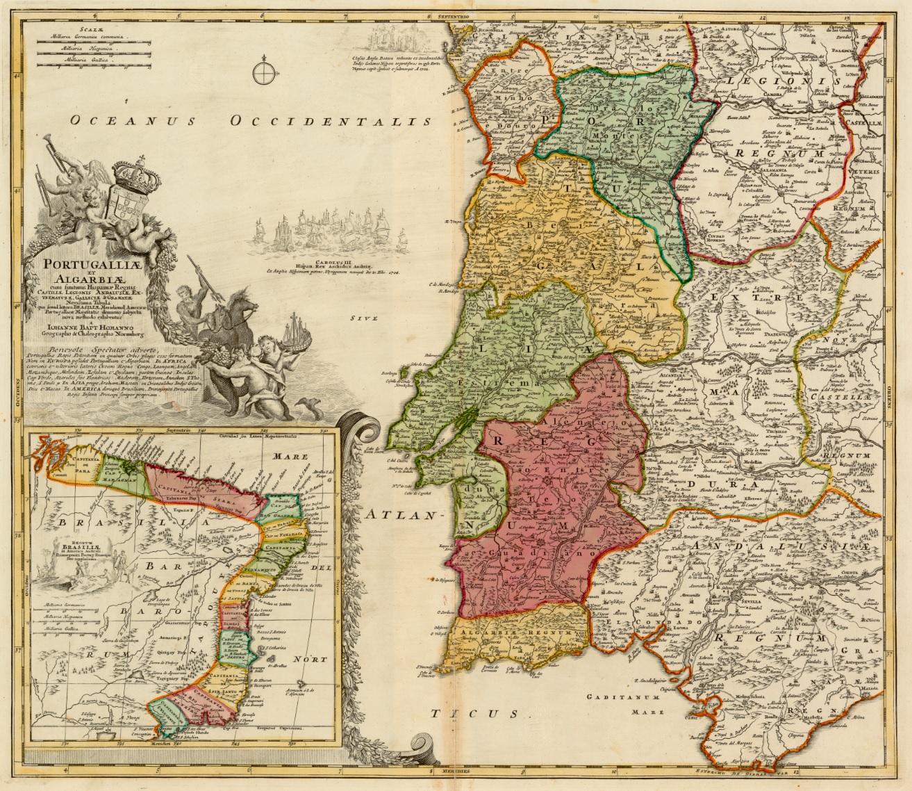
The Ribatejo () is the most central of the traditional provinces of Portugal, with no coastline or border with Spain. The region is crossed by the Tagus river (''Ribatejo'' translates to "upper Tagus", or more precisely, "up the Tagus" relative to Lisbon at its mouth). The region contains some of the nation's richest agricultural land, and it produces most of the animals used in the Portuguese style of bullfighting. Ribatejo Province was formally created in 1936. It contained the municipalities of Abrantes, Alcanena, Almeirim, Alpiarça, Azambuja, Benavente, Cartaxo, Chamusca, Constância, Coruche, Entroncamento, Ferreira do Zêzere, Golegã, Rio Maior, Salvaterra de Magos, Santarém, Sardoal, Tomar, Torres Novas, Vila Franca de Xira and Vila Nova da Barquinha. The largest towns were Santarém and Tomar. In 1976 the Ribatejo Province was dissolved. Most of the area belongs to the Santarém District. For EU statistical purposes, it was divided between the Lezír ... [...More Info...] [...Related Items...] OR: [Wikipedia] [Google] [Baidu] |
Vila Franca De Xira
Vila Franca de Xira (), officially the City of Vila Franca de Xira (), is a city and municipality in the Lisbon District in Portugal. The population in 2021 was 137,659, in an area of 318.19 km2. Situated on both banks of the Tagus River, north-east of the Portuguese capital Lisbon, settlement in the area dates back to Neolithic times, as evidenced by findings in the Cave of Pedra Furada. Vila Franca de Xira is said to have been founded by French followers of Portugal's first king, Afonso I of Portugal, Afonso Henriques, around 1200. The town is mostly famous for its bull-running festivals in July and October. Bulls are raised in the salty marshlands of the Ribatejo Province, Ribatejo, which is also a notable breeding ground for the Lusitano horse, esteemed for its quick reflexes and maneuverability. A number of brightly coloured Portuguese-style bullfighting, Portuguese bullfighting costumes are on display in the ethnographic museum in the town's bullring, the Vila Franca ... [...More Info...] [...Related Items...] OR: [Wikipedia] [Google] [Baidu] |
Provinces Of Portugal
The term "provinces" () has been used throughout history to identify regions of continental Portugal. Current legal subdivisions of Portugal do not coincide with the provinces, but several provinces, in their 19th- and 20th-century versions, still correspond to culturally relevant, strongly self-identifying categories. They include: *Alentejo (Alto Alentejo Province, Alto Alentejo, Baixo Alentejo Province, Baixo Alentejo) *Algarve *Beira (Portugal), Beira (Beira Alta Province, Beira Alta, Beira Baixa Province, Beira Baixa, Beira Litoral Province, Beira Litoral) *Douro Litoral Province, Douro Litoral *Estremadura Province (1936–1976), Estremadura *Minho Province, Minho *Ribatejo Province, Ribatejo *Trás-os-Montes e Alto Douro Province, Trás-os-Montes e Alto Douro The islands of Azores and Madeira were never called "provinces". History The first provinces, instituted during the Roman occupation of the Iberian peninsula, divided the peninsula into three areas: Tarraconensis, ... [...More Info...] [...Related Items...] OR: [Wikipedia] [Google] [Baidu] |
Cartaxo
Cartaxo () is a concelho, municipality in the district of Santarém (district), Santarém in continental Portugal. The population in 2011 was 24,462, in an area of 158.17 km2. The urbanized centre of Cartaxo had a population of 9,507 in 2001. History In written and oral history, the territory of Cartaxo was an important point in the interior of the country. A Roman road, crossing Alenquer (Lerabriga), connected ancient Olissipo (Lisbon) to Santarém (Scallabis) through the territory of Cartaxo. Yet, before the Romans, other civilizations settled in the region, establishing Castro culture, castros in Vila Nova de São Pedro, Vale do Tejo or in the areas of Muge. Situated in the plains of the Ribatejo, Cartaxo was a battleground between Muslim and the Christians. Due to its proximity to Santarém, it was one of the centres disputed between Muslim and Christian forces for years, resulting in the destruction of Cartaxo. King Sancho II of Portugal found it necessary to repopulat ... [...More Info...] [...Related Items...] OR: [Wikipedia] [Google] [Baidu] |
Almeirim
Almeirim () is a city and a municipality in Santarém District, Portugal. The population in 2011 was 23,376, in an area of 222.12 km2. The city proper had a population of 10,520 in 2001. History There are vestiges of mid-Paleolithic to Mesolithic period along the territory, including traces from Neolithic, Calcolithic and Bronze Age remnants. The Iron Age also marked this region, with archaeological excavations unearthing settlements and artefacts. Roman legions of Décimo Junius Brutus occupied the territory, following the Tagus upstream and disembarking in Santarém, where they left their marks. These, along with other groups, occupied arable lands, beginning in the first century A.D. This included the development of agriculture (particularly wheat and olive orchards) and raising of cattle, supporting the establishment of Almeirim along the margins of the Tagus. References to this municipality, began appearing in the 14th century. With rich lands, the territory supported h ... [...More Info...] [...Related Items...] OR: [Wikipedia] [Google] [Baidu] |
Lezíria Do Tejo
The Comunidade Intermunicipal da Lezíria do Tejo (; "Tagus Floodplain") is an administrative division in Portugal. It was established as an ''Associação de Municípios'' in 1987, converted into a ''Comunidade Urbana'' in 2003, and converted into a ''Comunidade Intermunicipal'' in November 2008. It is also a NUTS3 subregion of the Oeste e Vale do Tejo. The seat of the intermunicipal community is the city of Santarém. Lezíria do Tejo comprises municipalities of the former districts of [...More Info...] [...Related Items...] OR: [Wikipedia] [Google] [Baidu] |
Santarém District
The District of Santarém ( ) is a district of Portugal, located in Portugal's West and Tagus Valley region. The district capital is the city of Santarém. The district is the 3rd largest in Portugal, with an area of , and a population of 475,344 inhabitants, giving it a population density of 70 people per sq. kilometer (180 people per sq. mile). Municipalities The district includes the following 21 municipalities. * Abrantes * Alcanena * Almeirim * Alpiarça * Benavente * Cartaxo * Chamusca * Constância * Coruche * Entroncamento * Ferreira do Zêzere * Golegã * Mação * Ourém * Rio Maior * Salvaterra de Magos * Santarém * Sardoal * Tomar * Torres Novas * Vila Nova da Barquinha Summary of votes and seats won 1976–2022 , - class="unsortable" !rowspan=2, Parties!!%!!S!!%!!S!!%!!S!!%!!S!!%!!S!!%!!S!!%!!S!!%!!S!!%!!S!!%!!S!!%!!S!!%!!S!!%!!S!!%!!S!!%!!S!!%!!S , - class="unsortable" align="center" !colspan=2 , 1976 !colspan=2 , 1979 !colspan=2 , 1980 !co ... [...More Info...] [...Related Items...] OR: [Wikipedia] [Google] [Baidu] |
Portuguese-style Bullfighting
Portuguese-style bullfighting () differs in many aspects from Spanish-style bullfighting, most notably in the fact that the bull is not killed in front of an audience in the arena. The ''cavaleiros'' and the '' forcados'' are unique to the Portuguese variety of bullfighting, as well as the participation of horsewomen (''cavaleiras'') in the routines. Main figures * ''Cavaleiros'' - A horseman or horsewoman (rider), dressed in traditional 17th century costume, antagonizes a bull while on horseback. The horses are of the Lusitano breed, specially-trained for these “fights”. The horses are usually skilled in ''dressage'', and may exhibit their art at points in the spectacle. The purpose of the bullfight is to pin three or four ''bandarilhas'' (small spears) in the back of the bull. In the past, cavaleiros were often members of older, aristocratic families. The horsewomen, the cavaleiras, are pioneers and became a unique feature of Portuguese bullfighting. Ana Batista, Sónia Mat ... [...More Info...] [...Related Items...] OR: [Wikipedia] [Google] [Baidu] |
Abrantes
Abrantes () is a concelho, municipality in the central Médio Tejo Subregion, Médio Tejo subregion of Portugal. The population was 39,325, in an area of . The municipality includes several parishes divided by the Tagus River, which runs through the middle of the municipality. The urbanized part, the parish of Abrantes (São Vicente e São João) e Alferrarede, located on the north bank of the Tagus, has about 17,000 residents. History The Celts are believed to have established the first settlement in Abrantes around 300 BC. The name is derived from Latin ''Aurantes'', perhaps referring to deposits of alluvial gold (Latin: '':wiktionary:aurum, aurum'') along the Tagus. Similarly, Roman art, Roman mosaics, coins, the remains of ancient aqueducts, as well as other antiquities, have been discovered in the vicinity of Abrantes. The village of Abrantes and the Abrantes Castle were conquered from the Al-Andalus, Moors by Afonso I of Portugal in 1148. After 1172, Abrantes was a milit ... [...More Info...] [...Related Items...] OR: [Wikipedia] [Google] [Baidu] |
Tomar
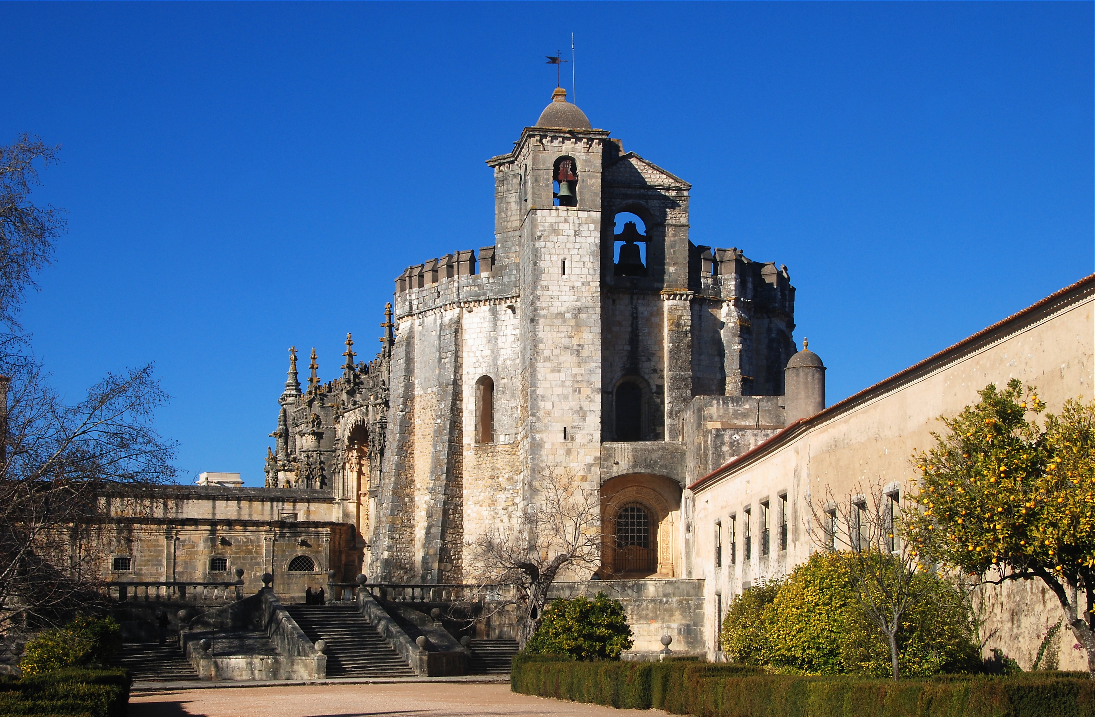
Tomar (), also known in English as Thomar (the ancient name of Tomar), is a Portugal, Portuguese city and a municipality in the historical Ribatejo Portuguese Provinces of Portugal, province, and in Santarém District, Santarém district. The town proper has a population of about 20,000. The municipality population in 2011 was 40,677, in an area of . The town of Tomar was created inside the walls of the Convento de Cristo, constructed under the orders of Gualdim de Pais, the fourth Grand master (order), Grand Master of the Knights Templar in Portugal in the late 12th century. Tomar was the last Templar town to be commissioned for construction and one of Portugal's historical jewels. The town was especially important in the 15th century when it was a center of Portuguese overseas expansion under Henry the Navigator, the Grand Master of the Order of Christ (Portugal), Order of Christ, successor organization to the Knights Templar in Portugal. Geography Tomar lies in the most fe ... [...More Info...] [...Related Items...] OR: [Wikipedia] [Google] [Baidu] |
Ferreira Do Zêzere
Ferreira do Zêzere (, ) is a portuguese municipality in the historical Ribatejo portuguese province and in Santarém District The District of Santarém ( ) is a district of Portugal, located in Portugal's West and Tagus Valley region. The district capital is the city of Santarém. The district is the 3rd largest in Portugal, with an area of , and a population of 475 .... The population in 2011 was 8,619, in an area of 190.38 km2. The municipal holiday is June 13. Parishes Administratively, the municipality is divided into 7 civil parishes ('' freguesias''): * Águas Belas * Areias e Pias * Beco * Chãos * Ferreira do Zêzere * Igreja Nova do Sobral * Nossa Senhora do Pranto History Ferreira do Zêzere, founded by Pedro Ferreira and his wife in the 13th century, is said to be one of the most-visited villages in the district of Santarém. In the surroundings of the village there is the medieval Vila de Dornes with a view over the Zêzere River and classed as a Templa ... [...More Info...] [...Related Items...] OR: [Wikipedia] [Google] [Baidu] |
Entroncamento
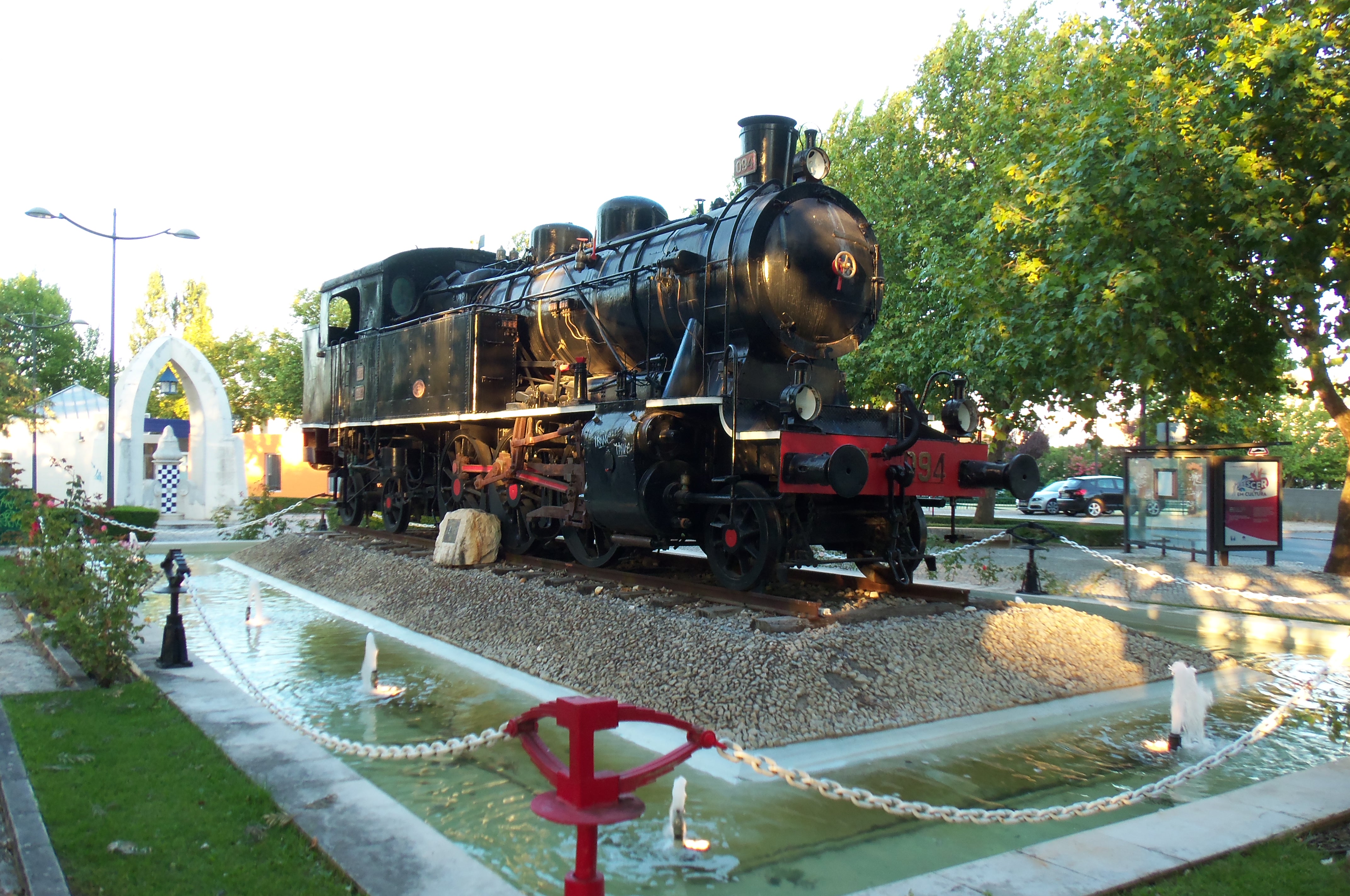
Entroncamento () is a Portuguese municipality in district of Santarém in the Médio Tejo Subregion (''Middle Tagus'') of the Centro Region. The population in 2011 was 20,206, in an area of 13.73 km2. Situated in the Ribatejo, it benefits from its geo-strategic position along the Tagus Valley, with important accessibility to the motorways and railway lines that historically promoted its growth and expansion. History Entroncamento originated in the middle of the 19th century, with the birth of the national railway network, as a simple train-stop, from two small railway construction camps: Casal das Vaginhas and Casal das Gouveias. The majority of the early rail workers/settlers were foreign, coming from different countries throughout Europe, but eventually workers from Beira Baixa and Alentejo moved to the region. Its toponymic name ''Entroncamento'' literally means ''junction'', due to the junction of the two railway lines that developed in 1864: the Linha do Norte ('' ... [...More Info...] [...Related Items...] OR: [Wikipedia] [Google] [Baidu] |


