|
Püttlach
The Püttlach is a left tributary of the River Wiesent. It is about long and flows through the Bavarian region of Franconian Switzerland in Germany. Geography Course The Püttlach rises in Franconian Switzerland, south of Bärnreuth at a height of about within the parish of Lindenhardter Forst-Nordwest, near the source of the Red Main and origin of the Fichtenohe, a headstream source of the Pegnitz river. It initially flows northwest to the Pond (''Püttlachweiher''). There it turns sharply to the south and flows through woods. In Muthmannsreuth, it is fed from the left by the ''Heringsbach'' and, at Heringslohe, from the right by the ''Heroldsgraben''. West of Trockau is the ''Herrenmühle'' and, in the vicinity, a sewage treatment plant. Just south of a second mill, the ''Heddelmühle'', it is joined from the right by the Kohlbrunnbach. Near the ''Hasenloch'' it is fed from the right by the ''Pullendorfer Bächlein'' brook. It flows through the eponymous parish of Püt ... [...More Info...] [...Related Items...] OR: [Wikipedia] [Google] [Baidu] |
Ailsbach
Ailsbach is a river of Bavaria, Germany. It flows into the Püttlach near Gößweinstein. See also *List of rivers of Bavaria A list of rivers of Bavaria, Germany: A * Aalbach *Abens * Ach * Afferbach * Affinger Bach * Ailsbach *Aisch * Aiterach *Alpbach *Alster * Altmühl *Alz * Amper * Anlauter * Arbach * Arbachgraben *Aschaff * Aschbach * Attel * Aubach, tributary of ... References Rivers of Bavaria Rivers of Germany {{Bavaria-river-stub ... [...More Info...] [...Related Items...] OR: [Wikipedia] [Google] [Baidu] |
Tüchersfeld
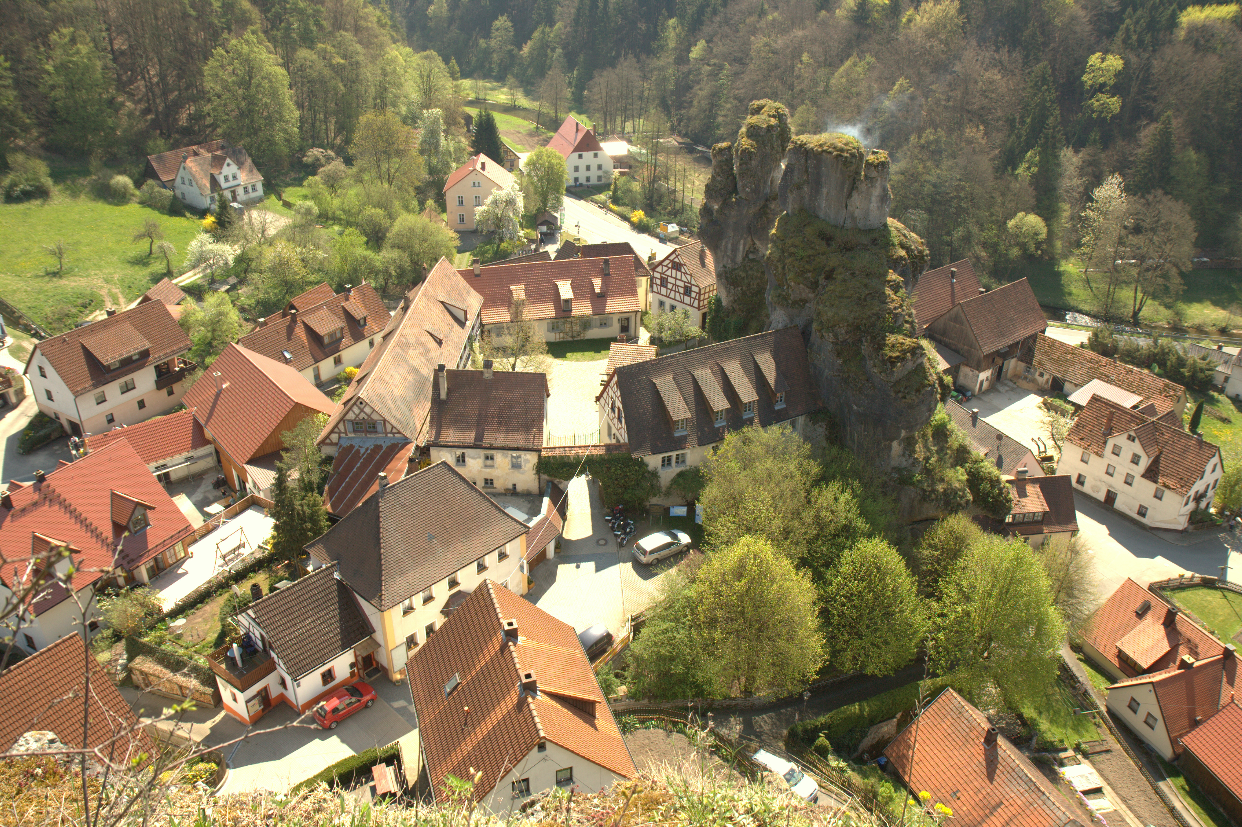
Tüchersfeld is a church village in the Püttlach valley in Franconian Switzerland and belongs to the town of Pottenstein. Geography Due to the prominent rocks (sponge reefs in cone karst shapes) of a meander cutoff hill, which emerged as the result of the uplifting of the Franconian Jura in the Late Tertiary and the deposition of a thick bed of sand in the Upper Cretaceous, and its timber-framed-houses, which appear in places to be glued onto the rocks, Tüchersfeld is a symbol of Franconian Switzerland and has also been portrayed on postage stamps of the Deutsche Post. Until the Thirty Years' War there were two castles here, the Upper and Lower Castles, the latter was recorded in 1269 as a fortress that had already been in existence for a long time. History The Franconian Switzerland Museum is housed in the old ''Judenhof'' ("Jews Court"), a group of 17th- and 18th-century buildings built by Jews on the grounds of the Lower Castle and inhabited until 1860 by 18 Jewish f ... [...More Info...] [...Related Items...] OR: [Wikipedia] [Google] [Baidu] |
Franconian Switzerland
Franconian Switzerland (german: Fränkische Schweiz) is an upland in Upper Franconia, Bavaria, Germany and a popular tourist retreat. Located between the River Pegnitz in the east and the south, the River Regnitz in the west and the River Main in the north, its relief, which reaches 600 metres in height, forms the northern part of the Franconian Jura (''Frankenjura''). Like several other mountainous landscapes in the German-speaking lands, e.g. Holstein Switzerland, Märkische Schweiz, or Pommersche Schweiz, Franconian Switzerland was given its name by Romantic artists and poets in the 19th century who compared the landscape to Switzerland. Franconian Switzerland is famous for its high density of traditional breweries. Name The region was once called ''Muggendorfer Gebürg'' (''Muggendorf hills''). The first tourists arrived during the age of Romanticism. Two law students of Erlangen University, Ludwig Tieck and Wilhelm Heinrich Wackenroder have been credited as "discoverers" o ... [...More Info...] [...Related Items...] OR: [Wikipedia] [Google] [Baidu] |
Pottenstein (Upper Franconia)
Pottenstein is a town in the district of Bayreuth, in Bavaria, Germany. It is situated 23 km southwest of Bayreuth, and 26 km east of Forchheim. History During World War II, a subcamp of Flossenbürg concentration camp was located here. Geography The city of Pottenstein, altitude 350–614 m AMSL, with its nearly 1,500 inhabitants, is a health-resort in Franconian Switzerland. It nestles at the convergence of the Püttlach, Weihersbach and Haselbrunn valleys surrounded by high cliffs and at the foot of the 1000-year-old castle, which has played an important role throughout the city's history. Mayors Since 2002 Stefan Frühbeißer (CWU-UWV) has been the mayor of Pottenstein. His predecessor was Dieter Bauernschmitt (CSU), who was in office for 12 years. [...More Info...] [...Related Items...] OR: [Wikipedia] [Google] [Baidu] |
