|
Puerto Rico Highway 111
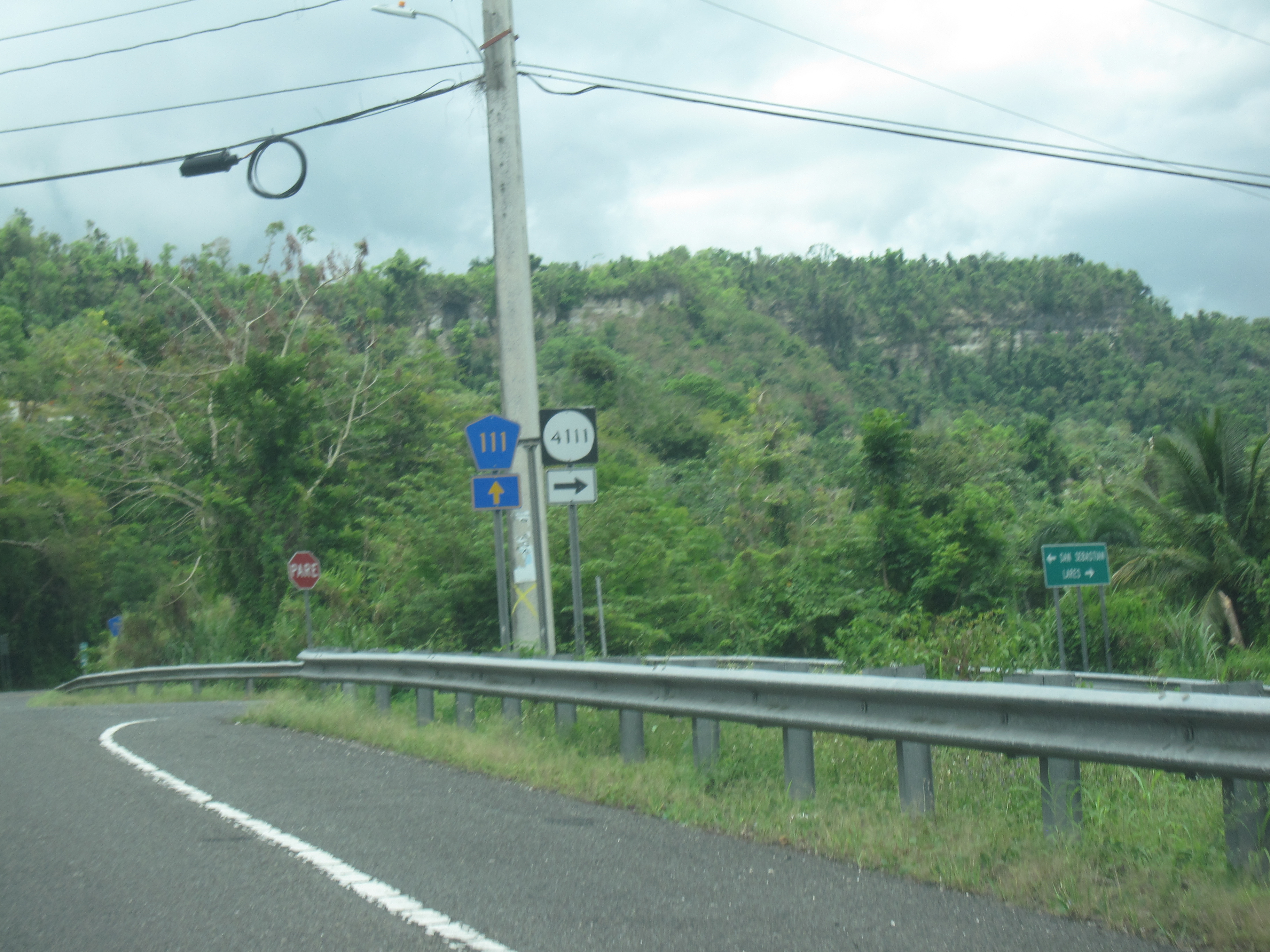
Puerto Rico Highway 111 (PR-111) is a highway connecting Aguadilla, Puerto Rico at Puerto Rico Highway 2 and Puerto Rico Highway 115 to Utuado, Puerto Rico at Puerto Rico Highway 140. Route description It is the main highway to Moca and San Sebastián, being a two-lane highway before turning rural on its way to Lares, where it meets PR-129, which taking north goes to Arecibo and meets PR-2 and PR-22. In Lares, it becomes a divided avenue, replacing an old, narrow segment, but then becomes rural again. It continues to Utuado, crossing PR-10, and merging shortly with PR-123. It ends at PR-140 east of Utuado, near Jayuya. It is one of two long highways going west–east through the center of Puerto Rico (the other being PR-156). It is named the ''Carretera Enrique Laguerre'' through all its length. Aguadilla Pueblo.jpg, PR-111 on the Aguadilla pueblo coast Planta electrica en PR-111, Bahomamey, San Sebastián, Puerto Rico.jpg, Electric plant on PR-111 in Bahomamey Parque ... [...More Info...] [...Related Items...] OR: [Wikipedia] [Google] [Baidu] |
Puerto Rico Planning Board
The Puerto Rico Planning Board ( es, Junta de Planificación) created in the May 12, 1942 during Rexford G. Tugwell's governorship as the Puerto Rico Planning, Urbanization, and Zoning Board, is the only government agency in charge of centralized planning under the American flag. Its creation was in keeping with Tugwell's New Deal philosophy that Puerto Rico should operate under a highly centralized, all-encompassing territorial government. For decades, the Planning Board was in charge of all economic planning, land use zoning and case-by-case permitting in Puerto Rico. In the 1970s the permitting process was delegated to another government agency, the Rules and Permits Administration (ARPE) and since the late 1990s, major cities have been taking over that role in their own jurisdictions. Organization The Planning Board currently has a Chair and four Associate Members, all appointed by the Governor and requiring the consent of the Puerto Rico Senate. Presidents The followin ... [...More Info...] [...Related Items...] OR: [Wikipedia] [Google] [Baidu] |
Utuado, Puerto Rico
Utuado () is a town and municipality of Puerto Rico located in the central mountainous region of the island known as the '' Cordillera Central''. It is located north of Adjuntas and Ponce; south of Hatillo and Arecibo; east of Lares; and west of Ciales and Jayuya. It is the third-largest municipality in land area in Puerto Rico (after Arecibo and Ponce). According to the 2020 US Census, the municipality has a population of 28,287 spread over 24 barrios and Utuado pueblo (the downtown area and the administrative center of the city). Utuado is the main municipality of the Utuado micropolitan statistical area and is part of the San Juan-Caguas-Fajardo Combined Statistical Area. Etymology and nicknames The name Utuado derives from the Taíno word ''otoao'', meaning ''between mountains'' (i.e. valley). The municipality is known as ''Ciudad del Viví'' (Viví City), derived from the Viví River which runs through Utuado: one river branch comes from Adjuntas and the oth ... [...More Info...] [...Related Items...] OR: [Wikipedia] [Google] [Baidu] |
Seagull Intersection
A seagull intersectionJohn Harper, Wal Smart, Michael de Roos''Seagull Intersection Layout. Island Point Road – A Case Study'' 2000 – 2010 or continuous green T-intersection (also known as a turbo-T (in Florida) or High-T intersection (in Nevada and Utah)Nevada DOT''US93 Lakeshore v4 Handouts''/ref>) is a type of three-way road intersection, usually used on high traffic volume roads and dual carriageways. This form of intersection is popular in Australia and New Zealand, and sometimes used in the United States and other countries. Design Seagull intersections get their name from the pattern that the two cross-traffic turn lanes make when looking down at them from the air. In a seagull intersection, one or more lanes of traffic on the arterial road, on the carriageway opposite the intersecting side road, are free flowing, that is, one direction of traffic on the arterial is allowed to travel straight through without stopping. The free-flowing lane(s) are called "continuou ... [...More Info...] [...Related Items...] OR: [Wikipedia] [Google] [Baidu] |
Partial Cloverleaf Interchange
A partial cloverleaf interchange or parclo is a modification of a cloverleaf interchange. The design has been well received, and has since become one of the most popular freeway-to- arterial interchange designs in North America. It has also been used occasionally in some European countries, such as Germany, Hungary, Italy, the Netherlands, and the United Kingdom. Comparison with other interchanges *A diamond interchange has four ramps. *A cloverleaf interchange has eight ramps, as does a stack interchange. They are fully grade separated, unlike a parclo, and have traffic flow without stops on all ramps and throughways. *A parclo generally has either four or six ramps but less commonly has five ramps. Naming In Ontario, the specific variation is identified by a letter/number suffix after the name. Ontario's naming conventions are used in this article. The letter ''A'' designates that two ramps meet the freeway ''ahead'' of the arterial road, while ''B'' designates that two ram ... [...More Info...] [...Related Items...] OR: [Wikipedia] [Google] [Baidu] |
Enrique Laguerre
Enrique Arturo Laguerre Vélez (July 15, 1905 – June 16, 2005) was a teacher, novelist, playwright, critic, and newspaper columnist from Moca, Puerto Rico. He is the author of the 1935 novel ''La Llamarada'' (), which has been for many years obligatory reading in many literature courses in Puerto Rico. Biography Laguerre studied at various universities, obtaining degrees in arts from the University of Puerto Rico and Columbia University. In 1924, he took courses on teaching in rural areas in the town of Aguadilla. The courses were taught by Carmen Gómez Tejera. After this, he taught from 1925 to 1988, both at the elementary school and university levels. Laguerre was known to use the pen-names of Tristán Ronda, Luis Urayoán, Motial and Alberto Prado, among others. Married for many years to the well-respected writer Luz V. Romero García, he also worked in many Puerto Rican publications before joining the staff of ''El Vocero''. In 1998, his peers as well as former gove ... [...More Info...] [...Related Items...] OR: [Wikipedia] [Google] [Baidu] |
Puerto Rico Highway 156
Puerto Rico Highway 156 (PR-156) is a long east–west highway which connects Caguas to Orocovis and is the main artery to Aguas Buenas since the highway from Puerto Rico Highway 52 to the main downtown has at least two lanes and a shoulder per direction. From Aguas Buenas to Orocovis it is a rural, yet safe road which enters all the business districts and ''plazas'' of Aguas Buenas, Comerío, Barranquitas and Orocovis. It is one of two long east–west highways through the center of the island (the other being Puerto Rico Highway 111) but it never approaches a coast. Puerto Rico Highway 111 approaches Aguadilla's shore near PR-2 but PR-156, ending in Caguas, is nearly 35 kilometers away from the east coast. Major intersections Carretera PR-156, Barranquitas, Puerto Rico.jpg, PR-156 in Barranquitas barrio-pueblo Comerio to Barranquitas Road, Puerto Rico.jpg, Comerío to Barranquitas Road Puente Rio Hondo, Spanning Hondo River on PR Road 156, Barrio Rio Ho, Comer ... [...More Info...] [...Related Items...] OR: [Wikipedia] [Google] [Baidu] |
Jayuya, Puerto Rico
Jayuya (, ) is a town and municipality of Puerto Rico located in the mountainous center region of the island, north of Ponce; east of Utuado; and west of Ciales. Jayuya is spread over 10 barrios and Jayuya Pueblo (the downtown and administrative center of the city). It is the principal city of the Jayuya Micropolitan Statistical Area. Named after the Taíno tribal leader, Hayuya, Jayuya is known for its skilled wood carvers. Among its monuments are the statue of Nemesio Canales and the bust of Hayuya, both by the Puerto Rican sculptor Tomás Batista. History The town of Jayuya was founded in 1911, but history traces non-indigenous settlers living in the region as far back as 1878. At that time, a small community was established there, separated from the larger cities of the coasts with little to no communication. Near the end of the 19th century, the town focused on the production of coffee, which greatly boosted the local economy. In 1911, the town was officially decl ... [...More Info...] [...Related Items...] OR: [Wikipedia] [Google] [Baidu] |
Puerto Rico Highway 123
Puerto Rico Highway 123 (PR-123) is a secondary highway that connects the city Arecibo to the city of Ponce. It runs through the towns of Utuado and Adjuntas, before reaching Ponce. A parallel road is being built, PR-10, that is expected to take on most of the traffic currently using PR-123. History The road dates from the late 19th century and it started as a road to link the coffee-farming mountain town of Adjuntas to the southern port city of Ponce for the export of coffee. (Eventually the road was completed to the smaller northern port city of Arecibo as well, connecting the mountain town of Utuado in its way.) PR-123 was built under the colonial government of Spain in Puerto Rico to connect the coffee-growing town of Adjuntas to the port city of Ponce as a farm-to-market road. [...More Info...] [...Related Items...] OR: [Wikipedia] [Google] [Baidu] |
Puerto Rico Highway 10
Puerto Rico Highway 10 (PR-10) is a major highway in Puerto Rico. The primary state road connects the city of Ponce in the south coast to Arecibo in the north; it is also the shortest route between the two cities. Construction on the modern PR-10, a new highway, began in 1974. The highway is being built parallel to the old PR-10; that road is now signed PR-123. Most of the new PR-10 is now complete, with an approximately stretch still remaining to be finished. In its current state it is a freeway only in the completed portions, which consists of over three-fourths of the highway. In May 2010, Autoridad de Carreteras estimated the road would be completed in 2015, at a cost of $500 million. Upon completion, the highway is expected to become one of the two major roads on the island that cross the Cordillera Central mountain range. The first section of the road was inaugurated in the year 2000. After "more than 40 years" since the project was initiated, as of 22 January 2017, ... [...More Info...] [...Related Items...] OR: [Wikipedia] [Google] [Baidu] |
Puerto Rico Highway 22
PR-22 (also part of unsigned Interstate PR2) is an long toll road in the north coast of Puerto Rico that connects the cities of San Juan and Hatillo. The road is also known as the ''José de Diego Expressway'' (Spanish: ''Expreso José de Diego''), and is part of unsigned Interstate PR-2. It is a 4-lane road for much of its length, but expands to up to 12 lanes in the San Juan metro area. The road is frequently congested, in particular during rush hour due to heavy commuter traffic. Route description PR-22 is Puerto Rico's most traveled highway. PR-22 runs parallel to PR-2 and is concurrent with unsigned Interstate Highway PRI-2. Unlike PR-22, PR-2 is not a controlled-access road, and has numerous traffic signals throughout the full run of its course. The construction of highway PR-22 reduced congestion on PR-2. The eastern terminus is at PR-26 (a non-tolled freeway) in Santurce, and passes through the Minillas Tunnel before its terminus at PR-26. The freeway bypasses al ... [...More Info...] [...Related Items...] OR: [Wikipedia] [Google] [Baidu] |
Arecibo, Puerto Rico
Arecibo (; ) is a city and municipality on the northern coast of Puerto Rico, on the shores of the Atlantic Ocean, located north of Utuado and Ciales; east of Hatillo; and west of Barceloneta and Florida. It is about west of San Juan, the capital city. Arecibo is the largest municipality in Puerto Rico by area, and it is the core city of the Arecibo Metropolitan Statistical Area and part of the greater San Juan Combined Statistical Area. It is spread over 18 ''barrios'' and Arecibo Pueblo (the downtown area and the administrative center of the city). Its population in 2020 was 87,754. The Arecibo Observatory, which housed the Arecibo telescope, the world's largest radio telescope until July 2016, is located in the municipality. The Arecibo telescope collapsed on December 1, 2020. Arecibo is the seat of the Roman Catholic Diocese of Arecibo. Etymology and nicknames The name ''Arecibo'' comes from the Taíno chief Xamaica Arasibo, cacique of the ''yucayeque'' (Taíno s ... [...More Info...] [...Related Items...] OR: [Wikipedia] [Google] [Baidu] |
Puerto Rico Highway 129
PR-129 is a north–south (actually diagonal) highway in North-Central Puerto Rico, connecting the town of Lares with Arecibo. It crosses the northern karst country of the island. When traveling from the northern coast of Puerto Rico, PR-129 can be used to reach the Arecibo Observatory and the Camuy River Caverns Park. Route description PR-129.jpg, PR-129 near the interchange with PR-22 in Arecibo PR Highway 134 junction sign from 129.jpg, PR-134 junction sign in Bayaney barrio, Hatillo Sign for Arecibo Observatory from PR Hwy 129 North.jpg, Sign for Arecibo Observatory from PR-129 (northbound) It is a four-lane, divided highway in Arecibo, and a super two highway in Hatillo, Camuy Camuy () is a town and municipality of Puerto Rico, bordering the Atlantic Ocean, north of Lares and San Sebastián; east of Quebradillas; and west of Hatillo. Camuy is spread over 12 barrios and Camuy Pueblo (the downtown area and the admini ... and Lares. It then merges with PR-1 ... [...More Info...] [...Related Items...] OR: [Wikipedia] [Google] [Baidu] |


