|
Petaling District
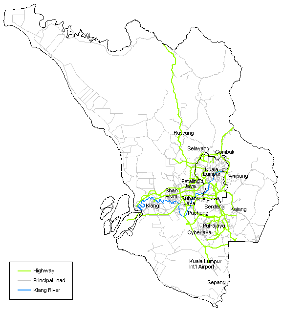
The Petaling District is a district located in the heart of Selangor in Malaysia. Petaling is not to be confused with the city of Petaling Jaya located in it, nor the ''mukim'' of Petaling under Petaling Jaya City. The district office is located in Subang. The district of Petaling was established on 1 February 1974, the same day Kuala Lumpur was declared a Federal Territory. This district is located in the middle of the Klang Valley adjacent to the capital and thus has experienced tremendous urbanisation. Some of the original forests remain in the Bukit Cherakah Forest Reserve (including the National Botanic Gardens), Kota Damansara Community Forest Park and Bukit Gasing. During the 1991 census, it recorded 633,165 people. The official 2010 census recorded the population of Petaling as 1,660,869 people, excluding foreigners. Petaling is 484.32 km² in area. The urban centres are divided into the cities of Shah Alam, Petaling Jaya and Subang Jaya. However, there are numero ... [...More Info...] [...Related Items...] OR: [Wikipedia] [Google] [Baidu] |
Jawi Script
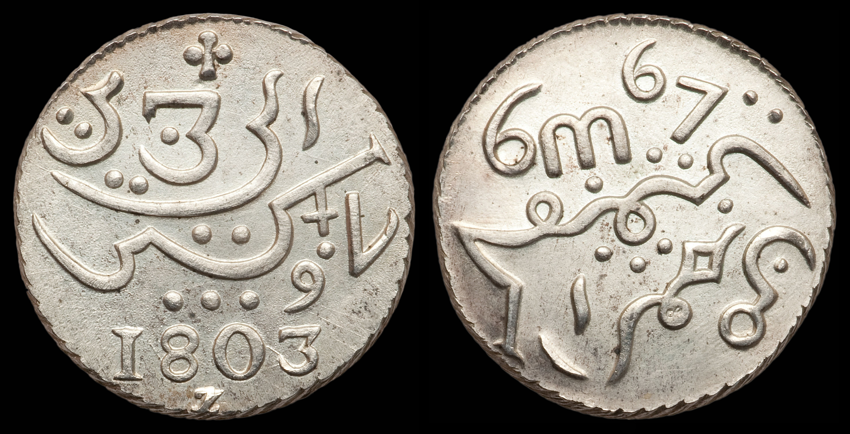
Jawi (; ace, Jawoë; Kelantan-Pattani Malay, Kelantan-Pattani: ''Yawi''; ) is a writing system used for writing several languages of Southeast Asia, such as Acehnese language, Acehnese, Banjar language, Banjarese, Kerinci language, Kerinci, Maguindanao language, Maguindanaon, Malay language, Malay, Minangkabau language, Minangkabau, Tausug language, Tausūg, and Ternate language, Ternate. Jawi is based on the Arabic script, consisting of all of the original 31 Arabic letters, and six additional letters constructed to fit the phonemes native to Malay, and an additional phoneme used in foreign loanwords, but not found in Classical Arabic, which are ''ca'' ( ), ''nga'' ( ), ''pa'' ( ), ''ga'' ( ), ''va'' ( ), and ''nya'' ( ). Jawi was developed from the Spread of Islam in Southeast Asia, advent of Islam in the Maritime Southeast Asia, supplanting the earlier Brahmic scripts used during Hindu-Buddhist era. The oldest evidence of Jawi writing can be found on the 14th century Tere ... [...More Info...] [...Related Items...] OR: [Wikipedia] [Google] [Baidu] |
Sultan Of Selangor
Sultan of Selangor (سلطان سلاڠور) is the title of the constitutional ruler of Selangor, Malaysia who is the head of state and head of the Islamic religion in Selangor. The current monarch, Sultan Sharafuddin Idris Shah ascended the throne on the death of his father, on 22 November 2001. History 1743–1766: Pre-formation The Sultans of Selangor are descended from a Bugis dynasty that claim descent from the rulers of Luwu in the southern part of Celebes (today known as Sulawesi). Nobles from this bloodline were involved in the dispute over the Johor-Riau Sultanate in the early 18th century, eventually placing their full support in the cause of Sulaiman Badrul Alam Shah of Johor of the Bendahara dynasty against the claimant to the Malaccan lineage, Raja Kechil. For this reason, the Bendahara rulers of Johor-Riau established close relations with the Bugis nobles, providing them with titles and control over many areas within the empire, including Selangor. Daeng Chela ... [...More Info...] [...Related Items...] OR: [Wikipedia] [Google] [Baidu] |
Subang Jaya
Subang Jaya is a city in Petaling District, Selangor, Malaysia. It comprises the southern third district of Petaling. It consists of the neighbourhoods from SS12 to SS19, UEP Subang Jaya (USJ), Putra Heights, Batu Tiga as well as PJS7, PJS9 and PJS11 of Bandar Sunway, the latter of which are partially jurisdictional within Petaling Jaya under the MBPJ. The city is governed by Subang Jaya City Council (MBSJ), which also governs other areas of the Petaling district, such as Puchong and Seri Kembangan. According to Subang Jaya City Council, Subang Jaya has a population of 642,100 in 2015, which makes it the sixth largest city in Malaysia by population. History Before 1974, what is today Subang Jaya was part of Klang District. Development on Subang Jaya began on 21 February 1976 and was concluded in 1988 by Sime UEP Properties Berhad, the property development arm of the Malaysian conglomerate Sime Darby. The site was formerly a rubber plantation called Seafield Estate under ... [...More Info...] [...Related Items...] OR: [Wikipedia] [Google] [Baidu] |
Bukit Gasing
Bukit Gasing is a tropical forest reserve in Malaysia. It straddles the federal territory of Kuala Lumpur, as well as the state of Selangor. Due to that, the reserve is governed by two different governments — the Kuala Lumpur City Hall and the government of Selangor. There are many hiking trails in Bukit Gasing. Geography and wildlife Bukit Gasing is a tropical forest reserve located on the border between Kuala Lumpur and Petaling Jaya, Selangor in Malaysia. It was a rubber plantation before it became a secondary forest. Since the park is located in both Kuala Lumpur and Petaling Jaya, it has two entrances, with the main entrance located in Petaling Jaya and the secondary entrance located in Kuala Lumpur. There are many free hiking trails in Bukit Gasing, and visitors can use them for trail running and hiking. It takes approximately one to two hours to hike each of the trails, and at the end of all the trails is a suspension bridge, a Telekom tower, and a Hindu temple. ... [...More Info...] [...Related Items...] OR: [Wikipedia] [Google] [Baidu] |
Kota Damansara Community Forest Park
The Kota Damansara Community Forest Park (KDCFP) is a secondary forest located in Selangor, Malaysia. It was part of a defunct Sungai Buloh Forest Reserve gazetted in 1898 which contained of protected primary forest. This made it as the oldest forest reserve in Peninsular Malaysia. The forest reserve was degazetted a number of times and subsequent development brought down the size of the reserve to a . Logging activities especially has turned the area into a secondary forest. This results in the abundance of pioneer plants as well as rare species of plant such as Begonia aequilateralis. Despite being a secondary forest, a number of primary forest species such as meranti are observable at the park. Furthermore, KDCFP is a dipterocarp forest typically found in tropical countries such as Malaysia. The area is a combination of flat land and low elevation hill. The trademark of KDCFP is an artificial lake. The lake was created in early 2000s due to the building of a road that block ... [...More Info...] [...Related Items...] OR: [Wikipedia] [Google] [Baidu] |
National Botanic Gardens Shah Alam
National Botanic Gardens Shah Alam ( ms, Taman Botani Negara Shah Alam or TBNSA) is a national botanic garden in Shah Alam, Selangor, Malaysia. It is incorporated in the Ministry of Agriculture and Food Industries. With area of 817 hectares, it is the habitat of flora and fauna, also a recreational destination in the Klang Valley. As of August 2021, the director of TBNSA is Siti Zubaidah binti Mohamad. History National Botanic Gardens Shah Alam (TBNSA) was constructed on 24 April 1986, known as Taman Pertanian Bukit Cerakah (the Bukit Cherakah Agricultural Park). It is located in the Bukit Cherakah Forest Reserve that was constituted in 1909. In the year of 1991, the name was changed to Taman Pertanian Malaysia Bukit Cahaya Seri Alam. In the year of 2007, TBNSA has finally got its current name, Taman Botani Negara Shah Alam. The garden was established on the forest reserve area of Bukit Cerakah which served as a reservoir for the water for the people of Shah Alam. The forest i ... [...More Info...] [...Related Items...] OR: [Wikipedia] [Google] [Baidu] |
Urbanisation
Urbanization (or urbanisation) refers to the population shift from rural to urban areas, the corresponding decrease in the proportion of people living in rural areas, and the ways in which societies adapt to this change. It is predominantly the process by which towns and cities are formed and become larger as more people begin living and working in central areas. Although the two concepts are sometimes used interchangeably, urbanization should be distinguished from urban growth. Urbanization refers to the ''proportion'' of the total national population living in areas classified as urban, whereas urban growth strictly refers to the ''absolute'' number of people living in those areas. It is predicted that by 2050 about 64% of the developing world and 86% of the developed world will be urbanized. That is equivalent to approximately 3 billion urbanites by 2050, much of which will occur in Africa and Asia. Notably, the United Nations has also recently projected that nearly all globa ... [...More Info...] [...Related Items...] OR: [Wikipedia] [Google] [Baidu] |
Klang Valley
Klang Valley ( ms, Lembah Klang; zh, 巴生谷; ) is an urban conglomeration in Malaysia that is centered in the federal territories of Kuala Lumpur and Putrajaya, and includes its adjoining cities and towns in the state of Selangor. It is conterminous with Greater Kuala Lumpur, although there are variations between the two. The Klang Valley is geographically delineated by the Titiwangsa Mountains to the north and east and the Strait of Malacca to the west. It extends to Rawang in the northwest, Semenyih in the southeast, and Klang and Port Klang in the southwest. The conurbation is the heartland of Malaysia's industry and commerce. As of 2020, the Klang Valley is home to roughly 8 million people. Origin The valley is named after the Klang River, the principal river that flows through it that starts at Klang Gates Quartz Ridge in Gombak and flows into the Straits of Malacca in Port Klang, The river is closely linked to the early development of the area as a cluster of tin ... [...More Info...] [...Related Items...] OR: [Wikipedia] [Google] [Baidu] |
Federal Territories (Malaysia)
The Federal Territories ( ms, Wilayah Persekutuan) in Malaysia comprise three territories—Kuala Lumpur, Labuan, and Putrajaya—governed directly by the Federal Government of Malaysia. Kuala Lumpur is the national capital of Malaysia, Putrajaya is the administrative capital, and Labuan is an offshore international financial centre. Kuala Lumpur and Putrajaya are enclaves in the state of Selangor, while Labuan is an island off the coast of Sabah. Administrations The territories fall under the jurisdiction of the Ministry for the Federal Territories. Originally the Federal Territory Ministry was established in 1979 and was in charge of planning and administration of Kuala Lumpur and Klang Valley. In 1981, the FT Ministry has been re-established under the Prime Minister's Office which acts as the Planning Unit of Klang Valley. In 2004, FT Ministry is then again formed into a full-fledged ministry which focuses on the development of Kuala Lumpur, Labuan and Putrajaya. History Th ... [...More Info...] [...Related Items...] OR: [Wikipedia] [Google] [Baidu] |
Kuala Lumpur
, anthem = '' Maju dan Sejahtera'' , image_map = , map_caption = , pushpin_map = Malaysia#Southeast Asia#Asia , pushpin_map_caption = , coordinates = , subdivision_type = Country , subdivision_name = , subdivision_type1 = Administrative areas , subdivision_name1 = , established_title = Establishment , established_date = 1857 , established_title2 = City status , established_date2 = 1 February 1972 , established_title3 = Transferred to federal jurisdiction , established_date3 = 1 February 1974 , government_type = Federal administrationwith local government , governing_body = Kuala Lumpur City Hall , leader_title = Mayor , leader_name = Mahadi bin Che Ngah , total_type = Federal territory , area_footnotes = , area_total_km2 = 2 ... [...More Info...] [...Related Items...] OR: [Wikipedia] [Google] [Baidu] |
Mukim
A mukim is a type of administrative division used in Brunei, Indonesia, Malaysia and Singapore. The word ''mukim'' is a loanword in English. However, it was also originally a loanword in Malay from the Arabic word: (meaning ''resident''). The closest English translation for mukim is township. Usage Brunei In Brunei, a mukim is the immediate subdivision of a district (). The equivalent English word for 'mukim' is 'township'. There are 38 mukims in Brunei. Each mukim is an administrative area made up of several (Malay for "village"). A mukim is headed by a (Malay for "headman"), which is an elected office. The number of mukims in each of the districts in Brunei is as follows: The smallest mukim by area is Mukim Saba in the Brunei-Muara District. The largest mukim by area is Mukim Sukang in the Belait District. The last change in the mukim boundaries was in the late 1990s when Mukim Kumbang Pasang was merged into Mukim Kianggeh and Mukim Berakas was divided into Muki ... [...More Info...] [...Related Items...] OR: [Wikipedia] [Google] [Baidu] |
Vehicle Registration Plates Of Malaysia
Malaysian registration plates are displayed at the front and rear of all private and commercial motor vehicle, motorised vehicles in Malaysia, as required by law. The issuing of the number plates is regulated and administered by the Malaysian Road Transport Department ( ms, Jabatan Pengangkutan Jalan Malaysia) or JPJ. Latest number plate being issued can be checked through Road Transport Department Malaysia, JPJ website. The following are examples of the formats currently used; Design The current standard for Malaysian number plates were originally derivatives of Vehicle registration plates of the United Kingdom#Before 1932, pre-1932 number plate formats in the United Kingdom, first issued after the introduction of motorised vehicles in the 1900s during British Empire, British rule. Number plates are typically issued and are formatted similarly for any motorised vehicle that runs on rubber tyres, including most road-legal private, commercial and industrial vehicles, motor ... [...More Info...] [...Related Items...] OR: [Wikipedia] [Google] [Baidu] |


