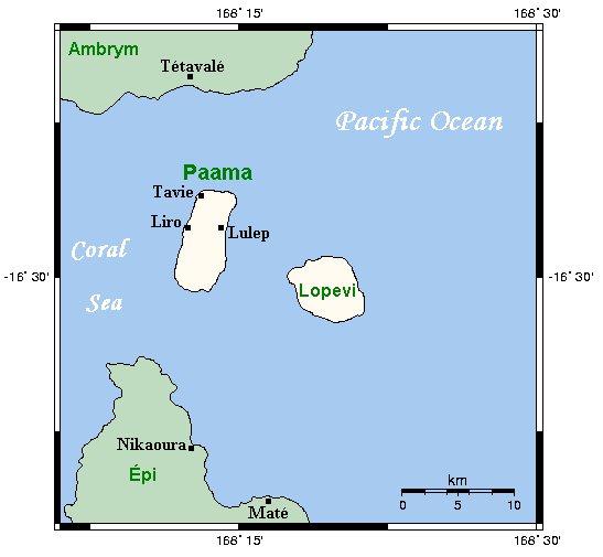
|
Paama Island
Paama (Paama language: VoumCrowley, Terry. (1982). ''The Paamese Language of Vanuatu. Pacific Linguistics, Series B – No. 87''. Canberra: ANU Printing Services.) is a small island in Malampa Province, Vanuatu. The island is about 8 km from north to south and only 5 km or so at its widest point. The island is dominated by hills, rising to a height of around 550 m in the north. Paama lies a short distance south of Ambrym, a little further east of Malakula, about 7 km west of the large active volcano Lopevi (Ulvae, in the vernacular (see Crowley 1982), and a short distance north of the island of Epi (island), Epi. During daylight, all of Paama's neighbouring islands are clearly visible from various locations on the island. Indeed, on a clear night the red glow of Ambrym's twin volcanos can be seen clearly from the black sand beach at Liro. The now uninhabited island of Lopevi dominates the view east from the village of Lulep, on the northeast coast of the is ... [...More Info...] [...Related Items...] OR: [Wikipedia] [Google] [Baidu] |
Pacific Ocean
The Pacific Ocean is the largest and deepest of Earth's five oceanic divisions. It extends from the Arctic Ocean in the north to the Southern Ocean (or, depending on definition, to Antarctica) in the south, and is bounded by the continents of Asia and Oceania in the west and the Americas in the east. At in area (as defined with a southern Antarctic border), this largest division of the World Ocean—and, in turn, the hydrosphere—covers about 46% of Earth's water surface and about 32% of its total surface area, larger than Earth's entire land area combined .Pacific Ocean . '' Britannica Concise.'' 2008: Encyclopædia Britannica, Inc. The centers of both the |

.jpg)