|
Pugwash, Nova Scotia
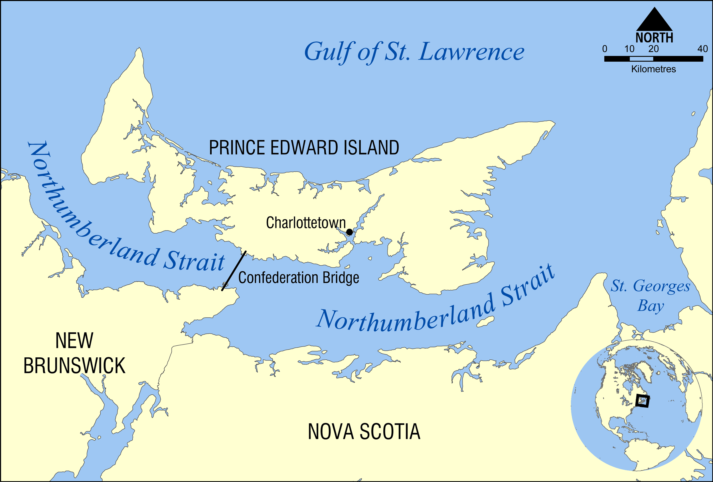
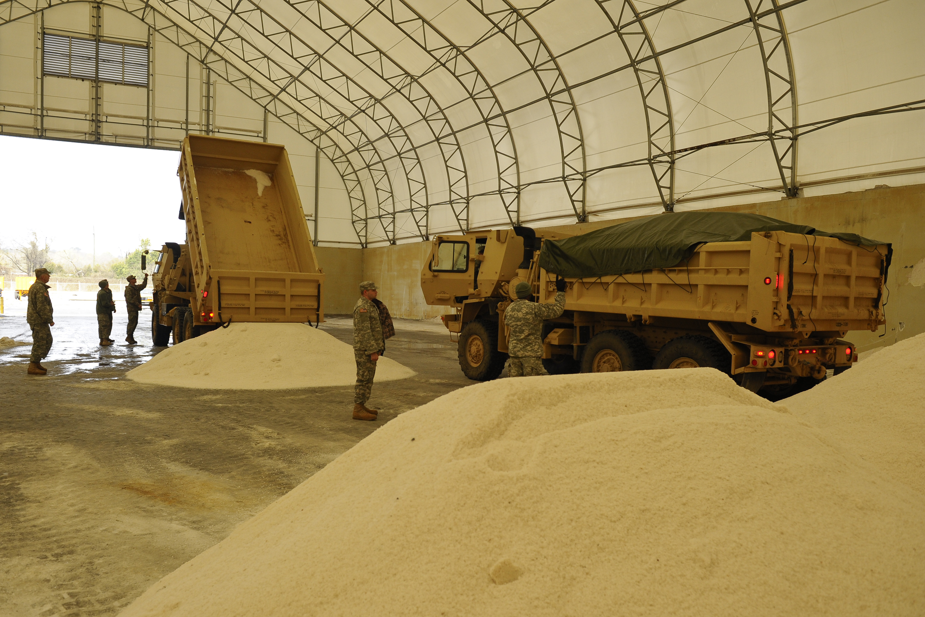
Pugwash is an incorporated village in Cumberland County, Nova Scotia, Canada, located on the Northumberland Strait at the mouth of the Pugwash River. It had a population of 746 as of the 2021 census. The name Pugwash is derived from the Mi'kmaq word Pakwesk (also written as Pagwĕsk), meaning "a shoal", in reference to a reef near the mouth of the harbour. The village is home to fishing, salt mining, small-scale manufacturing, and tourism. Pugwash sits atop a salt deposit measuring thick and is home to the largest underground salt mine in Atlantic Canada, with shipments from its port, as well as by rail from a facility at Oxford Junction. History The end of glaciation began 13,500 years ago and ended with the region becoming largely ice-free 11,000 years ago. The earliest evidence of Paleo-Indian settlement in the region follows rapidly after deglaciation. What is now the Northumberland Shore, including Pugwash, is part of the Mi'kma'ki, the territory of the Mi'kmaq, ... [...More Info...] [...Related Items...] OR: [Wikipedia] [Google] [Baidu] |
Villages Of Nova Scotia
A village is a human settlement or Residential community, community, larger than a hamlet (place), hamlet but smaller than a town with a population typically ranging from a few hundred to a few thousand. Although villages are often located in rural areas, the term urban village is also applied to certain urban neighborhoods. Villages are normally permanent, with fixed dwellings; however, transient villages can occur. Further, the dwellings of a village are fairly close to one another, not scattered broadly over the landscape, as a dispersed settlement. In the past, villages were a usual form of community for societies that practice subsistence agriculture and also for some non-agricultural societies. In Great Britain, a hamlet earned the right to be called a village when it built a Church (building), church. [...More Info...] [...Related Items...] OR: [Wikipedia] [Google] [Baidu] |
Northumberland Strait
The Northumberland Strait (French: ''détroit de Northumberland'') is a strait in the southern part of the Gulf of Saint Lawrence in eastern Canada. The strait is formed by Prince Edward Island and the gulf's eastern, southern, and western shores. Boundaries The western boundary of the strait is delineated by a line running between North Cape, Prince Edward Island and Point Escuminac, New Brunswick while the eastern boundary is delineated by a line running between East Point, Prince Edward Island and Inverness, Nova Scotia. Hydrography The Northumberland Strait varies in depth between 17 and 65 metres, with the deepest waters at either end. The tidal patterns are complex; the eastern end has the usual two tides per day, with a tidal range of 1.2 to 1.8 metres, while the western end effectively has only one tide per day. The strait's shallow depths lend to warm water temperatures in summer months, with some areas reaching 25° C, or 77° F. Consequently, the strait is re ... [...More Info...] [...Related Items...] OR: [Wikipedia] [Google] [Baidu] |
Expulsion Of The Acadians
The Expulsion of the Acadians was the forced removal of inhabitants of the North American region historically known as Acadia between 1755 and 1764 by Great Britain. It included the modern Canadian Maritime provinces of Nova Scotia, New Brunswick, and Prince Edward Island, along with part of the US state of Maine. The expulsion occurred during the French and Indian War, the North American theatre of the Seven Years' War. Prior to 1758, Acadians were deported to the Thirteen Colonies, then later transported to either Britain or France. Of an estimated 14,100 Acadians, approximately 11,500 were deported, of whom 5,000 died of disease, starvation or shipwrecks. Their land was given to settlers loyal to Britain, mostly immigrants from New England and Scotland. The event is largely regarded as a crime against humanity, though the modern-day use of the term "genocide" is debated by scholars. According to a 1764 census, 2,600 Acadians remained in Nova Scotia at that time, having e ... [...More Info...] [...Related Items...] OR: [Wikipedia] [Google] [Baidu] |
Acadians
The Acadians (; , ) are an ethnic group descended from the French colonial empire, French who settled in the New France colony of Acadia during the 17th and 18th centuries. Today, most descendants of Acadians live in either the Northern American Acadia (region), region of Acadia, where descendants of Acadians who escaped the Expulsion of the Acadians (a.k.a. The Great Upheaval / ''Le Grand Dérangement'') re-settled, or in Louisiana, where thousands of Acadians moved in the late 1700s. Descendants of the Louisiana Acadians are most commonly known as Cajuns, the anglicized term of "Acadian". Acadia was one of the five regions of New France, located in what is now Eastern Canada's The Maritimes, Maritime provinces, as well as parts of Quebec and present-day Maine to the Kennebec River. It was ethnically, geographically and administratively different from the other French colonies such as the Canada (New France), French colony of Canada. As a result, the Acadians developed a dist ... [...More Info...] [...Related Items...] OR: [Wikipedia] [Google] [Baidu] |
Mi'kmaq
The Mi'kmaq (also ''Mi'gmaq'', ''Lnu'', ''Mi'kmaw'' or ''Mi'gmaw''; ; , and formerly Micmac) are an Indigenous group of people of the Northeastern Woodlands, native to the areas of Canada's Atlantic Provinces, primarily Nova Scotia, New Brunswick, Prince Edward Island, and Newfoundland, and the Gaspé Peninsula of Quebec as well as Native Americans in the northeastern region of Maine. The traditional national territory of the Mi'kmaq is named Mi'kma'ki (or Mi'gma'gi). There are 66,748 Mi'kmaq people in the region as of 2023 (including 25,182 members in the more recently formed Qalipu First Nation in Newfoundland). According to the Canadian 2021 census, 9,245 people claim to speak Mi'kmaq, an Eastern Algonquian language. Once written in Mi'kmaw hieroglyphic writing, it is now written using most letters of the Latin alphabet. The Mi'kmaq, Maliseet, and Pasamaquoddy nations signed a series of treaties known as the Covenant Chain of Peace and Friendship Treaties with ... [...More Info...] [...Related Items...] OR: [Wikipedia] [Google] [Baidu] |
Mi'kma'ki
Mi'kma'ki or Mi'gma'gi is composed of the traditional and current territories, or country, of the Mi'kmaq people, in what is now Nova Scotia, New Brunswick, Prince Edward Island, and eastern Quebec, Canada. It is shared by an Non-governmental organization, inter-Nation forum among Mi'kmaq First Nations in Canada, First Nations and is divided into seven geographical and traditional districts with Newfoundland (island), ''Taqamkuk'' being separately represented as an eighth district, formerly joined with Cape Breton Island, ''Unama'ki'' (Cape Breton). Mi'kma'ki and the Mi'kmaq, Mi'kmaw Nation are one of the confederated entities within the Wabanaki Confederacy. History Each district was autonomous, headed by a ''Sachem, Sagamaw''. He would meet with Wampum readers and knowledge keepers called ''turkey keepers'', a women's council, and the ''Kji Sagamaw'', or Grand Chief, to form the Grand Council (Mi'kmaq), ''Sante'Mawio'mi'' (or ''Mi'kmawey Mawio'mi''), the Grand Council. The se ... [...More Info...] [...Related Items...] OR: [Wikipedia] [Google] [Baidu] |
Paleo-Indian
Paleo-Indians were the first peoples who entered and subsequently inhabited the Americas towards the end of the Late Pleistocene period. The prefix ''paleo-'' comes from . The term ''Paleo-Indians'' applies specifically to the lithic period in the Western Hemisphere and is distinct from the term ''Paleolithic''.''Paleolithic'' specifically refers to the period between million years ago and the end of the Pleistocene in the Eastern Hemisphere. It is not used in New World archaeology. Traditional theories suggest that big-animal hunters crossed the Bering Strait from North Asia into the Americas over a land bridge (Beringia). This bridge existed from 45,000 to 12,000 BCE (47,000–14,000 BP). Small isolated groups of hunter-gatherers migrated alongside herds of large herbivores far into Alaska. From BCE ( BP), ice-free corridors developed along the Pacific coast and valleys of North America. [...More Info...] [...Related Items...] OR: [Wikipedia] [Google] [Baidu] |
Oxford Junction, Nova Scotia
Oxford Junction is a Canadian rural community in Cumberland County, Nova Scotia, which lies approximately 5 kilometers to the southwest of the town of Oxford. Oxford Junction received its name from its railway heritage. The Intercolonial Railway of Canada built its Halifax-Montreal mainline through the area in the early 1870s. In the late 1880s, the ICR built a line nicknamed the "Short Line" along the Northumberland Strait shore of Nova Scotia from Oxford Junction to Stellarton Stellarton is a town in the province of Nova Scotia, Canada. It is adjacent and to the south of the larger town of New Glasgow. In pioneer times the area was called Coal Mines Station, and from 1833 until 1889, it was known as Albion Mines. The ... but it was abandoned in 1986. Many of the homes built in the early 1900s still stand to this day, and several are still in use. References * Communities in Cumberland County, Nova Scotia {{CumberlandNS-geo-stub ... [...More Info...] [...Related Items...] OR: [Wikipedia] [Google] [Baidu] |
Atlantic Canada
Atlantic Canada, also called the Atlantic provinces (), is the list of regions of Canada, region of Eastern Canada comprising four provinces: New Brunswick, Newfoundland and Labrador, Nova Scotia, and Prince Edward Island. As of 2021, the landmass of the four Atlantic provinces was approximately , and had a population of over 2.4 million people. The term ''Atlantic Canada'' was popularized following the admission of Newfoundland as a Canadian province in 1949. The province of Newfoundland and Labrador is not included in the Maritimes, another significant regional term, but ''is'' included in Atlantic Canada. History The Atlantic Provinces are the historical territories of the Mi'kmaq, Naskapi, Beothuk and Nunatsiavut peoples. The people of Nunatsiavut are the Labrador Inuit (Labradormiut), who are descended from the Thule people. Exploration and settlement Leif Erikson and other members of his family began exploring the North American coast in 986 CE. Leif landed in three pla ... [...More Info...] [...Related Items...] OR: [Wikipedia] [Google] [Baidu] |
Mining
Mining is the Resource extraction, extraction of valuable geological materials and minerals from the surface of the Earth. Mining is required to obtain most materials that cannot be grown through agriculture, agricultural processes, or feasibly created Chemical synthesis, artificially in a laboratory or factory. Ores recovered by mining include Metal#Extraction, metals, coal, oil shale, gemstones, limestone, chalk mining, chalk, dimension stone, rock salt, potash, gravel, and clay. The ore must be a rock or mineral that contains valuable constituent, can be extracted or mined and sold for profit. Mining in a wider sense includes extraction of any non-renewable resource such as petroleum, natural gas, or even fossil water, water. Modern mining processes involve prospecting for ore bodies, analysis of the profit potential of a proposed mine, extraction of the desired materials, and final mine reclamation, reclamation or restoration of the land after the mine is closed. Mining ma ... [...More Info...] [...Related Items...] OR: [Wikipedia] [Google] [Baidu] |
Sodium Chloride
Sodium chloride , commonly known as Salt#Edible salt, edible salt, is an ionic compound with the chemical formula NaCl, representing a 1:1 ratio of sodium and chloride ions. It is transparent or translucent, brittle, hygroscopic, and occurs as the mineral halite. In its edible form, it is commonly used as a condiment and curing (food preservation), food preservative. Large quantities of sodium chloride are used in many industrial processes, and it is a major source of sodium and chlorine compounds used as feedstocks for further Chemical synthesis, chemical syntheses. Another major application of sodium chloride is deicing of roadways in sub-freezing weather. Uses In addition to the many familiar domestic uses of salt, more dominant applications of the approximately 250 million tonnes per year production (2008 data) include chemicals and de-icing.Westphal, Gisbert ''et al.'' (2002) "Sodium Chloride" in Ullmann's Encyclopedia of Industrial Chemistry, Wiley-VCH, Weinheim . Chem ... [...More Info...] [...Related Items...] OR: [Wikipedia] [Google] [Baidu] |


