|
Priory Park, Haringey
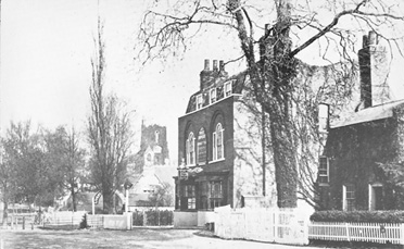
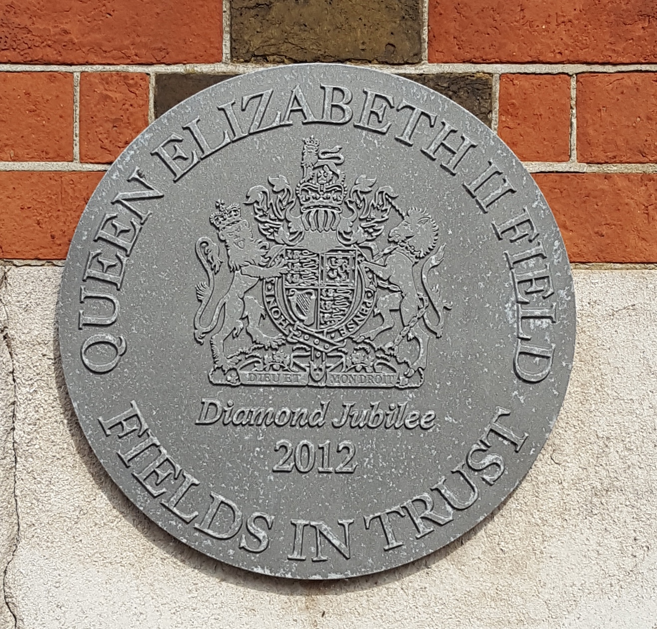
Priory Park is a 6.5-hectare public park in Hornsey, in the London Borough of Haringey. It is located between Priory Road and Middle Lane, approximately 0.5 km north of Crouch End Broadway. The park is protected as a Fields in Trust Queen Elizabeth II Field. It has won multiple Green Flag Awards since 2003, and has an active community group. The park contains a small wildlife pond hosting a sculpture called “the drop”, as well as a fountain made from Lamorna#Lamorna stone, Lamorna stone which was installed in 1909. This originally stood in St Paul's Cathedral churchyard. History The park was created in two sections. Two parcels of land at the eastern and southern ends were purchased in 1891 by the Municipal Borough of Hornsey, Borough of Hornsey at the instigation of Henry Reader Williams and opened in 1896 as the ''Middle Lane Pleasure Grounds''. In 1926 the western section was added after the acquisition of a piece of land known as ''Lewcock's Field''. During World War ... [...More Info...] [...Related Items...] OR: [Wikipedia] [Google] [Baidu] |
Priory Park 2006
A priory is a monastery of men or women under religious vows that is headed by a prior or prioress. They were created by the Catholic Church. Priories may be monastic houses of monks or nuns (such as the Benedictines, the Cistercians, or the Charterhouses). Houses of canons & canonesses regular also use this term, the alternative being "canonry". Mendicant houses, of friars, nuns, or tertiary sisters (such as the Friars Preachers, Augustinian Hermits, and Carmelites) also exclusively use this term. In pre-Reformation England, if an abbey church was raised to cathedral status, the abbey became a cathedral priory. The bishop, in effect, took the place of the abbot, and the monastery itself was headed by a prior. History Priories first came to existence as subsidiaries to the Abbey of Cluny. Many new houses were formed that were all subservient to the abbey of Cluny and called Priories. As such, the priory came to represent the Benedictine ideals espoused by the Cluniac reform ... [...More Info...] [...Related Items...] OR: [Wikipedia] [Google] [Baidu] |
Hornsey
Hornsey () is a district of north London, England, in the London Borough of Haringey. It is an inner-suburban, for the most part residential, area centred north of Charing Cross. It adjoins green spaces Queen's Wood to the west and Alexandra Park to the north, and lies in the valley of the now-culverted River Moselle. The central core of the area is known as Hornsey Village. Locale Hornsey is relatively old, and the oldest recorded village 202, according to the Place Names of Middlesexnow in London. Originally a village, it grew up along Hornsey High Street- at the eastern end of which is the churchyard and tower of the former St Mary's parish church, which was first mentioned in 1291. At the western end is Priory Park. This was the administrative centre of the historically broad parish. North of Hornsey High Street, and immediately to its south, some of the area is public sector housing, surrounded by the late-Victorian terraces developed by builders such as John Farr ... [...More Info...] [...Related Items...] OR: [Wikipedia] [Google] [Baidu] |
London Borough Of Haringey
The London Borough of Haringey ( , same as Harringay) is a London boroughs, London borough in north London, classified by some definitions as part of Inner London, and by others as part of Outer London. It was created in 1965 by the amalgamation of three former boroughs. It shares borders with six other London boroughs. Clockwise from the north, they are: London Borough of Enfield, Enfield, London Borough of Waltham Forest, Waltham Forest, London Borough of Hackney, Hackney, London Borough of Islington, Islington, London Borough of Camden, Camden, and London Borough of Barnet, Barnet. Haringey covers an area of more than . Some of the more familiar local landmarks include Alexandra Palace, Bruce Castle, Hornsey Town Hall, Jacksons Lane, Highpoint I and II, and Tottenham Hotspur F.C., Tottenham Hotspur Football Club. Areas such as Highgate, Muswell Hill and Crouch End are among the most prosperous in the country. Haringey is also a borough of contrasts geographically. From the woo ... [...More Info...] [...Related Items...] OR: [Wikipedia] [Google] [Baidu] |
Crouch End Broadway
Crouch End is an area of North London, England, from the City of London in the western half of the borough of Haringey. It is within the Hornsey postal district (N8). It has been described as one of "a new breed of urban villages" in London. In 2023, it was voted the best place to live in London. Location Crouch End lies between Harringay to the east; Muswell Hill to the north-west; Hornsey to the north; Wood Green to the north-east; Finsbury Park, Stroud Green and Archway to the south; and Highgate to the west. It is located north of Charing Cross and from the City of London. Toponymy The name Crouch End is derived from Middle English. A "crouch" meant cross while an "end" referred to an outlying area. Some think that this refers to the borders of the parish, in other words, the area where the influence of the parish ends. Its name has been recorded as Crouchend (1465), Crowchende (1480), the Crouche Ende (1482), and Crutche Ende (1553). In 1593, it was recorded as "Cr ... [...More Info...] [...Related Items...] OR: [Wikipedia] [Google] [Baidu] |
Fields In Trust
Fields in Trust is a British charity set up in 1925 as the National Playing Fields Association (NPFA), by Brigadier-General Reginald Kentish and the Duke of York, later King George VI, who was the first president, which protects parks and green spaces and promotes the cause of accessible spaces for play, sports and recreation in British cities and towns. As well as campaigning to protect playing fields and open space, Fields in Trust legally protects the King George's Fields, 471 public recreation grounds set up as a memorial to King George V. History The charity was set up in 1925 as the National Playing Fields Association (NPFA), by Brigadier-General Reginald Kentish and was founded by the Duke of York, later King George VI, who was the first president. This royal link continued with Queen Elizabeth II as Patron from 1952 until her death in 2022 and Prince Philip, Duke of Edinburgh, as President from 1947 until he stepped down in 2013 to be succeeded by his grandson William, ... [...More Info...] [...Related Items...] OR: [Wikipedia] [Google] [Baidu] |
Green Flag Award
The Green Flag Award is an international accreditation given to publicly accessible parks and open spaces, managed under licence from the Department for Levelling Up, Housing and Communities, a UK Government department, by Keep Britain Tidy, who also administers the scheme in England. History The Green Flag Award was introduced in 1996, and first awarded in 1997, by the Ministry of Housing, Communities and Local Government (MHCLG) with the intention of establishing agreed standards of good management, to help to justify and evaluate funding and to raise park attendance. The scheme was managed by Civic Trust, on MHCLG's behalf, until they lost the contract and the charity went bust in 2009. The scheme has been managed by Keep Britain Tidy since 2012, with sister organisations Keep Scotland Beautiful, Keep Wales Tidy and TIDY Northern Ireland delivering the scheme across the UK, and various other bodies delivering worldwide. Purpose and description The scheme's aim is to ... [...More Info...] [...Related Items...] OR: [Wikipedia] [Google] [Baidu] |
Lamorna
Lamorna () is a village, valley and cove in west Cornwall, England, UK. It is on the Penwith peninsula approximately south of Penzance. Lamorna became popular with the artists of the Newlyn School, including Alfred Munnings, Laura Knight and Harold Knight, and is also known for former residents Derek and Jean Tangye who farmed land and wrote "The Minack Chronicles". Toponymy First recorded as ''Nansmorno'' (in 1305), than ''Nansmurnou'' (1309), ''Nansmorne'' (1319), ''Nansmornou'' (1339), ''Nansmorna'' (1387) and ''Namorna'' (1388). In Cornish ''Nans'' means valley, and the 2nd element is possibly ''mor'', which means sea. Geography Lamorna Cove is at the SE end of a north-west to south-east valley. The cove is delineated by Carn-du (Black Rock) on the eastern side and Lamorna Point on the western side. The valley is privately owned from The Wink (public house) down to the cove, which is reached by a narrow lane to the car park and quay. The small village, half a mile i ... [...More Info...] [...Related Items...] OR: [Wikipedia] [Google] [Baidu] |
St Paul's Cathedral
St Paul's Cathedral, formally the Cathedral Church of St Paul the Apostle, is an Anglican cathedral in London, England, the seat of the Bishop of London. The cathedral serves as the mother church of the Diocese of London in the Church of England. It is on Ludgate Hill at the highest point of the City of London. Its dedication in honour of Paul the Apostle dates back to the original church on this site, founded in AD 604. The high-domed present structure, which was completed in 1710, is a Listed Building, Grade I listed building that was designed in the English Baroque style by Sir Christopher Wren. The cathedral's reconstruction was part of a major rebuilding programme initiated in the aftermath of the Great Fire of London. The earlier Gothic cathedral (Old St Paul's Cathedral), largely destroyed in the Great Fire, was a central focus for medieval and early modern London, including Paul's walk and St Paul's Churchyard, being the site of St Paul's Cross. The cathedral is o ... [...More Info...] [...Related Items...] OR: [Wikipedia] [Google] [Baidu] |
Municipal Borough Of Hornsey
The Municipal Borough of Hornsey was a local government district in east Middlesex from 1867 to 1965. History In 1867, a Local board of health, Local Board was formed for part of the civil parish of Hornsey (parish), Hornsey. The rest of the parish was already under South Hornsey Local Board, formed in 1865. In 1894, under the local Government Act 1894, Local Government Act of that year, Hornsey became an Urban district (Great Britain and Ireland), urban district. In November 1903, it was incorporated as a municipal borough. The corporation made two unsuccessful attempts to gain county borough status in 1904 and 1915. The borough was part of the London postal district and Metropolitan Police District. The borough's coat of arms, granted in 1904, featured two oak trees recalling the ancient forest that once covered the area and surviving remnants including Queen's Wood, Highgate Wood and Coldfall Wood. The manor of Hornsey had at one time been held by the Diocese of London and ... [...More Info...] [...Related Items...] OR: [Wikipedia] [Google] [Baidu] |
Allotment (gardening)
An allotment (British English), is a plot of land made available for individual, non-commercial gardening for growing food plants, so forming a kitchen garden away from the residence of the user. Such plots are formed by subdividing a piece of land into a few or up to several hundred parcels that are assigned to individuals or families, contrary to a community garden where the entire area is tended collectively by a group of people. The term "victory garden" is also still sometimes used, especially when a garden dates back to the World War I, First or World War II, Second World War. The individual size of a parcel typically suits the needs of a family, and often the plots include a shed for tools and shelter, and sometimes a hut for seasonal or weekend accommodation. The individual gardeners are usually organised in an allotment association, which leases or is granted the land from an owner who may be a public, private or ecclesiastical entity, and who usually stipulates that it ... [...More Info...] [...Related Items...] OR: [Wikipedia] [Google] [Baidu] |


