|
Primoži
Primoži (; ,''Leksikon občin kraljestev in dežel zastopanih v državnem zboru,'' vol. 6: ''Kranjsko''. 1906. Vienna: C. Kr. Dvorna in Državna Tiskarna, p. 36. Gottscheerish: ''Handlarə''Petschauer, Erich. 1980. "Die Gottscheer Siedlungen – Ortsnamenverzeichnis." In ''Das Jahrhundertbuch der Gottscheer'' (pp. 181–197). Klagenfurt: Leustik.) is a small settlement in the Municipality of Kočevje in southern Slovenia. The area is part of the traditional region of Lower Carniola and is now included in the Southeast Slovenia Statistical Region. Name The German name ''Handlern''—and the Slovene name ''Handlerji'', based on it—are both plural forms, derived from a surname. The Slovene name of the settlement was changed from ''Handlerji'' (previously also ''Handlarji'') to ''Primoži'' in 1953. The name was changed on the basis of the 1948 Law on Names of Settlements and Designations of Squares, Streets, and Buildings as part of efforts by Slovenia’s postwar communist governm ... [...More Info...] [...Related Items...] OR: [Wikipedia] [Google] [Baidu] |
Mlaka Pri Kočevski Reki
Mlaka pri Kočevski Reki (; ''Leksikon občin kraljestev in dežel zastopanih v državnem zboru,'' vol. 6: ''Kranjsko''. 1906. Vienna: C. Kr. Dvorna in Državna Tiskarna, p. 36.) is a settlement in the Municipality of Kočevje in southern Slovenia. The area is part of the traditional region of Lower Carniola and is now included in the Southeast Slovenia Statistical Region. Geography Mlaka pri Kočevski Reki is a scattered settlement north of Primoži in an open valley, along a secondary road that is wooded on both sides. The soil is loamy and sandy. Surrounding hills include Roch's Head (, 728 m) to the northeast, Sexton's Head (, 791 m) to the east, and Wood Hill (, 686 m) to the west.Savnik, Roman, ed. 1971. ''Krajevni leksikon Slovenije'', vol. 2. Ljubljana: Državna založba Slovenije, p. 232. Name The name of the settlement was changed from ''Mlaka'' to ''Mlaka pri Kočevski Reki'' (literally, 'Mlaka near Kočevska Reka') in 1953. The three villages of Primoži, Koče, an ... [...More Info...] [...Related Items...] OR: [Wikipedia] [Google] [Baidu] |
Koče, Kočevje
Koče (; ''Leksikon občin kraljestev in dežel zastopanih v državnem zboru,'' vol. 6: ''Kranjsko''. 1906. Vienna: C. Kr. Dvorna in Državna Tiskarna, p. 36.Ferenc, Mitja. 2007. ''Nekdanji nemški jezikovni otok na kočevskem''. Kočevje: Pokrajinski muzej, p. 4.) is a settlement in the hills south of Kočevje in southern Slovenia. The area is part of the traditional region of Lower Carniola and is now included in the Southeast Slovenia Statistical Region. Name Koče was known as ''Kotchen'' in German and as ''Götschə'' or ''Gotsch''''Koče / Kotschen''. 2008. Signpost. Created by the Peter Kozler Slovenian Gottschee Society, represented by Erik Krisch. Financed by the Municipality of Kočevje and Hubert Kosler. Text by Mitja Ferenc, design by Manca Dekleva, printed by Mema d.o.o. of Kočevje. in Gottscheerish. The name was first attested in 1498 as ''Kötschen'' and is believed to be derived from a plural form of the Slovene common noun ''koča'' '(small) house, shack' in refer ... [...More Info...] [...Related Items...] OR: [Wikipedia] [Google] [Baidu] |
Municipality Of Kočevje
The Municipality of Kočevje (; ) is a Municipalities of Slovenia, municipality in southern Slovenia. The seat of the municipality is the city of Kočevje. Today it is part of the Southeast Slovenia Statistical Region. In terms of area, it is the largest municipality in Slovenia. It borders Croatia. History In 1247 Berthold (patriarch of Aquileia), Berthold, Patriarch of Patriarchate of Aquileia (state), Aquileia granted the area around Ribnica, Slovenia, Ribnica within the imperial March of Carniola to the Duchy of Carinthia, Carinthian counts of Grafschaft Ortenburg, Ortenburg. When the counts received further estates on the wooded plateau down to Kostel, Slovenia, Kostel on the Kupa, Kolpa River in 1336 from Patriarch Bertram of St. Genesius, Bertram, they called for German-speaking settlers from Carinthia and County of Tyrol, Tyrol. These Germanic people became known as the Gottscheers, and their dialect, Gottscheerish. The Gottscheers lived in isolation in the Gottschee a ... [...More Info...] [...Related Items...] OR: [Wikipedia] [Google] [Baidu] |
Hip Roof
A hip roof, hip-roof or hipped roof, is a type of roof where all sides slope downward to the walls, usually with a fairly gentle slope, with variants including Tented roof, tented roofs and others. Thus, a hipped roof has no gables or other vertical sides to the roof. A square hip roof is shaped like a pyramid. Hip roofs on houses may have two triangular sides and two Trapezoid, trapezoidal ones. A hip roof on a rectangular plan has four faces. They are almost always at the same pitch or slope, which makes them symmetrical about the centerlines. Hip roofs often have a consistent level fascia (architecture), fascia, meaning that a gutter can be fitted all around. Hip roofs often have dormer slanted sides. Construction Hip roofs can be constructed on a wide variety of plan shapes. Each ridge is central over the rectangle of the building below it. The triangular faces of the roof are called the hip ends, and they are bounded by the hips themselves. The "hips" and hip rafters ... [...More Info...] [...Related Items...] OR: [Wikipedia] [Google] [Baidu] |
Wayside Shrine
A wayside shrine is a religious image, usually in some sort of small shelter, placed by a road or pathway, sometimes in a settlement or at a crossroads, but often in the middle of an empty stretch of country road, or at the top of a hill or mountain. They have been a feature of many cultures, including Chinese folk religious communities, Catholic and Orthodox Europe and some Asian regions. The origins of wayside shrines Wayside shrines were often erected to honor the memory of the victim of an accident, which explains their prevalence near roads and paths; in Carinthia (state), Carinthia, for example, they often stand at crossroads. Some commemorate a specific incident near the place; either a death in an accident or escape from harm. Other icons commemorate the victims of the Plague (disease), plague. The very grand medieval English Eleanor crosses were erected by her husband to commemorate the nightly resting places of the journey made by the body of Queen Eleanor of Castile ... [...More Info...] [...Related Items...] OR: [Wikipedia] [Google] [Baidu] |
Sacred Heart
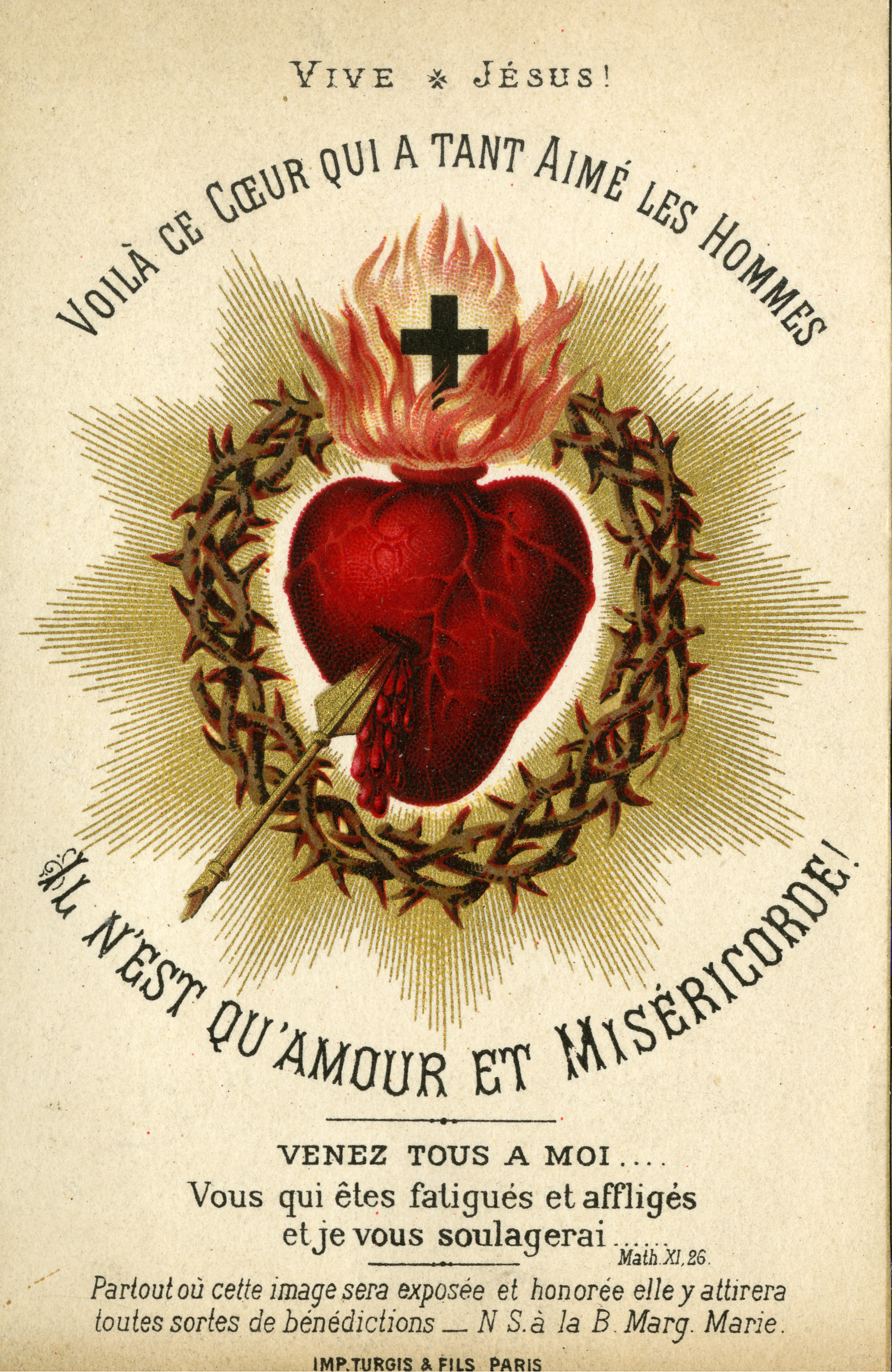
The Most Sacred Heart of Jesus () is one of the most widely practised and well-known Catholic devotions, wherein the heart of Jesus Christ is viewed as a symbol of "God's boundless and passionate love for mankind". This devotion to Christ is predominantly used in the Catholic Church, followed by high church Anglicans, and some Western Rite Orthodox. In the Latin Church, the liturgical Solemnity of the Most Sacred Heart of Jesus is celebrated on the third Friday after Pentecost. The 12 promises of the Most Sacred Heart of Jesus are also popular. The devotion is especially concerned with what the church deems to be the long-suffering love and compassion of the heart of Christ towards humanity. The popularization of this devotion in its modern form is derived from a Roman Catholic nun from France, Margaret Mary Alacoque, who said she learned the devotion from Jesus during a series of apparitions to her between 1673 and 1675, and later, in the 19th century, from the mystical ... [...More Info...] [...Related Items...] OR: [Wikipedia] [Google] [Baidu] |
Our Lady Of Lourdes
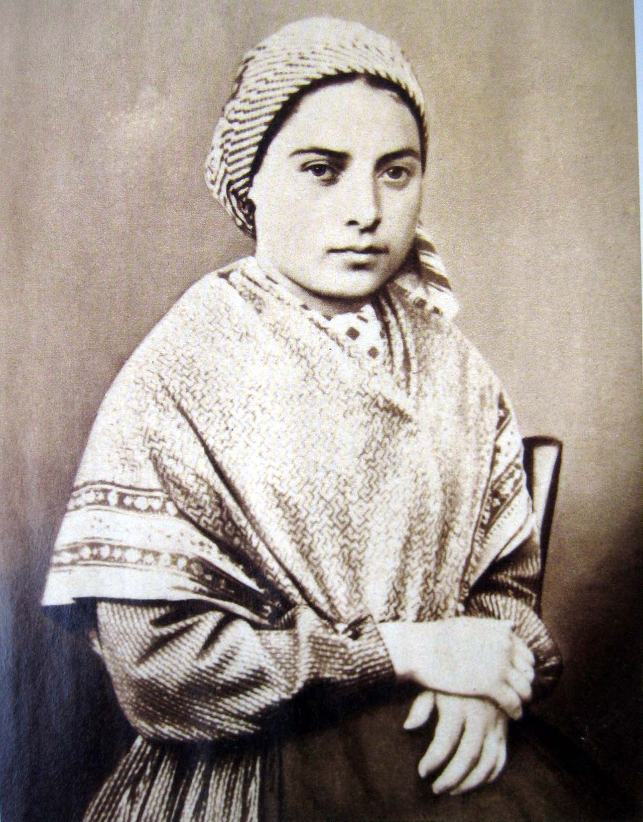
Our Lady of Lourdes (; ) is one the Marian devotions, devotional names or titles under which the Catholic Church venerates the Mary, mother of Jesus, Virgin Mary. The name commemorates a series of Lourdes apparitions, 18 apparitions reported by a 14-year-old girl, Bernadette Soubirous, in Lourdes, France in 1858. After the first reported apparition on 11 February 1858, Bernadette told her mother that a "Lady" had spoken to her in the cave of Massabielle ( from the town) while Bernadette, her sister, and a friend were gathering firewood. Bernadette reported similar apparitions of the "Lady" over the ensuing weeks, in the last of which the "Lady" identified herself as "the Immaculate Conception". On 18 January 1862, the local Bishop of Tarbes Bertrand-Sévère Laurence endorsed the veneration of the Blessed Virgin Mary (Roman Catholic), Blessed Virgin Mary in Lourdes. On 1 February 1876, Pope Pius IX officially granted a decree of canonical coronation to the image as ''Notre-Dame d ... [...More Info...] [...Related Items...] OR: [Wikipedia] [Google] [Baidu] |
Gottscheers
Gottscheers (, , ) are the German settlers of the Kočevje, Kočevje region (a.k.a. Gottschee) of Slovenia, formerly Gottschee, Gottschee County. Until the World War II, Second World War, their main language of communication was Gottscheerish, a Bavarian language, Bavarian dialect of German. History Duchy of Carniola In 1247, Berthold (patriarch of Aquileia), Berthold, Patriarch of Aquileia, transferred fiefdom of Ribnica, Ribnica, Ribnica and its Lower Carniola, Lower Carniolan environs to the Counts of Ortenburg, a Carinthian noble family. This area included the primeval forest area that would eventually become known as the Gottschee. In 1336, Patriarch Bertrand of Saint-Geniès reaffirmed and expanded the rights and responsibilities of Otto V of Ortenburg and his successors as rulers of the area. Starting in 1330 and continuing until ''circa'' 1400, the Counts of Ortenburg settled German peasants from East Tyrol and Carinthia within their fiefdom. In 1377, the town of Ko� ... [...More Info...] [...Related Items...] OR: [Wikipedia] [Google] [Baidu] |
Hide (unit)
The hide was an English unit of land measurement originally intended to represent the amount of land sufficient to support a household. The Anglo-Saxon hide commonly appeared as of arable land, but it probably represented a much smaller holding before 1066. It was a measure of value and tax assessment, including obligations for food-rent ('), maintenance and repair of bridges and fortifications, manpower for the army ('), and (eventually) the ' land tax. The hide's method of calculation is now obscure: different properties with the same hidage could vary greatly in extent even in the same county. Following the Norman Conquest of England, the hidage assessments were recorded in the Domesday Book of 1086, and there was a tendency for land producing £1 of income per year to be assessed at 1 hide. The Norman kings continued to use the unit for their tax assessments until the end of the 12th century. The hide was divided into four yardlands or virgates. It was hence nominally ... [...More Info...] [...Related Items...] OR: [Wikipedia] [Google] [Baidu] |
Flag Of Slovenia
The national flag of Slovenia () features three equal horizontal bands of white (top), blue, and red, with the coat of arms of Slovenia located in the upper hoist side of the flag centred in the white and blue bands. The coat of arms is a shield with the image of Mount Triglav, Slovenia's highest peak, in white against a blue background at the centre; beneath it are two wavy blue lines representing the Adriatic Sea and local rivers, and above it are three six-pointed golden stars arranged in an inverted triangle which are taken from the coat of arms of the Counts of Celje, the great Slovene dynastic house of the late 14th and early 15th centuries. The Slovenian flag's colours are considered to be Pan-Slavism, pan-Slavic, but they actually come from the Middle Ages, medieval coat of arms of the Holy Roman duchy of Carniola, consisting of 3 stars, a mountain, and three colours (red, blue, yellow), crescent. The existing Slovene tricolor, Slovene tricolour was raised for the first t ... [...More Info...] [...Related Items...] OR: [Wikipedia] [Google] [Baidu] |
Slovenia
Slovenia, officially the Republic of Slovenia, is a country in Central Europe. It borders Italy to the west, Austria to the north, Hungary to the northeast, Croatia to the south and southeast, and a short (46.6 km) coastline within the Adriatic Sea to the southwest, which is part of the Mediterranean Sea. Slovenia is mostly mountainous and forested, covers , and has a population of approximately 2.1 million people. Slovene language, Slovene is the official language. Slovenia has a predominantly temperate continental climate, with the exception of the Slovene Littoral and the Julian Alps. Ljubljana, the capital and List of cities and towns in Slovenia, largest city of Slovenia, is geographically situated near the centre of the country. Other larger urban centers are Maribor, Ptuj, Kranj, Celje, and Koper. Slovenia's territory has been part of many different states: the Byzantine Empire, the Carolingian Empire, the Holy Roman Empire, the Kingdom of Hungary, the Republic of Venice ... [...More Info...] [...Related Items...] OR: [Wikipedia] [Google] [Baidu] |
Gottscheerish
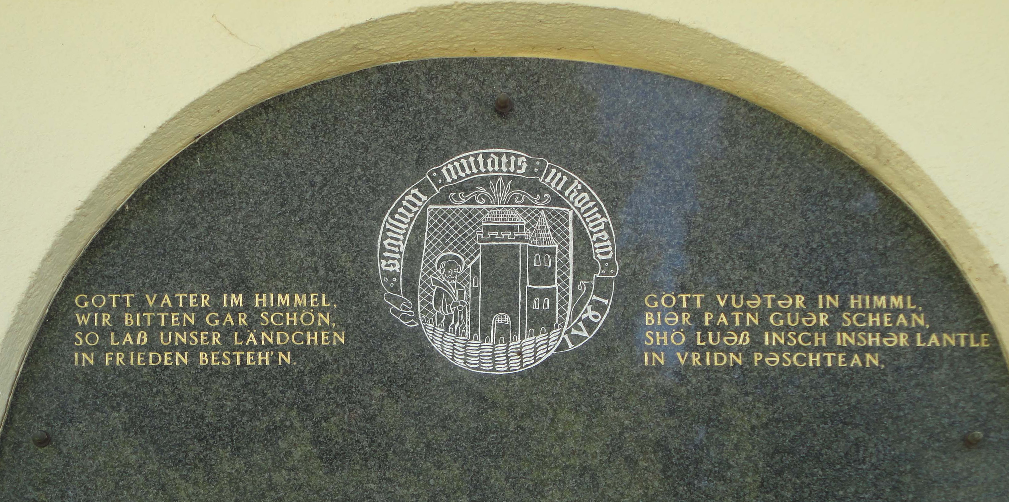
Gottscheerish (''Göttscheabarisch'',Maridi Tscherne: Wörterbuch Gottscheerisch-Slowenisch. Einrichtung für die Erhaltung des Kulturerbes Nesseltal, Koprivnik/Nesseltal 2010. , ) is an Upper German dialect which was the main language of communication among the Gottscheers in the enclave of Gottschee, Slovenia, before 1941. It is occasionally referred to as Granish or Granisch in the United States (< German ''Krainisch'' ' Carniolan'), a term also used for Slovene. Language history Gottscheerish belongs to Southern Bavarian within the Bavarian dialect group. The Bavarian dialec ...[...More Info...] [...Related Items...] OR: [Wikipedia] [Google] [Baidu] |


