|
Prignitz
Prignitz () is a ''Kreis'' (district) in the northwestern part of Brandenburg, Germany. Neighboring are (from the north clockwise) the district Ludwigslust-Parchim in Mecklenburg-Western Pomerania, the district Ostprignitz-Ruppin in Brandenburg, the district Stendal in Saxony-Anhalt and the district Lüchow-Dannenberg in Lower Saxony. Geography The term Prignitz originally meant the region north of the confluence of the Elbe and Havel rivers. This region is larger than the district. It also includes the town of Havelberg in Saxony-Anhalt and large portions of the neighbouring district of Ostprignitz-Ruppin. The Elbe river forms the southwestern border of the district. History The historical region Prignitz consisted of the following eleven districts, established in the 13th century: Wittenberge, Lenzen, Perleberg, Putlitz, Kyritz, Nitzow, Wittstock, Pritzwalk, Havelberg, Wusterhausen and Grabow. The present district of Prignitz was created in 1993 by merging the prev ... [...More Info...] [...Related Items...] OR: [Wikipedia] [Google] [Baidu] |
Ostprignitz-Ruppin
Ostprignitz-Ruppin is a ''Kreis'' (district) in the northwestern part of Brandenburg, Germany. Neighboring are (from north clockwise) the districts Müritz and Mecklenburg-Strelitz in Mecklenburg-Western Pomerania, the districts Oberhavel and Havelland, the district Stendal in Saxony-Anhalt, and the district Prignitz. Geography The district consists of plain countryside northwest of Berlin. It is densely forested. Many rivers and lakes can be found in its western, its central and its northeastern part. The main river in the district is the Dosse. History The district has always been distinguishable from the West Prignitz, having been settled originally by Slavs from a different part of Mecklenburg. It was officially created in 1993 by merging the districts Kyritz, Neuruppin and Wittstock. The district roughly covers the same territory as the two historic districts Ostprignitz and Ruppin. Osprignitz was created in 1815 as one of two districts covering the former county Prignit ... [...More Info...] [...Related Items...] OR: [Wikipedia] [Google] [Baidu] |
Kyritz
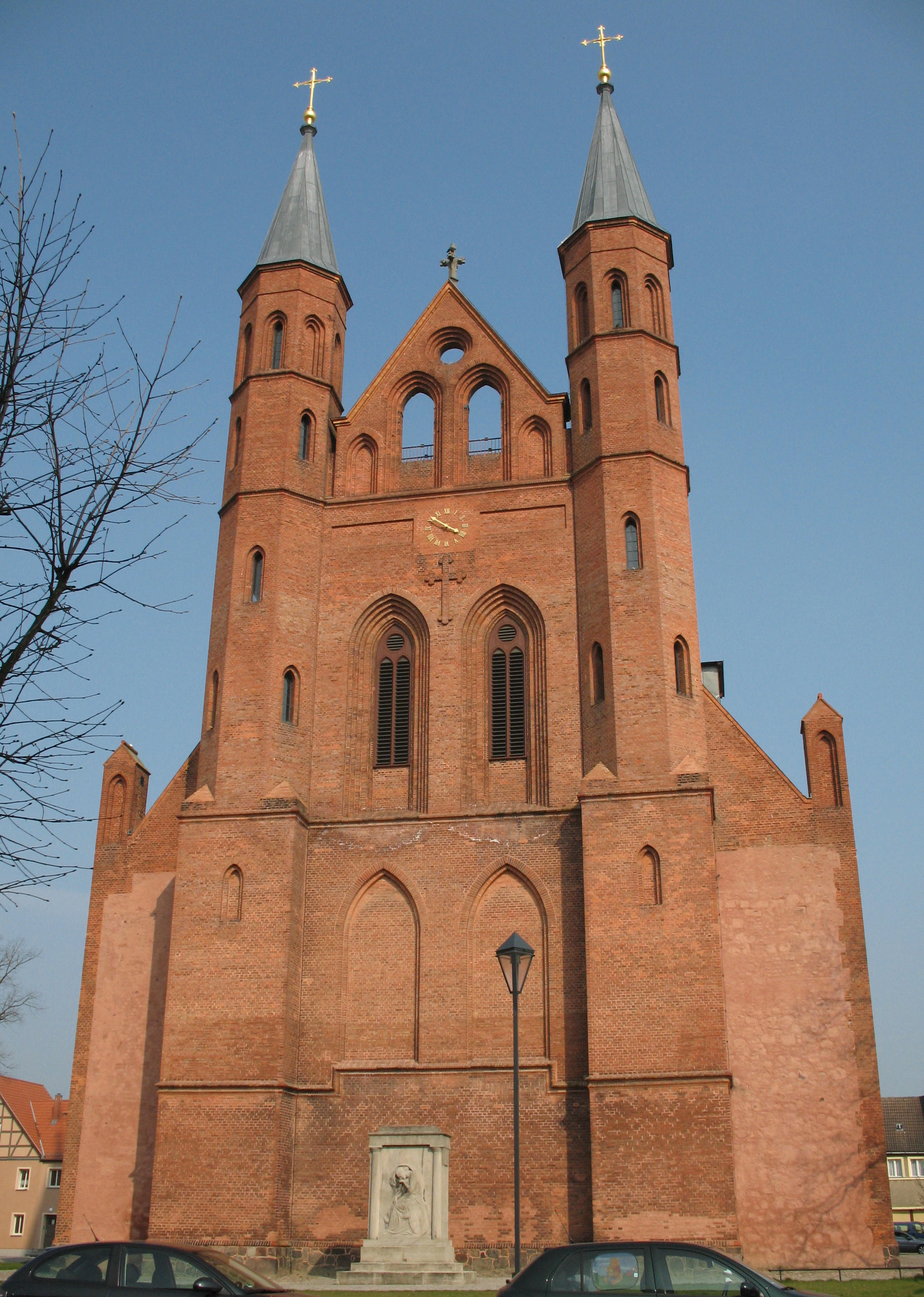
Kyritz () is a town in the Ostprignitz-Ruppin district, in Brandenburg, Germany. It is situated 28 km west of Neuruppin and 28 km southeast of Pritzwalk. The town has 9,260 inhabitants (2019). Overview The town is situated near the Kyritzer Seenkette, a chain of lakes. The town is nicknamed "Kyritz an der Knatter" (Kyritz at the Rattle). The noise of numerous water mills along a stream parallel to the river Jäglitz was the reason for this nickname. This river channel does not exist anymore. The town includes the districts Berlitt, Bork, Drewen, Gantikow, Ganz, Holzhausen, Kötzlin, Lellichow, Mechow, Rehfeld and Teetz. History The oldest document mentioning the area around Kyritz as "Chorizi" was written in 948. The region was called "Prignitz". The name is derived from the slavic word "pregynica" meaning "inaccessible woods". A castle was built here in 1148, and little by little a town developed close to the castle. In the year 1225 a Franciscan friary was establi ... [...More Info...] [...Related Items...] OR: [Wikipedia] [Google] [Baidu] |
Wusterhausen
Wusterhausen (official name Wusterhausen/Dosse) is a municipality in the Ostprignitz-Ruppin district, in northwestern Brandenburg, Germany. It is situated on the river Dosse, 7 km southeast of Kyritz, and 75 km northwest of Berlin. Demography File:Bevölkerungsentwicklung Wusterhausen-Dosse.pdf, Development of population since 1875 within the current Boundaries (Blue Line: Population; Dotted Line: Comparison to Population development in Brandenburg state; Grey Background: Time of Nazi Germany; Red Background: Time of communist East Germany) File:Bevölkerungsprognosen Wusterhausen-Dosse.pdf, Recent Population Development and Projections (Population Development before Census 2011 (blue line); Recent Population Development according to the Census in Germany in 2011 (blue bordered line); Official projections for 2005-2030 (yellow line); for 2017-2030 (scarlet line); for 2020-2030 (green line) People * Dieter Helm (1941–2022), farmer and politician * Herm ... [...More Info...] [...Related Items...] OR: [Wikipedia] [Google] [Baidu] |
Wittstock
Wittstock/Dosse is a town in the Ostprignitz-Ruppin district, in north-western Brandenburg, Germany. Geography It is located in the eastern Prignitz region on the Dosse River near the confluence with its Glinze tributary, about east of Pritzwalk and northwest of Berlin. Wittstock is situated in a terminal moraine landscape south of the Mecklenburg Lake District. Town structure After the incorporation of several suburban villages in December 1993 and again in October 2003, Wittstock became the 6th largest town in Germany by area. However, the former independent districts Herzsprung and Königsberg, which were forced to be integrated in 2003, regained their independence in 2004, claiming that the compulsive integration was void because of a clerical error. Both districts were still under the overview of the department of Wittstock. Since 2005, Herzsprung and Königsberg are parts of the commune Heiligengrabe, so the size of the town decreased. The current districts of Wittstoc ... [...More Info...] [...Related Items...] OR: [Wikipedia] [Google] [Baidu] |
Brandenburg
Brandenburg (; nds, Brannenborg; dsb, Bramborska ) is a state in the northeast of Germany bordering the states of Mecklenburg-Vorpommern, Lower Saxony, Saxony-Anhalt, and Saxony, as well as the country of Poland. With an area of 29,480 square kilometres (11,382 square miles) and a population of 2.5 million residents, it is the fifth-largest German state by area and the tenth-most populous. Potsdam is the state capital and largest city, and other major towns are Cottbus, Brandenburg an der Havel and Frankfurt (Oder). Brandenburg surrounds the national capital and city-state of Berlin, and together they form the Berlin/Brandenburg Metropolitan Region, the third-largest metropolitan area in Germany with a total population of about 6.2 million. There was an unsuccessful attempt to unify both states in 1996 and the states cooperate on many matters to this day. Brandenburg originated in the Northern March in the 900s AD, from areas conquered from the Wends. It later became the ... [...More Info...] [...Related Items...] OR: [Wikipedia] [Google] [Baidu] |
Perleberg
Perleberg (; North Margravian: ''Perlberg'') is the capital of the district of Prignitz, located in the northwest of the German state of Brandenburg. The town received city rights in 1239 and today has about 12,000 inhabitants. Located in a mostly agricultural area, the town has a long history of troops (most notably Prussian) being stationed there and as an administrative center for local government. Geography Perleberg is located in the heart of the district of Prignitz, about halfway between the two largest German cities Berlin and Hamburg. It is surrounded by the municipalities Karstädt to the north-west, Gross Pankow (Prignitz) to the north-east, Plattenburg to the south-east; the ''Ämter'' Bad Wilsnack/Weisen in the south, Lenzen-Elbtalaue in the west; and the town of Wittenberge to the south-west. The Stepenitz flows from northeast to southwest through Perleberg. The town's historic center is built on an island between two arms of the river. History One of t ... [...More Info...] [...Related Items...] OR: [Wikipedia] [Google] [Baidu] |
Stendal (district)
Stendal () is a district (''Landkreis'') in the north-east of Saxony-Anhalt, Germany. Its neighbouring districts are (clockwise from the south): Jerichower Land, Börde, Altmarkkreis Salzwedel, Lüchow-Dannenberg in Lower Saxony, and the districts of Prignitz, Ostprignitz-Ruppin and Havelland in Brandenburg. History In the administrative reform of 1994 the previous district of Stendal was merged with the districts of Osterburg and Havelberg. Geography The district is located in the Altmark region. With an area of , it is the largest district of Saxony-Anhalt. Its highest elevation is the 132.8 metre high ''Landsberg''. The main rivers in the district are the Elbe and the Havel. Partnerships In 1990, a friendship with the Russian Yartsevsky District was started, which grew into a partnership in 1996. In 1994, a partnership with the Lithuanian district Mažeikiai was started. Further partnerships exist with the Lippe district in North Rhine-Westphalia and the Swedish mu ... [...More Info...] [...Related Items...] OR: [Wikipedia] [Google] [Baidu] |
Germany
Germany, officially the Federal Republic of Germany (FRG),, is a country in Central Europe. It is the most populous member state of the European Union. Germany lies between the Baltic and North Sea to the north and the Alps to the south. Its 16 constituent states have a total population of over 84 million in an area of . It borders Denmark to the north, Poland and Czechia to the east, Austria and Switzerland to the south, and France, Luxembourg, Belgium, and the Netherlands to the west. The nation's capital and most populous city is Berlin and its main financial centre is Frankfurt; the largest urban area is the Ruhr. Settlement in what is now Germany began in the Lower Paleolithic, with various tribes inhabiting it from the Neolithic onward, chiefly the Celts. Various Germanic tribes have inhabited the northern parts of modern Germany since classical antiquity. A region named Germania was documented before AD 100. In 962, the Kingdom of Germany formed the ... [...More Info...] [...Related Items...] OR: [Wikipedia] [Google] [Baidu] |
Nazi Germany
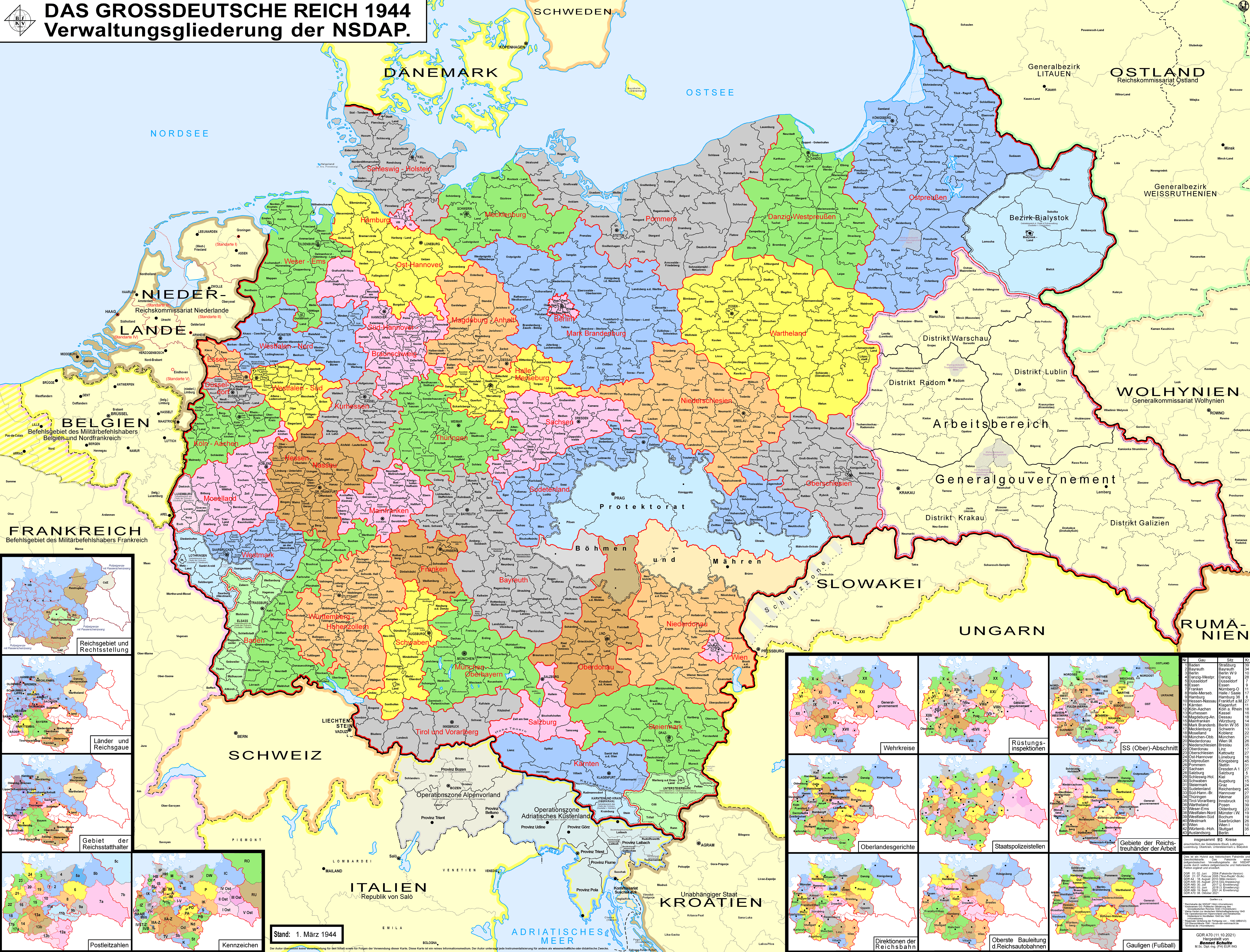
Nazi Germany (lit. "National Socialist State"), ' (lit. "Nazi State") for short; also ' (lit. "National Socialist Germany") (officially known as the German Reich from 1933 until 1943, and the Greater German Reich from 1943 to 1945) was the German Reich, German state between 1933 and 1945, when Adolf Hitler and the Nazi Party controlled the country, transforming it into a dictatorship. Under Hitler's rule, Germany quickly became a totalitarian state where nearly all aspects of life were controlled by the government. The Third Reich, meaning "Third Realm" or "Third Empire", alluded to the Nazi claim that Nazi Germany was the successor to the earlier Holy Roman Empire (800–1806) and German Empire (1871–1918). The Third Reich, which Hitler and the Nazis referred to as the Thousand-Year Reich, ended in May 1945 after just 12 years when the Allies of World War II, Allies defeated Germany, End of World War II in Europe, ending World War II in Europe. On 30 January 1933, H ... [...More Info...] [...Related Items...] OR: [Wikipedia] [Google] [Baidu] |
Wends
Wends ( ang, Winedas ; non, Vindar; german: Wenden , ; da, vendere; sv, vender; pl, Wendowie, cz, Wendové) is a historical name for Slavs living near Germanic settlement areas. It refers not to a homogeneous people, but to various peoples, tribes or groups depending on where and when it was used. In the modern day, communities identifying as Wendish exist in Slovenia, Austria, Lusatia, Texas, and Australia. In German-speaking Europe This article details the geographical distribution of speakers of the German language, regardless of the legislative status within the countries where it is spoken. In addition to the German-speaking area (german: Deutscher Sprachraum) in Europ ... during the Middle Ages, the term "Wends" was interpreted as synonymous with "Slavs" and sporadically used in literature to refer to West Slavs and South Slavs living within the Holy Roman Empire. The name has possibly survived in Finnic languages ( , et, Vene , krl, Veneä), denoting moder ... [...More Info...] [...Related Items...] OR: [Wikipedia] [Google] [Baidu] |
Von Quitzow
The von Quitzow family is a noble family of Brandenburg Brandenburg (; nds, Brannenborg; dsb, Bramborska ) is a state in the northeast of Germany bordering the states of Mecklenburg-Vorpommern, Lower Saxony, Saxony-Anhalt, and Saxony, as well as the country of Poland. With an area of 29,480 square ..., whose power in the late fourteenth and early fifteenth century was so great that this period of Brandenburg history is sometimes called the "Age of the von Quitzows." Its most famous sons were the robber barons, the brothers Dietrich (born 1366) and Hans (born 1370). German families Margraviate of Brandenburg {{Germany-noble-stub ... [...More Info...] [...Related Items...] OR: [Wikipedia] [Google] [Baidu] |


