|
Port Leopold
The locality Port Leopold is an abandoned trading post in the Qikiqtaaluk Region of Nunavut, Canada. It faces Prince Regent Inlet at the northeast tip of Somerset Island. Elwin Bay is to the south, while Prince Leopold Island is to the north. History In 1848, the English explorer James Clark Ross wintered here during his search for the missing Franklin expedition. Later, it became the site of a Hudson's Bay Company trading post A trading post, trading station, or trading house, also known as a factory in European and colonial contexts, is an establishment or settlement where goods and services could be traded. Typically a trading post allows people from one geogr .... Mapping *Elwin Bay, *Prince Leopold Island, References Ghost towns in Nunavut Geography of Qikiqtaaluk Region Ports and harbours of Nunavut Former populated places in the Qikiqtaaluk Region Hudson's Bay Company trading posts in Nunavut {{Canada-ghost-town-stub ... [...More Info...] [...Related Items...] OR: [Wikipedia] [Google] [Baidu] [Amazon] |
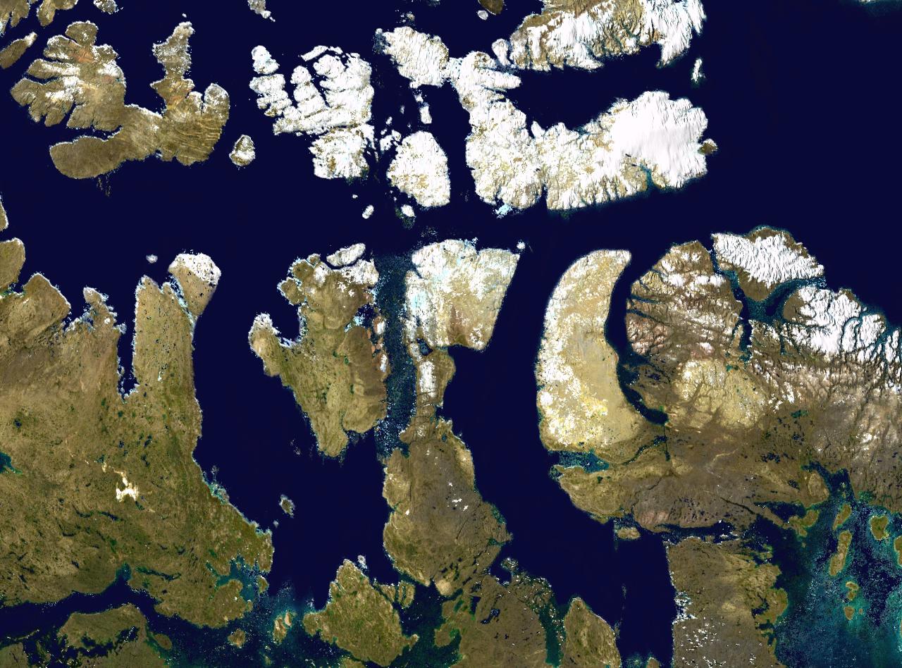
Map Indicating Port Leopold, Somerset Island, Nunavut, Canada
A map is a symbolic depiction of interrelationships, commonly spatial, between things within a space. A map may be annotated with text and graphics. Like any graphic, a map may be fixed to paper or other durable media, or may be displayed on a transitory medium such as a computer screen. Some maps change interactively. Although maps are commonly used to depict geography, geographic elements, they may represent any space, real or fictional. The subject being mapped may be two-dimensional such as Earth's surface, three-dimensional such as Earth's interior, or from an abstract space of any dimension. Maps of geographic territory have a very long tradition and have existed from ancient times. The word "map" comes from the , wherein ''mappa'' meant 'napkin' or 'cloth' and ''mundi'' 'of the world'. Thus, "map" became a shortened term referring to a flat representation of Earth's surface. History Maps have been one of the most important human inventions for millennia, allowin ... [...More Info...] [...Related Items...] OR: [Wikipedia] [Google] [Baidu] [Amazon] |
Trading Post
A trading post, trading station, or trading house, also known as a factory in European and colonial contexts, is an establishment or settlement where goods and services could be traded. Typically a trading post allows people from one geographic area to exchange for goods produced in another area. Usually money is not used. The barter that occurs often includes an aspect of haggling. In some examples, local inhabitants can use a trading post to exchange what they have (such as locally-harvested furs) for goods they wish to acquire (such as manufactured trade goods imported from industrialized places). Given bulk transportation costs, exchanges made at a trading post for long-distance distribution can involve items which either party or both parties regard as luxury goods. A trading post can consist either of a single building or of an entire town. Trading posts have been established in a range of areas, including relatively remote ones, but most often near an ocean, a ri ... [...More Info...] [...Related Items...] OR: [Wikipedia] [Google] [Baidu] [Amazon] |
Qikiqtaaluk Region
The Qikiqtaaluk Region, Qikiqtani Region (Inuktitut syllabics: ᕿᑭᖅᑖᓗᒃ ) or the Baffin Region is the easternmost, northernmost, and southernmost administrative region of Nunavut, Canada. Qikiqtaaluk is the traditional Inuktitut name for Baffin Island. Although the Qikiqtaaluk Region is the most commonly used name in official contexts, several notable public organizations, including Statistics Canada prior to the 2021 Canadian census, use the older term Baffin Region. With a population of 19,355 and an area of , slightly smaller than Egypt, it is the largest and most populated of the three regions. It is also the largest second-level administrative division in the world. The region consists of Baffin Island, the Belcher Islands, Akimiski Island, Mansel Island, Prince Charles Island, Bylot Island, Devon Island, Baillie-Hamilton Island, Cornwallis Island, Bathurst Island, Amund Ringnes Island, Ellef Ringnes Island, Axel Heiberg Island, Ellesmere Island, the ... [...More Info...] [...Related Items...] OR: [Wikipedia] [Google] [Baidu] [Amazon] |
Nunavut
Nunavut is the largest and northernmost Provinces and territories of Canada#Territories, territory of Canada. It was separated officially from the Northwest Territories on April 1, 1999, via the ''Nunavut Act'' and the Nunavut Land Claims Agreement, ''Nunavut Land Claims Agreement Act'', which provided this territory to the Inuit for self-government. The boundaries had been drawn in 1993. The creation of Nunavut resulted in the territorial evolution of Canada, first major change to Canada's political map in half a century since the province of Newfoundland and Labrador, Newfoundland (now Newfoundland and Labrador) was admitted in 1949. Nunavut comprises a major portion of Northern Canada and most of the Arctic Archipelago. Its vast territory makes it the list of the largest country subdivisions by area, fifth-largest country subdivision in the world, as well as North America's second-largest (after Greenland). The capital Iqaluit (formerly "Frobisher Bay"), on Baffin Island in ... [...More Info...] [...Related Items...] OR: [Wikipedia] [Google] [Baidu] [Amazon] |
Prince Regent Inlet
Prince Regent Inlet () is a body of water in Nunavut, Canada between the west end of Baffin Island ( Brodeur Peninsula) and Somerset Island on the west. It opens north into Lancaster Sound and to the south merges into the Gulf of Boothia. The Arctic inlet's northern portion is approximately wide; the southern portion is approximately wide. It is deep throughout and there are no islands within the inlet. During the quest for the Northwest Passage it was entered several times until it was realized that Prince Regent Inlet-Gulf of Boothia is a cul-de-sac for practical purposes. In 1819 William Edward Parry Sir William Edward Parry (19 December 1790 – 8 July 1855) was a Royal Navy officer and explorer best known for his 1819–1820 expedition through the Parry Channel, probably the most successful in the long quest for the Northwest Passa ... penetrated more than 100 miles south before turning back. In 1829 John Ross passed through it and was frozen in the Gulf of ... [...More Info...] [...Related Items...] OR: [Wikipedia] [Google] [Baidu] [Amazon] |
Somerset Island (Nunavut)
Somerset Island (Inuktitut ''Kuuganajuk'') is a large, uninhabited island of the Arctic Archipelago, that is part of the Canadian territory of Nunavut. The island is separated from Cornwallis Island and Devon Island to the north by the Parry Channel, from Baffin Island to the east by Prince Regent Inlet, from the Boothia Peninsula to the south by Bellot Strait, and from Prince of Wales Island to the west by Peel Sound. It has an area of , making it the 46th largest island in the world and Canada's twelfth largest island. The majority of the island lies in the Qikiqtaaluk Region and is home to the summer Arctic Watch Lodge. A small southern portion lies in the Kitikmeot Region and is the site of the former Fort Ross trading post. History Around 1000 AD, the north coast of Somerset Island was inhabited by the Thule people, as evidenced by whale bones, tunnels and stone ruins. William Edward Parry was the first documented European to sight the island in 1819. HMS ''F ... [...More Info...] [...Related Items...] OR: [Wikipedia] [Google] [Baidu] [Amazon] |
Elwin Bay
Elwin Bay is an Arctic waterway in the Qikiqtaaluk Region, Nunavut, Canada. It is located Prince Regent Inlet by the northeastern shore of Somerset Island. The abandoned trading post of Port Leopold lies north. History In 1852, in search of Franklin's lost expedition, the French Arctic explorer Lieutenant Joseph René Bellot spent time in the bay and its surrounds. It is filled with the skeletons and bones of several hundred beluga Beluga may refer to: Animals *Beluga (sturgeon) * Beluga whale Vehicles * Airbus Beluga, a large transport airplane * Airbus BelugaXL, a larger transport airplane * Beluga-class submarine, a class of Russian SSA diesel-electric submarine * U ... left by whalers. Many hunters died on whaling expeditions. References Bays of Qikiqtaaluk Region {{QikiqtaalukNU-geo-stub ... [...More Info...] [...Related Items...] OR: [Wikipedia] [Google] [Baidu] [Amazon] |
Prince Leopold Island
Prince Leopold Island (, ) is an island in the Qikiqtaaluk Region of Nunavut, Canada. It is located in Lancaster Sound at the junction of Prince Regent Inlet and Barrow Strait. Somerset Island is situated to the southwest; Port Leopold, an abandoned trading post, is the closest landmark. The island is significant as a summer habitat and breeding ground for large populations of several arctic bird species. History Evidence of Inuit habitation in the form of house pits and bones from bowhead whales and other marine mammals is present on the north and southeast spits of the island. The island and Somerset Island to its south were first sighted by a European on August 4, 1819, during William Parry's 1819 expedition, who named them Prince Leopold's Isles after then prince Leopold of Saxe-Coburg-Saalfeld (the future King Leopold I of Belgium). Ornithological field research began on the island in the 1950s, and an Environment Canada research station was established on the island i ... [...More Info...] [...Related Items...] OR: [Wikipedia] [Google] [Baidu] [Amazon] |
James Clark Ross
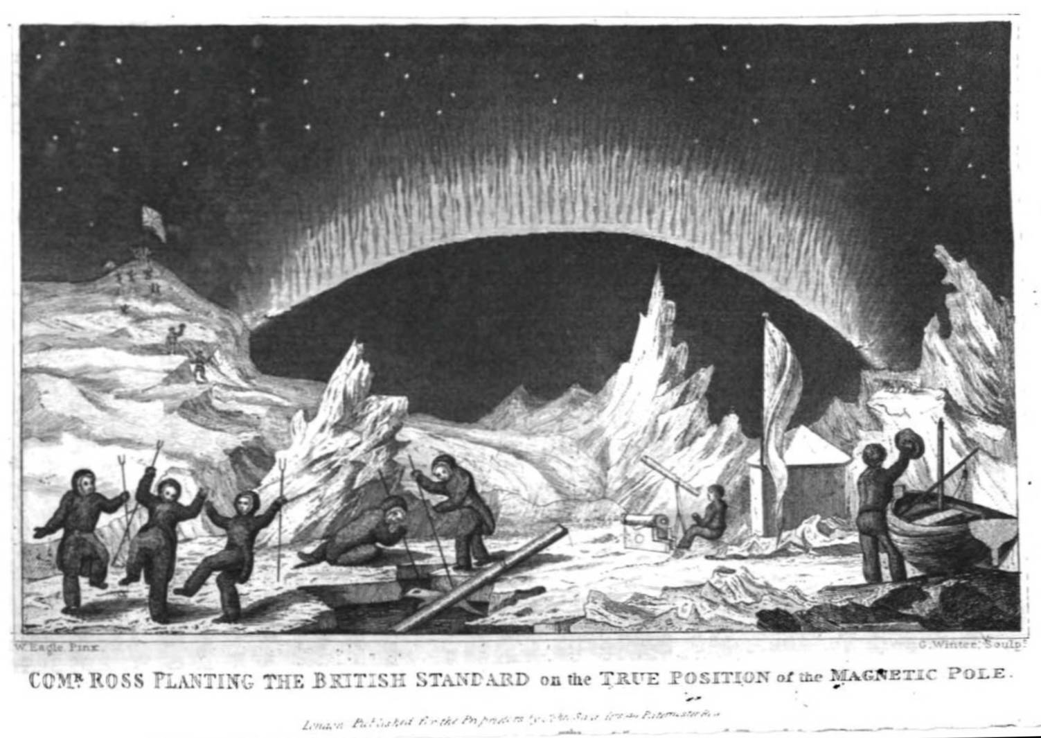
Sir James Clark Ross (15 April 1800 – 3 April 1862) was a British Royal Navy officer and explorer of both the northern and southern polar regions. In the Arctic, he participated in two expeditions led by his uncle, Sir John Ross, John Ross, and in four led by Sir William Parry, William Edward Parry: in the Antarctic, he led Ross expedition, his own expedition from 1839 to 1843. Biography Early life Ross was born in London, the son of George Ross and nephew of Sir John Ross, John Ross, under whom he entered the Royal Navy on 5 April 1812. Ross was an active participant in the Napoleonic Wars, being present at an action where HMS Briseis (1808), HMS ''Briseis'', commanded by his uncle, captured ''Le Petit Poucet'' (a French privateer) on 9 October 1812. Ross then served successively with his uncle on HMS Acteon (1805), HMS ''Actaeon'' and HMS Driver (1840), HMS ''Driver''. Arctic exploration Ross participated in John's unsuccessful first Arctic voyage in search o ... [...More Info...] [...Related Items...] OR: [Wikipedia] [Google] [Baidu] [Amazon] |


