|
Poole, Cheshire
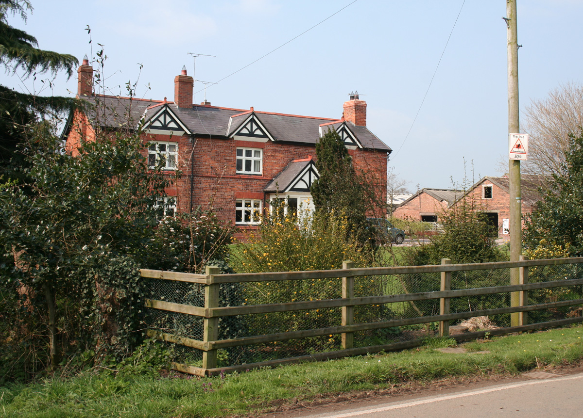
Poole is a civil parish in the unitary authority of Cheshire East and the ceremonial county of Cheshire, England, which lies to the north west of Nantwich and to the west of Crewe. The Shropshire Union Canal runs through the parish. Nearby villages include Acton, Aston juxta Mondrum, Barbridge, Stoke Bank, Rease Heath and Worleston. The civil parish is largely rural with scattered farms and buildings, and a total population of around 90 in 2006. At the time of the 2011 Census the population of the civil parish remained less than 100. Details are included in the civil parish of Worleston. History Poole was a late Saxon village; the name derives from the Saxon ''Pol'', meaning a pool. Two holdings were recorded in the Domesday survey of 1086, with a total population of 9, greater than any of the surrounding manors except Acton. A coppice or small wood was recorded. Before the Norman Conquest, it was held by Wulfeva, described as "a free woman", and afterwards by William M ... [...More Info...] [...Related Items...] OR: [Wikipedia] [Google] [Baidu] |
Cheshire East
Cheshire East is a unitary authority area with borough status in the ceremonial county of Cheshire, England. The local authority is Cheshire East Council. Towns within the area include Crewe, Macclesfield, Congleton, Sandbach, Wilmslow, Handforth, Knutsford, Poynton, Bollington, Alsager and Nantwich. The council is based in the town of Sandbach. History The borough council was established in April 2009 as part of the 2009 structural changes to local government in England, by virtue of an order under the Local Government and Public Involvement in Health Act 2007. It is an amalgamation of the former boroughs of Macclesfield, Congleton and Crewe and Nantwich, and includes the functions of the former Cheshire County Council. The residual part of the disaggregated former County Council, together with the other three former Cheshire borough councils (Chester City, Ellesmere Port & Neston and Vale Royal) were, similarly, amalgamated to create the new unitary council of Ches ... [...More Info...] [...Related Items...] OR: [Wikipedia] [Google] [Baidu] |
Delamere Forest
Delamere Forest is a large wood in the village of Delamere in Cheshire, England. The woodland, which is managed by Forestry England, covers an area of making it the largest area of woodland in the county. It contains a mixture of deciduous and evergreen trees.Forestry Commission: Delamere Forest Park: Information (accessed 4 May 2010) Delamere, which means "forest of the lakes", is all that remains of the great Forests of Mara and Mondrem which covered over of this part of Cheshire. Established in the late 11th century, they were the hunting fore ... [...More Info...] [...Related Items...] OR: [Wikipedia] [Google] [Baidu] |
Earl Of Dysart
Earl of Dysart (pronounced ) is a title in the Peerage of Scotland. It was created in 1643 and has been held continuously since then by descendants of the 1st Earl, William Murray. Creation The title was created in 1643 for William Murray, who had earlier represented Fowey and East Looe in the English House of Commons. He was made Lord Huntingtower at the same time, also in the Peerage of Scotland. William Murray had been a lifelong friend of King Charles I, in fact having been his whipping boy while the latter was Prince of Wales. Succession Murray was succeeded by his daughter, Elizabeth, the 2nd Countess. In 1670 she resigned the peerage and received a new grant thereof by patent with precedency of her father, and with remainder to her heirs of the body, failing which to her heirs whatsoever. Lady Dysart married, firstly, Sir Lionel Tollemache, 3rd Baronet (see Tollemache baronets for the earlier history of this title), and, secondly, John Maitland, 1st Duke of Laud ... [...More Info...] [...Related Items...] OR: [Wikipedia] [Google] [Baidu] |
Oulton Estate
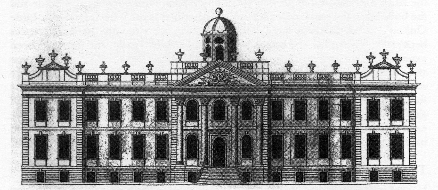
In the early 18th century the Oulton Estate was home to the Egerton family and comprised a manor house and a formal garden surrounded by farmland in Cheshire, England. Later in the century the farmland was converted into a park. The estate is now the site of the motor racing track called Oulton Park. History Grounds In 1731, Philip Egerton (1694–1766) inherited the estate upon the death of his uncle, John Egerton (1656–1731). At that time the estate comprised a house, a formal garden and farmland totalling . Around 1752, Philip Egerton began to construct a brick wall to enclose the estate plus some additional fields, an area totalling . At his death in 1766, Philip was succeeded by his brother John, and then in 1770, by his son Philip (1738–1786). By this time the fashion for formal gardens had been overtaken by the concept of a landscaped garden with surrounding parkland. Philip Egerton commissioned William Emes to plan this for his estate. Emes' plan was prod ... [...More Info...] [...Related Items...] OR: [Wikipedia] [Google] [Baidu] |
Chester
Chester is a cathedral city and the county town of Cheshire, England. It is located on the River Dee, close to the English–Welsh border. With a population of 79,645 in 2011,"2011 Census results: People and Population Profile: Chester Locality"; downloaded froCheshire West and Chester: Population Profiles, 17 May 2019 it is the most populous settlement of Cheshire West and Chester (a unitary authority which had a population of 329,608 in 2011) and serves as its administrative headquarters. It is also the historic county town of Cheshire and the second-largest settlement in Cheshire after Warrington. Chester was founded in 79 AD as a " castrum" or Roman fort with the name Deva Victrix during the reign of Emperor Vespasian. One of the main army camps in Roman Britain, Deva later became a major civilian settlement. In 689, King Æthelred of Mercia founded the Minster Church of West Mercia, which later became Chester's first cathedral, and the Angles extended and stren ... [...More Info...] [...Related Items...] OR: [Wikipedia] [Google] [Baidu] |
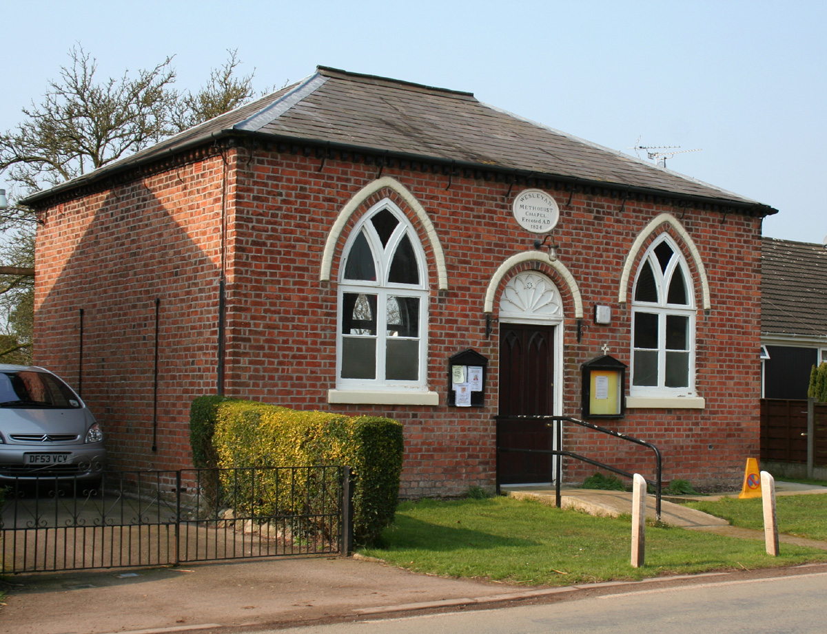
Poole Chapel, Cheshire
Poole () is a large coastal town and seaport in Dorset, on the south coast of England. The town is east of Dorchester and adjoins Bournemouth to the east. Since 1 April 2019, the local authority is Bournemouth, Christchurch and Poole Council which is a unitary authority. Poole had an estimated population of 151,500 (mid-2016 census estimates) making it the second-largest town in the ceremonial county of Dorset. Together with Bournemouth and Christchurch, the conurbation has a total population of nearly 400,000. Human settlement in the area dates back to before the Iron Age. The earliest recorded use of the town's name was in the 12th century when the town began to emerge as an important port, prospering with the introduction of the wool trade. Later, the town had important trade links with North America and, at its peak during the 18th century, it was one of the busiest ports in Britain. In the Second World War, Poole was one of the main departing points for the Normandy land ... [...More Info...] [...Related Items...] OR: [Wikipedia] [Google] [Baidu] |
John Wesley
John Wesley (; 2 March 1791) was an English cleric, theologian, and evangelist who was a leader of a revival movement within the Church of England known as Methodism. The societies he founded became the dominant form of the independent Methodist movement that continues to this day. Educated at Charterhouse and Christ Church, Oxford, Wesley was elected a fellow of Lincoln College, Oxford, in 1726 and ordained as an Anglican priest two years later. At Oxford, he led the " Holy Club", a society formed for the purpose of the study and the pursuit of a devout Christian life; it had been founded by his brother Charles and counted George Whitefield among its members. After an unsuccessful ministry of two years, serving at Christ Church, in the Georgia colony of Savannah, he returned to London and joined a religious society led by Moravian Christians. On 24 May 1738, he experienced what has come to be called his evangelical conversion, when he felt his "heart strangely wa ... [...More Info...] [...Related Items...] OR: [Wikipedia] [Google] [Baidu] |
Cholmondeston
Cholmondeston ( (accessed 31 March 2010)) is a village and in the unitary authority of and the ceremonial county of , England. The village lies to the northwest of . Nearby villages include |
Methodism
Methodism, also called the Methodist movement, is a group of historically related Christian denomination, denominations of Protestantism, Protestant Christianity whose origins, doctrine and practice derive from the life and teachings of John Wesley. George Whitefield and John's brother Charles Wesley were also significant early leaders in the movement. They were named ''Methodists'' for "the methodical way in which they carried out their Christian faith". Methodism originated as a Christian revival, revival movement within the 18th-century Church of England and became a separate denomination after Wesley's death. The movement spread throughout the British Empire, the United States, and beyond because of vigorous Christian mission, missionary work, today claiming approximately 80 million adherents worldwide. Wesleyan theology, which is upheld by the Methodist churches, focuses on sanctification and the transforming effect of faith on the character of a Christians, Christian ... [...More Info...] [...Related Items...] OR: [Wikipedia] [Google] [Baidu] |
St Mary's Church, Acton
St Mary's Church is an active Anglican parish church located in Monk's Lane, Acton, a village to the west of Nantwich, Cheshire, England. Since 1967 it has been designated a Grade I listed building. A church has been present on this site since before the time of the Domesday Survey. The tower is the oldest in Cheshire, although it had to be largely rebuilt after it fell in 1757. One unusual feature of the interior of the church is that the old stone seating around its sides has been retained. In the south aisle are some ancient carved stones dating back to the Norman era. The architectural historian Alec Clifton-Taylor includes the church in his list of 'best' English parish churches. In the churchyard is a tall 17th-century sundial. The church is an active Anglican parish church in the diocese of Chester, the archdeaconry of Macclesfield and the deanery of Nantwich. Its benefice is united with those of St David, Wettenhall, St Oswald, Worleston, and St B ... [...More Info...] [...Related Items...] OR: [Wikipedia] [Google] [Baidu] |
Hundreds Of Cheshire
The Hundreds of Cheshire, as with other Hundreds in England, were the geographic divisions of Cheshire for administrative, military and judicial purposes. They were introduced in Cheshire some time before the Norman conquest. Later on, both the number and names of the hundreds changed by processes of land being lost from Cheshire, and merging or amalgamation of remaining hundreds. The Ancient parishes of Cheshire were usually wholly within a specific hundred, although a few were divided between two hundreds. The hundreds at the time of the Domesday Survey Cheshire, in the Domesday Book was recorded as a larger county than it is today. There is a small disagreement in published sources about where the northern boundary of Cheshire lay, and some parts of the border areas with Wales were disputed with the predecessors of Wales. One source states that the northern border was the River Ribble, resulting in large parts of what was to become Lancashire being at that time part of Cheshir ... [...More Info...] [...Related Items...] OR: [Wikipedia] [Google] [Baidu] |
Acton, Cheshire (ancient Parish)
Acton was an ancient parish in the Nantwich Hundred of Cheshire, England. At one time it included the townships of Acton, Aston juxta Mondrum, Austerson, Baddington, Brindley, Burland, Cholmondeston, Edleston, Faddiley, Henhull, Hurleston, Poole, Stoke, Worleston, most of Coole Pilate, parts of Dodcott cum Wilkesley, Newhall and Sound, and possibly all or part of Baddiley.Dunn FI. ''The Ancient Parishes, Townships and Chapelries of Cheshire'' ( Cheshire Record Office and Cheshire Diocesan Record Office; 1987) ()Latham FA, ed. ''Acton'', p. 9, (The Local History Group; 1995) () It also contained the chapelries of Church Minshull, Nantwich and Wrenbury. By around 1870, the townships and chapelries of Baddiley, Church Minshull, Dodcott cum Wilkesley, Nantwich, Newhall, Sound and Wrenbury had been lost from Acton; the total area of the ancient parish was then 15,542 acres (6,290 hectares), with a population of 3,125.Wilson JM. ''Imperial Gazetteer of England and Wale ... [...More Info...] [...Related Items...] OR: [Wikipedia] [Google] [Baidu] |


.jpg)
