|
Plaffeien
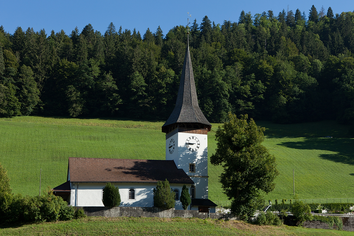
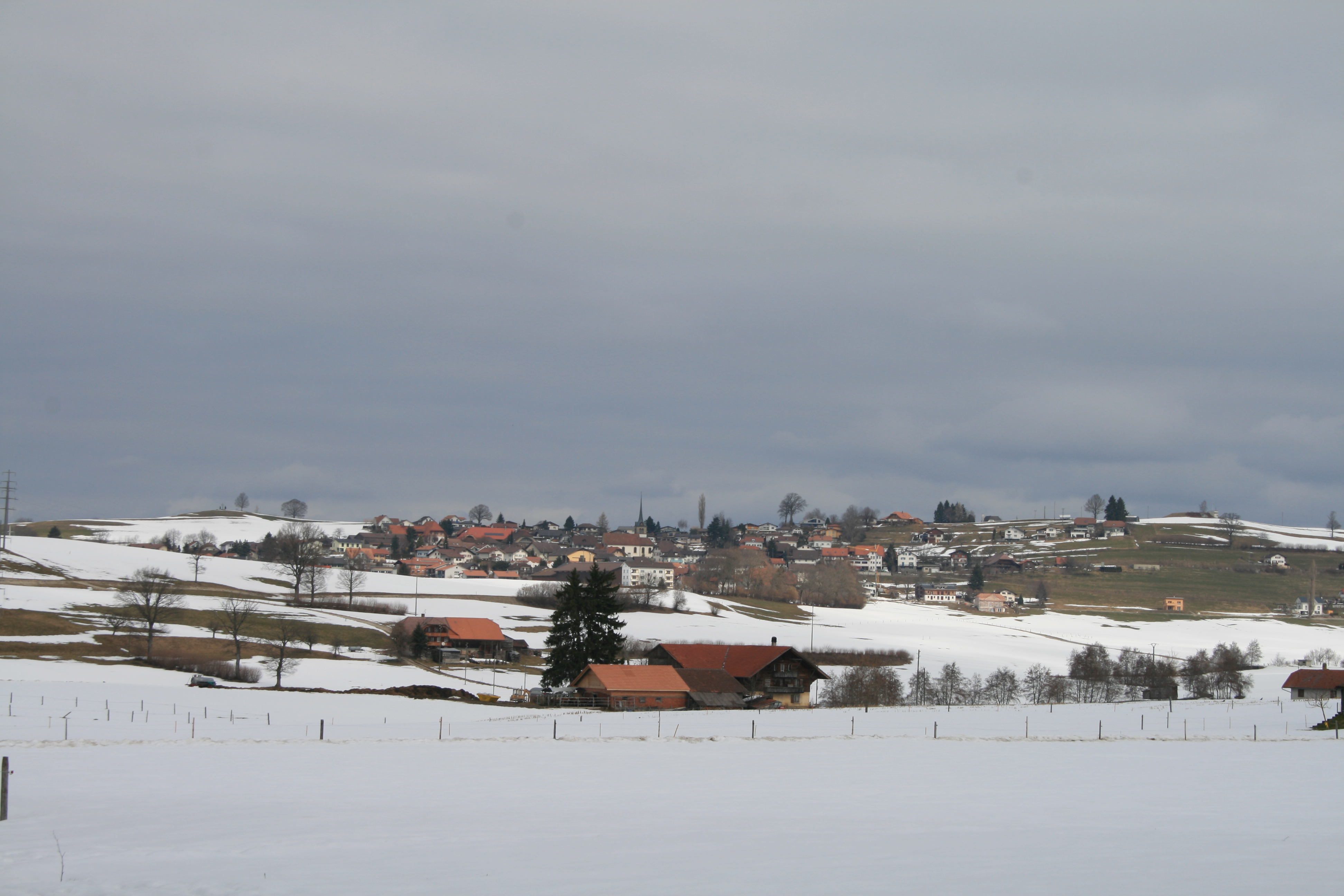
Plaffeien (french: Planfayon; frp, Pllanfayon ) is a municipality in the district of Sense in the canton of Fribourg in Switzerland. It is one of the municipalities with a large majority of German speakers in the mostly French speaking Canton of Fribourg. History Plaffeien is first mentioned in 1148 as ''Planfeiun''. In 1339 it was mentioned as ''Blanfeyen''. Name The name Plaffeien probably comes from the Latin "planum-fageum" meaning beech forest and therefore may date to the Roman era. The spelling of the name changed over time. In addition to the spellings given above, in the 13th century it was ''Planfeium'', followed by ''Plainfaon'' or ''Planfeyen''. Beginning around the 16th century the name became ''Plaffeyen''. To match the standard German orthography of the German Empire, an 1899 Swiss federal decree changed the "y" in German place names into an "i", changing the official name to "Plaffeien". Brief History During the Roman era Plaffeien was probably a village ... [...More Info...] [...Related Items...] OR: [Wikipedia] [Google] [Baidu] |
Oberschrot
Oberschrot was a municipality in the district of Sense in the canton of Fribourg in Switzerland. It is one of the municipalities with a large majority of German speakers in the mostly French speaking Canton of Fribourg. On 1 January 2017 the former municipalities of Oberschrot and Zumholz merged into the municipality of Plaffeien. History Oberschrot was created as an independent municipality in 1831. Before that, the name meant an area in the parish of Rechthalten that consisted of four ''Schrote'' or village sections. Geography Oberschrot had an area, in 2009, of . Of this area, or 56.1% is used for agricultural purposes, while or 34.4% is forested. Of the rest of the land, or 7.7% is settled (buildings or roads), or 0.4% is either rivers or lakes.Swiss Fed ... [...More Info...] [...Related Items...] OR: [Wikipedia] [Google] [Baidu] |
Sense (district)
Sense District (german: Sensebezirk; french: District de la Singine ; frp, District de la Singena ) is one of the seven administrative districts of the canton of Fribourg in Switzerland, and the only completely German-speaking one. It is named after the Sense river, which forms the majority of its eastern border with the canton of Bern. History The Sense region was first mentioned historically in 1076 under the name ''Sensuna''. It became a district since the canton was reorganized from four into seven districts in 1848. Most of the Sense belonged to the lordship of the Republik Freiburg (Respublicas Friburgensis) until the demise of the ancien régime. The district has its own dialect, called Sensler German. Municipalities It contains 15 municipalities. The municipalities are: Coat of arms The blazon of the district coat of arms is ''Azure, a Guard statant afrontee clad Azure and Sable ensigned with a Cross on sinister, holding in dexter a Halberd Argent.'' Demographics ... [...More Info...] [...Related Items...] OR: [Wikipedia] [Google] [Baidu] |
Zumholz FR
Zumholz is a former municipality in the district of Sense in the canton of Fribourg in Switzerland. It is one of the municipalities with a large majority of German speakers in the mostly French speaking Canton of Fribourg. On 1 January 2017 the former municipalities of Zumholz and Oberschrot merged into the municipality of Plaffeien. Geography Zumholz had an area, in 2009, of . Of this area, or 72.0% is used for agricultural purposes, while or 18.0% is forested. Of the rest of the land, or 7.9% is settled (buildings or roads), or 3.2% is either rivers or lakes.Swiss Federal Statistical Office-Land Use Statistics 2009 data accessed 25 March 2010 Of the built up area, housing and buildings made up 5.8% and transportation infrastructure made up 1. ... [...More Info...] [...Related Items...] OR: [Wikipedia] [Google] [Baidu] |
Boltigen
Boltigen is a municipality in the Obersimmental-Saanen administrative district in the canton of Bern in Switzerland. Boltigen is a mixed community, with traits both of a burgess community and a village community. Beside it, there is also a reformed evangelical Church community. The history of the community goes back to 1386 and the so-called ''Freiheitsbrief von 1386''. The community president is Hermann Maurer, since 1 January 2005. History Boltigen is first mentioned in 1276. The oldest trace of a settlement in the area is the mesolithic shelter in the ''Ranggiloch'' cave. A few Bronze Age artifacts have also been found. During the Middle Ages there were forts or castles at Simmenegg, Eichstalden and Laubegg though all three have fallen into ruin. Many of the villages and '' Bäuerten'' were founded in the Early Middle Ages and grew slowly over the following centuries. The villages and farm lands came under Bernese control partly in 1386 and completely in 1391. When B ... [...More Info...] [...Related Items...] OR: [Wikipedia] [Google] [Baidu] |
Val-de-Charmey
Val-de-Charmey () is a municipality in the district of Gruyère in the canton of Fribourg in Switzerland. On 1 January 2014 the former municipalities of Cerniat Cerniat (; frp, Cèrniê ) is a former Municipalities of Switzerland, municipality in the district of Gruyère (district), Gruyère in the Cantons of Switzerland, canton of Fribourg (canton), Fribourg in Switzerland. On 1 January 2014 the forme ... and Charmey merged into the municipality of Val-de-Charmey.Nomenklaturen – Amtliches Gemeindeverzeichnis der Schweiz accessed 13 December 2014 History Cerniat is first mentioned in 1288 as ''Sernia''. Charmey is first mentioned in 1211 as ''Chalmeis''. Until 1760 it was known ...[...More Info...] [...Related Items...] OR: [Wikipedia] [Google] [Baidu] |
Rüeggisberg Priory
Rüeggisberg Priory (Kloster Rüeggisberg) was a Cluniac priory in the municipality of Rüeggisberg, Canton of Bern, Switzerland. History The Priory was founded between 1072 and 1076 by Lütold of Rümligen. He granted the property and estates to Cluny Abbey making it the first Cluniac house in the German-speaking world. Under Cuno of Siegburg and Ulrich of Zell the first cells were built. Construction of the Romanesque church lasted from about 1100 to about 1185, of which there still remain the north transept and parts of the crossing tower. The Priory was dependent on Cluny Abbey and normally had a prior and two to four monks from Cluny. In 1148, it had two priories that were dependent on Rüeggisberg, in Röthenbach im Emmental and Alterswil. At its peak the priory controlled estates throughout what is now the Canton of Bern, including Guggisberg, Alterswil, Plaffeien and Schwarzenburg as well as scattered farm houses and vineyards on the shores of Lake Biel. The priory ... [...More Info...] [...Related Items...] OR: [Wikipedia] [Google] [Baidu] |
Kasterlee
Kasterlee () is a municipality located in the Belgian province of Antwerp. The municipality comprises the towns of Kasterlee proper, Lichtaart and Tielen. In 2021, Kasterlee had a total population of 19,052. The total area is 71.56 km2. The town is twinned with Plaffeien ( Switzerland). Notable people * Baron Bob Stouthuysen (b. 10 March 1929), businessman. Gallery Image:Crepuscular rays in the woods of Kasterlee, Belgium.jpg, Crepuscular rays Crepuscular rays are sunbeams that originate when the Sun is just below the horizon, during the twilight period. Crepuscular rays are noticeable when the contrast between light and dark is most obvious. Crepuscular comes from the Latin word ... in the woods of Kasterlee File:Kasterlee - Kleine Nete.jpg, the Kleine Nete in Kasterlee File:A Kasterlee, Keeses Molen, standerdmolen 12W.JPG, Keeses Molen References External links * * - Available only in Dutch Municipalities of Antwerp Province Populated plac ... [...More Info...] [...Related Items...] OR: [Wikipedia] [Google] [Baidu] |
Guggisberg
Guggisberg (Bernese German ''Guggishbärg'' ) is a municipality in the Bern-Mittelland administrative district in the Swiss canton of Bern. History Guggisberg is first mentioned in 1076 as ''Mons Guchani''. The next earliest reference to the community dates from 1148, when Guggisberg (spelled ''Cucansperc'') was mentioned in a document of Pope Eugene III. In 1423 the territory was divided in two and sold by Amadeus VII, Count of Savoy to Bern and Fribourg. It would remain as two separate entitites until reunified by Napoleon's Act of Mediation in 1803. In the early 19th century the village of Guggisberg was known as destination for tourists due to the view of the Guggershorn and other surrounding mountains. However, in 1819 the canton began moving many landless poor (''Allmendsiedler'' literally: Common land settler) into the municipality. The large, poor population and famines in 1816-1818 and the 1840s overwhelmed the community. Many farmers had to sell their grazing rights ... [...More Info...] [...Related Items...] OR: [Wikipedia] [Google] [Baidu] |
Oberwil Im Simmental
Oberwil im Simmental is a municipality in the Frutigen-Niedersimmental administrative district in the canton of Bern in Switzerland. History Oberwil is first mentioned in 1278 as ''Oberwile''. During the Paleolithic era (20,000-10,000 BC) humans lived in several caves above the valley floor during the summer. The caves, Schnurenloch, Mamilchloch, Zwergliloch and Chniechälebalm, contained about 5,000 bones from the now extinct cave bear which the inhabitants had butchered. While no human remains were discovered, a number of stone tools were found. Today the tools and bones are at the Historical Museum of Bern while the caves can be visited with tour groups. These caves and other nearby rock shelters continued to be used through the Neolithic, the late Bronze Age and into the Middle Ages. After the collapse of the Western Roman Empire, Alamanni tribes settled in the Simmen valley and established villages and alpine pastures. In 994, the royal estate at Wimmis and part of O ... [...More Info...] [...Related Items...] OR: [Wikipedia] [Google] [Baidu] |
Rechthalten
Rechthalten is a municipality in the district of Sense, in the canton of Fribourg in Switzerland. It was known in French as ''Dirlaret'' ( frp, Drètlarèt ), but this name is no longer used. It is one of the municipalities with a large majority of German speakers in the mostly French speaking Canton of Fribourg. History Rechthalten is first mentioned in 1142 as ''Drallaris''. In 1173 it was mentioned as ''de Recto Clivo'', followed in 1180 by ''Dreitlaris'' and in 1250 it was ''Rehthalton''. Geography Rechthalten has an area of . Of this area, or 73.7% is used for agricultural purposes, while or 18.2% is forested. Of the rest of the land, or 7.1% is settled (buildings or roads), or 0.5% is either rivers or lakes and or 0.5% is unproductive land.Swiss Fede ... [...More Info...] [...Related Items...] OR: [Wikipedia] [Google] [Baidu] |
Plasselb
Plasselb ( frp, Pllanassiva, locally ) is a municipality in the district of Sense in the canton of Fribourg in Switzerland. It is one of the municipalities with a large majority of German speakers in the mostly French speaking Canton of Fribourg. History Plasselb is first mentioned in 1324 as ''Plannaseyva''. Geography Plasselb has an area of . Of this area, or 37.1% is used for agricultural purposes, while or 55.5% is forested. Of the rest of the land, or 4.0% is settled (buildings or roads), or 1.1% is either rivers or lakes and or 2.2% is unproductive land.Swiss Federal Statistical Office-Land Use Statistics 2009 data accessed 25 March 2010 Of the built up area, housing and buildings made up 2.0% and transportation infrastructure made up 1. ... [...More Info...] [...Related Items...] OR: [Wikipedia] [Google] [Baidu] |
Jaun
Jaun (french: Bellegarde; frp, Bèlagouàrda ) is a municipality in the district of Gruyère in the canton of Fribourg in Switzerland. It is the only German-speaking municipality in Gruyère. History Jaun is first mentioned in 1228 as ''Balavarda''. In 1397 it was mentioned as ''Youn''. Geography Jaun has an area, , of . Of this area, or 42.5% is used for agricultural purposes, while or 38.9% is forested. Of the rest of the land, or 1.7% is settled (buildings or roads), or 0.8% is either rivers or lakes and or 16.1% is unproductive land.Swiss Federal Statistical Office-Land Use Statistics 2009 data accessed 25 March 2010 Of the built up area, housing and buildings made up 0.5% and transportation infrastructure made up 1.0%. Out of the fores ... [...More Info...] [...Related Items...] OR: [Wikipedia] [Google] [Baidu] |


