|
Pityme and Splatt although the villages form one contiguous settlement. The public house is the Pityme Inn and there is a small trading estate south of the village. The name of the village has its origins in a tragic tale of loss at sea. The skipper of a fishing vessel set to sea despite the deteriorating weathe ...
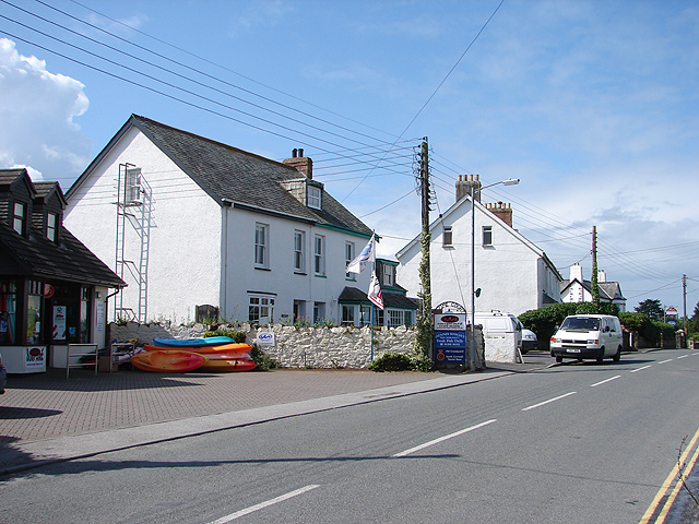
Pityme () is a small village at in north Cornwall, England, United Kingdom. Pityme is at the junction of the road from Wadebridge to Polzeath and the road from St Minver to Rock. It straddles the boundary between the civil parishes of St Minver Highlands and St Minver Lowlands. It is situated between Tredrizzick Tredrizzick ( kw, Treredenek) [...More Info...] [...Related Items...] OR: [Wikipedia] [Google] [Baidu] |
Rock, Cornwall
Rock ( kw, Pennmeyn) is a coastal fishing village in Cornwall, England, United Kingdom. It is opposite Padstow on the north-east bank of the River Camel estuary. The village is in the civil parish of St Minver, St Minver Lowlands about north-west of Wadebridge.Ordnance Survey: Landranger map sheet 200 ''Newquay & Bodmin'' Ordnance Survey: Explorer map (scale 1:25000); Sheet 106 ''Newquay & Padstow'' Toponymy The original name recorded in 1303 was , Cornish language, Cornish for 'the end or head of stones'. An alternative, ''Blaketorre'' ('Black Tor'), is found in 1337. This had become ''Black Rock'' by the 18th century and was subsequently shortened to Rock. The name of the ferry that operates between Rock and Padstow recalls the old place name. Geography The main residential area is set back from the coast along the road from Pityme and St Minver. To the northeast, Rock is contiguous with the settlements of Splatt, Cornwall, Splatt and Pityme. Stoptide is a southern extensi ... [...More Info...] [...Related Items...] OR: [Wikipedia] [Google] [Baidu] |
St Minver
St Minver ( kw, Sen Menvra) is the name of an ecclesiastical parish, a civil parish and a village in north Cornwall, England, United Kingdom. The civil parish of St Minver is in Bodmin Registration District and is nominally divided into St Minver Highlands (to the north and east) and St Minver Lowlands (to the west). The combined parish is bounded on the south and west by the estuary of the River Camel, on the north by the Atlantic coast, and on the east by the parishes of St Endellion and St Kew. The population of the parish in the 2001 census was 2,474 (St Minver Highlands 1025; St Minver Lowlands 1449) decreasing to 2,393 at the 2011 census. Settlements The principal villages in the combined parish are the churchtown of St Minver, Rock, Trebetherick and Polzeath. Other settlements include Tredrizzick, Penmean, Splatt, Porthilly, Pityme and Trevanger. St Minver village is centred on a small square at the crossroads of two unclassified roads. It is situated ... [...More Info...] [...Related Items...] OR: [Wikipedia] [Google] [Baidu] |
Splatt, Cornwall
Splatt is a small settlement in north Cornwall, England, United Kingdom at . It is situated between Pityme and Rock Rock most often refers to: * Rock (geology), a naturally occurring solid aggregate of minerals or mineraloids * Rock music, a genre of popular music Rock or Rocks may also refer to: Places United Kingdom * Rock, Caerphilly, a location in Wales ... although the buildings along the Rock Road are continuous. It should not be confused with Splatt in the parish of Tresmeer.Ordnance Survey ''One-inch Map of England & Wales; Bodmin and Launceston, sheet 186''. 1946 References External links Hamlets in Cornwall {{NorthCornwall-geo-stub ... [...More Info...] [...Related Items...] OR: [Wikipedia] [Google] [Baidu] |
Cornwall
Cornwall (; kw, Kernow ) is a historic county and ceremonial county in South West England. It is recognised as one of the Celtic nations, and is the homeland of the Cornish people. Cornwall is bordered to the north and west by the Atlantic Ocean, to the south by the English Channel, and to the east by the county of Devon, with the River Tamar forming the border between them. Cornwall forms the westernmost part of the South West Peninsula of the island of Great Britain. The southwesternmost point is Land's End and the southernmost Lizard Point. Cornwall has a population of and an area of . The county has been administered since 2009 by the unitary authority, Cornwall Council. The ceremonial county of Cornwall also includes the Isles of Scilly, which are administered separately. The administrative centre of Cornwall is Truro, its only city. Cornwall was formerly a Brythonic kingdom and subsequently a royal duchy. It is the cultural and ethnic origin of the Cor ... [...More Info...] [...Related Items...] OR: [Wikipedia] [Google] [Baidu] |
Wadebridge
Wadebridge (; kw, Ponswad) is a town and civil parish in north Cornwall Cornwall (; kw, Kernow ) is a historic county and ceremonial county in South West England. It is recognised as one of the Celtic nations, and is the homeland of the Cornish people. Cornwall is bordered to the north and west by the Atlan ..., England, United Kingdom. The town straddles the River Camel upstream from Padstow.Ordnance Survey: Landranger map sheet 200 ''Newquay & Bodmin'' The permanent population was 6,222 in the census of 2001, increasing to 7,900 in the 2011 census. There are two electoral wards in the town (East and West). Their total population is 8,272. Originally known as ''Wade'', it was a dangerous fording point across the river until a bridge was built here in the 15th century, after which the name changed to its present form. The bridge was strategically important during the English Civil War, and Oliver Cromwell went there to take it. Since then, it has been widened t ... [...More Info...] [...Related Items...] OR: [Wikipedia] [Google] [Baidu] |
Polzeath
Polzeath (; kw, Polsegh, meaning ''dry creek'') is a small seaside resort village in the civil parish of St Minver in Cornwall, England, United Kingdom. It is approximately north west of Wadebridge on the Atlantic coast.Ordnance Survey: Landranger map sheet 200 ''Newquay & Bodmin'' Polzeath has a sandy beach and is popular with holiday-makers and surfers. The beach is wide and extends from the seafront at low water; however, most of the sand is submerged at high water. At exceptionally high spring tides the sea floods the car park at the top of the beach. Polzeath beach is patrolled by lifeguards during the summer and is described on the RNLI website as "a wide, flat beach with some shelter from winds, it sees good quality surf and is quite often extremely crowded". Dolphins may sometimes be spotted in the bay and the coastline north of Polzeath is a good area for seeing many types of birds including corn buntings and puffins. The main street runs along the seafront ... [...More Info...] [...Related Items...] OR: [Wikipedia] [Google] [Baidu] |
Civil Parish
In England, a civil parish is a type of Parish (administrative division), administrative parish used for Local government in England, local government. It is a territorial designation which is the lowest tier of local government below districts of England, districts and metropolitan and non-metropolitan counties of England, counties, or their combined form, the Unitary authorities of England, unitary authority. Civil parishes can trace their origin to the ancient system of Parish (Church of England), ecclesiastical parishes, which historically played a role in both secular and religious administration. Civil and religious parishes were formally differentiated in the 19th century and are now entirely separate. Civil parishes in their modern form came into being through the Local Government Act 1894, which established elected Parish councils in England, parish councils to take on the secular functions of the vestry, parish vestry. A civil parish can range in size from a sparsely ... [...More Info...] [...Related Items...] OR: [Wikipedia] [Google] [Baidu] |
Tredrizzick
Tredrizzick ( kw, Treredenek) List of place-names agreed by the MAGA Signage Panel . is a small village in , England, United Kingdom, at . It is on the road linking the villages of [...More Info...] [...Related Items...] OR: [Wikipedia] [Google] [Baidu] |


