|
Piracicaba River (São Paulo)
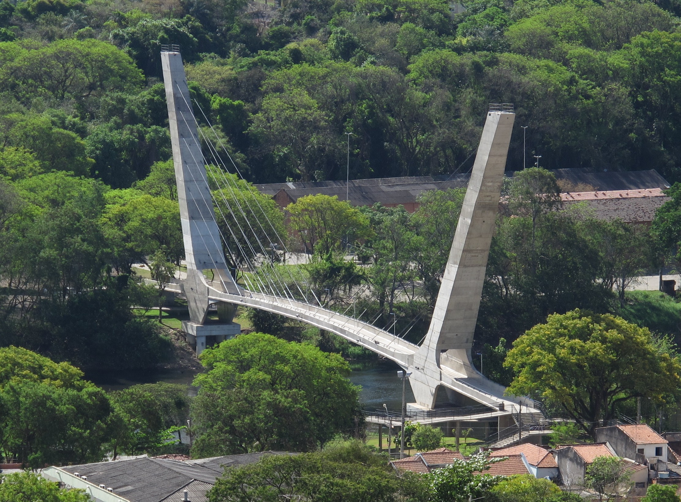
The Piracicaba River is a river of São Paulo state in southeastern Brazil. It is a tributary of the Tietê River, which it joins in the reservoir created by Barra Bonita Dam. There is also another Piracicaba river in the state of Minas Gerais, named after the one from São Paulo state, since the early colonizers of Minas Gerais largely came from São Paulo. Geography The basin of the Piracicaba River extends over an area of 12,531 km², located in the southeast of the state of São Paulo and extreme south of Minas Gerais. The Piracicaba river is born from the junction of the Atibaia and Jaguari rivers, in the municipality of Americana. After crossing the city of Piracicaba, it receives the waters of its main tributary, Corumbataí river. The Piracicaba River runs 115 km from its source to its mouth on the Tietê River between the municipalities of Santa Maria da Serra and Barra Bonita. Piracicaba has several meanders that make the waters of its bed suitable for ... [...More Info...] [...Related Items...] OR: [Wikipedia] [Google] [Baidu] |
Piracicaba
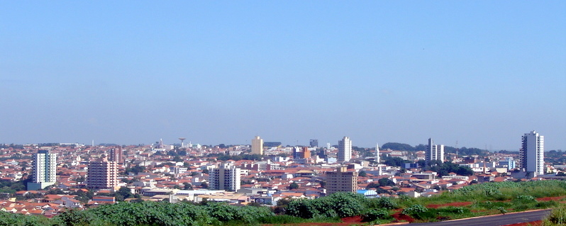
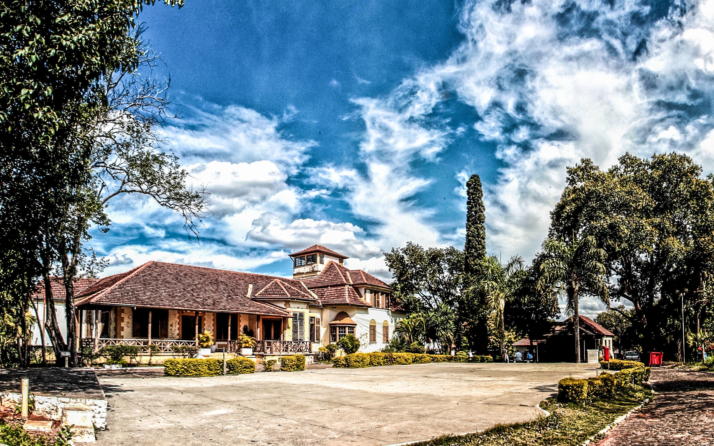
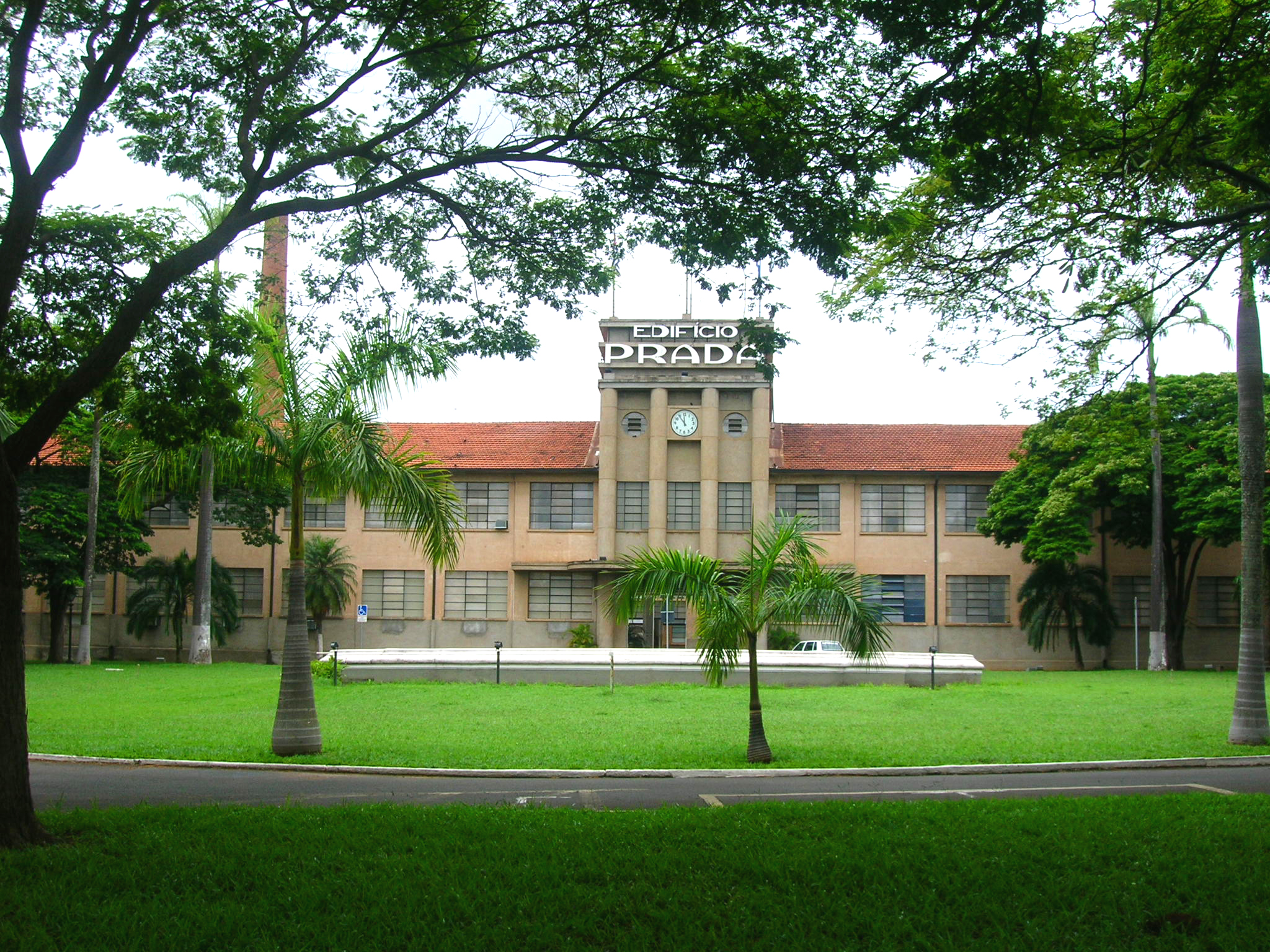
Piracicaba ( ) is a Municipalities of Brazil, Brazilian municipality located in the Interior of São Paulo, interior of São Paulo (state), São Paulo state, in the Southeast Region, Brazil, Southeast Region of Brazil. It serves as the main city of the Metropolitan Region of Piracicaba (RMP) and is situated approximately northwest of the state capital, São Paulo. Covering an area of just over , with around classified as urban area, Piracicaba has a population of 438,827 inhabitants, making it the List of municipalities in São Paulo, 13th most populous municipality in São Paulo state. Established in 1767 along the banks of the Piracicaba River (São Paulo), Piracicaba River, a vital water source for the region, Piracicaba saw significant agricultural development during the 19th century, particularly in sugarcane and coffee cultivation. However, the early 20th century brought economic decline due to the collapse of the Brazilian coffee cycle, coffee cycle and falling sugar pric ... [...More Info...] [...Related Items...] OR: [Wikipedia] [Google] [Baidu] |
Campinas
Campinas (, ''Plains'' or ''Meadows'') is a Brazilian Municipalities of Brazil, municipality in São Paulo (state), São Paulo State, part of the country's Southeast Region, Brazil, Southeast Region. According to the 2020 estimate, the city's population is 1,139,047, making it the List of cities in Brazil by population, fourteenth most populous Brazilian city and the São Paulo (state), third most populous municipality in São Paulo state, the fifth most populous municipality in Southeast Brazil, and the largest city in Brazil outside the metro region of a state capital. The city's metropolitan area, Metropolitan Region of Campinas, contains twenty municipalities with a total population of 3,656,363 people. Etymology Campinas means ''grass fields'' in Portuguese and refers to its characteristic landscape, which originally comprised large stretches of dense subtropical forests (mato grosso or thick woods in Portuguese), mainly along the many rivers, interspersed with gently rolling h ... [...More Info...] [...Related Items...] OR: [Wikipedia] [Google] [Baidu] |
Google Maps
Google Maps is a web mapping platform and consumer application offered by Google. It offers satellite imagery, aerial photography, street maps, 360° interactive panorama, interactive panoramic views of streets (Google Street View, Street View), real-time traffic conditions, and route planner, route planning for traveling by foot, car, bike, air (in Software release life cycle#Beta, beta) and public transportation. , Google Maps was being used by over one billion people every month around the world. Google Maps began as a C++ desktop program developed by brothers Lars Rasmussen (software developer), Lars and Jens Eilstrup Rasmussen, Jens Rasmussen, Stephen Ma and Noel Gordon in Australia at Where 2 Technologies. In October 2004, the company was acquired by Google, which converted it into a web application. After additional acquisitions of a geospatial data visualization company and a real-time traffic analyzer, Google Maps was launched in February 2005. The service's Front and ... [...More Info...] [...Related Items...] OR: [Wikipedia] [Google] [Baidu] |
GEOnet Names Server
The GEOnet Names Server (GNS), sometimes also referred to in official documentation as Geographic Names Data or geonames in domain and email addresses, is a service that provides access to the United States National Geospatial-Intelligence Agency's (NGA) and the US Board on Geographic Names's (BGN) database of geographic feature names and locations for locations outside the US. The database is the official repository for the US Federal Government on foreign place-name decisions approved by the BGN. Approximately 20,000 of the database's features are updated monthly. Names are not deleted from the database, "except in cases of obvious duplication". The database contains search aids such as spelling variations and non-Roman script spellings in addition to its primary information about location, administrative division, and quality. The accuracy of the database had been criticised. Accuracy A 2008 survey of South Korea toponyms on GNS found that roughly 1% of them were actually Ja ... [...More Info...] [...Related Items...] OR: [Wikipedia] [Google] [Baidu] |
Tributaries Of The Río De La Plata
A tributary, or an ''affluent'', is a stream or river that flows into a larger stream (''main stem'' or ''"parent"''), river, or a lake. A tributary does not flow directly into a sea or ocean. Tributaries, and the main stem river into which they flow, drain the surrounding drainage basin of its surface water and groundwater, leading the water out into an ocean, another river, or into an endorheic basin. The Irtysh is a chief tributary of the Ob river and is also the longest tributary river in the world with a length of . The Madeira River is the largest tributary river by volume in the world with an average discharge of . A confluence, where two or more bodies of water meet, usually refers to the joining of tributaries. The opposite to a tributary is a distributary, a river or stream that branches off from and flows away from the main stream. [...More Info...] [...Related Items...] OR: [Wikipedia] [Google] [Baidu] |
List Of Rivers Of São Paulo
List of rivers in São Paulo ( Brazilian State). The list is arranged by drainage basin from north to south, with respective tributaries indented under each larger stream's name and ordered from downstream to upstream. All rivers in São Paulo drain to the Atlantic Ocean. By Drainage Basin Atlantic Coast * Paraíba do Sul ** Barra Mansa River ** Bananal River ** Barreiro de Baixo River ** Sesmarias River ** Do Salto River ** Itagacaba River ** Bocaina River ** Guaratinguetá River ** Buquira River ** Jaguari River *** Parateí River (Lambari-Parateí River) *** Do Peixe River *** Pilões River ** Itapeti River ** Paraibuna River *** Lourenço Velho River *** Do Peixe River *** Ipiranga River ** Paraitinga River *** Itaim River *** Jacuí River ** Comprido River * Bracuí River * Mambucaba River * Puruba River * Camburu River * Itapanhaú River * Cubatão River * Branco River * Comprido River * Guaraú River * Una do Prelado River * Ribeira ... [...More Info...] [...Related Items...] OR: [Wikipedia] [Google] [Baidu] |
Santa Bárbara D'Oeste
Santa Bárbara d'Oeste is a Municipalities of Brazil, municipality in the São Paulo (state), State of São Paulo in Brazil. It is part of the Metropolitan Region of Campinas. It lies about northwest of the State capital. It occupies an area of , of which is urban. In 2020, the population was estimated at 194,390 by the Brazilian Institute of Geography and Statistics, making it the 43rd most populous city in São Paulo and the sixth largest in the metropolitan region of Campinas. Santa Bárbara d'Oeste has an annual average temperature of , and the original vegetation of the area predominates. The city has an urbanization rate of 98.73%. As of 2009, there were 44 medical institutions in the city, and its human development index (HDI) is rated as 0.819 in relation to the rest of the state. Founded on 4 December 1818, when the Church was built, the city was named in honor of its patron saint, Santa Barbara, it was originally part of Piracicaba. It separated from Piracicaba in 190 ... [...More Info...] [...Related Items...] OR: [Wikipedia] [Google] [Baidu] |
Rio Claro, São Paulo
Rio Claro is a city in the state of São Paulo in Brazil. The elevation is 613 m. It was incorporated as the village of '' São João Batista do Ribeirão Claro'' in 1827, and this incorporation is celebrated every year on June 24 as a municipal holiday. The name was changed later to ''Rio Claro''. Starting in the 19th century, Rio Claro attracted large numbers of immigrants from European countries, especially from Germany, Switzerland and Italy, but also from Spain, Portugal, some Eastern European countries, and a substantial community of Christian Arabs from the then Ottoman Empire (mostly Syrian and Lebanese). Japanese immigrants arrived later. There is also a large population of Afro-Brazilians. Rio Claro used to play a very important role in the railway system of São Paulo state. Image:HortoFlorestalRioClaro 4248.jpg, Horto Florestal "Edmundo Navarro de Andrade" en Rio Claro, São Paulo, Brazil Image:Horto Navarro de Andrade 2.jpg, Picture of the forest park of Edmundo N ... [...More Info...] [...Related Items...] OR: [Wikipedia] [Google] [Baidu] |
Atibaia
Atibaia (or ''Estância de Atibaia'') is a Municipalities of Brazil, Brazilian municipality in the state of São Paulo (state), São Paulo. According to the Brazilian statistics institute the IBGE, the city is a conurbation with Bom Jesus dos Perdões forming the largest urban agglomeration in the Bragantina Region with more than 180 thousand inhabitants. History In 1665, Jerônimo de Camargo and his expedition found a hill near a river named Tubaia (later called Atibaia River). Jerônimo de Camargo was a Bandeirante explorer. Geography Atibaia is located 64 km north-east of São Paulo (city), São Paulo and 88 km south-east of Campinas. Atibaia has 478 square kilometers of area, 40% of this area is urbanized. The average altitude is 800 meters. Demographics According to the census of 2007 by the Brazilian Institute of Geography and Statistics (Brazilian Institute of Geography and Statistics, IBGE), Atibaia has approximately 119,166 inhabitants and 65% of the popul ... [...More Info...] [...Related Items...] OR: [Wikipedia] [Google] [Baidu] |
Americana, São Paulo
Americana () is a municipality (''município'') located in the Brazilian States of Brazil, state of São Paulo (state), São Paulo. It is part of the Metropolitan Region of Campinas. The population is 237,240 (2022 Census) in an area of . The original settlement developed around the local railway station, founded in 1875, and the development of a cotton weaving factory in a nearby farm. After 1866, thousands of former Confederate States of America, Confederate soldiers and sympathizers from the American Civil War settled in the region. Following the Civil War, slavery was abolished in the United States. In Brazil, however, Slavery in Brazil, slavery was legal until 1888, making it a particularly attractive location to the defeated Confederates, among whom was a former member of the Alabama State Senate, William Hutchinson Norris. Around three hundred of the ''Confederados'' are members of the ''Fraternidade Descendência Americana'' (Fraternity of American Descendants). They meet ... [...More Info...] [...Related Items...] OR: [Wikipedia] [Google] [Baidu] |
Limeira
Limeira is a city in the eastern part of the Brazilian state of São Paulo. With a population of approximately 291,869 people (2022 IBGE.) and covering an area of 581 square kilometers, it sits at an elevation of 588 meters. The city is situated 154 kilometers from São Paulo, the capital of the state, and 1011 kilometers from Brasilia, the capital of Brazil. Limeira is conveniently accessible from São Paulo via two highways: Rodovia Anhanguera and Rodovia dos Bandeirantes. In the past, Limeira was a significant center for coffee cultivation and played a strategic role in the industry. It also earned the nickname "Brazilian orange capital" due to its extensive production of citrus fruits. However, the primary agricultural focus in the city has now shifted to sugar cane cultivation. Limeira has gained international recognition as "Brazil's plated jewelry capital" due to its thriving industry in plated and semi-jewelry. More than 450 companies in Limeira are responsible for half ... [...More Info...] [...Related Items...] OR: [Wikipedia] [Google] [Baidu] |
Bragança Paulista
Bragança Paulista is a municipality in the state of São Paulo in Brazil. The population is 170,533 (2020 est.) in an area of 512.6 km². The elevation is 817 m. The city is famous for its traditional sausages, with several establishments claiming to sell the "real Bragança sausage". Bragança has become a commuter town due to its proximity to São Paulo and Campinas. As a result, real estate is developing at a fast pace and several gated communities have sprung up all over town. The city is served by Arthur Siqueira Airport dedicated to general aviation. History The city was founded in December 15, 1763 as a settlement next to a small chapel and was originally called Conceição do Jaguari. The founders were Antonio Pires Pimentel and his wife, Ignácia da Silva Pimentel. By February 1765, the settlement was officially recognized and renamed as Distrito de Paz e Freguesia de Conceição do Jaguari. In October of 1767, the location was elevated to the condition of village ... [...More Info...] [...Related Items...] OR: [Wikipedia] [Google] [Baidu] |


