|
Piqua, Ohio
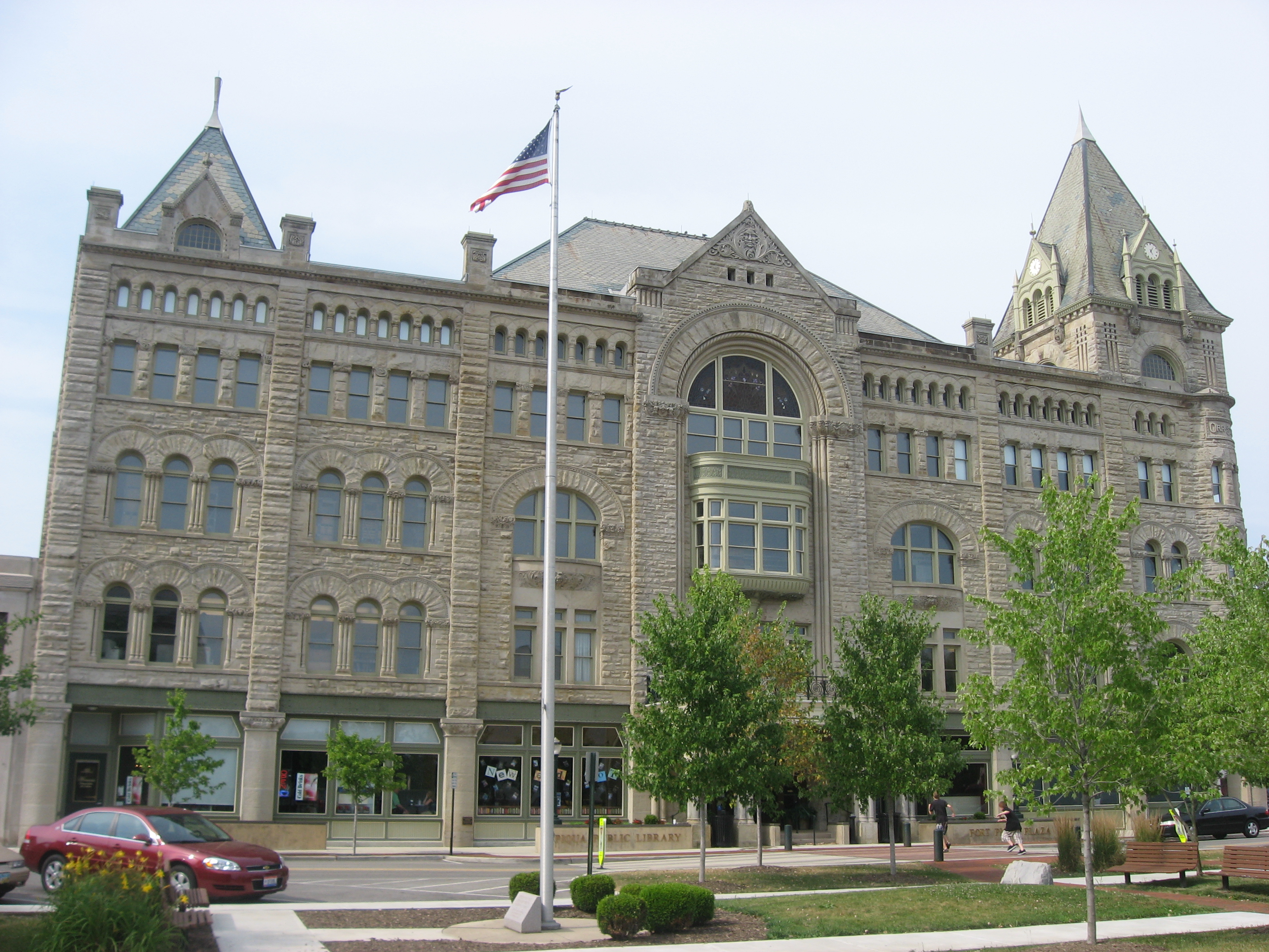
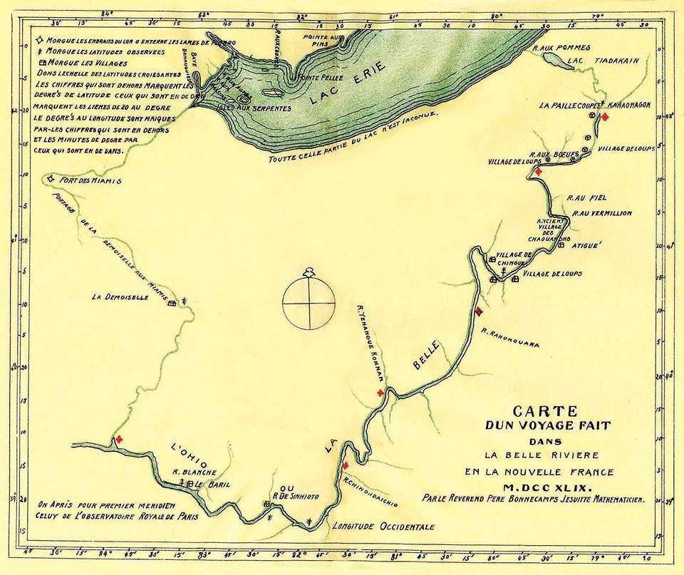
Piqua ( ) is a city in Miami County, Ohio, United States, along the Great Miami River. The population was 20,354 at the 2020 United States census, 2020 census. Located north of Dayton, Ohio, Dayton, it is part of the Greater Dayton, Dayton metropolitan area. History Etymology The word 'Piqua' is believed to be derived from a Shawnee language phrase: ''Othath-He-Waugh-Pe-Qua,'' translated as "He has risen from the ashes," related to a legend of the people. It became associated with the ''Pekowi'', one of the five divisions of the Shawnee people, who were eventually known as the Piqua. Early settlements In 1749, Pickawillany, Fort Pickawillany was constructed by the British to protect their trading post at a Miami people, Miami village of the same name. It was located at the confluence of Loramie Creek and the Great Miami River. In 1752, Charles Michel de Langlade, Charles de Langlade, an Odawa war chief of partial French Canadian descent, attacked the fort. He led more than 240 ... [...More Info...] [...Related Items...] OR: [Wikipedia] [Google] [Baidu] |
City
A city is a human settlement of a substantial size. The term "city" has different meanings around the world and in some places the settlement can be very small. Even where the term is limited to larger settlements, there is no universally agreed definition of the lower boundary for their size. In a narrower sense, a city can be defined as a permanent and Urban density, densely populated place with administratively defined boundaries whose members work primarily on non-agricultural tasks. Cities generally have extensive systems for housing, transportation, sanitation, Public utilities, utilities, land use, Manufacturing, production of goods, and communication. Their density facilitates interaction between people, government organisations, government organizations, and businesses, sometimes benefiting different parties in the process, such as improving the efficiency of goods and service distribution. Historically, city dwellers have been a small proportion of humanity overall, bu ... [...More Info...] [...Related Items...] OR: [Wikipedia] [Google] [Baidu] |
Pekowi
Pekowi was the name of one of the five divisions (or bands) of the Shawnee, a Native American people, during the 18th century. The other four divisions were the Chalahgawtha, Mekoche, Kispoko, and Hathawekela. Together these divisions formed the loose confederacy that was the Shawnee tribe. All five Shawnee division names have been spelled in a great variety of ways. Variations of the name "Pekowi" are reflected in many place names in the United States, including Piqua, Pickawillany, Pickaway, and Pequea. Traditionally, Shawnee ritual leaders came from the Pekowi patrilineal division. From 1737 to about 1750 the Pekowi were led by Peter Chartier (born Pierre Chartier), a fur trader of Pekowi and French colonial parentage. He was recognized as a leader and rose to be chief of the band. Through his mother's line, Chartier was the grandson of chief Straight Tail Meaurroway Opessa. In 1710 he married his cousin, ''Blanceneige-Wapakonee'' Opessa and they had three children: ... [...More Info...] [...Related Items...] OR: [Wikipedia] [Google] [Baidu] |
Legion Of The United States
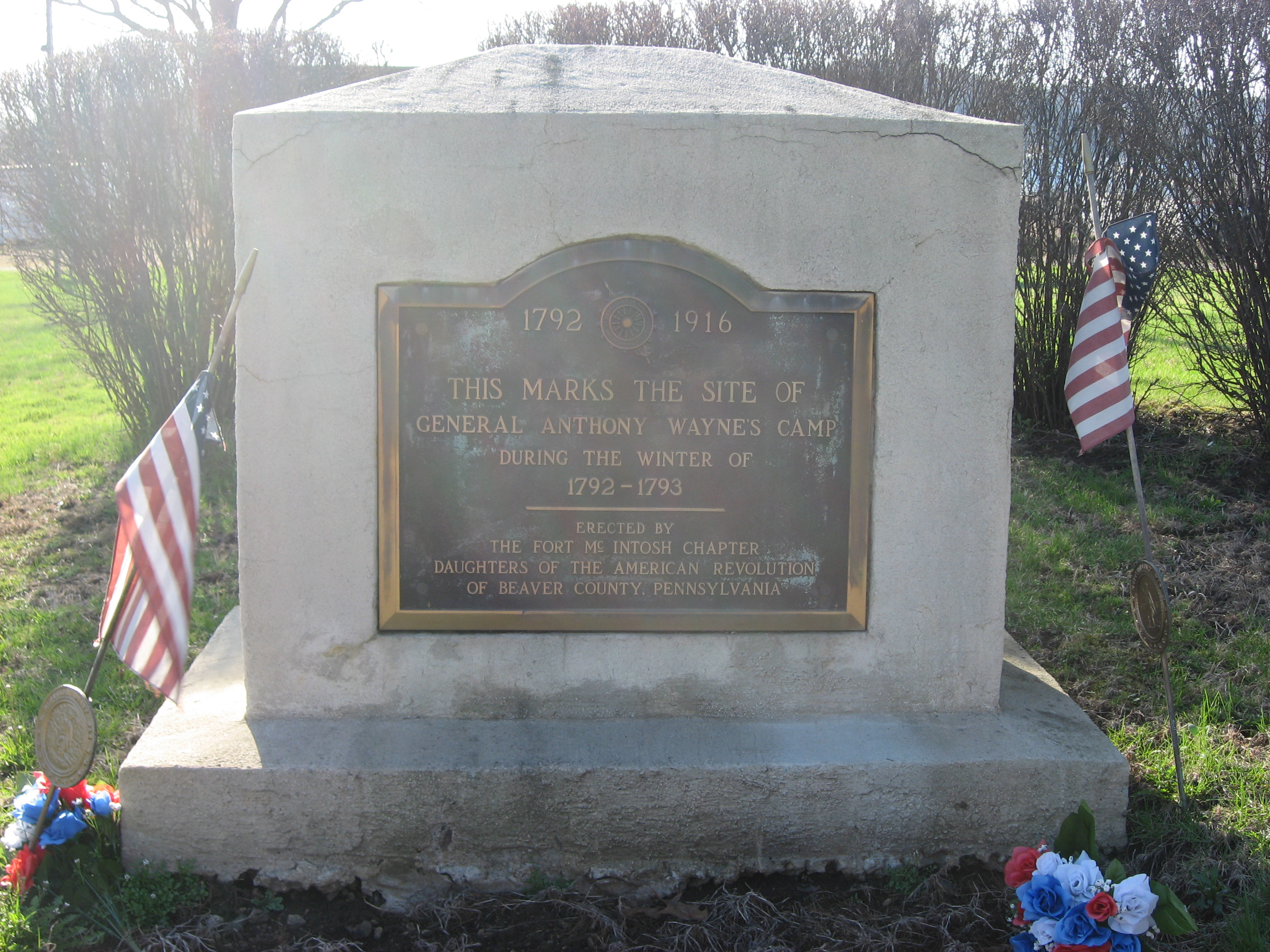
The Legion of the United States was a reorganization and extension of the United States Army from 1792 to 1796 under the command of Major General Anthony Wayne. It represented a political shift in the new United States, which had recently adopted the United States Constitution. The new Congressional and Executive branches authorized a standing army composed of professional soldiers rather than relying on state militias. The Legion was primarily formed in reaction to multiple defeats in the Ohio country in 1790 and 1791 and to assert U.S. sovereignty over U.S. borders in the western territories and Great Lakes regions. The Legion comprised four sub-legions, each with infantry, cavalry, riflemen, and artillery. The Legion is best known for its victory at the Battle of Fallen Timbers in August 1794. Following the 1795 Treaty of Greenville with the Western Confederacy of Native American nations and the Jay Treaty with Great Britain, the Legion was reduced in size and rechristen ... [...More Info...] [...Related Items...] OR: [Wikipedia] [Google] [Baidu] |
Battle Of Piqua
The Battle of Piqua, also known as the Battle of Peckowee, Battle of Pekowi, Battle of Peckuwe and the Battle of Pickaway, was a military engagement fought on August 8, 1780, at the Indian village of Piqua along the Mad River in western Ohio Country between the Kentucky County militia under General George Rogers Clark and Shawnee Indians under Chief Black Hoof. The Indians were driven off and the village and surrounding fields burned, but Clark suffered daunting casualties. Clark's expedition was in response to Bird's invasion of Kentucky earlier that summer by a combined force of Shawnee, Lenape and Miami warriors that killed and captured hundreds of white settlers. Background The battle was part of a campaign in Ohio Country in the Western theater of the American Revolutionary War. Led by General George Rogers Clark, 970 soldiers crossed the Ohio River near present-day Cincinnati in early August 1780 and proceeded up the Little Miami and Mad Rivers. They reached the Shaw ... [...More Info...] [...Related Items...] OR: [Wikipedia] [Google] [Baidu] |
George Rogers Clark
George Rogers Clark (November 19, 1752 – February 13, 1818) was an American military officer and surveyor from Virginia who became the highest-ranking Patriot (American Revolution), Patriot military officer on the American frontier, northwestern frontier during the American Revolutionary War, Revolutionary War. He served as leader of the Virginia militia in Kentucky (then part of Virginia) throughout much of the war. He is best known for his captures of Kaskaskia, Illinois, Kaskaskia in 1778 and Vincennes, Indiana, Vincennes in 1779 during the Illinois campaign, which greatly weakened Kingdom of Great Britain, British influence in the Northwest Territory (then part of the Province of Quebec (1763–1791), British Province of Quebec) and earned Clark the nickname of "Conqueror of the Old Northwest." The British ceded the entire Northwest Territory to the United States in the 1783 Treaty of Paris (1783), Treaty of Paris. Clark's major military achievements occurred before h ... [...More Info...] [...Related Items...] OR: [Wikipedia] [Google] [Baidu] |
Mad River (Ohio)
The Mad River (Shawnee: ''Hathennithiipi'' ) is a stream located in the west central part of the U.S. state of Ohio. It flows U.S. Geological Survey. National Hydrography Dataset high-resolution flowline dataThe National Map, accessed May 19, 2011 from Logan County to downtown Dayton, where it meets the Great Miami River. The stream flows southwest from its source near Campbell Hill through West Liberty, along U.S. Route 68 west of Urbana, past Springfield (the point of confluence with Buck Creek), then along Ohio State Route 4 into Dayton. The stream's confluence with the Great Miami River is in Deeds Park. The Mad River was one of the Great Miami River tributaries that flooded during the Great Dayton Flood of 1913, resulting in the creation of the Miami Conservancy District. The river derives its name from its mad, broken, and rapid current. Historically, the stream has also been known by the names Mad Creek and Tiber River, respectively, as well as by the Italian fo ... [...More Info...] [...Related Items...] OR: [Wikipedia] [Google] [Baidu] |
French And Indian War
The French and Indian War, 1754 to 1763, was a colonial conflict in North America between Kingdom of Great Britain, Great Britain and Kingdom of France, France, along with their respective Native Americans in the United States, Native American allies. European historians generally consider it a related conflict of the wider 1756 to 1763 Seven Years' War, although in the United States it is viewed as a singular conflict unassociated with any European war. Although Britain and France were officially at peace following the Treaty of Aix-la-Chapelle (1748), tensions over trade continued in North America. These culminated in a dispute over the Forks of the Ohio, and the related French Fort Duquesne which controlled them. In May 1754, this led to the Battle of Jumonville Glen, when Colony of Virginia, Virginia militia led by George Washington ambushed a French patrol. In 1755, Edward Braddock, the new Commander-in-Chief, North America, planned a four-way attack on the French. None s ... [...More Info...] [...Related Items...] OR: [Wikipedia] [Google] [Baidu] |
Raid On Pickawillany
Pickawillany (also spelled Pickawillamy, Pickawillani, or Picqualinni) was an 18th-century Miami Indian village located on the Great Miami River in North America's Ohio Valley near the modern city of Piqua, Ohio.R. David Edmunds, "Pickawillany: French Military Power versus British Economics" ''Western Pennsylvania Historical Magazine'', vol. 58, April 1975, pp 169–184, accessed 17 October 2021 In 1749 an English trading post was established alongside the Miami village, selling goods to neighboring tribes at the site. In 1750, a stockade (Fort Pickawillany) was constructed to protect the post. French and English colonists were competing for control of the fur trade in the |
Ojibwe
The Ojibwe (; Ojibwe writing systems#Ojibwe syllabics, syll.: ᐅᒋᐺ; plural: ''Ojibweg'' ᐅᒋᐺᒃ) are an Anishinaabe people whose homeland (''Ojibwewaki'' ᐅᒋᐺᐘᑭ) covers much of the Great Lakes region and the Great Plains, northern plains, extending into the subarctic and throughout the northeastern woodlands. The Ojibwe, being Indigenous peoples of the Northeastern Woodlands and of Indigenous peoples of the Subarctic, the subarctic, are known by several names, including Ojibway or Chippewa. As a large ethnic group, several distinct nations also consider themselves Ojibwe, including the Saulteaux, Nipissings, and Oji-Cree. According to the U.S. census, Ojibwe people are one of the largest tribal populations among Native Americans in the United States, Native American peoples in the U.S. In Canada, they are the second-largest First Nations in Canada, First Nations population, surpassed only by the Cree. They are one of the most numerous Indigenous peoples of t ... [...More Info...] [...Related Items...] OR: [Wikipedia] [Google] [Baidu] |
Odawa
The Odawa (also Ottawa or Odaawaa ) are an Indigenous North American people who primarily inhabit land in the Eastern Woodlands region, now in jurisdictions of the northeastern United States and southeastern Canada. Their territory long preceded the creation of the current border between the two countries in the 18th and 19th centuries. Their peoples are federally recognized as Native American tribes in the United States and have numerous recognized First Nations bands in Canada. They are one of the Anishinaabeg, related to but distinct from the Ojibwe and Potawatomi peoples. After migrating from the East Coast in ancient times, they settled on Manitoulin Island, near the northern shores of Lake Huron, and the Bruce Peninsula in the present-day province of Ontario, Canada. They considered this their original homeland. After the 17th century, they also settled along the Ottawa River, and in what became the present-day states of Michigan and Wisconsin. They also occupied ot ... [...More Info...] [...Related Items...] OR: [Wikipedia] [Google] [Baidu] |
Charles Michel De Langlade
Charles Michel Mouet de Langlade (9 May 1729 – after 26 July 1801)''Dictionnaire Généalogique Tanguay'' was a Great Lakes fur trader and war chief who was important in protecting French territory in North America. His mother was Ottawa and his father a French Canadian fur trader. Fluent in Ottawa and French, Langlade later led First Nations forces in warfare in the region. Given the shifting political realities of the time, he and his followers were at various times allied with the French, British and, lastly, Americans. Leading French and Indian forces, in 1752 he destroyed Pickawillany, a Miami village and British trading post in present-day Ohio, where the British and French were competing for control of the lucrative fur trade. During the subsequent Seven Years' War, he helped defend Fort Duquesne (Pittsburgh) against the British. The French appointed Langlade as second in command at Fort Michilimackinac and a captain in the Indian Department of French Canada. After the ... [...More Info...] [...Related Items...] OR: [Wikipedia] [Google] [Baidu] |
Loramie Creek
Loramie Creek is a U.S. Geological Survey. National Hydrography Dataset high-resolution flowline dataThe National Map, accessed May 19, 2011 tributary of the Great Miami River in western Ohio in the United States. Via the Great Miami and Ohio rivers, it is part of the watershed of the Mississippi River, draining an area of . According to the Geographic Names Information System, the stream has also been known historically as "Laramie Creek," "Loramie Ditch," "Loramies Creek," and "Lonamie Creek." It is named after Louis Lorimier, a French-Canadian fur trader who had a trading post in the area in the 18th century. Loramie Creek rises in northern Shelby County and initially flows southwestwardly, passing through a dam which causes the creek to form Lake Loramie, along which a state park is located. Near Fort Loramie the creek turns southeastwardly, flowing through Lockington Dam (a dry dam) and past the community of Lockington. It flows into the Great Miami River in northern ... [...More Info...] [...Related Items...] OR: [Wikipedia] [Google] [Baidu] |


