|
Pansy, Missouri
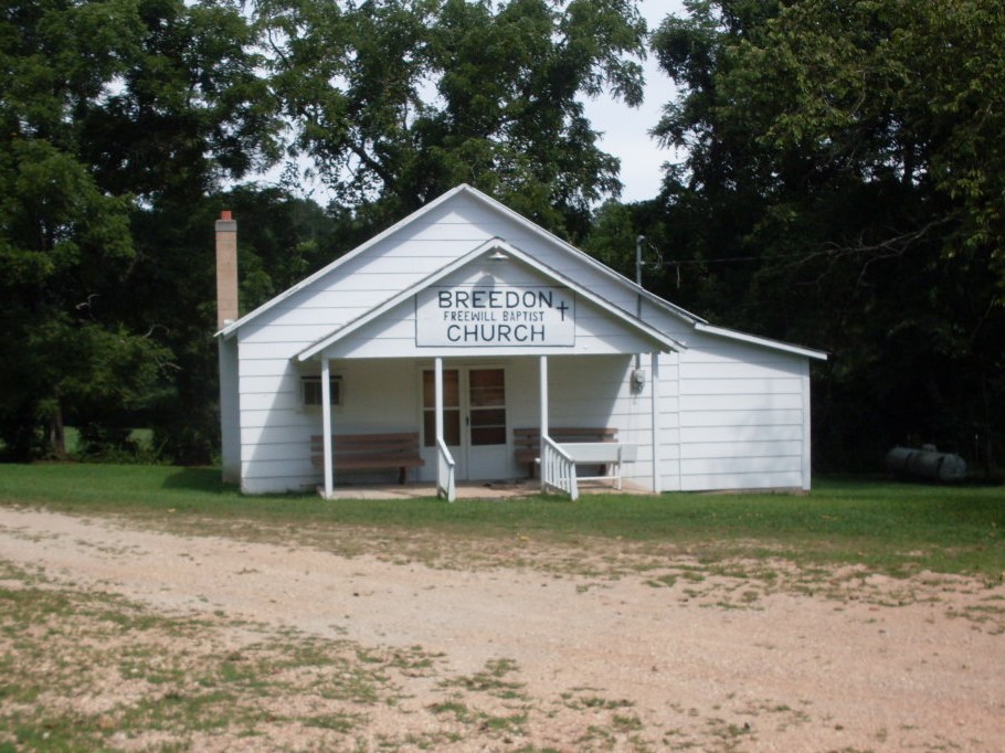
Pansy, Missouri is a community and former post office in western Douglas County, Missouri, Douglas County in the U.S. State of Missouri. The community is located along the east side of the Little Beaver Creek (Missouri), Little Beaver Creek valley (elevation approximately 1100 feet) at the west end of Missouri Route NN approximately 2.5 miles west of Red Bank, Missouri, Red Bank.''Bradlyville, MO,'' 1:48000 Scale Topographic Quadrangle, USGS, 1937 The old Breeden School was located just over one mile to the north-northwest along Breeden Creek. Keyger Mountain (peak elevation 1649 feet) lies 2.5 miles to the north at the head of Breeden Creek. A Colonel Huffman started the post office and store for the community in 1899. He named it for his daughter. The Pansy post office would remain in operation until 1935. References Unincorporated communities in Douglas County, Missouri 1891 establishments in Missouri Unincorporated communities in Missouri {{DouglasCountyMO-geo- ... [...More Info...] [...Related Items...] OR: [Wikipedia] [Google] [Baidu] |
Douglas County, Missouri
Douglas County is a county located in the south-central portion of the U.S. state of Missouri. As of the 2020 census, the population was 11,578. The county seat and only incorporated community is Ava. The county was officially organized on October 19, 1857, and is named after U.S. Senator Stephen A. Douglas ( D-Illinois) and later Democratic presidential candidate. History Previously, the county seat was located at Arno, west of Ava. Prior to that, Vera Cruz (formerly called Red Bud) was the county seat. Vera Cruz is located on Bryant Creek, which flows through the middle of the county. The Civil War Battle of Clark's Mill took place near Vera Cruz on November 7, 1862, and resulted in a Confederate victory. After the American Civil War, during a period of general chaos, a group from the western part of the county broke into the Arno courthouse and removed the records back to Vera Cruz. Later in 1871, a new town site was selected, present-day Ava, near the location of the ... [...More Info...] [...Related Items...] OR: [Wikipedia] [Google] [Baidu] |
Missouri
Missouri is a U.S. state, state in the Midwestern United States, Midwestern region of the United States. Ranking List of U.S. states and territories by area, 21st in land area, it is bordered by eight states (tied for the most with Tennessee): Iowa to the north, Illinois, Kentucky and Tennessee to the east, Arkansas to the south and Oklahoma, Kansas and Nebraska to the west. In the south are the Ozarks, a forested highland, providing timber, minerals, and recreation. The Missouri River, after which the state is named, flows through the center into the Mississippi River, which makes up the eastern border. With more than six million residents, it is the List of U.S. states and territories by population, 19th-most populous state of the country. The largest urban areas are St. Louis, Kansas City, Missouri, Kansas City, Springfield, Missouri, Springfield and Columbia, Missouri, Columbia; the Capital city, capital is Jefferson City, Missouri, Jefferson City. Humans have inhabited w ... [...More Info...] [...Related Items...] OR: [Wikipedia] [Google] [Baidu] |
Little Beaver Creek (Missouri)
Little Beaver Creek is a stream in Douglas, Christian and Taney counties of southern Missouri. The stream headwaters arise in northwestern Douglas County on the east flank of Keyger Mountain just west of Missouri Route AK to the northwest of Arden and south of Dogwood and about nine miles west-northwest of Ava. The stream flows south to southwest through western Douglas County. It is bridged by Missouri Route T just east of Merritt and Route DD west of Cross Roads. The stream then enters the Mark Twain National Forest. In the southwest corner of Douglas County the stream meanders for a short span into and out of southeast Christian County, back into Douglas and immediately south into Taney County. In northern Taney County the stream runs parallel to Missouri Route 125 Route 125 runs between U.S. Route 65 at Fair Grove and the Arkansas state line, where it continues as Highway 125. After the road crosses into Marion County, Arkansas, the highway crosses Bull Shoals Lak ... [...More Info...] [...Related Items...] OR: [Wikipedia] [Google] [Baidu] |
Missouri Route NN
A supplemental route is a state secondary road in the U.S. state of Missouri, designated with letters. Supplemental routes were various roads within the state which the Missouri Department of Transportation was given in 1952 to maintain in addition to the regular routes, though lettered routes had been in use from at least 1932. The four types of roads designated as Routes are: * Farm to market roads * Roads to state parks * Former alignments of U.S. or state highways * Short routes connecting state highways from other states to routes in Missouri Supplemental routes make up (59%) of the state highway system. History Prior to 1907, all road improvement activities in Missouri were undertaken by the individual counties, with little expertise or coordination between them. Amid growing automobile presence and insufficient road networks in Missouri in the ensuing years, the state legislature created a state highway department and the state highway commission as well as enacted vari ... [...More Info...] [...Related Items...] OR: [Wikipedia] [Google] [Baidu] |
Red Bank, Missouri
Redbank (also spelled Red Bank) is an unincorporated community in western Douglas County, Missouri, United States. Redbank is located on Missouri State Route O at its junction with Route NN to the west. The community of Arden Arden may refer to: Places ;Australia *Arden, an area in North Melbourne, Victoria near the Arden Street Oval ;Canada * Arden, Ontario ;Denmark * Arden, Denmark, a town **Arden Municipality, a former municipality, including the town of Arden ; ... is to the north and Goodhope is to the south along Route O and Merritt lies to the southwest along Route T. History A post office called Redbank was established in 1891, and remained in operation until 1898. The community was named for the red soil near the original town site. References Unincorporated communities in Douglas County, Missouri 1891 establishments in Missouri Unincorporated communities in Missouri {{DouglasCountyMO-geo-stub ... [...More Info...] [...Related Items...] OR: [Wikipedia] [Google] [Baidu] |
Breeden Creek
Breeden Creek is a stream in western Douglas County in the Ozarks of south central Missouri. The stream is a tributary to Little Beaver Creek.''Goodhope, MO,'' 7.5 Minute Topographic Quadrangle, USGS, 1982 The stream headwaters arise at at an elevation of approximately 1300 feet. The headwaters are on the south flank of Keyger Mountain which rises to a peak elevation of over 1660 feet just one-half mile from source. The stream flows generally south to its confluence with Little Beaver at at an elevation of 1099 feet. The stream confluence lies approximately one quarter mile northwest of the community of Pansy at the end of Missouri Route NN A supplemental route is a state secondary road in the U.S. state of Missouri, designated with letters. Supplemental routes were various roads within the state which the Missouri Department of Transportation was given in 1952 to maintain in additi .... The stream along with the old Breeden School that was adjacent to it bears the name of a ... [...More Info...] [...Related Items...] OR: [Wikipedia] [Google] [Baidu] |
Unincorporated Communities In Douglas County, Missouri
Unincorporated may refer to: * Unincorporated area, land not governed by a local municipality * Unincorporated entity, a type of organization * Unincorporated territories of the United States, territories under U.S. jurisdiction, to which Congress has determined that only select parts of the U.S. Constitution apply * Unincorporated association Unincorporated associations are one vehicle for people to cooperate towards a common goal. The range of possible unincorporated associations is nearly limitless, but typical examples are: :* An amateur football team who agree to hire a pitch onc ..., also known as voluntary association, groups organized to accomplish a purpose * ''Unincorporated'' (album), a 2001 album by Earl Harvin Trio {{disambig ... [...More Info...] [...Related Items...] OR: [Wikipedia] [Google] [Baidu] |
1891 Establishments In Missouri
Events January–March * January 1 ** Paying of old age pensions begins in Germany. ** A strike of 500 Hungarian steel workers occurs; 3,000 men are out of work as a consequence. **Germany takes formal possession of its new African territories. * January 2 – A. L. Drummond of New York is appointed Chief of the Treasury Secret Service. * January 4 – The Earl of Zetland issues a declaration regarding the famine in the western counties of Ireland. * January 5 **The Australian shearers' strike, that leads indirectly to the foundation of the Australian Labor Party, begins. **A fight between the United States and Indians breaks out near Pine Ridge agency. ** Henry B. Brown, of Michigan, is sworn in as an Associate Justice of the Supreme Court. **A fight between railway strikers and police breaks out at Motherwell, Scotland. * January 6 – Encounters continue, between strikers and the authorities at Glasgow. * January 7 ** General Miles' forces ... [...More Info...] [...Related Items...] OR: [Wikipedia] [Google] [Baidu] |


