|
Paciência
Paciência is a neighborhood in the West Zone of Rio de Janeiro, Brazil. After the inauguration in 1878 of the Campo Grande station of the Brazilian Central Railway made it easier to reach the center of the city quickly, the area, including the nearby neighbourhood of Paciência, began to develop rapidly; later Paciência got its own station. The neighbourhood is also near Santa Cruz and Sepetiba Sepetiba is a neighborhood in the West Zone of Rio de Janeiro, Brazil, surrounded by Santa Cruz and Guaratiba, and by the Sepetiba Bay. It occupies an area of 1,162.13 ha, and has a population of 35,892 (according to Instituto Brasileiro de .... There are around 85.000 inhabitants. There are 25 elementary and high schools. References {{DEFAULTSORT:Paciencia, Rio de Janeiro Neighbourhoods in Rio de Janeiro (city) ... [...More Info...] [...Related Items...] OR: [Wikipedia] [Google] [Baidu] |
Santa Cruz, Rio De Janeiro
Santa Cruz ('Holy Cross') is an extensive and populous neighborhood of the high class, lower middle and low in the Rio de Janeiro#West Zone, West Zone of the municipality of Rio de Janeiro, Brazil, the farthest from the Centro, Rio de Janeiro, center of Rio de Janeiro. Cut by the Santa Cruz extension of the urban passenger rail network of the metropolitan region of Rio de Janeiro, it has a very diverse landscape, with commercial areas, residential and industrial. The neighborhood of Santa Cruz is the seat of the administrative region of Santa Cruz, comprising the neighborhoods of Santa Cruz, Paciência and Sepetiba. The administrative region, in turn, belongs to the West Zone subprefecture. Since the installation of Itaguaí Port, is a rapidly developing neighborhood. It is 445 years old, and has important preserved monuments. But it is a place of contrasts. It is one of the most populated districts, and at the same time, due to its vast land area, one of the least densely populat ... [...More Info...] [...Related Items...] OR: [Wikipedia] [Google] [Baidu] |
List Of Sovereign States
The following is a list providing an overview of sovereign states around the world with information on their status and recognition of their sovereignty. The 205 listed states can be divided into three categories based on membership within the United Nations System: 193 member states of the United Nations, UN member states, two United Nations General Assembly observers#Current non-member observers, UN General Assembly non-member observer states, and ten other states. The ''sovereignty dispute'' column indicates states having undisputed sovereignty (188 states, of which there are 187 UN member states and one UN General Assembly non-member observer state), states having disputed sovereignty (15 states, of which there are six UN member states, one UN General Assembly non-member observer state, and eight de facto states), and states having a political status of the Cook Islands and Niue, special political status (two states, both in associated state, free association with New ... [...More Info...] [...Related Items...] OR: [Wikipedia] [Google] [Baidu] |
States Of Brazil
The federative units of Brazil () are subnational entities with a certain degree of autonomy (self-government, self-regulation, and self-collection) and endowed with their own government and constitution, which together form the Brazil, Federative Republic of Brazil. There are #List, 26 states (') and Federal District (Brazil), one federal district ('). The states are generally based on historical, conventional borders which have developed over time. The states are divided into municipalities of Brazil, municipalities, while the Federal District (Brazil), Federal District assumes the competences of both a state and a municipality. Government The government of each state of Brazil is divided into executive branch, executive, legislative branch, legislative and judiciary branches. The state executive branch is headed by a state governor and includes a vice governor, both elected by the citizens of the state. The governor appoints several secretaries of state (each one in charge ... [...More Info...] [...Related Items...] OR: [Wikipedia] [Google] [Baidu] |
Rio De Janeiro (state)
Rio de Janeiro () is one of the States of Brazil, 27 federative units of Brazil. It has the second largest economy of Brazil, with the largest being that of the state of São Paulo (state), São Paulo. The state, which has 8.2% of the Brazilian population, is responsible for 9.2% of the Brazilian Gross domestic product, GDP. The state of Rio de Janeiro is located within the Brazilian geopolitical region classified as the Southeast Region, Brazil, Southeast (assigned by Brazilian Institute of Geography and Statistics, IBGE). Rio de Janeiro shares borders with all the other states in the same Southeast macroregion: Minas Gerais (North, N and Ordinal directions, NW), Espírito Santo (Ordinal direction, NE) and São Paulo (state), São Paulo (Ordinal directions, SW). It is bounded on the east and south by the South Atlantic Ocean. Rio de Janeiro has an area of . Its capital is the city of Rio de Janeiro, Rio de Janeiro, Rio de Janeiro, which was the capital of the Portuguese Colonial ... [...More Info...] [...Related Items...] OR: [Wikipedia] [Google] [Baidu] |
Rio De Janeiro
Rio de Janeiro, or simply Rio, is the capital of the Rio de Janeiro (state), state of Rio de Janeiro. It is the List of cities in Brazil by population, second-most-populous city in Brazil (after São Paulo) and the Largest cities in the Americas, sixth-most-populous city in the Americas. Founded in 1565 by the Portuguese people, Portuguese, the city was initially the seat of the Captaincy of Rio de Janeiro, a domain of the Portuguese Empire. In 1763, it became the capital of the State of Brazil, a List of states of the Portuguese Empire, state of the Portuguese Empire. In 1808, when the Transfer of the Portuguese Court to Brazil, Portuguese Royal Court moved to Brazil, Rio de Janeiro became the seat of the court of Queen Maria I of Portugal. She subsequently, under the leadership of her son the prince regent John VI of Portugal, raised Brazil to the dignity of a kingdom, within the United Kingdom of Portugal, Brazil and the Algarves, United Kingdom of Portugal, Brazil, and Algar ... [...More Info...] [...Related Items...] OR: [Wikipedia] [Google] [Baidu] |
Brazil
Brazil, officially the Federative Republic of Brazil, is the largest country in South America. It is the world's List of countries and dependencies by area, fifth-largest country by area and the List of countries and dependencies by population, seventh-largest by population, with over 212 million people. The country is a federation composed of 26 Federative units of Brazil, states and a Federal District (Brazil), Federal District, which hosts the capital, Brasília. List of cities in Brazil by population, Its most populous city is São Paulo, followed by Rio de Janeiro. Brazil has the most Portuguese-speaking countries, Portuguese speakers in the world and is the only country in the Americas where Portuguese language, Portuguese is an Portuguese-speaking world, official language. Bounded by the Atlantic Ocean on the east, Brazil has a Coastline of Brazil, coastline of . Covering roughly half of South America's land area, it Borders of Brazil, borders all other countries and ter ... [...More Info...] [...Related Items...] OR: [Wikipedia] [Google] [Baidu] |
Campo Grande, Rio De Janeiro
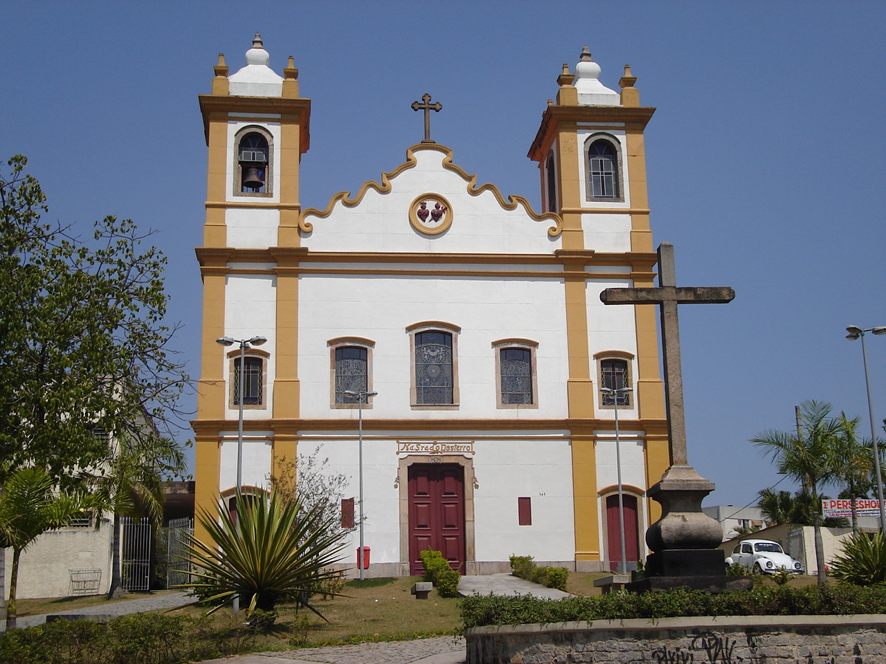
Campo Grande is the largest neighborhood in the West Zone of Rio de Janeiro. Campo Grande has a population of 328,370 inhabitants and an area of , on both counts Rio's largest. It is situated 50 kilometers (31 miles) away from Downtown Rio. The Campo Grande neighborhood is the headquarters of the administrative region of Campo Grande, which includes the neighborhoods of Campo Grande, Inhoaíba, Senador Vasconcelos and Santíssimo. Its occupation dates back to November 17, 1603, mainly due to the numerous Jesuit works in the region. History Campo Grande, which in the early 1940s was considered the "Empire of the Orange", grew along with the settlement of Brazil. The valley, which begins in the Rio da Prata and ends in Cabuçu, was inhabited by Picinguabas and granted by the Portuguese Crown to Barcelos Domingos. In 1673, Domingos built the chapel of Our Lady of the Exile, which later became the parish church of Campo Grande. Near the church was a well also called Ou ... [...More Info...] [...Related Items...] OR: [Wikipedia] [Google] [Baidu] |
Estrada De Ferro Central Do Brasil
The Estrada de Ferro Central do Brasil was one of the principal railways of Brazil, uniting the states of Rio de Janeiro, São Paulo and Minas Gerais. Origins On 9 February 1855, The imperial government of Brazil signed a contract with Edward Price for the construction of the first section of a railway which had the aim of linking the court (then in the city of Rio de Janeiro) with the provinces of São Paulo and Minas Gerais. It was constituted as the ''Companhia de Estrada de Ferro Dom Pedro II'', under the directorship of Christiano Benedicto Ottoni. Works commenced on 11 June 1855 and on 29 March 1858, the 48 km gauge section from Rio de Janeiro to Freguesia de Nossa Senhora da Conceição de Marapicu (now Queimados) was completed. At this time there were 5 stations: Campo, Engenho Novo, Cascadura (all in the city of Rio), Maxambomba (now Nova Iguaçu) and Queimados. On 8 November the railway was extended to Belém (now Japeri) at the foot of the Serra do Mar. E ... [...More Info...] [...Related Items...] OR: [Wikipedia] [Google] [Baidu] |
Sepetiba, Rio De Janeiro
Sepetiba is a neighborhood in the West Zone of Rio de Janeiro, Brazil, surrounded by Santa Cruz and Guaratiba, and by the Sepetiba Bay. It occupies an area of 1,162.13 ha, and has a population of 35,892 (according to Instituto Brasileiro de Geografia e Estatística, IBGE, 2000 demographic census). The origin of the name Sepetiba is the Tupi, which has the word "Sipitiba" as an alternative and ''çape-typa'' or ''çape-tyua'' as a corruption of the name, meaning Campo dos Sapés (''Sapé field'', in English), or Sapezal. Close to Sepetiba is the port of Sepetiba Terminal. The port handles containers and general bulk cargo Bulk cargo is Product (business), product cargo that is transported packaging, unpackaged in large quantities. Description Bulk cargo refers to material in either liquid or granular, particulate (as a mass of relatively small solids) form, .... Its maximum draft is 22.5m. References Neighbourhoods in Rio de Janeiro (city) Beaches of Rio d ... [...More Info...] [...Related Items...] OR: [Wikipedia] [Google] [Baidu] |


