|
Oklahoma State Highway 11
State Highway 11 (abbreviated SH-11) is a state highway in Oklahoma. It runs in an irregular west-to-east path across the northern part of the state, from U.S. Highway 281 (US-281) north of Alva to Interstate 244 (I-244) / US-412 in Tulsa. There is one letter-suffixed spur highway branching from SH-11, SH-11A. Route description From its beginning at US-281, SH-11 travels east through the town of Capron. later, it reaches SH-8. SH-11 and SH-8 overlap for , passing through the town of Burlington along the way. SH-8 / SH-11 meet SH-58 three miles (5 km) east of Burlington, and turn south, forming a three-route concurrency. The combined route passes through the unincorporated community of Driftwood and intersects US-64 just west of the town of Ingersoll. At this point, SH-11 turns to the east, leaving SH-8 and SH-58. SH-11 passes through the northern part of Great Salt Plains State Park, and after , intersects with SH-38. SH-11 continues on another seven mil ... [...More Info...] [...Related Items...] OR: [Wikipedia] [Google] [Baidu] |
Oklahoma Department Of Transportation
The Oklahoma Department of Transportation (ODOT) is an government agency, agency of the government of Oklahoma responsible for the construction and maintenance of the state's transportation infrastructure. Under the leadership of the Oklahoma Secretary of Transportation, Oklahoma secretary of transportation and ODOT executive director, the department maintains public infrastructure that includes highways and state-owned railroads and administers programs for county roads, city streets, public transit, passenger rail, waterways and active transportation. Along with the Oklahoma Turnpike Authority, the department is the primary infrastructure construction and maintenance agency of the State.Okla. Stat. tit. 47, § 2-106.2A ODOT is overseen by the Oklahoma Transportation Commission, composed of nine members appointed by the governor of Oklahoma, Oklahoma Senate and Oklahoma House of Representatives. Tim Gatz, a professional landscape architect with a bachelor's degree in landscape ar ... [...More Info...] [...Related Items...] OR: [Wikipedia] [Google] [Baidu] |
Wakita, Oklahoma
Wakita is a town in Grant County, Oklahoma, United States, founded in 1898, approximately south of the Kansas border. Its population was 344 at the 2010 census, a decrease of 18.1 percent (from 420) at the 2000 census. Wakita is notable as a location in the 1996 feature film ''Twister''. Geography Wakita is northwest of Medford, the county seat, on State Highway 11A.Wilson, Linda D. ''Encyclopedia of Oklahoma History and Culture''. "Wakita." Retrieved March 20, 201/ref> According to the United States Census Bureau, it has a total area of , all land. History Before the town's founding in 1898, there was a dispute over the right to name the town. The town's postmaster, and the owner of the first general store, and the town's first postmaster, believed it should be named Whiteville. Local Deputy U.S. Marshall Herbert John Green motioned for the town be named after a Cherokee chief of local significance named Wakita (pronounced Wok-ih-taw). Green and other local settlers wante ... [...More Info...] [...Related Items...] OR: [Wikipedia] [Google] [Baidu] |
State Highway 18 (Oklahoma)
State Highway 18, abbreviated as SH-18 or OK-18, is a highway maintained by the U.S. state of Oklahoma. It was once one of the longest state highways in the Oklahoma road system, but now has a total length of . Route description State Highway 18 was commissioned in August 1924 and, at one time, traveled from Dickson, Oklahoma to Shidler, Oklahoma at the Kansas border. Much of SH-18 has been replaced by US-177. The current Highway 18 begins in Shawnee, Oklahoma at an interchange with US-177/270 and SH-3W. The highway is known as Harrison Street through Shawnee. After Shawnee, SH-18 intersects with US-62 in Meeker, Oklahoma and then into Chandler, Oklahoma concurrent with SH-66. The highways split after leaving Chandler's business district. SH-18 intersects with I-44 and then travels on to Agra, Oklahoma. At Agra, SH-18 joins with SH-33 heading into Cushing, Oklahoma where SH-18 separates and heads to Pawnee, Oklahoma. South of there, the highway overlaps US-64 for two m ... [...More Info...] [...Related Items...] OR: [Wikipedia] [Google] [Baidu] |
Kaw Lake
Kaw Lake is a reservoir completed in 1976 in the northern reaches of the U.S. state of Oklahoma, near Kaw City which is located on a hill overlooking the lake. The lake is approximately east of Ponca City. The dam was completed by the United States Army Corps of Engineers, Corps of Engineers in May 1976. The cost of the dam and the lake was $111 million. The Oklahoma Municipal Power Authority (OMPA), a state governmental agency created in 1981 to provide wholesale electricity to cities and towns in Oklahoma, purchased the substructure of the dam in July 1987 at a cost of $3.8 million and constructed a hydroelectric plant that was completed in September 1989 at a cost of $25 million. Kaw Hydroelectric generates approximately 104 gigawatt hours of energy annually. The generator is nominally rated at 25.6 megawatts at of gross head with a maximum rating of 36.7 MVA. The plant at Kaw Dam provides power for over 35 municipal electrical systems in Oklahoma and southern Kansas. The pro ... [...More Info...] [...Related Items...] OR: [Wikipedia] [Google] [Baidu] |
Kaw City, Oklahoma
Kaw City is a city in eastern Kay County, Oklahoma, United States. The population was 375 at the 2010 census, an increase of 1 percent from the figure of 372 in 2000. Kaw City was named for the Kanza Indians, called ''the Kaw'' by locals. History In 1902, the original Kaw City was founded, prior to Oklahoma statehood, as a farming community in the fertile oxbow bend of the Arkansas River.Pittman, Annette. ''Encyclopedia of Oklahoma History and Culture''. "Kaw City/ref> Kaw City was across the river from the Kaw Indian reservation and the Kaw Agency. By statehood in 1907, it had 486 inhabitants. Although the original town site is now inundated by the waters of Kaw Lake, the old town was quite a busy place. It became a booming oil town in 1919, when 'black gold' was discovered in nearby Kay County and the present Osage Nation reservation. The population jumped from 627 in 1920 to 1,001 in 1930. It even had a very popular four-story hotel filled with one of the world's rarest ar ... [...More Info...] [...Related Items...] OR: [Wikipedia] [Google] [Baidu] |
Ponca City, Oklahoma
Ponca City ( iow, Chína Uhánⁿdhe) is a city in Kay County in the U.S. state of Oklahoma. The city was named after the Ponca tribe. Ponca City had a population of 25,387 at the time of the 2010 census- and a population of 24,424 in the 2020 census. History Ponca City was created in 1893 as "New Ponca" after the United States opened the Cherokee Outlet for European-American settlement during the Cherokee Strip land run, the largest land run in United States history. The site for Ponca City was selected for its proximity to the Arkansas River and the presence of a freshwater spring near the river. The city was laid out by Burton Barnes, who drew up the first survey of the city and sold certificates for the lots he had surveyed. After the drawing for lots in the city was completed, Barnes was elected the city's first mayor.Louis Seymour Barnes"The Founding of Ponca City" ''Chronicles of Oklahoma'' 35 (Summer 1957). Another city, Cross, vied with Ponca City to become the ... [...More Info...] [...Related Items...] OR: [Wikipedia] [Google] [Baidu] |
Newkirk, Oklahoma
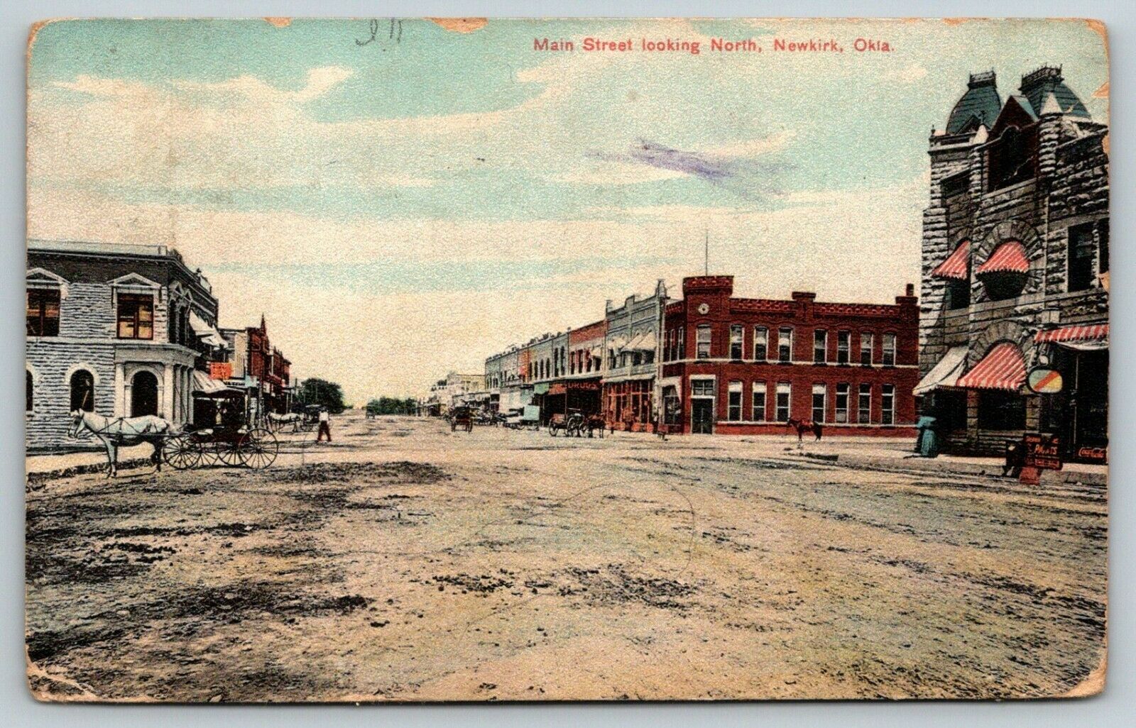
Newkirk is a city and county seat of Kay County, Oklahoma, United States. The population was 2,172 at the 2020 census. History Newkirk is on land known as the Cherokee Outlet (popularly called the "Cherokee Strip"), which belonged to the Cherokee Indians until 1893. The Cherokee acquiesced to the demand of the president and Department of the Interior to sell the land, then part of Oklahoma Territory, to the U.S. government. Efforts to buy the land from the Cherokee began in 1889, but were not concluded until 1893 when Congress authorized the purchase and the land was opened to non-Indian settlement by means of the Cherokee Strip Land Run on September 16, 1893. An estimated 100,000 people raced to claim plots of land. The town of Newkirk had been laid out before the run by the government as the county seat of “K” county. It was named Lamoreaux after Silas W. Lamoreaux, who was commissioner of the General Land Office. Two miles north of Lamoreaux was Kirk, a Santa Fe Railroa ... [...More Info...] [...Related Items...] OR: [Wikipedia] [Google] [Baidu] |
Blackwell, Oklahoma
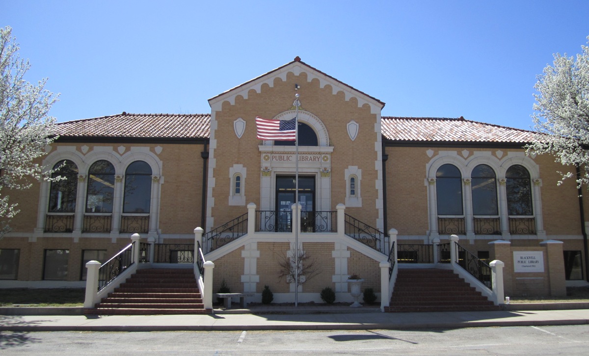
Blackwell is a city in Kay County, Oklahoma, United States, located at the intersection of U.S. Highway 177 and State Highway 11 along Interstate 35 (exit #222). The population was 7,092 at the 2010 census and 6,085 in the 2020 Census. Blackwell was established following the September 16, 1893 Cherokee Outlet land run by A. J. Blackwell.Wilson, Linda Blackwell, OklahomaOklahoma Historical Society Blackwell has an agricultural and fossil fuel based economy. History Founding Blackwell came into existence during the Cherokee Outlet Opening on September 16, 1893 in the run known as the Cherokee Strip Land Run. The town is named for A. J. Blackwell, who was the dominant force in its founding. Andrew Blackwell had settled in the area in 1882, having married the former Rosa Vaught who was of Cherokee descent, he was eligible to found the city. Blackwell served as Justice of the Peace and Mayor of Blackwell."Blackwell, Andrew Jackson," ''Herringshaw's Encyclopedia of American Biogra ... [...More Info...] [...Related Items...] OR: [Wikipedia] [Google] [Baidu] |
Interstate 35 (Oklahoma)
Interstate 35 (I-35), in the US State of Oklahoma, runs from the Red River at the Texas border to the Kansas state line near Braman for a length of .Stuve, EricInterstate Highways ''OKHighways''. 27 February 2007. I-35 has one spur route in the state, I-235 in the inner city of Oklahoma City. Route description I-35 enters Oklahoma with U.S. Highway 77 (US-77) on a bridge over the Red River in Love County, south of Thackerville. US-77 splits off at exit 1 (Red River Road) but parallels the Interstate for its entire length in Oklahoma. I-35 maintains a near–due north–south course through Love and Carter counties. I-35 provides four exits to Ardmore. After leaving Ardmore, it has a brief concurrency with State Highway 53 (SH-53) and enters Murray County and the Arbuckle Mountains. I-35 then passes through Garvin County and the county seat of Pauls Valley. North of exit 79 ( SH-145), I-35 enters McClain County. There, it passes through Pu ... [...More Info...] [...Related Items...] OR: [Wikipedia] [Google] [Baidu] |
Nardin, Oklahoma
Nardin is a census-designated place (CDP) and unincorporated community in Kay County, Oklahoma Oklahoma (; Choctaw language, Choctaw: ; chr, ᎣᎧᎳᎰᎹ, ''Okalahoma'' ) is a U.S. state, state in the South Central United States, South Central region of the United States, bordered by Texas on the south and west, Kansas on the nor ..., United States. Its population was 52 as of the 2010 census. Demographics References Census-designated places in Kay County, Oklahoma Census-designated places in Oklahoma Unincorporated communities in Oklahoma Unincorporated communities in Kay County, Oklahoma {{Oklahoma-geo-stub ... [...More Info...] [...Related Items...] OR: [Wikipedia] [Google] [Baidu] |
Deer Creek, Oklahoma
Deer Creek is a town in Grant County, Oklahoma, United States. The population was 130 at the 2010 census, an 11.6 percent decrease from the figure of 147 in 2000. It was named for a nearby stream, which is a tributary of the Salt Fork of the Arkansas River.Wilson, Linda D. "Deer Creek," ''Encyclopedia of Oklahoma History and Culture''. Accessed August 25, 2016. History The community began March 14, 1898, when W. A. Bradford, president of the bought of land to establish a town along the route his railroad planned to use for a rail line between[...More Info...] [...Related Items...] OR: [Wikipedia] [Google] [Baidu] |
State Highway 74 (Oklahoma)
State Highway 74, usually abbreviated as SH-74 or OK-74 (or simply Highway 74) is the numbering of two different highways maintained by the U.S. state of Oklahoma. These highways were once a single major north–south route, connecting Oklahoma City to more rural parts of the state. The original road stretched from SH-7 near Tatums, Oklahoma to SH-11 west of Deer Creek. Due to encroaching Interstate highways—especially Interstate 35—the middle section of the route through Norman, Moore, and Oklahoma City was decommissioned in 1979 for reasons of redundancy. However, some maps show SH-74 as concurrent with I-35, I-240, and I-44, thus linking the two sections. The north section of the route is in length, while the southern section is long. This leads to a total length of . Route descriptions Southern section From the southern terminus at SH-7, the southern section of SH-74 goes due north to Elmore City, where it intersects with SH-29. After a couple of turns in the ... [...More Info...] [...Related Items...] OR: [Wikipedia] [Google] [Baidu] |


