|
Otmoor Riots
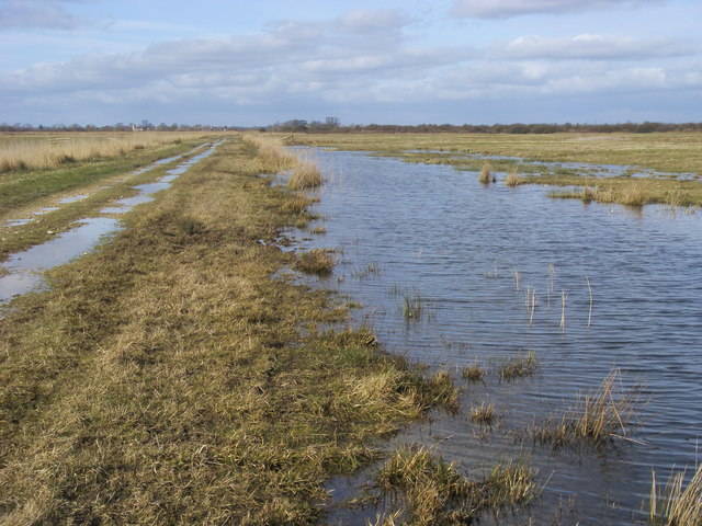
Otmoor or Ot Moor is an area of wetland and wet grassland in Oxfordshire, England, located halfway between Oxford and Bicester. It is about above sea level, and has an area of nearly . It is encircled by the "Seven Towns" of Otmoor: Beckley, Noke, Oddington, Charlton-on-Otmoor, Fencott, Murcott and Horton-cum-Studley. Part of it is a nature reserve, RSPB Otmoor, which adjoins a Ministry of Defence firing range, which is part of a Site of Special Scientific Interest. History Bisected north–south by the Roman Road between Alchester and Dorchester-on-Thames, its name is derived from the Old English for "Otta's Fen". Enclosure Watered by the River Ray, it was until the early 19th century unenclosed marshland, and regularly flooded in winter. An Enclosure Act was passed in 1815, under which the area was extensively drained. This disadvantaged the local farmers and led to civil disturbances known as the Otmoor Riots of 1829–30. Military range In 1920 the Royal Air Force acq ... [...More Info...] [...Related Items...] OR: [Wikipedia] [Google] [Baidu] |
Dorchester-on-Thames
Dorchester on Thames (or Dorchester-on-Thames) is a village and civil parish in Oxfordshire, about northwest of Wallingford and southeast of Oxford. The town is a few hundred yards from the confluence of the River Thames and River Thame. A common practice of the scholars at Oxford was to refer to the river Thames by two separate names, with Dorchester on Thames the point of change. Downstream of the village, the river continued to be named ''The Thames'', while upstream it was named The Isis. Ordnance Survey maps continued the practice by labelling the river as "River Thames or Isis" above Dorchester, however, this distinction is rarely made outside the city of Oxford. Etymology The town shares its name with Dorchester in Dorset, but there has been no proven link between the two names. The name is likely a combination of a Celtic or Pre-Celtic element "-Dor" with the common suffixation "Chester" ( Old English: "A Roman town or Fort"). As Dorchester on Thames is surrounded o ... [...More Info...] [...Related Items...] OR: [Wikipedia] [Google] [Baidu] |
Oxoniensia
The Oxfordshire Architectural and Historical Society (OAHS) has existed in one form or another since at least 1839, although with its current name only since 1972. , , United Kingdom. Its annual publication, ''Oxoniensia'', has been produced since 1936. Overview The Society was founded in 1839 as the Society for Promoting the Study of Gothic Architecture. In 1848, it was renamed to become the Oxford Architectural Society and in 1860 it was re-founded as the Oxford Architectural and Historical Society. In 1972, the society ...[...More Info...] [...Related Items...] OR: [Wikipedia] [Google] [Baidu] |
The Guardian
''The Guardian'' is a British daily newspaper A newspaper is a periodical publication containing written information about current events and is often typed in black ink with a white or gray background. Newspapers can cover a wide variety of fields such as politics, business, sport .... It was founded in 1821 as ''The Manchester Guardian'', and changed its name in 1959. Along with its sister papers ''The Observer'' and ''The Guardian Weekly'', ''The Guardian'' is part of the Guardian Media Group, owned by the Scott Trust Limited, Scott Trust. The trust was created in 1936 to "secure the financial and editorial independence of ''The Guardian'' in perpetuity and to safeguard the journalistic freedom and liberal values of ''The Guardian'' free from commercial or political interference". The trust was converted into a limited company in 2008, with a constitution written so as to maintain for ''The Guardian'' the same protections as were built into the structure of the ... [...More Info...] [...Related Items...] OR: [Wikipedia] [Google] [Baidu] |
Alice's Meadow
Alice's Meadow is the name given to a small field in the Oxfordshire parish of Fencott and Murcott, England. It became the focus of a campaign by local people and Friends of the Earth in the 1980s, who opposed government plans to route the M40 motorway across Otmoor. The name 'Alice's Meadow' is a reference to Lewis Carroll's book ''Through the Looking-Glass,'' which is said to have been partly inspired by the 'chessboard-like' field pattern of Otmoor. It lies to the north of Otmoor, between Fencott and Murcott, and was directly on a proposed route for the motorway, which would then have continued, bisecting Otmoor. Conventional campaigning and action under the planning process led to a public inquiry. Although this ruled in favour of the objectors its decision was not binding on the Department of Transport, which decided to proceed with its original route. While the planning appeals process had been exhausted, landowners of plots along the proposed route still had grounds to ap ... [...More Info...] [...Related Items...] OR: [Wikipedia] [Google] [Baidu] |
Friends Of The Earth (EWNI)
Friends of the Earth England, Wales and Northern Ireland (also known as FoE EWNI) is one of 75 national groups around the world which make up the Friends of the Earth network of environmental organisations. It is usually referred to as just 'Friends of the Earth' within its home countries. History Friends of the Earth in England was founded in 1971, two years after the group was first founded in San Francisco in 1969. Its first leader was Graham Searle, a former vice president of the National Union of Students. In 1975, Searle documented the New Zealand Beech Forest Controversy for Friends of the Earth during a year's sabbatical in that country. One of the early campaigns of the newly founded organisation was to dump almost 1000 glass bottles in front of the HQ of soft drinks giant Schweppes in Connaught House, London in protest at the company's policy of having non-returnable bottles. Other initial activities focused on opposing an open cast copper mine in the Snowdonia Na ... [...More Info...] [...Related Items...] OR: [Wikipedia] [Google] [Baidu] |
M40 Motorway
The M40 motorway links London, Oxford and Birmingham in England, a distance of approximately . The motorway is dual three lanes except for junction 1A to junction 3 (which is dual four lanes) a short section in-between the exit and entry slip-roads at junction 4 (which is two lanes in both directions) and also between the slip-roads at junction 9 (in the southbound direction only). An Active Traffic Management system operates on the short section northbound from junction 16 ( A3400) to the M42. History London to Great Milton The motorway between London and Oxford was constructed in stages between 1967 and 1974. The first section opened in June 1967, from Handy Cross roundabout, High Wycombe to Stokenchurch (junctions 4–5). In 1969, extending in a southerly direction to Holtspur, Beaconsfield, a temporary junction 2 was opened,. The section bypassing Beaconsfield was built in 1971 and the section past Gerrards Cross to junction 1 was completed in 1973. In 1974, the moto ... [...More Info...] [...Related Items...] OR: [Wikipedia] [Google] [Baidu] |
Rifle Range
A shooting range, firing range, gun range or shooting ground is a specialized facility, venue or field designed specifically for firearm usage qualifications, training, practice or competitions. Some shooting ranges are operated by military or law enforcement agencies, though the majority of ranges are privately owned by civilians and sporting clubs and cater mostly to recreational shooters. Each facility is typically overseen by one or more supervisory personnel, variously called a ''range master'' or "Range Safety Officer" (RSO) in the United States, or a ''range conducting officer'' (RCO) in the United Kingdom. Supervisory personnel are responsible for ensuring that all weapon safety rules and relevant government regulations are followed at all times. Shooting ranges can be indoor or outdoor, and may be restricted to certain types of firearm that can be used such as handguns or long guns, or they can specialize in certain Olympic disciplines such as trap/skeet sho ... [...More Info...] [...Related Items...] OR: [Wikipedia] [Google] [Baidu] |
Victoria County History
The Victoria History of the Counties of England, commonly known as the Victoria County History or the VCH, is an English history project which began in 1899 with the aim of creating an encyclopaedic history of each of the historic counties of England, and was dedicated to Victoria of the United Kingdom, Queen Victoria. In 2012 the project was rededicated to Elizabeth II, Queen Elizabeth II in celebration of her Diamond Jubilee year. Since 1933 the project has been coordinated by the Institute of Historical Research in the University of London. History The history of the VCH falls into three main phases, defined by different funding regimes: an early phase, 1899–1914, when the project was conceived as a commercial enterprise, and progress was rapid; a second more desultory phase, 1914–1947, when relatively little progress was made; and the third phase beginning in 1947, when, under the auspices of the Institute of Historical Research, a high academic standard was set, and pr ... [...More Info...] [...Related Items...] OR: [Wikipedia] [Google] [Baidu] |
Bombing Range
A bombing range usually refers to a remote military aerial bombing and gunnery training range used by combat aircraft to attack ground targets (air-to-ground bombing), or a remote area reserved for researching, developing, testing and evaluating new weapons and ammunition. Bombing ranges are used for precision targeting of high-explosive aerial bombs, precision-guided munitions and other aircraft ordnance, as opposed to a field firing range used by infantry and tanks. Various non-explosive inert "practice bombs" are also extensively used for precision aerial targeting bombing practice—to simulate various explosive aerial bomb types and minimise damage and environmental impact to bombing ranges. United Kingdom The Defence Training Estate of the UK Ministry of Defence currently runs five Air Weapons Ranges for military operational training: RAF Holbeach and RAF Donna Nook in Lincolnshire (England), RAF Pembrey in Carmarthenshire (Wales), RAF Tain in Rossshire and Cape W ... [...More Info...] [...Related Items...] OR: [Wikipedia] [Google] [Baidu] |
Royal Air Force
The Royal Air Force (RAF) is the United Kingdom's air and space force. It was formed towards the end of the First World War on 1 April 1918, becoming the first independent air force in the world, by regrouping the Royal Flying Corps (RFC) and the Royal Naval Air Service (RNAS). Following the Allied victory over the Central Powers in 1918, the RAF emerged as the largest air force in the world at the time. Since its formation, the RAF has taken a significant role in British military history. In particular, it played a large part in the Second World War where it fought its most famous campaign, the Battle of Britain. The RAF's mission is to support the objectives of the British Ministry of Defence (MOD), which are to "provide the capabilities needed to ensure the security and defence of the United Kingdom and overseas territories, including against terrorism; to support the Government's foreign policy objectives particularly in promoting international peace and security". T ... [...More Info...] [...Related Items...] OR: [Wikipedia] [Google] [Baidu] |
Otmoor Riots
Otmoor or Ot Moor is an area of wetland and wet grassland in Oxfordshire, England, located halfway between Oxford and Bicester. It is about above sea level, and has an area of nearly . It is encircled by the "Seven Towns" of Otmoor: Beckley, Noke, Oddington, Charlton-on-Otmoor, Fencott, Murcott and Horton-cum-Studley. Part of it is a nature reserve, RSPB Otmoor, which adjoins a Ministry of Defence firing range, which is part of a Site of Special Scientific Interest. History Bisected north–south by the Roman Road between Alchester and Dorchester-on-Thames, its name is derived from the Old English for "Otta's Fen". Enclosure Watered by the River Ray, it was until the early 19th century unenclosed marshland, and regularly flooded in winter. An Enclosure Act was passed in 1815, under which the area was extensively drained. This disadvantaged the local farmers and led to civil disturbances known as the Otmoor Riots of 1829–30. Military range In 1920 the Royal Air Force acq ... [...More Info...] [...Related Items...] OR: [Wikipedia] [Google] [Baidu] |


