|
Oneida County, Idaho
Oneida County is a County (United States), county located in the U.S. state of Idaho. As of the 2020 United States census, 2020 Census the county had a population of 4,564. The county seat and largest city is Malad City, Idaho, Malad City. Most of the county's population lives in Malad City and the surrounding Malad Valley. History The county is named for Oneida Lake, New York (state), New York, the area from which most of the early settlers had emigrated. Oneida County was organized on January 22, 1864, with its county seat established at Soda Springs, Idaho, Soda Springs in present-day Caribou County, Idaho, Caribou County. The county seat was moved to Malad City in 1866 because of its population growth and location on the freight road and stagecoach line between Corinne, Utah, Corinne, Utah, and the mines in Butte, Montana, Butte, Montana. Early in its lengthy history, Oneida County had the distinction of being Idaho's largest county by both area and population. Its initial ... [...More Info...] [...Related Items...] OR: [Wikipedia] [Google] [Baidu] |
Oneida Lake
Oneida Lake is the largest lake entirely within New York state, with a surface area of . The lake is located northeast of Syracuse and near the Great Lakes. It feeds the Oneida River, a tributary of the Oswego River (New York), Oswego River, which flows into Lake Ontario. From the earliest times until the opening of the Erie Canal in 1825, the lake was part of an important waterway connecting the Atlantic seaboard of North America to the continental interior. The lake is about long and about wide with an average depth of . The shoreline is about . Portions of six counties and 69 communities are in the watershed. Oneida Creek, which flows past the cities of Oneida, New York, Oneida and Sherrill, New York, Sherrill, empties into the southeast part of the lake, at South Bay. While not geologically considered one of the Finger Lakes, Oneida Lake, because of its proximity, is referred by some as their "thumb". Because it is shallow, it is warmer than the deeper Finger Lakes in summer ... [...More Info...] [...Related Items...] OR: [Wikipedia] [Google] [Baidu] |
Bannock County, Idaho
Bannock County is a county in the southeastern part of Idaho. As of the 2020 census, the population was 87,018, making it the sixth-most populous county in Idaho. The county seat and largest city is Pocatello. The county was established in 1893 and named after the local Bannock tribe. It is one of the counties with territories included in the Fort Hall Indian Reservation of the federally recognized Shoshone-Bannock Tribes. The county would get international attention in 2006 when the murder of Cassie Jo Stoddart occurred in a home located in the area. Geography According to the United States Census Bureau, the county has a total area of , of which is land and (3.1%) is water. The Portneuf River flows through the county, meeting the Snake River (the American Falls Reservoir) at the county's lowest point, its northwestern corner. Bonneville Peak, on the eastern border in the Portneuf Range, is the county's highest point at ASL; on its western slopes is the Pebble Cree ... [...More Info...] [...Related Items...] OR: [Wikipedia] [Google] [Baidu] |
Caribou National Forest
The reindeer or caribou (''Rangifer tarandus'') is a species of deer with circumpolar distribution, native to Arctic, subarctic, tundra, boreal, and mountainous regions of Northern Europe, Siberia, and North America. It is the only representative of the genus ''Rangifer''. More recent studies suggest the splitting of reindeer and caribou into six distinct species over their range. Reindeer occur in both migratory and sedentary populations, and their herd sizes vary greatly in different regions. The tundra subspecies are adapted for extreme cold, and some are adapted for long-distance migration. Reindeer vary greatly in size and color from the smallest, the Svalbard reindeer (''R.'' (''t.'') ''platyrhynchus''), to the largest, Osborn's caribou (''R. t. osborni''). Although reindeer are quite numerous, some species and subspecies are in decline and considered vulnerable. They are unique among deer (Cervidae) in that females may have antlers, although the prevalence of ant ... [...More Info...] [...Related Items...] OR: [Wikipedia] [Google] [Baidu] |
Idaho State Highway 38
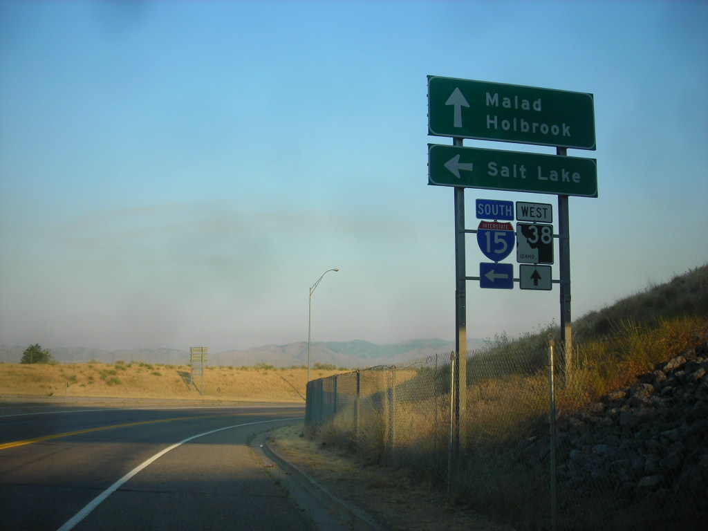
State Highway 38 (SH‑38) is a east–west State highway#United States, state highway in Oneida County, Idaho, Oneida County, Idaho, United States, that connects 2100 West and Old Highway 37 (northwest of Holbrook, Idaho, Holbrook) with Interstate 15 in Idaho, Interstate 15 (I‑15), just east of Malad City, Idaho, Malad City. Route description SH‑38 begins at an intersection with Old Highway 37 (also known as Rockland Highway and North Holbrook Road) and 2100 West (also known as Stone Highway) northwest of Holbrook. From the western terminus of SH‑38 the Old Highway 37, former routing of Idaho State Highway 37, SH-37, continues northwest to the Power County, Idaho, Power County line and the southern terminus of SH‑37. From its western terminus, SH‑38 heads east through a rural area between sections of the Curlew National Grassland. It takes a more crooked route east of Holbrook, intersecting Arbon Valley Road. From there, the SH‑38 enters mountainous terr ... [...More Info...] [...Related Items...] OR: [Wikipedia] [Google] [Baidu] |
Idaho State Highway 36
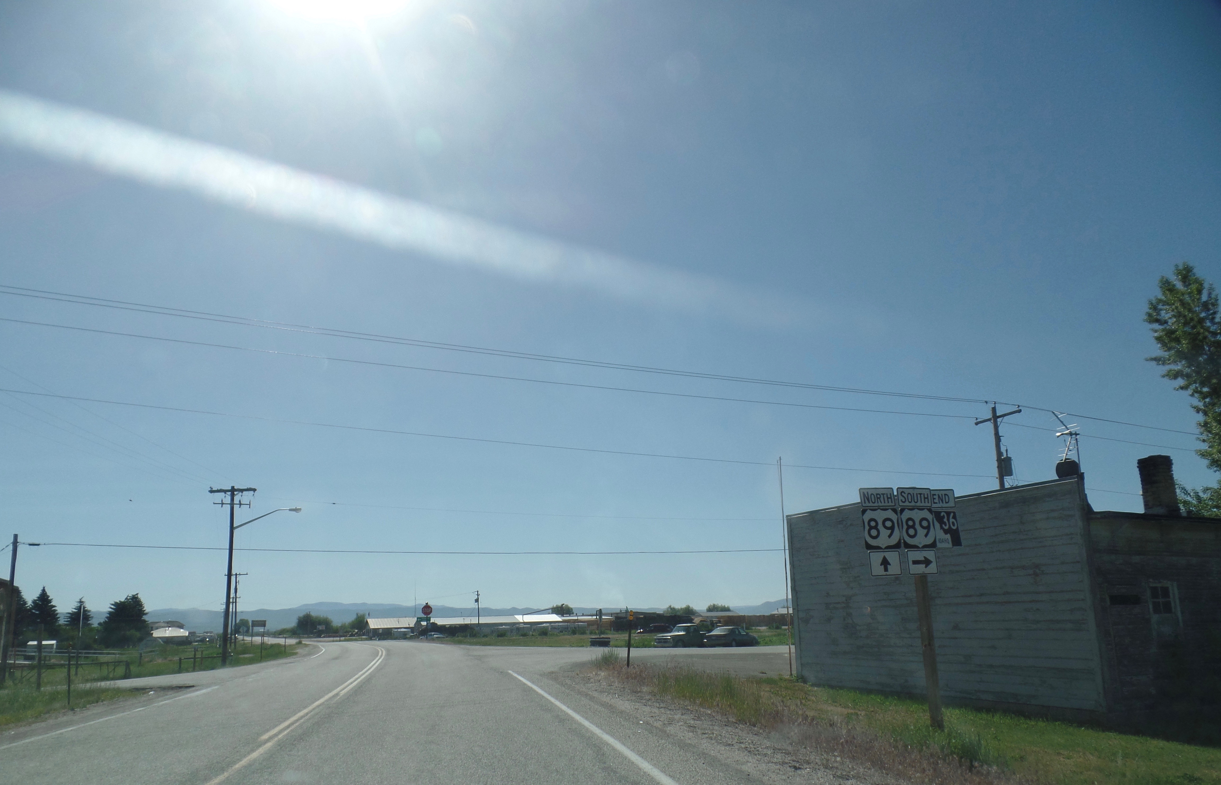
State Highway 36 (SH-36) is a east-west state highway located in the southeast part of the U.S. state of Idaho. SH-36 runs from Interstate 15 (I-15) near Malad City to U.S. Route 89 (US-89) near Montpelier. The highway is maintained by the Idaho Transportation Department. Route description SH-36 begins at a diamond interchange with I-15. As Deep Creek Road, the highway travels east before turning southeast, passing through the forest and just west of Old Baldy Peak before entering the town of Weston. There, SH-36 turns north, entering Dayton before turning east. Crossing the Bear River, the highway continues into the city of Preston, running concurrently with US-91 due north along State Street before turning northeast along a roadway with SH-34. After crossing the Bear River again, SH-36 continues northeast, passing through the community of Mink Creek before passing through fields and forests. SH-36 passes through Liberty before ending in the town of Ovid Publi ... [...More Info...] [...Related Items...] OR: [Wikipedia] [Google] [Baidu] |
Interstate 84 In Idaho
The Dwight D. Eisenhower National System of Interstate and Defense Highways, commonly known as the Interstate Highway System, or the Eisenhower Interstate System, is a network of controlled-access highways that forms part of the National Highway System in the United States. The system extends throughout the contiguous United States and has routes in Hawaii, Alaska, and Puerto Rico. In the 20th century, the United States Congress began funding roadways through the Federal Aid Road Act of 1916, and started an effort to construct a national road grid with the passage of the Federal Aid Highway Act of 1921. In 1926, the United States Numbered Highway System was established, creating the first national road numbering system for cross-country travel. The roads were funded and maintained by U.S. states, and there were few national standards for road design. United States Numbered Highways ranged from two-lane country roads to multi-lane freeways. After Dwight D. Eisenhower ... [...More Info...] [...Related Items...] OR: [Wikipedia] [Google] [Baidu] |
I-84
Interstate 84 may refer to: * Interstate 84 (Oregon–Utah), passing through Idaho, formerly known as Interstate 80N * Interstate 84 (Pennsylvania–Massachusetts), passing through New York and Connecticut {{road disambiguation ... [...More Info...] [...Related Items...] OR: [Wikipedia] [Google] [Baidu] |
Interstate 15 In Idaho
Interstate 15 (I-15) is a part of the Interstate Highway System that runs from San Diego, California, to Sweetgrass, Montana. In Idaho, the Interstate Highway runs exactly from the Utah state line near Woodruff north to the Montana state line at Monida Pass. I-15 is the primary north–south highway of Eastern Idaho. The Interstate Highway connects Pocatello and Idaho Falls, the fourth and fifth largest cities in Idaho, and the smaller county seats of Malad City, Blackfoot, and Dubois. I-15 connects all of those cities with Salt Lake City to the south and Butte to the north. The Interstate has business loops through McCammon, Inkom, Pocatello, Blackfoot, and Idaho Falls. Route description I-15 is designated the Veterans Memorial Highway for its entire length in Idaho. Woodruff to Pocatello I-15 enters Oneida County from Box Elder County, Utah, south of the hamlet of Woodruff. The four-lane freeway heads north parallel to the Union Pacific Railroad's Malad Su ... [...More Info...] [...Related Items...] OR: [Wikipedia] [Google] [Baidu] |
I-15 (I 15) a former Swedish Army infantry regiment
{{Letter-NumberCombDisambig ...
I15 may refer to: * Interstate 15, a north–south Interstate Highway in the United States of America * Polikarpov I-15, a Soviet fighter aircraft * I15 (band), a band * , of the Imperial Japanese Navy * Älvsborg Regiment The Älvsborg Regiment (), designation I 15 and I 15/Fo 34, was a Swedish Army infantry regiment that traces its origins back 1624. It was disbanded in 1998. The regiment's soldiers were originally recruited from the provinces of Västergötland, ... [...More Info...] [...Related Items...] OR: [Wikipedia] [Google] [Baidu] |
Cassia County, Idaho
Cassia County is a county in the U.S. state of Idaho. As of the 2020 Census the county had a population of 24,655. The county seat and largest city is Burley. Cassia County is included in the Burley, ID Micropolitan Statistical Area. History The first Europeans explored the Milner area in Cassia County in 1811. It was trappers who initially developed the Oregon Trail, which ran on the county's northern border. The Raft River's junction with the Oregon Trail marked the split for the California Trail. While the Oregon and California trails brought hundreds of thousands of emigrants through Cassia County, it also brought settlers. A stage line through the county was established between Kelton, Utah and Boise, Idaho in 1869. A stage station existed at City of Rocks. Additional stations were spaced at increments of 10–12 miles between stations to include one at Oakley Meadows, in the Goose Creek valley two miles west of the present settlement of Oakley. William Oakley settled ... [...More Info...] [...Related Items...] OR: [Wikipedia] [Google] [Baidu] |


