|
Old Homestead, Southgate, Michigan
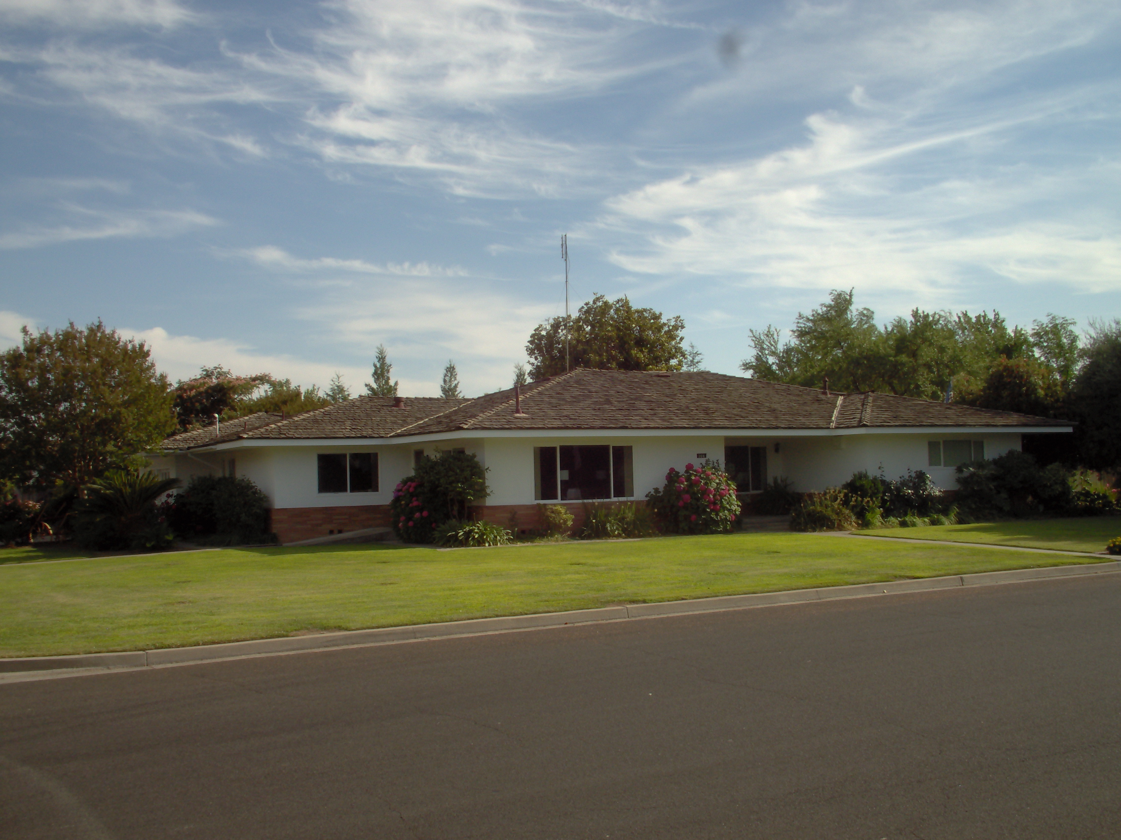
Old Homestead is a neighborhood on the east side of the Metro Detroit suburb of Southgate, Michigan. Usually, Old Homestead is bordered by Superior Street to the north, Eureka Road to the south, M-85 (Fort Street) to the east and either Trenton Road or Burns Street to the west. Commercial districts are located along Eureka Road and Fort Street and the rest of the neighborhood is mostly single-family homes, most of which were built during the 1940s and 1950s. The most common housing styles within Old Homestead consist of one-story ranch homes, one-and-a-half-story Cape Cods and two-story colonial revivals. History Old Homestead was originally platted in 1923 as a subdivision of Ecorse Township, however, for approximately the next two decades, it continued to remain mostly agricultural land. From this original plat, only four of the residential streets-Sycamore, Chestnut, Commonwealth and Superior Streets-retain their original names. In 1958, the remaining areas of Ecorse Township w ... [...More Info...] [...Related Items...] OR: [Wikipedia] [Google] [Baidu] |
Southgate, Michigan
Southgate is a city in Wayne County in the U.S. state of Michigan. The population was 30,047 at the 2020 census. Southgate was incorporated as a city in October 1958, which was one of the last remaining portions of the now-defunct Ecorse Township. It is part of the Downriver collection of communities south of the city of Detroit. History Pierre Michel Campau was the first white settler in Southgate. He moved into the area in 1795, which subsequently became a farming community. Other people from the Detroit area at the Rouge and Detroit Rivers followed him to Southgate. Historically a rural area of Ecorse Township, the areas within present-day Southgate were originally platted with street grids beginning in the 1920s - though most developments did not start until just after World War II. Among the oldest residential areas in the city is the Old Homestead neighborhood, on the east side. There are two accounts of the city's name: Southgate is described in local guides as be ... [...More Info...] [...Related Items...] OR: [Wikipedia] [Google] [Baidu] |
Ranch Home
Ranch (also known as American ranch, California ranch, rambler, or rancher) is a domestic architectural style that originated in the United States. The ranch-style house is noted for its long, close-to-the-ground profile, and wide open layout. The style fused modernist ideas and styles with notions of the American Western period of wide open spaces to create a very informal and casual living style. While the original ranch style was informal and basic in design, ranch-style houses built in the United States (particularly in the Sun Belt region) from around the early 1960s increasingly had more dramatic features such as varying roof lines, cathedral ceilings, sunken living rooms, and extensive landscaping and grounds. First appearing as a residential style in the 1920s, the ranch was extremely popular with the booming post-war middle class of the 1940s to the 1970s. The style is often associated with tract housing built at this time, particularly in the southwest United States, ... [...More Info...] [...Related Items...] OR: [Wikipedia] [Google] [Baidu] |
Populated Places Established In 1923
Population typically refers to the number of people in a single area, whether it be a city or town, region, country, continent, or the world. Governments typically quantify the size of the resident population within their jurisdiction using a census, a process of collecting, analysing, compiling, and publishing data regarding a population. Perspectives of various disciplines Social sciences In sociology and population geography, population refers to a group of human beings with some predefined criterion in common, such as location, race, ethnicity, nationality, or religion. Demography is a social science which entails the statistical study of populations. Ecology In ecology, a population is a group of organisms of the same species who inhabit the same particular geographical area and are capable of interbreeding. The area of a sexual population is the area where inter-breeding is possible between any pair within the area and more probable than cross-breeding with ... [...More Info...] [...Related Items...] OR: [Wikipedia] [Google] [Baidu] |
1923 Establishments In Michigan
Nineteen or 19 may refer to: * 19 (number), the natural number following 18 and preceding 20 * one of the years 19 BC, AD 19, 1919, 2019 Films * ''19'' (film), a 2001 Japanese film * ''Nineteen'' (film), a 1987 science fiction film Music * 19 (band), a Japanese pop music duo Albums * ''19'' (Adele album), 2008 * ''19'', a 2003 album by Alsou * ''19'', a 2006 album by Evan Yo * ''19'', a 2018 album by MHD * ''19'', one half of the double album '' 63/19'' by Kool A.D. * '' Number Nineteen'', a 1971 album by American jazz pianist Mal Waldron * ''XIX'' (EP), a 2019 EP by 1the9 Songs * "19" (song), a 1985 song by British musician Paul Hardcastle. * "Nineteen", a song by Bad4Good from the 1992 album ''Refugee A refugee, conventionally speaking, is a displaced person who has crossed national borders and who cannot or is unwilling to return home due to well-founded fear of persecution. [...More Info...] [...Related Items...] OR: [Wikipedia] [Google] [Baidu] |
Wayne County Community College District
Wayne County Community College District (WCCCD) is a public community college district with its headquarters in Detroit, Michigan. It was founded in 1967 and has six campuses: Eastern, Downtown, Downriver, Northwest, Western, and University Square. Governance The college is governed by a nine-member board of trustees, three seats are elected every two years for six-year terms. Campuses The Downriver Campus is located on in Taylor, Michigan, and was built in 1978. The Northwest Campus, located in northwest Detroit, was for many years located on Greenfield Road just south of Joy Road, less than half a mile from the Dearborn city line. In August 2008, the campus relocated to a new location at 8200 West Outer Drive, just west of the Southfield Freeway, at the former site of Mercy College of Detroit before it merged in 1990 with University of Detroit to become University of Detroit Mercy (UDM) and after the merger the UDM Dental School. The district also has a western campus loc ... [...More Info...] [...Related Items...] OR: [Wikipedia] [Google] [Baidu] |
Trenton, Michigan
Trenton is a city in Wayne County, Michigan, United States. At the 2010 census, the city population was 18,853. A Shawnee village was built in the area by war chief Blue Jacket after the 1795 Treaty of Greenville. The area later became the site of the Battle of Monguagon between Americans and a British-Indian coalition during the War of 1812. The battle is commemorated with a Michigan State Historical Site marker in present-day Elizabeth Park, which was the first county park in Michigan when it was established in 1919. Portions of the Detroit River International Wildlife Refuge are within the southern portion of Trenton. The area was once part of the now-defunct Monguagon Township. Trenton was incorporated as a village in 1855 and again as a city in 1957. The city is part of the Downriver collection of communities south of Detroit on the west bank of the Detroit River. Trenton is known for its waterfront and growing boating community. Major industries include Stellantis-Chr ... [...More Info...] [...Related Items...] OR: [Wikipedia] [Google] [Baidu] |
Downtown Detroit
Downtown Detroit is the central business district and a residential area of the city of Detroit, Michigan, United States. Locally, downtown tends to refer to the 1.4 square mile region bordered by M-10 (Lodge Freeway) to the west, Interstate 75 (I-75, Fisher Freeway) to the north, I-375 (Chrysler Freeway) to the east, and the Detroit River to the south. Although, it may also refer to the Greater Downtown area, a 7.2 square mile region that includes surrounding neighborhoods such as Midtown, Corktown, Rivertown, and Woodbridge. The city's main thoroughfare M-1 (Woodward Avenue) links Downtown to Midtown, New Center, and the North End. Downtown contains much historic architecture, including prominent skyscrapers, ranging from the Renaissance Center, the Penobscot Building, One Detroit Center, and the Guardian Building. Historic churches, theatres, and commercial buildings anchor the various downtown districts. Downtown has a number of parks including those linked by ... [...More Info...] [...Related Items...] OR: [Wikipedia] [Google] [Baidu] |
Southland Center (Michigan)
Southland Center (also known as Southland Mall) is an enclosed mall located at 23000 Eureka Road in Taylor, Michigan (a Downriver community located southwest of Detroit), exactly halfway between U.S. Highway 24 (Telegraph Road) and the Interstate 75 freeway. The anchor stores are Cinemark Theatres, Forever 21, Best Buy, Shoe Carnival, JCPenney, and Macy's. Other major stores include H&M and Ulta Beauty. It is the newest of the Detroit area's four "land" malls (Northland, Southland, Eastland, Westland). Southland Center opened on July 20, 1970. It is owned and managed by Brookfield Properties, one of the largest mall owners in the United States. History Southland Center was designed by Victor Gruen Associates and Louis G. Redstone Associates, and the newly formed Dayton-Hudson Corporation (a merger of Dayton's of Minneapolis and Hudson's of Detroit) developed the mall. When opened in 1970, Southland Mall was originally anchored by a three-level; Hudson's at the center ... [...More Info...] [...Related Items...] OR: [Wikipedia] [Google] [Baidu] |
River Rouge, Michigan
River Rouge (, french: link=no, Rivière Rouge, translation=red river) is a city in Wayne County in the U.S. state of Michigan. The population was 7,224 at the 2020 census. The city is named after the River Rouge, which flows along the city's northern border and into the Detroit River. The city includes the heavily industrialized Zug Island and also has its own school district, River Rouge School District. History The small settlement incorporated as a village in 1899 within Ecorse Township. In 1922 as the city of Detroit expressed interest in annexing land in the township, the Village of River Rouge incorporated as a city on April 3 to avoid being annexed. A month later Detroit completed annexation of land in the township immediately to the west of River Rouge. One of the most important historical associations with River Rouge is its relationship to a Great Lakes freighter, the SS '' Edmund Fitzgerald'', which sank in 1975 in a fierce storm in Lake Superior, with the lo ... [...More Info...] [...Related Items...] OR: [Wikipedia] [Google] [Baidu] |
Detroit Metropolitan Wayne County Airport
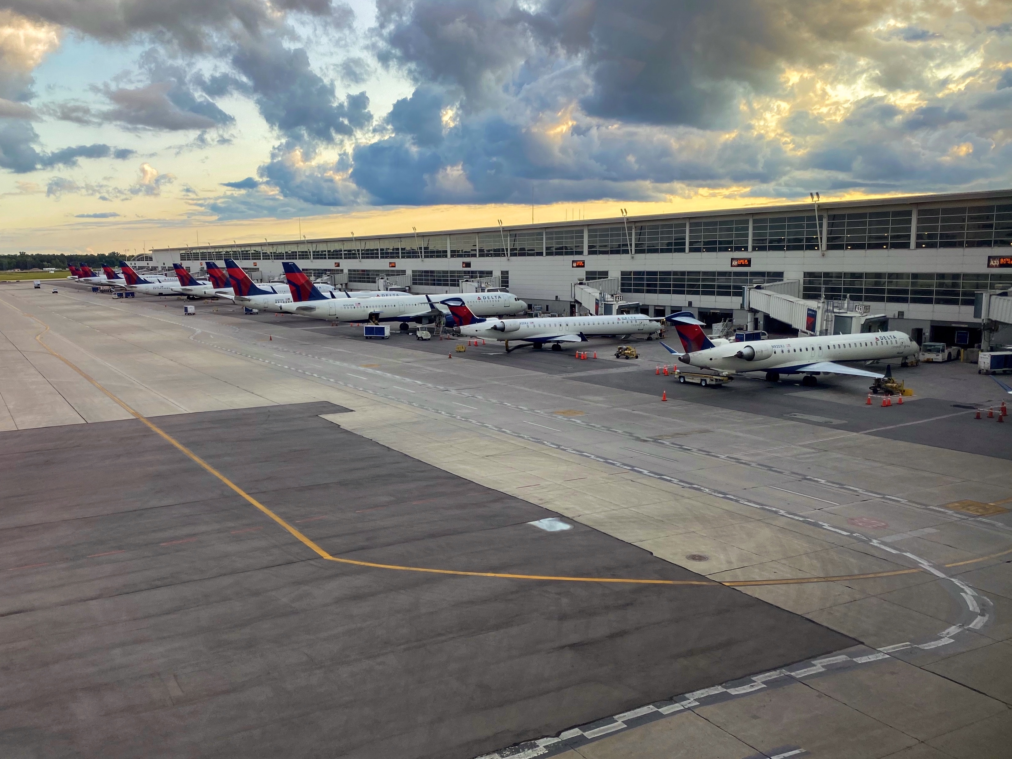
Detroit Metropolitan Wayne County Airport , usually called Detroit Metro Airport, Metro Airport, or simply DTW, is a major international airport in the United States covering effective December 30, 2021. in Romulus, Michigan. It is the primary international airport serving Detroit and is Michigan's busiest airport. The Federal Aviation Administration (FAA) National Plan of Integrated Airport Systems for 2017–2021 categorized it as a large hub primary commercial service facility. The airport is a major hub for Delta Air Lines and is also a base for Spirit Airlines. Detroit serves as Delta's main gateway to Asia for the Eastern United States. The airport has service to 30 international destinations and service to 39 states across the United States. Operated by the Wayne County Airport Authority, the airport has six runways, two terminals, and 129 in-service gates. Detroit Metropolitan Airport has maintenance facilities capable of servicing and repairing aircraft as large as t ... [...More Info...] [...Related Items...] OR: [Wikipedia] [Google] [Baidu] |
Suburban Mobility Authority For Regional Transportation
The Suburban Mobility Authority for Regional Transportation (SMART) is the public transit operator serving the suburbs of Detroit, Michigan, United States. It supplements the Detroit Department of Transportation, which operates buses within the city of Detroit. Beginning operations in 1967 as the Southeastern Michigan Transportation Authority (SEMTA), the agency was reorganized and renamed SMART in 1989. SMART operates 47 bus routes, plus paratransit and microtransit services, covering select communities in Wayne and Oakland counties, plus all of Macomb County. As of 2008, SMART has the third-highest ridership of Michigan's transit systems, surpassed by Lansing's Capital Area Transportation Authority and the Detroit Department of Transportation. History 1967-1989: SEMTA The Michigan Legislature passed the Metropolitan Transportation Authorities Act of 1967, which included the creation of Southeastern Michigan Transportation Authority (SEMTA). SEMTA was charged to take ... [...More Info...] [...Related Items...] OR: [Wikipedia] [Google] [Baidu] |
Wyandotte, Michigan
Wyandotte ( ) is a city in Wayne County in the U.S. state of Michigan. The population was 25,058 at the 2020 census. Wyandotte is located in southeastern Michigan, approximately south of Detroit on the Detroit River, and it is part of the collection of communities known as Downriver. Wyandotte is bounded by Southgate to the west, Lincoln Park to the northwest, Riverview to the south, Grosse Ile Township to the southeast, Ecorse to the north, and LaSalle, Ontario on the east. Wyandotte is a sister city to Komaki, Japan, and each year delegates from Komaki come to Wyandotte to tour the city. History The site where Wyandotte sits today in the 18th century was a small village called by the native Indians "Maquaqua" and by the local French "Monguagon". This Native American tribe was known as the Wyandot or Wendat, and were part of the Huron nation originally from the Georgian Bay area of Canada. Except for the intervening colonial war activities, when the Wyandots were ... [...More Info...] [...Related Items...] OR: [Wikipedia] [Google] [Baidu] |


.jpg)