|
Ogden, West Yorkshire
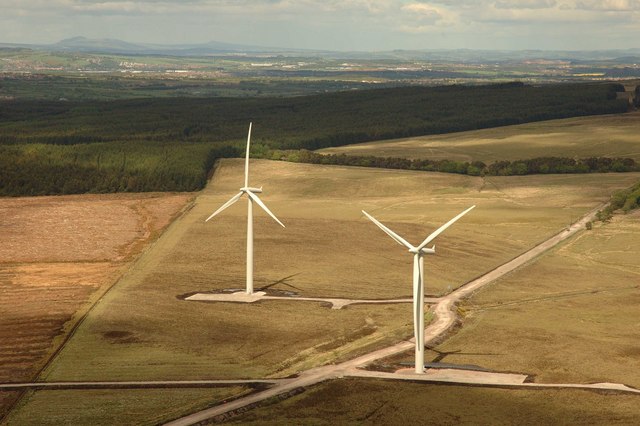
Ogden in West Yorkshire, England, is a small hamlet north of Halifax. The hamlet falls within the Calderdale Ward of Illingworth and Mixenden. Its most recognisable landmarks are Ovenden Moor wind farm, which can be seen from as far as away on a clear day; a golf course, which offers views of the surrounding moorland; and Ogden reservoir, around which are footpaths for visitors to walk and view the local wildlife. See also *Wind power in the United Kingdom The United Kingdom is the best location for wind power in Europe and one of the best in the world. The combination of long coastline, shallow water and strong winds make offshore wind unusually effective. By 2023, the UK had over 11 thousand ... References External links Geography of Calderdale Villages in West Yorkshire Wind farms in England {{UK-powerstation-stub ... [...More Info...] [...Related Items...] OR: [Wikipedia] [Google] [Baidu] |
Calderdale
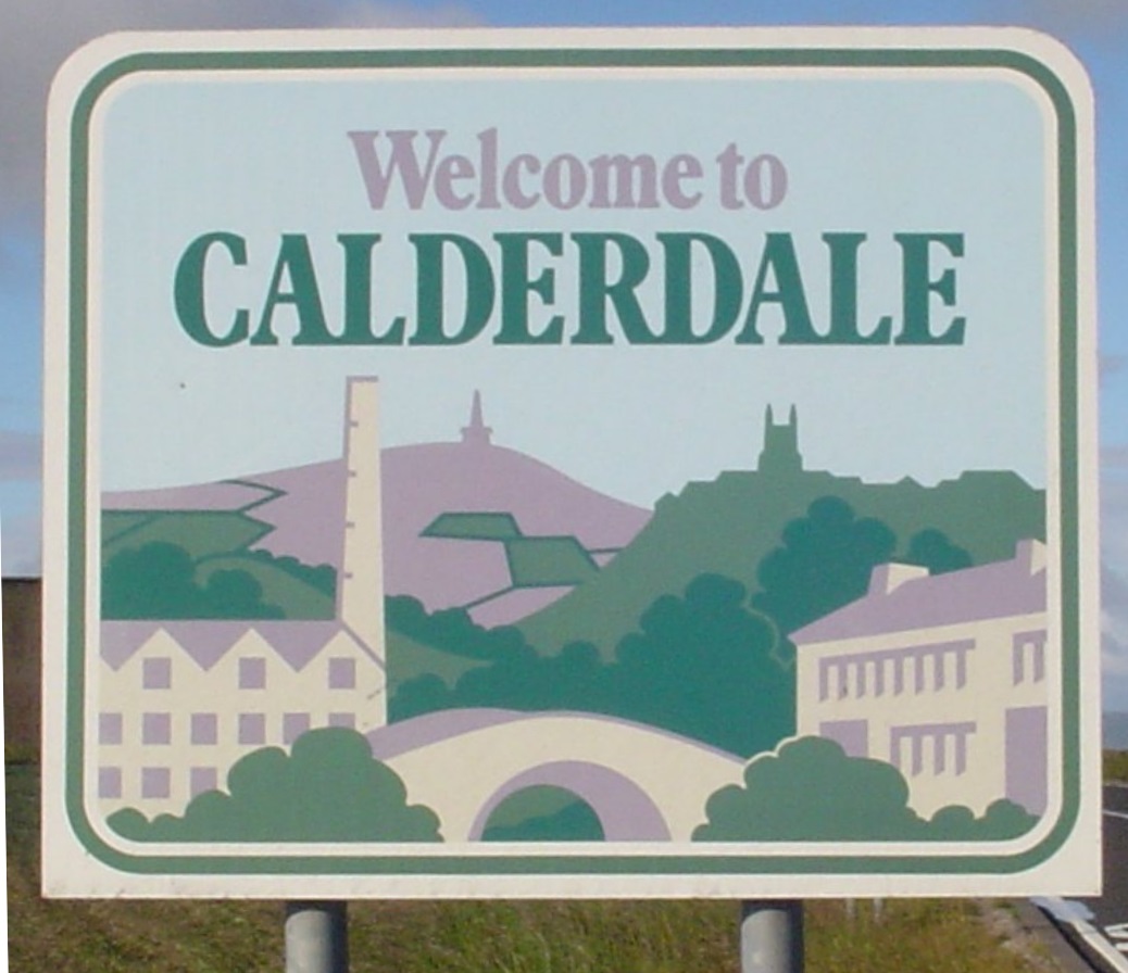
Calderdale () is a metropolitan borough of West Yorkshire, England, which had a population of 211,439. It takes its name from the River Calder, and dale, a word for valley. The name Calderdale usually refers to the borough through which the upper river flows, while the actual landform is known as the Calder Valley. Several small valleys contain tributaries of the River Calder. The main towns of the borough are Brighouse, Elland, Halifax, Hebden Bridge, Sowerby Bridge and Todmorden. Calderdale covers part of the South Pennines, and the Calder Valley is the southernmost of the Yorkshire Dales, though it is not part of the Yorkshire Dales National Park. The borough was formed in 1974 by the merger of nine local government districts. Halifax is the commercial, cultural and administrative centre of the borough. Calderdale is served by Calderdale Council, which is headquartered in Halifax, with some functions based in Todmorden. History The Roman settlement of Cambo ... [...More Info...] [...Related Items...] OR: [Wikipedia] [Google] [Baidu] |
West Yorkshire
West Yorkshire is a Metropolitan counties of England, metropolitan and Ceremonial counties of England, ceremonial county in the Yorkshire and the Humber region of England. It borders North Yorkshire to the north and east, South Yorkshire and Derbyshire to the south, Greater Manchester to the south-west, and Lancashire to the west. The city of Leeds is the largest settlement. The county has an area of and a population of 2.3 million, making it the fourth-largest ceremonial county by population. The centre of the county is urbanised, and contains the city of Leeds in the north-east, the city of Bradford in the north-west, Huddersfield in the south-west, and Wakefield in the south-east. The outer areas of the county are rural. For local government purposes the county comprises five metropolitan boroughs: City of Bradford, Bradford, Calderdale, Kirklees, City of Leeds, Leeds, and City of Wakefield, Wakefield, which collaborate through West Yorkshire Combined Authority. The cou ... [...More Info...] [...Related Items...] OR: [Wikipedia] [Google] [Baidu] |
Hamlet (place)
A hamlet is a human settlement that is smaller than a town or village. This is often simply an informal description of a smaller settlement or possibly a subdivision or satellite entity to a larger settlement. Sometimes a hamlet is defined for official or Administrative division, administrative purposes. The word and concept of a hamlet can be traced back to Anglo-Normans, Norman England, where the Old French came to apply to small human settlements. Etymology The word comes from Anglo-Norman language, Anglo-Norman ', corresponding to Old French ', the diminutive of Old French ' meaning a little village. This, in turn, is a diminutive of Old French ', possibly borrowed from (West Germanic languages, West Germanic) Franconian languages. It is related to the modern French ', Dutch language, Dutch ', Frisian languages, Frisian ', German ', Old English ', and Modern English ''home''. By country Afghanistan In Afghanistan, the counterpart of the hamlet is the Qila, qala ... [...More Info...] [...Related Items...] OR: [Wikipedia] [Google] [Baidu] |
Halifax, West Yorkshire
Halifax is a town in the Metropolitan Borough of Calderdale, in West Yorkshire, England. It is in the eastern foothills of the Pennines. In the 15th century, the town became an economic hub of the old West Riding of Yorkshire, primarily in woollen manufacture with the large Piece Hall square later built for trading wool in the town centre. The town was a thriving mill town during the Industrial Revolution with the Dean Clough Mill buildings a surviving landmark. In 2021, it had a population of 88,109. It is also the administrative centre of the wider Calderdale Metropolitan Borough. Toponymy The town's name was recorded in about 1091 as ''Halyfax'', most likely from the Old English ''halh-gefeaxe'', meaning "area of coarse grass in the of land". This explanation is generally preferred to derivations from the Old English ' (holy), in ''hālig feax'' or "holy hair", proposed by 16th-century antiquarians. The probably-incorrect interpretation gave rise to two legends. One concern ... [...More Info...] [...Related Items...] OR: [Wikipedia] [Google] [Baidu] |
Ovenden Moor Wind Farm
Ovenden Moor Wind Farm is a wind powered electricity generating site in England. Ovenden Moor is located north of Halifax and west of Bradford in West Yorkshire. The site was opened in 1993 with 23 turbines, but these were later removed in favour of larger turbines but with 14 fewer towers. This updated the output of the site from 9.2 MW to 22.5 MW with an expected generation lifetime of 25 years. As the turbines can be seen from some distance and the fact that they overlook the Brontë Country to the north, they have the subject of continued criticism and objections. Geology This moorland area of the South Pennines is mostly overlaid with peat and underlaid with sandstone that is 310 million years old. The area in and around Ovenden Moor was quarried for the Rough Rock Flagstone that was used for buildings in the Halifax area. There are also bands of mudstone and coal, with coal being worked historically in the area (east of Ovenden Moor) even though the seams w ... [...More Info...] [...Related Items...] OR: [Wikipedia] [Google] [Baidu] |
Golf Course
A golf course is the grounds on which the sport of golf is played. It consists of a series of holes, each consisting of a teeing ground, tee box, a #Fairway and rough, fairway, the #Fairway and rough, rough and other hazard (golf), hazards, and a green with a cylindrical hole in the ground, known as a "cup". The cup holds a flagstick, known as a "pin". A standard round of golf consists of 18 holes, and as such most courses contain 18 distinct holes; however, there are many 9-hole courses and some that have holes with shared fairways or greens. There are also courses with a non-standard number of holes, such as 12 or 14. The vast majority of golf courses have holes of varying length and difficulties that are assigned a standard score, known as Par (score), par, that a proficient player should be able to achieve; this is usually three, four or five strokes. Par-3 courses consist of holes all of which have a par of three. Short courses have gained in popularity; these consist of mo ... [...More Info...] [...Related Items...] OR: [Wikipedia] [Google] [Baidu] |
Moorland
Moorland or moor is a type of Habitat (ecology), habitat found in upland (geology), upland areas in temperate grasslands, savannas, and shrublands and the biomes of montane grasslands and shrublands, characterised by low-growing vegetation on Soil pH, acidic soils. Moorland today generally means uncultivated hill land (such as Dartmoor in South West England), but also includes low-lying wetlands (such as Sedgemoor, also South West England). It is closely related to heath, although experts disagree on the exact distinction between these types of vegetation. Generally, moor refers to Highland (geography), highland and high rainfall areas, while heath refers to lowland zones which are more likely to be the result of human activity. Moorland habitats are found mainly in Tropics, tropical Africa, Northern Europe, northern and western Europe, and South America. Most of the world's moorlands are diverse ecosystems. In the extensive moorlands of the tropics, biodiversity can be extremely ... [...More Info...] [...Related Items...] OR: [Wikipedia] [Google] [Baidu] |
Wind Power In The United Kingdom
The United Kingdom is the best location for wind power in Europe and one of the best in the world. The combination of long coastline, shallow water and strong winds make offshore wind unusually effective. By 2023, the UK had over 11 thousand wind turbines with a total installed capacity of 30gigawatts (GW): 16 GW onshore and 15 GW offshore, the fifth largest capacity of any country. Wind power is the largest source of renewable energy in the UK, but at under 5% still far less primary energy than oil or fossil gas. However, wind power generates electricity which is far more powerful in terms of useful energy than the same amount of thermal primary energy. Wind generates more than a quarter of UK electricity, and as of May 2024 generates more than gas over a whole year. Polling of public opinion consistently shows strong support for wind power in the UK, with nearly three-quarters of the population agreeing with its use, even for people living near onshore wind turbines. ... [...More Info...] [...Related Items...] OR: [Wikipedia] [Google] [Baidu] |
Geography Of Calderdale
Geography (from Ancient Greek ; combining 'Earth' and 'write', literally 'Earth writing') is the study of the lands, features, inhabitants, and phenomena of Earth. Geography is an all-encompassing discipline that seeks an understanding of Earth and its human and natural complexities—not merely where objects are, but also how they have changed and come to be. While geography is specific to Earth, many concepts can be applied more broadly to other celestial bodies in the field of planetary science. Geography has been called "a bridge between natural science and social science disciplines." Origins of many of the concepts in geography can be traced to Greek Eratosthenes of Cyrene, who may have coined the term "geographia" (). The first recorded use of the word γεωγραφία was as the title of a book by Greek scholar Claudius Ptolemy (100 – 170 AD). This work created the so-called "Ptolemaic tradition" of geography, which included "Ptolemaic cartographic theory." ... [...More Info...] [...Related Items...] OR: [Wikipedia] [Google] [Baidu] |
Villages In West Yorkshire
A village is a human settlement or community, larger than a hamlet but smaller than a town with a population typically ranging from a few hundred to a few thousand. Although villages are often located in rural areas, the term urban village is also applied to certain urban neighborhoods. Villages are normally permanent, with fixed dwellings; however, transient villages can occur. Further, the dwellings of a village are fairly close to one another, not scattered broadly over the landscape, as a dispersed settlement. In the past, villages were a usual form of community for societies that practice subsistence agriculture and also for some non-agricultural societies. In Great Britain, a hamlet earned the right to be called a village when it built a church.-4; we might wonder whether there's a point at which it's appropriate to talk of the beginnings of French, that is, when it wa ... ''village'', from Latin ''villāticus'', ultimately from Latin ''villa'' (English ''villa''). Ce ... [...More Info...] [...Related Items...] OR: [Wikipedia] [Google] [Baidu] |


