|
Nsi Kwilu
Nsi Kwilu is a modern Kikongo respelling of "''Essiquilu''" the term used by the Italian Capuchin missionary Girolamo da Montesarchio in 1650 for the territory along the Kwilu River near Matadi in the modern-day Democratic Republic of Congo. Jean Cuvelier determined this spelling, which means, in Kikongo, "the country of Kwilu". According to Montesarchio, it was in Nsi Kwilu that the first kings of Kongo reigned before they became the rulers of a great kingdom that controlled the northern part of modern-day Angola , national_anthem = " Angola Avante"() , image_map = , map_caption = , capital = Luanda , religion = , religion_year = 2020 , religion_ref = , coordina ... in the fifteenth century. Geography of the Democratic Republic of the Congo Regions of Africa places {{DRCongo-geo-stub ... [...More Info...] [...Related Items...] OR: [Wikipedia] [Google] [Baidu] |
Kikongo
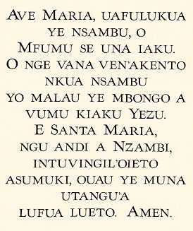
Kongo or Kikongo is one of the Bantu languages spoken by the Kongo people living in the Democratic Republic of the Congo, the Republic of the Congo, Gabon and Angola. It is a tonal language. It was spoken by many of those who were taken from the region and sold as slaves in the Americas. For this reason, while Kongo still is spoken in the above-mentioned countries, creolized forms of the language are found in ritual speech of Afro-American religions, especially in Brazil, Cuba, Puerto Rico, the Dominican Republic and Haiti. It is also one of the sources of the Gullah language and the Palenquero creole in Colombia. The vast majority of present-day speakers live in Africa. There are roughly seven million native speakers of Kongo, with perhaps two million more who use it as a second language. Geographic distribution Kongo was the language of the Kingdom of Kongo prior to the creation of Angola by the Portuguese Crown in 1575 and the Berlin Conference (1884-1885) that balkanized the ... [...More Info...] [...Related Items...] OR: [Wikipedia] [Google] [Baidu] |
Order Of Friars Minor Capuchin
The Order of Friars Minor Capuchin (; postnominal abbr. O.F.M. Cap.) is a religious order of Franciscan friars within the Catholic Church, one of Three " First Orders" that reformed from the Franciscan Friars Minor Observant (OFM Obs., now OFM), the other being the Conventuals (OFM Conv.). Franciscans reformed as Capuchins in 1525 with the purpose of regaining the original Habit (Tunic) of St. Francis of Assisi and also for returning to a stricter observance of the rule established by Francis of Assisi in 1209. History Origins The Order arose in 1525 when Matteo da Bascio, an Observant Franciscan friar native to the Italian region of Marche, said he had been inspired by God with the idea that the manner of life led by the friars of his day was not the one which their founder, St. Francis of Assisi, had envisaged. He sought to return to the primitive way of life of solitude and penance, as practised by the founder of their Order. His religious superiors tried to suppress ... [...More Info...] [...Related Items...] OR: [Wikipedia] [Google] [Baidu] |
Missionary
A missionary is a member of a Religious denomination, religious group which is sent into an area in order to promote its faith or provide services to people, such as education, literacy, social justice, health care, and economic development.Thomas Hale 'On Being a Missionary' 2003, William Carey Library Pub, . In the Bible translations into Latin, Latin translation of the Bible, Jesus, Jesus Christ says the word when he sends the disciples into areas and commands them to preach the gospel in his name. The term is most commonly used in reference to Christian missions, but it can also be used in reference to any creed or ideology. The word ''mission'' originated in 1598 when Jesuits, the members of the Society of Jesus sent members abroad, derived from the Latin (nominative case, nom. ), meaning 'act of sending' or , meaning 'to send'. By religion Buddhist missions The first Buddhist missionaries were called "Dharma Bhanaks", and some see a missionary charge in the symbolis ... [...More Info...] [...Related Items...] OR: [Wikipedia] [Google] [Baidu] |
Girolamo Da Montesarchio
The Italian Capuchin Girolamo da Montesarchio spent twenty years in the mid-17th century in the Kingdom of Kongo in West Africa. His manuscript account, ''Viaggio al Congho'', provides modern historians a rich source of information on the region's history and society. The manuscript, preserved in the Archivio Provinciale dei Cappucini di Provincia di Toscana, Montughi Convent, Florence, was first edited and published in 1976.Montescarchio, Calogero Piazza, ed. ''La Prefettura Apostolica del Congo alla' Meta del XVII secolo: la relazione inedita di Girolamo da Montesarchio'', noted in John Kelly Thornton, 1998. ''Africa and Africans in the making of the Atlantic world, 1400-1800'' p 79 note 22. Montesarchio's account supplements the material in Giovanni Cavazzi da Montecuccolo's ''Istorica descrizione'', printed in 1687. Largo Girolamo da Montesarchio in Rome , established_title = Founded , established_date = 753 BC , founder = King Romulus (legendary) ... [...More Info...] [...Related Items...] OR: [Wikipedia] [Google] [Baidu] |
Kwilu River (Congo Tributary)
The Kwilu River is a major river in the Kwilu Province formerly known as Bandundu province in the Democratic Republic of the Congo (DRC) to the city of Bandundu, where it joins the Kwango River just before this stream enters the Kasai River. In the DRC the river flows past the towns of Gungu, Kikwit, Bulungu, Bagata, Rutherfordia and Bandundu. Lusanga, formerly Leverville, lies at the location where the Kwenge River joins the Kwilu, between Kikwit and Bulungu. Characteristics It is a meandering river. Near its mouth it is 950 meter wide. The bed material is sand. The river is about long. In the wet season the flooded area covers . The headwaters of the river rise at elevations between and in the Angolan highlands. They drop steeply to the flat central Congo Basin The Congo Basin (french: Bassin du Congo) is the sedimentary basin of the Congo River. The Congo Basin is located in Central Africa, in a region known as west equatorial Africa. The Congo Basin region is someti ... [...More Info...] [...Related Items...] OR: [Wikipedia] [Google] [Baidu] |
Matadi
Matadi is the chief sea port of the Democratic Republic of the Congo and the capital of the Kongo Central province, adjacent to the border with Angola. It had a population of 245,862 (2004). Matadi is situated on the left bank of the Congo River, from the mouth and below the last navigable point before the rapids that make the river impassable for a long stretch upriver. It was founded by Sir Henry Morton Stanley in 1879. History Matadi was founded by Sir Henry Morton Stanley in 1879. It was strategically important because it was the last navigable port going upstream on the Congo River; it became the furthest inland port in the Congo Free State. The construction of the Matadi–Kinshasa Railway (built between 1890 and 1898) made it possible to transport goods from deeper within Congo's interior to the port of Matadi, stimulating the city to become an important trading center. Portuguese and French West-African commercial interests influenced the city's architecture and urban des ... [...More Info...] [...Related Items...] OR: [Wikipedia] [Google] [Baidu] |
Democratic Republic Of Congo
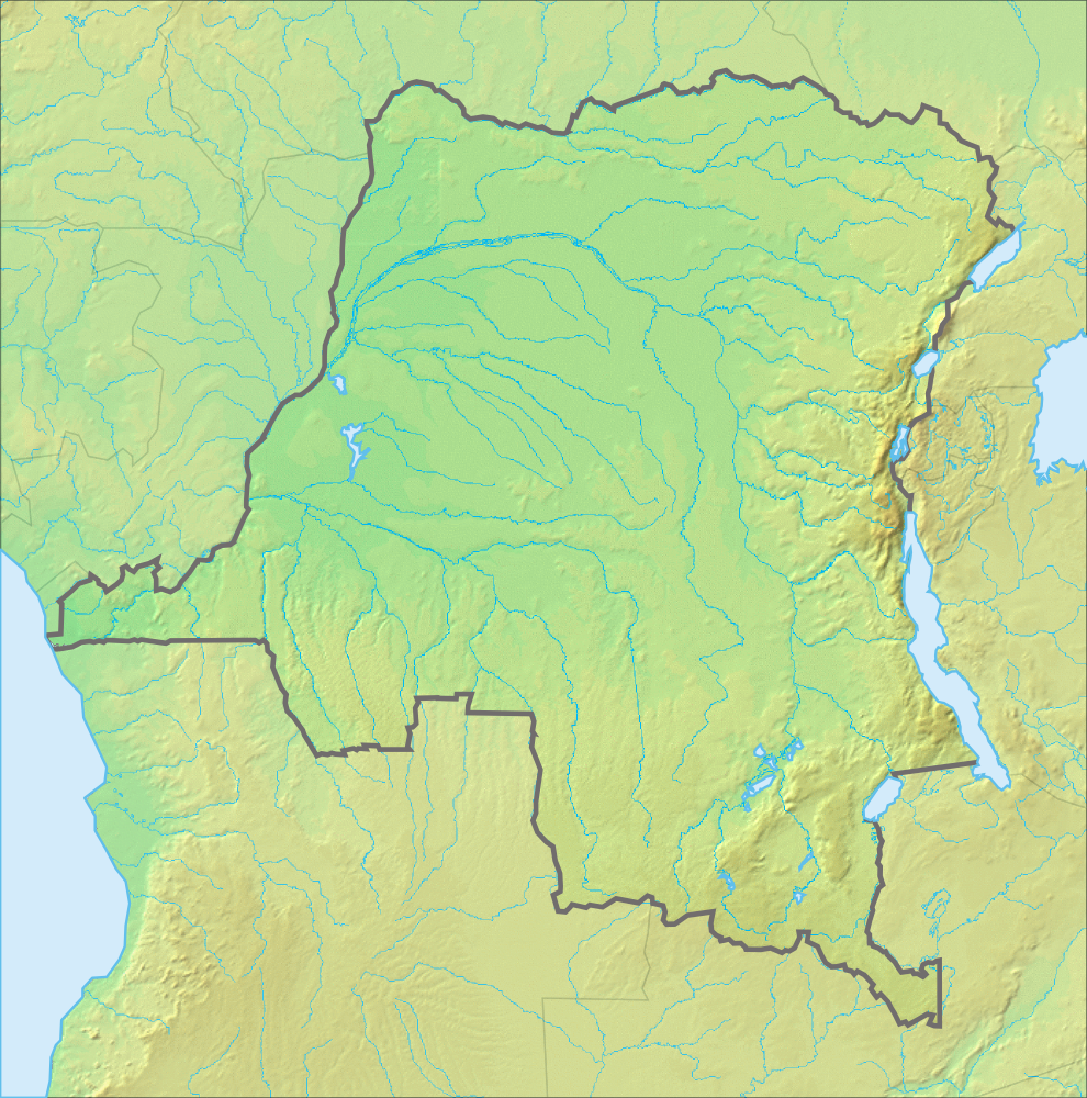
The Democratic Republic of the Congo (french: République démocratique du Congo (RDC), colloquially "La RDC" ), informally Congo-Kinshasa, DR Congo, the DRC, the DROC, or the Congo, and formerly and also colloquially Zaire, is a country in Central Africa. It is bordered to the northwest by the Republic of the Congo, to the north by the Central African Republic, to the northeast by South Sudan, to the east by Uganda, Rwanda, and Burundi, and by Tanzania (across Lake Tanganyika), to the south and southeast by Zambia, to the southwest by Angola, and to the west by the South Atlantic Ocean and the Cabinda exclave of Angola. By area, it is the second-largest country in Africa and the 11th-largest in the world. With a population of around 108 million, the Democratic Republic of the Congo is the most populous officially Francophone country in the world. The national capital and largest city is Kinshasa, which is also the nation's economic center. Centered on the Congo Ba ... [...More Info...] [...Related Items...] OR: [Wikipedia] [Google] [Baidu] |
Jean Cuvelier
Jean Cuvelier (1882–1962) was a Belgian Redemptorist missionary and bishop of Matadi in Belgian Congo from 1930 until his death in 1962. Cuvelier was notable for his interest in the history of the Kingdom of Kongo, which he saw as a route to evangelization in his time. By stressing the Christian nature of the old kingdom, he hoped to increase the attachment of Kongo parishioners to the Catholic Church as opposed to Protestantism or traditional religions. Cuvelier started the Kikongo language missionary newspaper '' Kukiele'' in 1928 with a mixture of missionary news, cultural articles and especially historical accounts of the old kingdom. In his articles, which initially bore the title "Lusansu" Cuvelier began writing a history of Kongo using oral traditions that he collected combined with increasingly detailed historical documentation. His inspiration came from reading a manuscript written in 1913 by two catechists, Mpetelo Boka, and Lievan Sakala Mboku, for Cuvelier's manu ... [...More Info...] [...Related Items...] OR: [Wikipedia] [Google] [Baidu] |
Kingdom Of Kongo
The Kingdom of Kongo ( kg, Kongo dya Ntotila or ''Wene wa Kongo;'' pt, Reino do Congo) was a kingdom located in central Africa in present-day northern Angola, the western portion of the Democratic Republic of the Congo, and the Republic of the Congo. At its greatest extent it reached from the Atlantic Ocean in the west to the Kwango River in the east, and from the Congo River in the north to the Kwanza River in the south. The kingdom consisted of several core provinces ruled by the ''Manikongo'', the Portuguese version of the Kongo title ''Mwene Kongo'', meaning "lord or ruler of the Kongo kingdom", but its sphere of influence extended to neighbouring kingdoms, such as Ngoyo, Kakongo, Loango, Ndongo and Matamba, the latter two located in what is Angola today. From c. 1390 to 1862 it was an independent state. From 1862 to 1914 it functioned intermittently as a vassal state of the Kingdom of Portugal. In 1914, following the Portuguese suppression of a Kongo revolt, Portugal abol ... [...More Info...] [...Related Items...] OR: [Wikipedia] [Google] [Baidu] |
Angola
, national_anthem = " Angola Avante"() , image_map = , map_caption = , capital = Luanda , religion = , religion_year = 2020 , religion_ref = , coordinates = , largest_city = capital , official_languages = Portuguese , languages2_type = National languages , languages2 = , ethnic_groups = , ethnic_groups_ref = , ethnic_groups_year = 2000 , demonym = , government_type = Unitary dominant-party presidential republic , leader_title1 = President , leader_name1 = João Lourenço , leader_title2 = Vice President , leader_name2 = Esperança da CostaInvestidura do Pr ... [...More Info...] [...Related Items...] OR: [Wikipedia] [Google] [Baidu] |
Geography Of The Democratic Republic Of The Congo
The Democratic Republic of the Congo (DRC) is the largest country of sub-Saharan Africa, occupying some . Most of the country lies within the vast hollow of the Congo River basin. The vast, low-lying central area is a plateau-shaped basin sloping toward the west, covered by tropical rainforest and criss-crossed by rivers. The forest center is surrounded by mountainous terraces in the west, plateaus merging into savannas in the south and southwest. Dense grasslands extend beyond the Congo River in the north. High mountains of the Ruwenzori Range (some above ) are found on the eastern borders with Rwanda and Uganda (see Albertine Rift montane forests for a description of this area). Geographic regions Several major geographic regions may be defined in terms of terrain and patterns of natural vegetation, namely the central Congo Basin, the uplands north and south of the basin, and the eastern highlands. The country's core region is the central Congo Basin. Having an average elevat ... [...More Info...] [...Related Items...] OR: [Wikipedia] [Google] [Baidu] |
Regions Of Africa
The continent of Africa is commonly divided into five regions or subregions, four of which are in sub-Saharan Africa. List of subregions in Africa The five UN subregions: * Northern Africa * Sub-Saharan Africa ** Eastern Africa ** Middle Africa ** Southern Africa ** Western Africa Directional approach One common approach categorizes Africa directionally, e.g., by cardinal direction (compass direction): *North Africa lies north of the Sahara and runs along the Mediterranean coast. *Northwest Africa *West Africa is the portion roughly west of 10° east longitude, excluding Northern Africa and the Maghreb. West Africa contains large portions of the Sahara Desert and the Adamawa Mountains. *Northeast Africa *East Africa stretches from the Red Sea and the Horn of Africa to Mozambique, including Madagascar *Southeast Africa *Central Africa is the large mass at the center of Africa which either does not fall squarely into any other region or only partially does so. *Southern ... [...More Info...] [...Related Items...] OR: [Wikipedia] [Google] [Baidu] |


