|
National Register Of Historic Places Listings In Northern Boston
__NOTOC__ Boston, Massachusetts is home to many listings on the National Register of Historic Places. This list encompasses those locations that are located north of the Massachusetts Turnpike. See National Register of Historic Places listings in southern Boston for listings south of the Turnpike. Properties and districts located elsewhere in Suffolk County's other three municipalities are also listed separately. There are 341 properties and districts listed on the National Register in Suffolk County, including 58 National Historic Landmarks. The northern part of the city of Boston is the location of 148 of these properties and districts, including 44 National Historic Landmarks. Current listings Former listing See also * List of National Historic Landmarks in Massachusetts * National Register of Historic Places listings in ... [...More Info...] [...Related Items...] OR: [Wikipedia] [Google] [Baidu] |
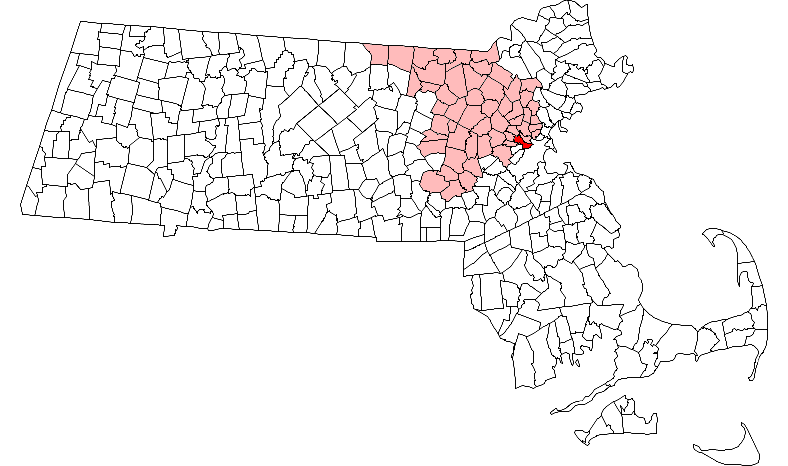
Boston Ma Highlight
Boston (), officially the City of Boston, is the capital city, state capital and List of municipalities in Massachusetts, most populous city of the Commonwealth (U.S. state), Commonwealth of Massachusetts, as well as the cultural and financial center of the New England region of the United States. It is the 24th-List of United States cities by population, most populous city in the country. The city boundaries encompass an area of about and a population of 675,647 2020 U.S. Census, as of 2020. It is the seat of Suffolk County, Massachusetts, Suffolk County (although the county government was disbanded on July 1, 1999). The city is the economic and cultural anchor of a substantially larger metropolitan area known as Greater Boston, a metropolitan statistical area (MSA) home to a census-estimated 4.8 million people in 2016 and ranking as the tenth-largest MSA in the country. A broader combined statistical area (CSA), generally corresponding to the commuting area and includ ... [...More Info...] [...Related Items...] OR: [Wikipedia] [Google] [Baidu] |
Bay Village, Boston
Bay Village is the smallest officially recognized neighborhood of Boston, Massachusetts. , its population was approximately 1,312 residents living in 837 housing units, most of which are small brick rowhouses. Description The Massachusetts Turnpike is the southern boundary of the neighborhood, which coincides with the right-of-way of the former Boston and Worcester Railroad, laid down in the 1830s. Marginal Road and Cortes Street are the surface roads that parallel "the Pike". Across the Pike to the southwest lies the South End neighborhood; to the southeast of the Pike and Tremont Street is the southern edge of Chinatown. To the west of Berkeley Street and north of Columbus Avenue (west of Arlington Street) is the Back Bay neighborhood. To the north of Stuart Street is Park Square, and to the east of Charles Street is the Washington Street Theatre District. In 1983, the area bounded by Cortes Street, Tremont Street, Piedmont Street, and Isabella Street was designated ... [...More Info...] [...Related Items...] OR: [Wikipedia] [Google] [Baidu] |
National Register Of Historic Places Listings In Newton, Massachusetts
__NOTOC__ The following properties in Newton, Massachusetts are listed on the National Register of Historic Places. They are a subset of all properties in Middlesex County. There are over 180 places listed in Newton. The 13 villages are: * Auburndale * Chestnut Hill * Newton Centre (spelled ''Newton Center'' by the MBTA, but not by the city) *Newton Corner *Newton Highlands *Newton Lower Falls * Newton Upper Falls * Newtonville *Nonantum * Oak Hill * Thompsonville *Waban * West Newton Current listings Notes on Zip Codes used *Most villages have their own Zip Codes, but some do not. To further add to the confusion, the Zip Codes do not always coincide with the village boundaries which are "unofficial" according to the city. Most residents, though, seem to know exactly where the village l ... [...More Info...] [...Related Items...] OR: [Wikipedia] [Google] [Baidu] |
National Register Of Historic Places Listings In Cambridge, Massachusetts
This is a list of sites listed on the National Register of Historic Places in Cambridge, Massachusetts. This is intended to be a complete list of the properties and districts on the National Register of Historic Places in Cambridge, Massachusetts, United States. Latitude and longitude coordinates are provided for many National Register properties and districts; these locations may be seen together in an online map. There are 206 properties and districts listed on the National Register in Cambridge, including 18 National Historic Landmarks. Current listings Former listing See also * Blue plaque *List of National Historic Landmarks in Massachusetts *National Register of Historic Places listings in Massachusetts * National Register of Historic Places listings in Midd ... [...More Info...] [...Related Items...] OR: [Wikipedia] [Google] [Baidu] |
Brighton, Massachusetts
Brighton is a former town and current neighborhood of Boston, Massachusetts, United States, located in the northwestern corner of the city. It is named after the English city of Brighton. Initially Brighton was part of Cambridge, and known as "Little Cambridge". Brighton separated from Cambridge in 1807 after a bridge dispute, and was annexed to Boston in 1874. For much of its early history, it was a rural town with a significant commercial center at its eastern end. The neighborhood of Allston was also formerly part of the town of Brighton, but is now often considered to be separate, leading to the name Allston–Brighton for the combined area. This historic center of Brighton is the Brighton Center Historic District. The Aberdeen section of Brighton was designated as a local architectural conservation district by the Boston Landmarks Commission in 2001. History In 1630, land comprising present-day Allston–Brighton and Newton was assigned to Watertown. In 1634, the Mas ... [...More Info...] [...Related Items...] OR: [Wikipedia] [Google] [Baidu] |
Allston, Massachusetts
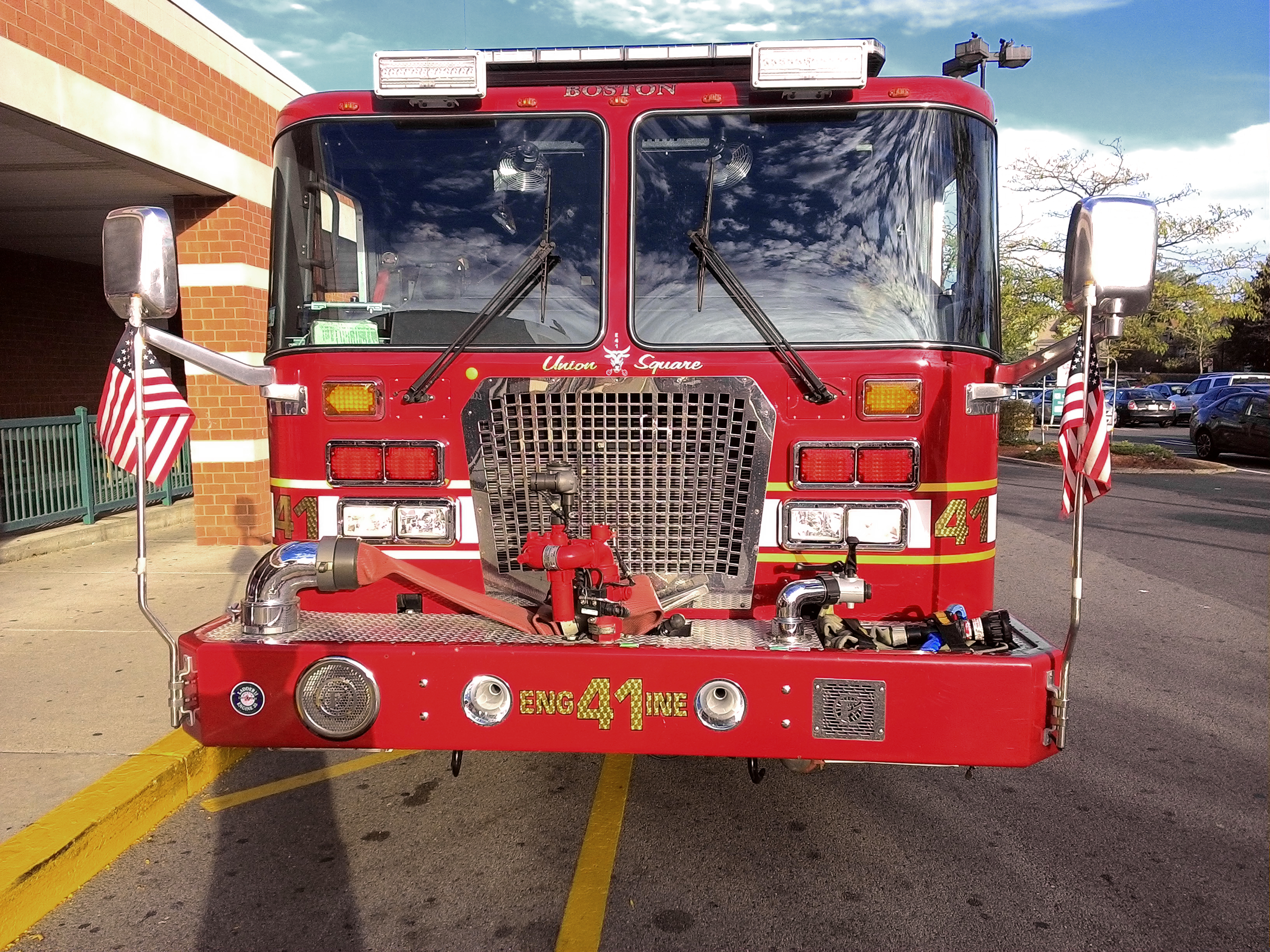
Allston is an officially recognized neighborhood within the City of Boston, Massachusetts, United States. It was named after the American painter and poet Washington Allston. It comprises the land covered by the zip code 02134. For the most part, Allston is administered collectively with the adjacent neighborhood of Brighton. The two are often referred to together as " Allston–Brighton". Boston Police Department District D-14 covers the Allston-Brighton area and a Boston Fire Department Allston station is located in Union Square which houses Engine 41 and Ladder 14. Engine 41 is nicknamed "The Bull" to commemorate the historic stockyards of Allston. Housing stock varies but largely consists of brick apartment buildings, especially on Commonwealth Avenue and the streets directly off it, while areas further down Brighton Avenue, close to Brighton, are largely dotted with wooden triple-deckers. Lower Allston, across the Massachusetts Turnpike from the southern portion of Allston, ... [...More Info...] [...Related Items...] OR: [Wikipedia] [Google] [Baidu] |
Louis Comfort Tiffany
Louis Comfort Tiffany (February 18, 1848 – January 17, 1933) was an American artist and designer who worked in the decorative arts and is best known for his work in stained glass. He is the American artist most associated with the Art NouveauLander, David"The Buyable Past: Quezal Glass" ''American Heritage'' (April/May 2006) and Aesthetic movements. He was affiliated with a prestigious collaborative of designers known as the Associated Artists, which included Lockwood de Forest, Candace Wheeler, and Samuel Colman. Tiffany designed stained glass windows and lamps, glass mosaics, blown glass, ceramics, jewellery, enamels, and metalwork. He was the first design director at his family company, Tiffany & Co., founded by his father Charles Lewis Tiffany. __TOC__ Early life Louis Comfort Tiffany was born in New York City, the son of Charles Lewis Tiffany, founder of Tiffany and Company, and Harriet Olivia Avery Young. He attended school at Pennsylvania Military Academy in West ... [...More Info...] [...Related Items...] OR: [Wikipedia] [Google] [Baidu] |
Back Bay, Boston
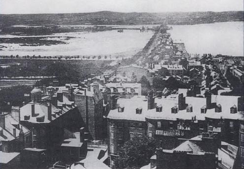
Back Bay is an officially recognized neighborhood of Boston, Massachusetts, built on reclaimed land in the Charles River basin. Construction began in 1859, as the demand for luxury housing exceeded the availability in the city at the time, and the area was fully built by around 1900. It is most famous for its rows of Victorian brownstone homes—considered one of the best preserved examples of 19th-century urban design in the United States—as well as numerous architecturally significant individual buildings, and cultural institutions such as the Boston Public Library, and Boston Architectural College. Initially conceived as a residential-only area, commercial buildings were permitted from around 1890, and Back Bay now features many office buildings, including the John Hancock Tower, Boston's tallest skyscraper. It is also considered a fashionable shopping destination (especially Newbury and Boylston Streets, and the adjacent Prudential Center and Copley Place malls) and home ... [...More Info...] [...Related Items...] OR: [Wikipedia] [Google] [Baidu] |
North End, Boston
The North End is a neighborhood of Boston, Massachusetts, United States. It has the distinction of being the city's oldest residential community, where Europeans have continuously inhabited since it was colonized in the 1630s. Though small, only , the neighborhood has nearly one hundred establishments and a variety of tourist attractions. It is known for its Italian American population and Italian-themed restaurants. The district is a pending Boston Landmark. History 17th century The North End as a distinct community of Boston was evident as early as 1646. Three years later, the area had a large enough population to support its own church, called the North Meeting House. The construction of the building also led to the development of the area now known as North Square, which was the center of community life. Increase Mather, the minister of the North Meeting House, was an influential and powerful figure who attracted residents to the North End. His home, the meeting house, ... [...More Info...] [...Related Items...] OR: [Wikipedia] [Google] [Baidu] |
Boston Harbor
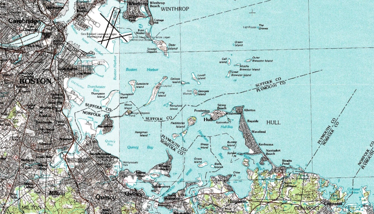
Boston Harbor is a natural harbor and estuary of Massachusetts Bay, and is located adjacent to the city of Boston, Massachusetts. It is home to the Port of Boston, a major shipping facility in the northeastern United States. History Since its discovery to Europeans by John Smith in 1614, Boston Harbor has been an important port in American history. Early on, it was recognized by Europeans as one of the finest natural harbors in the world due to its depth and natural defense from the Atlantic as a result of the many islands that dot the harbor. It was also favored due to its access to the Charles River, Neponset River and Mystic River which made travel from the harbor deeper into Massachusetts far easier. It was the site of the Boston Tea Party, as well as almost continuous building of wharves, piers, and new filled land into the harbor until the 19th century. By 1660, almost all imports came to the greater Boston area and the New England coast through the waters ... [...More Info...] [...Related Items...] OR: [Wikipedia] [Google] [Baidu] |
South Boston
South Boston is a densely populated neighborhood of Boston, Massachusetts, located south and east of the Fort Point Channel and abutting Dorchester Bay. South Boston, colloquially known as Southie, has undergone several demographic transformations since being annexed to the city of Boston in 1804. The neighborhood, once primarily farmland, is popularly known by its twentieth century identity as a working class Irish Catholic community. Throughout the twenty-first century, the neighborhood has become increasingly popular with millennial professionals. South Boston contains Dorchester Heights, where George Washington forced British troops to evacuate during the American Revolutionary War. South Boston has undergone gentrification, and consequently, its real estate market has seen property values join the highest in the city. South Boston has also left its mark on history with Boston busing desegregation. South Boston is also home to the St. Patrick's Day Parade, a celebration o ... [...More Info...] [...Related Items...] OR: [Wikipedia] [Google] [Baidu] |
Chinatown, Boston
Chinatown, Boston (Cantonese: 唐人街; Jyutping: ''Tong4jan4gaai1'') is a neighborhood located in downtown Boston, Massachusetts. It is the only surviving historic ethnic Chinese enclave in New England since the demise of the Chinatowns in Providence, Rhode Island and Portland, Maine after the 1950s. Because of the high population of Asians and Asian Americans living in this area of Boston, there is an abundance of Chinese and Vietnamese restaurants located in Chinatown. It is one of the most densely populated residential areas in Boston and serves as the largest center of its East Asian and Southeast Asian cultural life. Chinatown borders the Boston Common, Downtown Crossing, the Washington Street Theatre District, Bay Village, the South End, and the Southeast Expressway/Massachusetts Turnpike. Boston's Chinatown is one of the largest Chinatowns outside of New York City. Demographics Because it is a gathering place and home to many immigrants, Chinatown has a diverse ... [...More Info...] [...Related Items...] OR: [Wikipedia] [Google] [Baidu] |


