|
Naito Parkway
Naito Parkway is a major thoroughfare of Portland in the U.S. state of Oregon. It was formerly known as Front Avenue and Front Street and was renamed in 1996 to honor Bill Naito. It runs between SW Barbur Boulevard and NW Front Avenue, and adjacent to Tom McCall Waterfront Park through Downtown Portland. Route description Starting from the south, SW Naito Parkway begins at its interchange with Barbur Boulevard. Up to that point, Barbur serves as Oregon Route 99W (OR 99W) and OR 10, but Naito takes over this designation north of the interchange. Continuing northbound, the parkway has an interchange with the Ross Island Bridge, part of U.S. Highway 26 (US 26). The street then passes over Interstate 405 (I-405), including ramps for the Marquam Bridge, and into Downtown Portland. After passing Harbor Drive, which provides an I-5 southbound connection, the parkway runs adjacent to Tom McCall Waterfront Park through most of downtown, with connections to the Hawthorne ... [...More Info...] [...Related Items...] OR: [Wikipedia] [Google] [Baidu] |
Steel Bridge
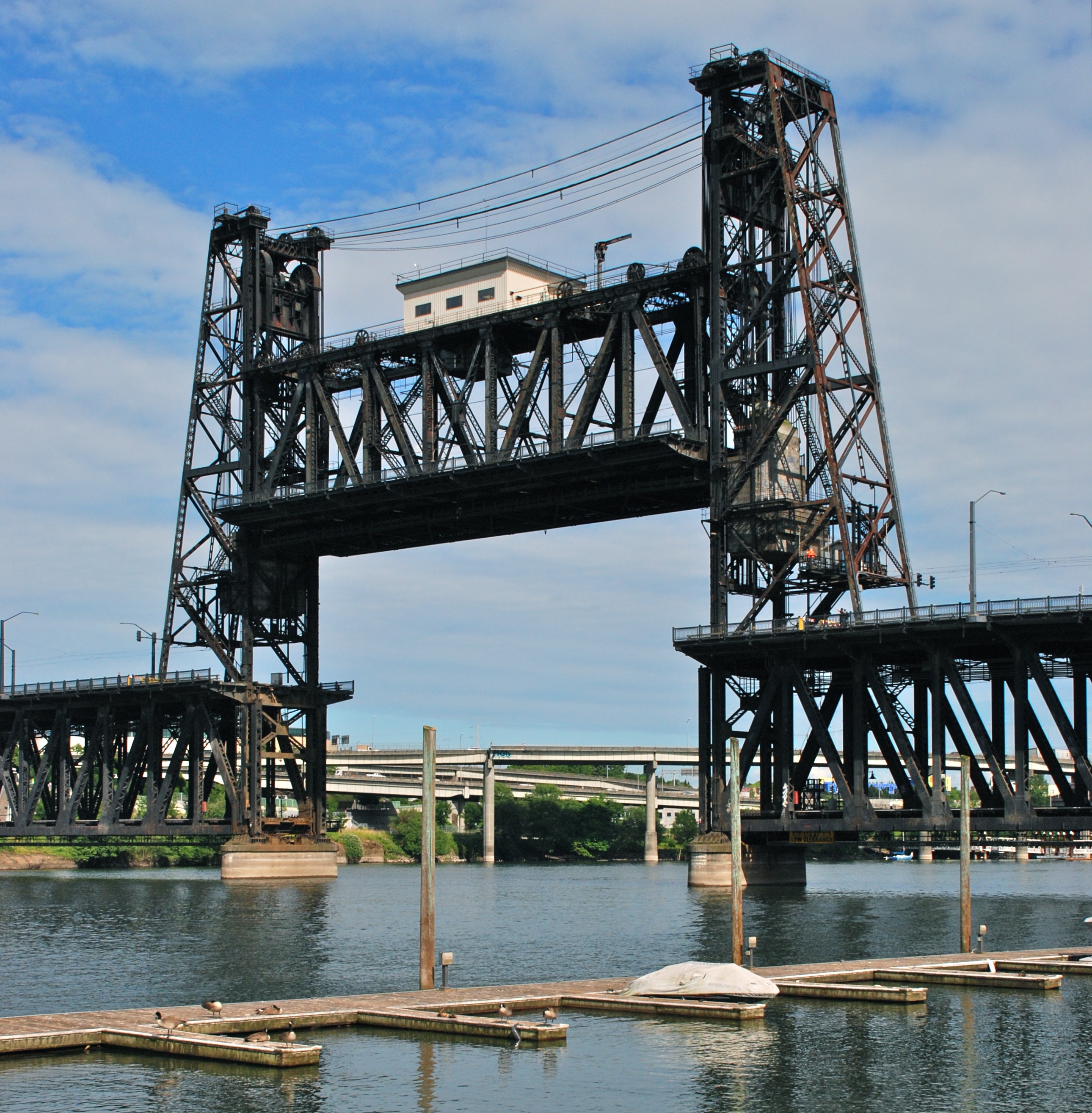
The Steel Bridge is a through truss, double-deck vertical-lift bridge across the Willamette River in Portland, Oregon, United States, opened in 1912. Its lower deck carries railroad and bicycle/pedestrian traffic, while the upper deck carries road traffic (on the Pacific Highway West No. 1W, former Oregon Route 99W), and light rail (MAX), making the bridge one of the most multimodal in the world. It is the only double-deck bridge with independent lifts in the world and the second oldest vertical-lift bridge in North America, after the nearby Hawthorne Bridge. The bridge links the Rose Quarter and Lloyd District in the east to Old Town Chinatown neighborhood in the west. History The bridge was completed in 1912 and replaced the Steel Bridge that was built in 1888 as a double-deck swing-span bridge. The 1888 structure was the first railroad bridge across the Willamette River in Portland. Its name originated because steel, instead of wrought iron, was used in its construction, ... [...More Info...] [...Related Items...] OR: [Wikipedia] [Google] [Baidu] |
Morrison Bridge
The Morrison Bridge is a bascule bridge that spans the Willamette River in Portland, Oregon. Completed in 1958, it is the third bridge at approximately the same site to carry that name. It is one of the most heavily used bridges in Portland. It was added to the National Register of Historic Places in November 2012. Predecessors The original Morrison Bridge (or Morrison Street Bridge) was a wooden truss swing-span bridge that opened to the public on April 9, 1887 (with a formal opening three days later), as the first Willamette River bridge in Portland and the longest bridge west of the Mississippi River. It was named for the street it carried, which had been named for John L. Morrison, a Scottish immigrant who built the first home on Morrison Street. It was first a toll bridge (rates: horse-drawn rig - US$0.15, team of horses - $0.20, pedestrian - $0.05) but went toll-free in 1895. The second Morrison was another swing bridge that was built in 1905. It was not designed for ... [...More Info...] [...Related Items...] OR: [Wikipedia] [Google] [Baidu] |
Beaverton, Oregon
Beaverton is a city in Washington County, in the U.S. state of Oregon with a small portion bordering Portland in the Tualatin Valley. The city is among the main cities that make up the Portland metropolitan area. Its population was 97,494 at the 2020 census, making it the second-largest city in the county and the seventh-largest city in Oregon. Beaverton is an economic center for Washington County along with neighboring Hillsboro. It is home to the world headquarters of Nike, Inc., although it sits outside of city limits on unincorporated county land. The hunter–gatherer Atfalati tribe of the Kalapuya people inhabited the Tualatin Valley prior to the arrival of European–American settlers in the 19th century. They occupied a village near the Beaverton and Fanno creeks called Chakeipi, which meant "place of the beaver", and early white settlers referred to this village as Beaverdam. Lawrence Hall took up the first land claim in 1847 and established a grist mill. The entry o ... [...More Info...] [...Related Items...] OR: [Wikipedia] [Google] [Baidu] |
Tigard, Oregon
Tigard ( ) is a city in Washington County, Oregon, United States. The population was 48,035 at the 2010 census. As of 2007, Tigard was the state's 12th largest city. Incorporated in 1961, the city is located south of Beaverton and north of Tualatin, and is part of the Portland metropolitan area. Interstate 5 and Oregon Route 217 are the main freeways in the city, with Oregon Route 99W and Oregon Route 210 serving as other major highways. Public transit service is provided by TriMet, via several bus routes and the WES Commuter Rail line. History Before colonization by European settlers, the Atfalati inhabited the Tualatin Valley in several hunter-gatherer villages including Chachimahiyuk ("Place of aromatic herbs"), near present-day Tigard. Primary food stuffs included deer, camas root, fish, berries, elk, and various nuts. To encourage the growth of the camas plant and maintain a habitat beneficial to deer and elk, the group regularly burned the valley floor to discourage the ... [...More Info...] [...Related Items...] OR: [Wikipedia] [Google] [Baidu] |
Tualatin, Oregon
Tualatin () is a city located primarily in Washington County in the U.S. state of Oregon. A small portion of the city is also located in neighboring Clackamas County. It is a southwestern suburb in the Portland Metropolitan Area that is located south of Tigard. The population was 26,054 at the 2010 census. History The name of the city is taken from the Tualatin River, which flows along most of the city's northern boundary. It is probably a Native American word meaning "lazy" or "sluggish" but possibly meaning "treeless plain" for the plain near the river or "forked" for its many tributaries. According to '' Oregon Geographic Names'', a post office with the spelling "Tualitin" was established November 5, 1869, and the spelling changed to "Tualatin" in 1915. In the 1850s, the settlement was first called ''Galbreath'' after its founder Samuel Galbreath. In 1853, Galbreath built the first bridge over the Tualatin river, and the town became known as ''Bridgeport''. In the 1880s, J ... [...More Info...] [...Related Items...] OR: [Wikipedia] [Google] [Baidu] |
TriMet
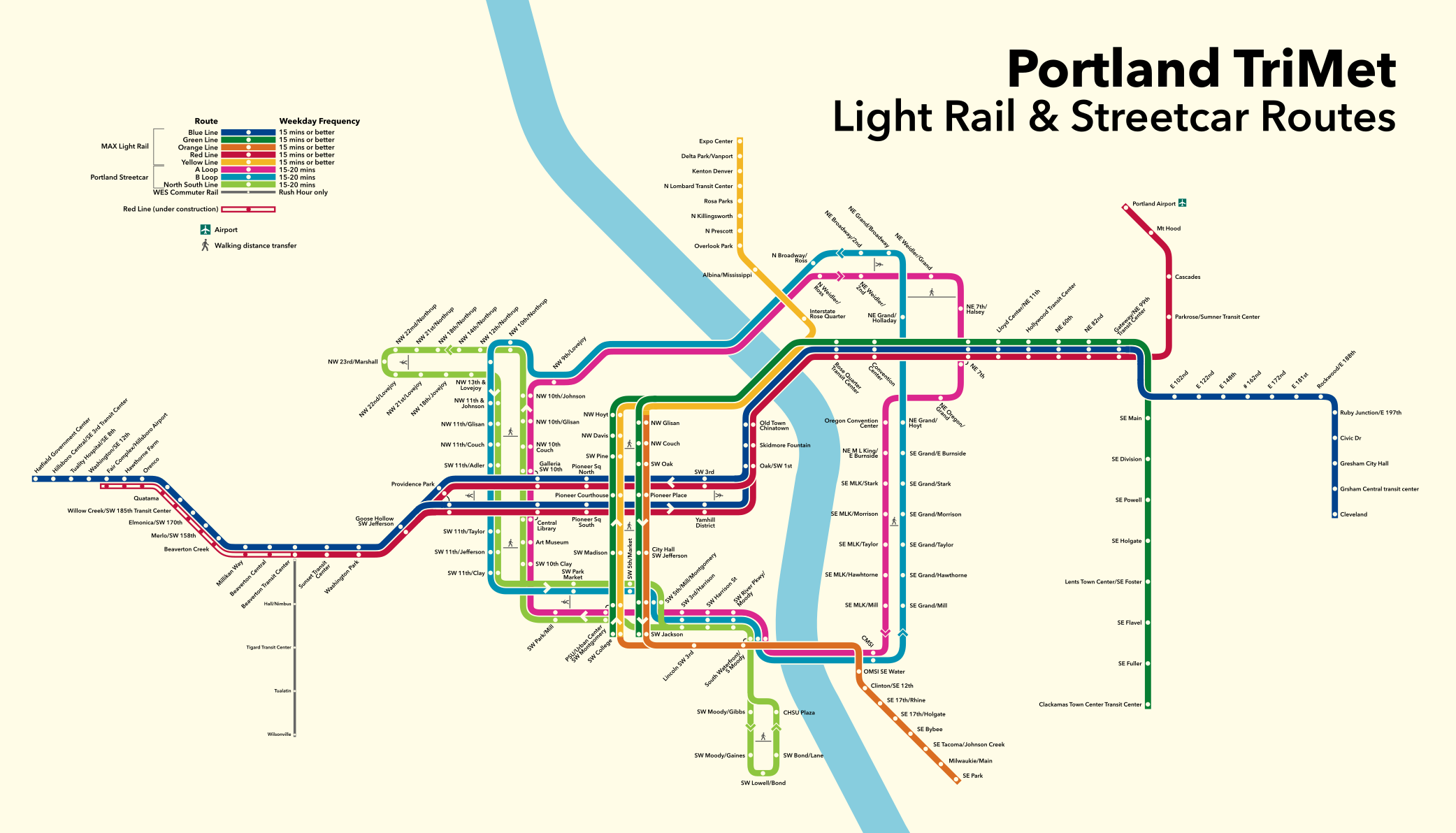
TriMet, formally known as the Tri-County Metropolitan Transportation District of Oregon, is a public agency that operates mass transit in a region that spans most of the Portland metropolitan area in the U.S. state of Oregon. Created in 1969 by the Oregon legislature, the district replaced five private bus companies that operated in the three counties: Multnomah, Washington, and Clackamas. TriMet started operating a light rail system, MAX, in 1986, which has since been expanded to five lines that now cover , as well as the WES Commuter Rail line in 2009. It also provides the operators and maintenance personnel for the city of Portland-owned Portland Streetcar system. In , the system had a ridership of , or about per weekday as of . In addition to rail lines, TriMet provides the region's bus system, as well as LIFT paratransit service. There are 688 buses in TriMet's fleet that operate on 85 lines. In 2018, the entire system averaged 310,000 rides per weekday and operat ... [...More Info...] [...Related Items...] OR: [Wikipedia] [Google] [Baidu] |
Radial Route
A radial route is a public transport route linking a central point in a city or town, usually in the central business district (CBD), with a suburb (or satellite) of that city or town. Such a route can be operated by various forms of public transport, including commuter rail, rapid transit, trams (streetcars), trolleybuses, or motor buses. Typically, a pair of radial routes will be combined, solely for operational reasons, into a single cross-city route, between one suburb and another suburb. A cross-city route of that type is sometimes called a ''through route''. A public transport operator may combine radial routes into a through route because terminating a route in a city or town centre has certain disadvantages: *Vehicles can cause congestion while standing between journeys and when turning. *Valuable land is often occupied with route terminal facilities. *Time is wasted by vehicles turning round or reversing (reducing vehicle utilization and increasing costs). *Passengers ... [...More Info...] [...Related Items...] OR: [Wikipedia] [Google] [Baidu] |
Portland Union Station
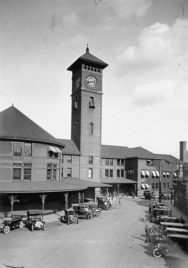
Portland Union Station is a train station in Portland, Oregon, United States, situated near the western shore of the Willamette River in Old Town Chinatown. It serves as an intermediate stop for Amtrak's '' Cascades'' and ''Coast Starlight'' routes and, along with King Street Station in Seattle, is one of two western termini of the ''Empire Builder''. The station is a major transport hub for the Portland metropolitan area with connections to MAX Light Rail, the Portland Streetcar, and local and intercity bus services. The station building contains Wilf's Restaurant & Bar on the ground level and offices on the upper floors. It also has Amtrak's first Metropolitan Lounge on the West Coast, which is reserved for first-class sleeping car and business-class passengers. Southeast of the station, the tracks make a sharp turn and cross the river on the historic Steel Bridge. To the northwest, they follow the river, passing through rail yards before crossing the river again on the Burl ... [...More Info...] [...Related Items...] OR: [Wikipedia] [Google] [Baidu] |
Level Crossing
A level crossing is an intersection where a railway line crosses a road, Trail, path, or (in rare situations) airport runway, at the same level, as opposed to the railway line crossing over or under using an Overpass#Railway, overpass or tunnel. The term also applies when a light rail line with separate Right-of-way (railroad), right-of-way or reserved track crosses a road in the same fashion. Other names include railway level crossing, railway crossing (chiefly international), grade crossing or railroad crossing (chiefly American), road through railroad, criss-cross, train crossing, and RXR (abbreviated). There are more than 100,000 level crossings in Europe and more than 200,000 in North America. History The history of level crossings depends on the location, but often early level crossings had a Flagman (rail), flagman in a nearby booth who would, on the approach of a train, wave a red flag or lantern to stop all traffic and clear the tracks. Gated crossings bec ... [...More Info...] [...Related Items...] OR: [Wikipedia] [Google] [Baidu] |
Fremont Bridge (Portland, Oregon)
The Fremont Bridge is a steel tied-arch bridge over the Willamette River located in Portland, Oregon, United States. It carries Interstate 405 and US 30 traffic between downtown and North Portland where it intersects with Interstate 5. It has the longest main span of any bridge in Oregon and is the second longest tied-arch bridge in the world (after Caiyuanba Bridge across the Yangtze River, China). The bridge was designed by Parsons, Brinckerhoff, Quade and Douglas, and built by Murphy Pacific Corporation. The bridge has two decks carrying vehicular traffic, each with four lanes. The upper deck is signed westbound on US 30 and southbound on I-405. The lower deck is signed eastbound on US 30 and northbound on I-405. Design and construction Due to the public's dissatisfaction with the appearance of the Marquam Bridge, the Portland Art Commission was invited to participate in the design process of the Fremont. The improvement in visual quality resulted in a bridge that was n ... [...More Info...] [...Related Items...] OR: [Wikipedia] [Google] [Baidu] |
Broadway Bridge (Portland, Oregon)
The Broadway Bridge is a Rall-type bascule bridge spanning the Willamette River in Portland, Oregon, United States, built in 1913. It was Portland's first bascule bridge, and it continues to hold the distinction of being the longest span of its bascule design type in the world. It was added to the National Register of Historic Places in November 2012. History and description The bridge was anticipated to be the world's longest bascule bridge and there was competition between the Strauss, Scherzer, and Rall bascule design patent holders. The "Rall" was selected based on cost. Ralph Modjeski designed the structure, which opened on April 22, 1913, at a cost of $1.6 million. It was the world's longest double-leaf bascule bridge, of any bascule type, at the time. The bridge's name derives from the street it carries, Broadway, but at the time of the bridge's construction that street name was in use only east of the river. The westside portion of what is now Broadway had been named 7th A ... [...More Info...] [...Related Items...] OR: [Wikipedia] [Google] [Baidu] |
Burnside Bridge
The Burnside Bridge is a 1926-built bascule bridge that spans the Willamette River in Portland, Oregon, United States, carrying Burnside Street. It is the second bridge at the same site to carry that name. It was added to the National Register of Historic Places in November 2012. Design The bridge was designed by Ira G. Hedrick and Robert E. Kremers, incorporating a bascule lift mechanism designed by Joseph Strauss. Including approaches, the Burnside has a total length of and a center span. While lowered this span is normally above the river. The deck is made of concrete, which contributes to its being one of the heaviest bascule bridges in the United States. The counterweights, housed inside the two piers, weigh . The lifting is normally controlled by the Hawthorne Bridge operator, but an operator staffs the west tower during high river levels. As of 2005, the bridge opened for river traffic an average of 35 times a month. The bridge provides shelter for the initially un ... [...More Info...] [...Related Items...] OR: [Wikipedia] [Google] [Baidu] |


.jpg)
.jpg)


_open.jpg)