|
Nyūtabaru Kofun Cluster
The is the name for four groups of Kofun period burial mounds located in the Nitta neighborhood of the town of Shintomi and the Umatsu neighborhood of the city of Saito, Miyazaki Prefecture in Kyushu Japan. The tumulus group was designated a National Historic Site of Japan in 1944. Background The Nyūtabaru Plateau is at an elevation of about 70 meters on the left bank of the Hitotsuse River that flows southeast from Hitotsuse Dam through Saito City and into the Hyūga Sea. The plateau contains 207 known burial mounds of various sizes and types. These are divided into four groups based on their distribution and construction period, and from the east to west are name the Tsukahara Kofun Cluster, Ishifune Kofun Cluster, Yamanobo Kofun Cluster, and Gionbara Kofun Cluster. The Gionbara group, where the ''kofun'' are most concentrated, consists of 139 -style round tumuli, 14 keyhole-shaped , one square -style tumulus, and one tumulus of unknown shape. One of the '' zenpō-kōen-fu ... [...More Info...] [...Related Items...] OR: [Wikipedia] [Google] [Baidu] |
Shintomi, Miyazaki
is a town located in Koyu District, Miyazaki Prefecture, Japan. , the town had an estimated population of 16,117 in 6,593 households, and a population density of 260 persons per km2. The total area of the town is . Geography Shintomi is located in central Miyazaki Prefecture, bordered by the Hyūga Sea to the east.The town is generally flat, with plains on the sides and south, and a plateau on the west side, and approximately 70% of the town area is flat. The Hitotsuse River flows through the south of the town. Neighbouring municipalities Miyazaki Prefecture * Miyazaki * Saito * Takanabe Climate Shintomi has a humid subtropical climate (Köppen ''Cfa'') characterized by warm summers and cool winters with light to no snowfall. The average annual temperature in Shintomi is 16.4 °C. The average annual rainfall is 2216 mm with September as the wettest month. The temperatures are highest on average in August, at around 26.1 °C, and lowest in January, at around 6 ... [...More Info...] [...Related Items...] OR: [Wikipedia] [Google] [Baidu] |
Zenpō-kōen-fun
Zenpokoenfun is an architectural model of Japanese ancient tombs (Kofun), which consists of a square front part (, Zenpō-bu) and a circular back part (, Kōen-bu). The part connecting the two is called the middle part (, Kubire-bu), which looks like a keyhole when viewed from above. Therefore, they are also called keyhole-shaped mounds in English, and in Korean, they are called long drum tombs (, Janggobun) due to their resemblance to Janggu, and it is also a form of the Kofun that appeared earlier in the Kofun period along with the . Generally, large Kofun are front and rear circular tombs, widely distributed in Honshu, Shikoku, and Kyushu with Gokishichidō as the center. Among them, the largest front and rear circular tomb in Japan are the Mozu Tombs with a total length of 525 meters. In addition to Japan, there are also the front and rear circular tombs in South Korea, as well as the front and rear circular tombs in Chosan County Ancient Tomb Group and Chasong County Ancient ... [...More Info...] [...Related Items...] OR: [Wikipedia] [Google] [Baidu] |
Archaeological Sites In Japan
Archaeology or archeology is the study of human activity through the recovery and analysis of material culture. The archaeological record consists of artifacts, architecture, biofacts or ecofacts, sites, and cultural landscapes. Archaeology can be considered both a social science and a branch of the humanities. It is usually considered an independent academic discipline, but may also be classified as part of anthropology (in North America – the four-field approach), history or geography. The discipline involves surveying, excavation, and eventually analysis of data collected, to learn more about the past. In broad scope, archaeology relies on cross-disciplinary research. Archaeologists study human prehistory and history, from the development of the first stone tools at Lomekwi in East Africa 3.3 million years ago up until recent decades. Archaeology is distinct from palaeontology, which is the study of fossil remains. Archaeology is particularly important for learning ... [...More Info...] [...Related Items...] OR: [Wikipedia] [Google] [Baidu] |
List Of Historic Sites Of Japan (Miyazaki)
This list is of the Historic Sites of Japan located within the Prefecture of Miyazaki. National Historic Sites As of 1 July 2019, twenty-three Sites have been designated as being of national significance (including one * Special Historic Site). Prefectural Historic Sites As of 1 May 2018, one hundred and nine Sites have been designated as being of prefectural importance. Municipal Historic Sites As of 1 May 2018, a further one hundred and nine Sites have been designated as being of municipal importance. See also * Cultural Properties of Japan * History of Miyazaki Prefecture * Hyūga Province was a province of Japan in the area of southeastern Kyūshū, corresponding to modern Miyazaki Prefecture Hyūga bordered on Ōsumi to the south, Higo to the west, and Bungo to the north. Its abbreviated form name was , although it was als ... * List of Places of Scenic Beauty of Japan (Miyazaki) * Miyazaki Prefectural Museum of Nature and History References Exte ... [...More Info...] [...Related Items...] OR: [Wikipedia] [Google] [Baidu] |
Nippō Main Line
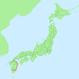
The is a railway line in Kyushu, in southern Japan, operated by Kyushu Railway Company (JR Kyushu). Also known as the Fukuhoku Nippo Line, The line connects Kokura Station in Kitakyushu, Fukuoka, and Kagoshima Station in Kagoshima, Kagoshima, Kagoshima via the east coast of Kyushu, passing through the Prefectures of Japan, prefectural capitals of Ōita, Ōita, Ōita and Miyazaki, Miyazaki, Miyazaki. A number of Limited Express trains operate along the route, including Limited Express Sonic trains between Hakata and Oita. Stations :●: Stops :▲: Rapid service connecting to Hitahikosan Line non-stop, :|: Non-stop :Liner services: ''Sawayaka Liner'', ''Home Liner'' Though Kagoshima is the southern terminus for the line, some trains continue via the Kagoshima Main Line to the adjacent Kagoshima-Chūō Station, Kagoshima-Chūō station. History The Kyushu Railway Co. opened the 6 km Kokura - Jono section in 1895, and the Hōshū Railway Co. opened the 46 km Yukuhas ... [...More Info...] [...Related Items...] OR: [Wikipedia] [Google] [Baidu] |
JR Kyushu
The , also referred to as , is one of the seven constituent companies of Japan Railways Group (JR Group). It operates intercity rail services within Kyushu, Japan. It formerly operated the Beetle hydrofoil service across the Tsushima Strait between Fukuoka and Busan, South Korea, before its discontinuation in 2024. It also operates hotels, restaurants, and drugstores across its service region. JR Kyushu's headquarters are in Hakata-ku, Fukuoka. ." Kyushu Railway Company. Retrieved on March 27, 2010. History When was divided in 1987, Kyushu Railway Company inherited its assets and operations on the island of |
Hyūga-Shintomi Station
is a passenger railway station located in the town of Shintomi, Miyazaki, Japan. It is operated by JR Kyushu and is on the Nippō Main Line. Lines The station is served by the Nippō Main Line and is located 320.0 km from the starting point of the line at . Layout The station consists of an island platform serving two tracks at grade with two sidings. The station building is modern structure built in 1992 from local materials and designed with elements to resemble the town logo as well as an agricultural greenhouse, recalling the key economic activity of the town. It houses a staffed ticket window and a waiting area. Access to the island platform is by means of a footbridge. A bike shed is provided at the station forecourt. The station is not staffed by JR Kyushu but some types of tickets are available from a Kan'i itaku station, kan'i itaku agent on site who staffs the ticket window. See images of tickets sold. Platforms History In 1913, the had opened a line from ... [...More Info...] [...Related Items...] OR: [Wikipedia] [Google] [Baidu] |
Haniwa
The are terracotta clay figures that were made for ritual use and buried with the dead as funerary objects during the Kofun period (3rd to 6th centuries AD) of the history of Japan. ''Haniwa'' were created according to the ''wazumi'' technique, in which mounds of coiled clay were built up to shape the figure, layer by layer. ''Haniwa'' can also refer to offering cylinders, not the clay sculptures on top of them as well as the "wooden haniwa" found in Kofun tumulus, tumuli. Terracotta ''Haniwa'' were made with water-based clay and dried into a coarse and absorbent material that stood the test of time. Their name means "circle of clay", referring to how they were arranged in a circle above the tomb. The protruding parts of the figures were made separately and then attached, while a few things were carved into them. They were smoothed out by a wooden paddle. Terraces were arranged to place them with a cylindrical base into the ground, where the earth would hold them in place. Dur ... [...More Info...] [...Related Items...] OR: [Wikipedia] [Google] [Baidu] |
Hyūga Sea
The Hyūga Nada () is the part of the Pacific Ocean that lies off the eastern shore of the island of Kyushu, to the south-west of the island of Honshu, off the south coast of Japan. Its name is derived from the former province of Hyūga, which corresponded to the prefecture of Miyazaki before the Meiji Restoration. Also, earthquakes occur repeatedly in Hyuga Nada (For example, 1968 Hyuga-nada earthquake). References See also Seas of Japan * Hyūga Province was a province of Japan in the area of southeastern Kyūshū, corresponding to modern Miyazaki Prefecture Hyūga bordered on Ōsumi to the south, Higo to the west, and Bungo to the north. Its abbreviated form name was , although it was als ... * 1968 Hyuga-nada earthquake {{Japan-geo-stub ... [...More Info...] [...Related Items...] OR: [Wikipedia] [Google] [Baidu] |
Saito, Miyazaki
is a city located in Miyazaki Prefecture, Japan. , the city had an estimated population of 28,538 in 13964 households, and a population density of 65 persons per km2. The total area of the city is . Geography Saito is the 5th largest city in the Miyazaki prefecture. 70% of the city is mountainous, and the Hitotsuse River cuts through the city from northwest to southeast. Many other smaller streams cut through the valleys in Saito. Much of the city is covered by mountains and forest (approximately 80%). *Mountains: , *Rivers: , *Lakes and Marshes: , *Dams: Neighboring municipalities Miyazaki Prefecture * Kijo * Kunitomi * Nango * Sadowara * Shiiba * Shintomi * Takanabe Climate Saito has a humid subtropical climate (Köppen climate classification ''Cfa'') with hot, humid summers and cool winters. The average annual temperature in Saito is . The average annual rainfall is with June as the wettest month. The temperatures are highest on average in August, at around , and l ... [...More Info...] [...Related Items...] OR: [Wikipedia] [Google] [Baidu] |
Agency For Cultural Affairs
The is a special body of the Japanese Ministry of Education, Culture, Sports, Science and Technology (MEXT). It was set up in 1968 to promote Japanese arts and culture. The agency's budget for FY 2018 rose to ¥107.7 billion. Overview The agency's Cultural Affairs Division disseminates information about the arts within Japan and internationally, and the Cultural Properties Protection Division protects the nation's cultural heritage. The Cultural Affairs Division is concerned with such areas as art and culture promotion, art copyrights, and improvements in the national language. It also supports both national and local arts and cultural festivals, and it funds traveling cultural events in music, theater, dance, art exhibitions, and film-making. Special prizes are offered to encourage young artists and established practitioners, and some grants are given each year to enable them to train abroad. The agency funds national museums of modern art in Kyoto and Tokyo and The National ... [...More Info...] [...Related Items...] OR: [Wikipedia] [Google] [Baidu] |
Miyazaki Prefecture
is a Prefectures of Japan, prefecture of Japan located on the island of Kyūshū. Miyazaki Prefecture has a population of 1,028,215 as of 1 January 2025 and has a geographic area of 7,735 Square kilometre, km2 (2,986 sq mi). Miyazaki Prefecture borders Ōita Prefecture to the north, Kumamoto Prefecture to the northwest, and Kagoshima Prefecture to the southwest. Miyazaki, Miyazaki, Miyazaki is the capital and largest city of Miyazaki Prefecture, with other major cities including Miyakonojō, Nobeoka, Miyazaki, Nobeoka, and Hyūga, Miyazaki, Hyūga. Miyazaki Prefecture is located in southeastern Kyūshū on Japan's Pacific coast, with its coastline extending from Nobeoka near the entrance to the Bungo Channel to Shibushi Bay in Kushima. History Historically, after the Meiji Restoration, Hyūga Province was renamed Miyazaki Prefecture. In Japan, Miyazaki Prefecture was first created in 1873 when Mimitsu Prefecture was merged with parts of Miyakonojō Prefecture. The first M ... [...More Info...] [...Related Items...] OR: [Wikipedia] [Google] [Baidu] |


