|
Nord-Kivu
North Kivu (french: link=no, Nord-Kivu) is a province bordering Lake Kivu in the eastern Democratic Republic of the Congo. Its capital is Goma. North Kivu borders the provinces of Ituri to the north, Tshopo to the northwest, Maniema to the southwest, and South Kivu to the south. To the east, it borders the countries of Uganda and Rwanda. The province consists of three cities—Goma, Butembo and Beni—and six territories— Beni, Lubero, Masisi, Rutshuru, Nyiragongo and Walikale. It is home to the Virunga National Park, a World Heritage Site containing the endangered mountain gorillas. The region is politically unstable and since 1998 has been one of the flashpoints of the military conflicts in the region. North Kivu was the site of an Ebola epidemic, which was compounded by political instability in the region. History The frontiers of the Congo Free State were defined by the Neutrality Act during the 1885 Berlin Conference, in which the European powers staked o ... [...More Info...] [...Related Items...] OR: [Wikipedia] [Google] [Baidu] |
Walikale Territory
Walikale Territory is a territory located within the Congolese province of North Kivu, in the eastern regions of the Democratic Republic of the Congo. The headquarters are in the town of Walikale. The locality is situated between Bukavu and Lubutu (Maniema Province) on DR Congo National Road No. 2 in the valley of the river Lowa, 135 km to the west of Goma. Walikale is rich in cassiterite, which is refined elsewhere into tin. As of 2008, Walikale's cassiterite resources were largely controlled by warlords empowered by the ongoing Kivu conflict. Specifically, the renegade FARDC 85th Brigade, under Colonel Samy Matumo, controlled the mine at Bisie, up to early 2009, when it was replaced by "accelerated integration" FARDC elements. The FDLR is continuing its activities in the territory, with May 2009 attacks in Busurungi, in the area bordering South Kivu. Busurungi has around 7,000 inhabitants, spread between the villages of Bunyamisimbwa, Busurungi, Kahunju, Kamaito, Kama ... [...More Info...] [...Related Items...] OR: [Wikipedia] [Google] [Baidu] |
Lubero Territory
Lubero Territory is a territory in North Kivu, Democratic Republic of the Congo. Internally displaced persons On 10 June, 2014, the administrator of Lubero Territory, Joy Bokele, requested assistance for six hundred displaced households who sought refuge two months ago in the south of the territory. These people come from Walikale where they fled clashes between FDLR militia and Nduma défense of Congo (NDC) (NDC) Cheka. These internally displaced persons An internally displaced person (IDP) is someone who is forced to leave their home but who remains within their country's borders. They are often referred to as refugees, although they do not fall within the legal definitions of a refugee. A ... (IDPs) are grouped in several sites, including Kasuho, Bunyantenge and Njiapanda. References Territories of the Democratic Republic of the Congo Populated places in North Kivu Democratic Republic of the Congo refugees {{DRC-geo-stub ... [...More Info...] [...Related Items...] OR: [Wikipedia] [Google] [Baidu] |
Constant Ndima Kongba
Constant Ndima Kongba is a Congolese military officer who has served as the military governor of North Kivu since May 2021. Before this appointment, he had served in high-ranking positions in the Armed Forces of the Democratic Republic of the Congo (FARDC). In the Second Congo War (1998–2003), Ndima was a commander in the Movement for the Liberation of the Congo; in this role, he was involved in Operation ''Effacer le tableau'', a campaign that resulted in genocidal massacres. Biography Early career in the FAZ and MLC Constant Ndima Kongba joined the Zairian Armed Forces (FAZ) during the rule of Mobutu Sese Seko, becoming part of the elite Special Presidential Division. In the Second Congo War, Ndima joined the Movement for the Liberation of the Congo (MLC) rebel group. He served as general and led the MLC's "Effacer le tableau" battalion, infamous for the ferocity and brutality of its troops. By 2001/2002, he was placed directly under General Amuli Bahigua, MLC chief of st ... [...More Info...] [...Related Items...] OR: [Wikipedia] [Google] [Baidu] |
Goma
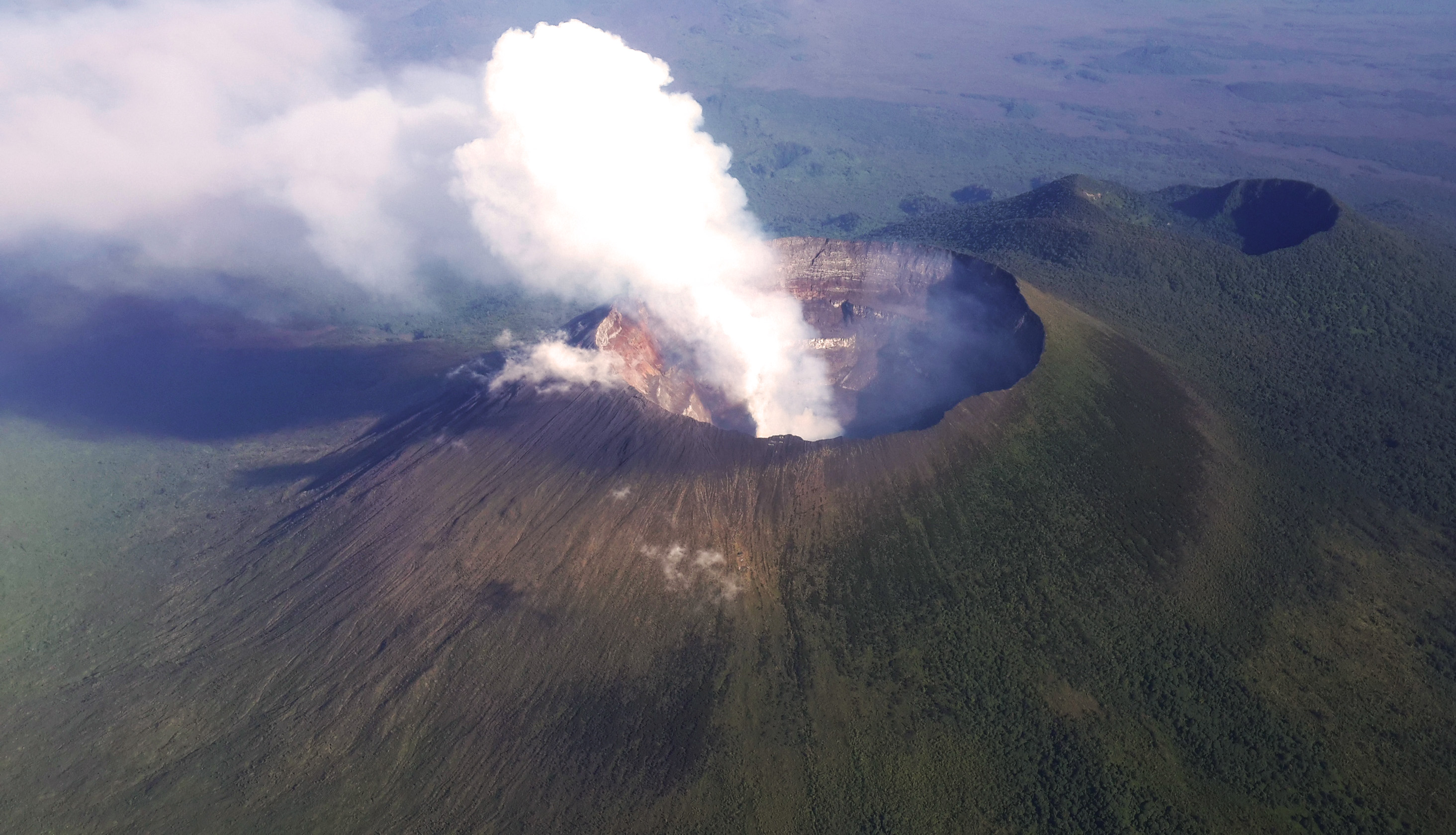
Goma is the capital of North Kivu province in the eastern Democratic Republic of the Congo. It is located on the northern shore of Lake Kivu, next to the Rwandan city of Gisenyi. The lake and the two cities are in the Albertine Rift, the western branch of the East African Rift system. Goma lies only south of the active Nyiragongo Volcano. The recent history of Goma has been dominated by the volcano and the Rwandan genocide of 1994, which in turn fuelled the First and Second Congo Wars. The aftermath of these events was still having effects on the city and its surroundings in 2010. The city was captured by rebels of the March 23 Movement during the M23 rebellion in late 2012, but it has since been retaken by government forces. Goma is the home of the annual Amani Festival which celebrates peace and in 2020 it attracted an audience of 36,000. History The city developed from 1910 when Belgium established an administrative center there. 1994 refugee crisis The Rwandan ... [...More Info...] [...Related Items...] OR: [Wikipedia] [Google] [Baidu] |
2018–19 Kivu Ebola Epidemic
The Kivu Ebola epidemic was an outbreak of Ebola virus disease (EVD) that ravaged the eastern Democratic Republic of the Congo (DRC) in Central Africa from 2018 to 2020. Between 1 August 2018 and 25 June 2020 it resulted in 3,470 reported cases. The Kivu outbreak also affected Ituri Province, whose first case was confirmed on 13 August 2018. In November 2018, the outbreak became the biggest Ebola outbreak in the DRC's history, and had become the second-largest Ebola outbreak in recorded history worldwide, behind only the 2013–2016 Western Africa epidemic. In June 2019, the virus reached Uganda, having infected a 5-year-old Congolese boy who entered Uganda with his family, but was contained. A military conflict in the region that had begun in January 2015 hindered treatment and prevention efforts. The World Health Organization (WHO) described the combination of military conflict and civilian distress as a potential "perfect storm" that could lead to a rapid worsening of the o ... [...More Info...] [...Related Items...] OR: [Wikipedia] [Google] [Baidu] |
Nyiragongo Territory
Nyiragongo Territory is a territory in North Kivu, Democratic Republic of the Congo. References {{Coord missing, Democratic Republic of the Congo Territories of the Democratic Republic of the Congo Populated places in North Kivu ... [...More Info...] [...Related Items...] OR: [Wikipedia] [Google] [Baidu] |
Beni Territory
Beni Territory is a territory in North Kivu, Democratic Republic of the Congo. It has been the site of fighting during the Allied Democratic Forces insurgency between government troops and the ADF militia, which also crosses the border into the territory from Uganda }), is a landlocked country in East Africa. The country is bordered to the east by Kenya, to the north by South Sudan, to the west by the Democratic Republic of the Congo, to the south-west by Rwanda, and to the south by Tanzania. The south .... France24, 6 November 2019. References {{coord, 0.4833, N, 29.4500, E, source:wikidata-and-enwiki-cat-tree_region:CD, display=title[...More Info...] [...Related Items...] OR: [Wikipedia] [Google] [Baidu] |
Beni, Democratic Republic Of The Congo
Beni is a city in north eastern Democratic Republic of the Congo, lying immediately west of the Virunga National Park and the Rwenzori Mountains, on the edge of the Ituri Forest. Overview Beni is home to a market, an airport and the Christian Bilingual University of Congo (UCBC). As of 2013 it had an estimated population of 231,952. Beni contains four ''communes'', or municipalities: Beni, Bungulu, Ruwenzori and Mulekera. The town was the scene of fierce fighting in the Second Congo War around 2001. Beni also has many MONUC bases; elements of the Indian-led North Kivu Brigade are based in the town. Between October 2014 and May 2016 over 500 people died in a series of attacks on Beni and its surrounding area that have been attributed to Ugandan Islamist rebels. The Beni massacre occurred here in August 2016. As of December 2018 Beni has been subject to over 200 cases of Ebola virus disease (EVD) according to the World Health Organization. Beni is near Mangina, the epicent ... [...More Info...] [...Related Items...] OR: [Wikipedia] [Google] [Baidu] |
Butembo
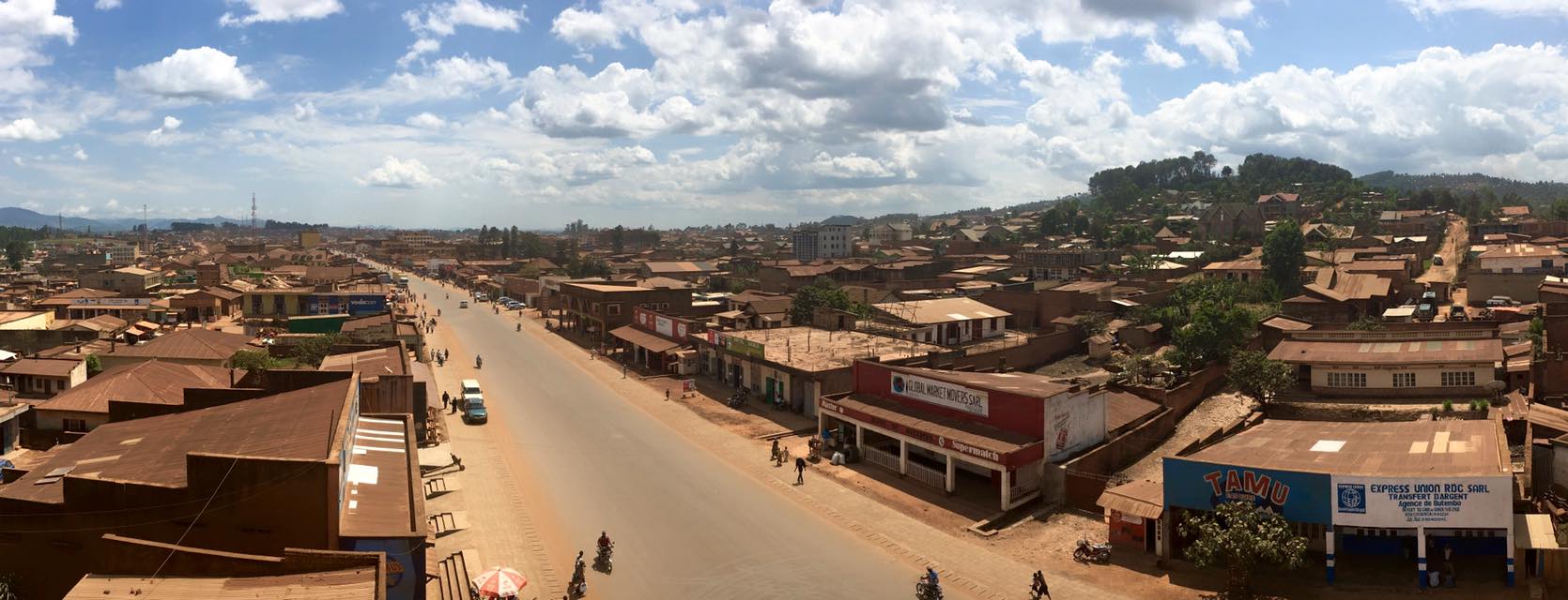
Butembo is a city in North Kivu, in the north eastern Democratic Republic of Congo, lying west of the Virunga National Park. The city is an important commercial centre with large markets, a cathedral, multiple large hospitals, and an airport. The city is located in a region known for tea and coffee growing. As of 2013 it had an estimated population of 670,285, making it the second largest city in North Kivu. Overview Butembo is 90% populated by the Nande tribe, a community distinguished by ethnic solidarity, conservative moral standards and influential leaders. The city is home to the 2nd Integrated Brigade of the Armed Forces of the Democratic Republic of the Congo The Armed Forces of the Democratic Republic of the Congo (french: Forces armées de la république démocratique du Congo ARDC is the state organisation responsible for defending the Democratic Republic of the Congo. The FARDC was rebuilt pat ..., the Institut Kambali, founded in 1959, the (UCG), founded in ... [...More Info...] [...Related Items...] OR: [Wikipedia] [Google] [Baidu] |
Provinces Of The Democratic Republic Of The Congo
Article 2 of the Constitution of the Democratic Republic of the Congo divides the country into the capital city of Kinshasa and 25 named provinces. It also gives the capital the status of a province. Therefore, in many contexts Kinshasa is regarded as the 26th province. List History When Belgium annexed the Belgian Congo as a colony in November 1908, it was initially organised into 22 districts. Ten western districts were administered directly by the main colonial government, while the eastern part of the colony was administered under two vice-governments: eight northeastern districts formed Orientale Province, and four southeastern districts formed Katanga. In 1919, the colony was organised into four provinces: * Congo-Kasaï (five southwestern districts), * Équateur (five northwestern districts), * Orientale Province and Katanga (previous vice-governments). [...More Info...] [...Related Items...] OR: [Wikipedia] [Google] [Baidu] |
Tshopo
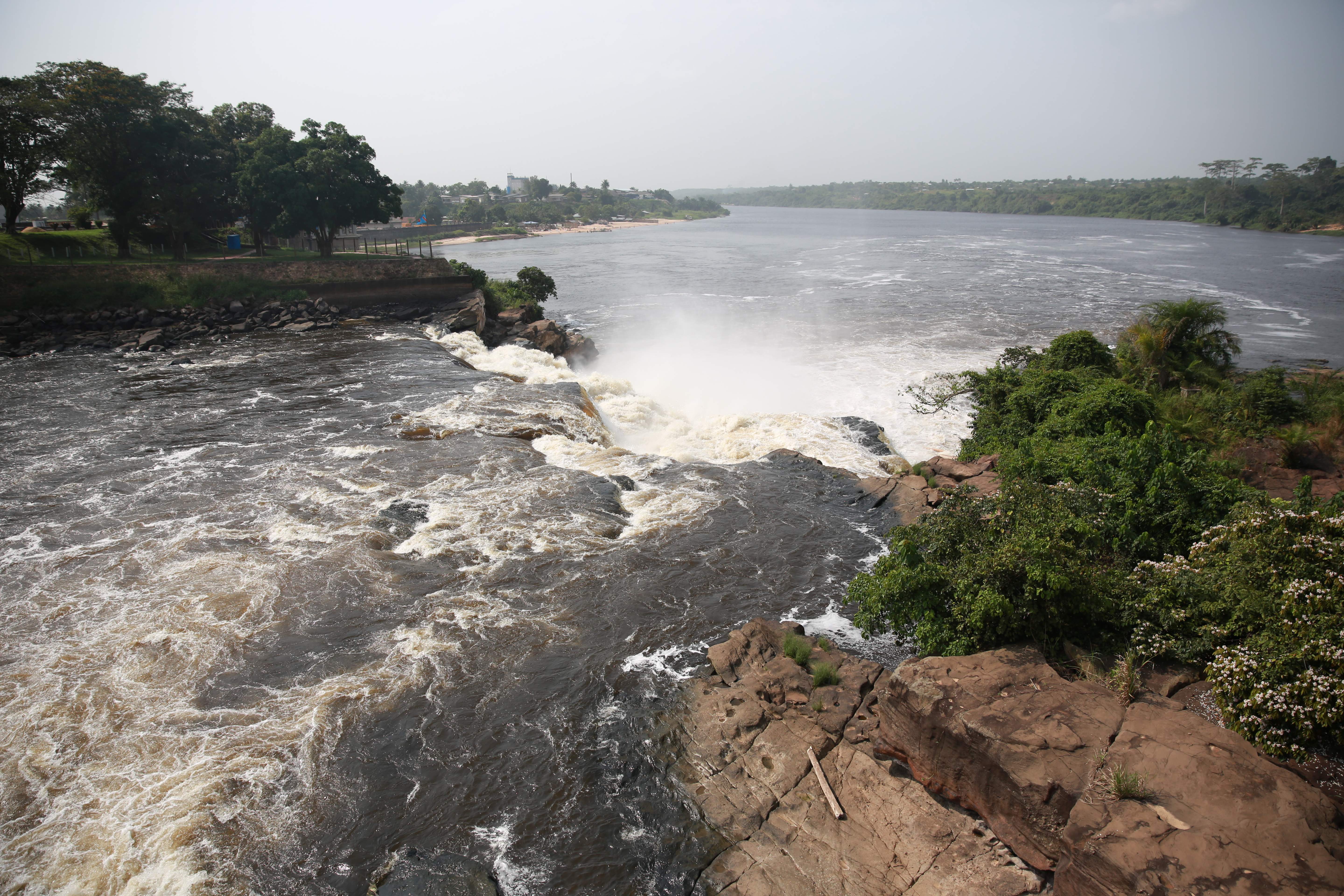
Tshopo is one of the 21 new provinces of the Democratic Republic of the Congo created in the 2015 repartitioning. It is situated in the north central part of the country on the Tshopo River, for which it is named. Tshopo, Bas-Uele, Haut-Uele, and Ituri provinces are the result of the dismemberment of the former Orientale province. Tshopo was formed from the Tshopo district and the independently administered city of Kisangani which retained its status as a provincial capital. History From 1963 to 1966, the area was constituted as the province of Haut-Congo. It was merged into Orientale Province in 1966 as, separately, the District of Tshopo and the city of Kisangani. The Presidents (later governors) of Haut-Congo were: * 1963 – 26 June 1963: Georges Grenfell (b. 1908) * 26 June 1963 – 1964: Paul Isombuma * 1964 – August 1964: François Aradjabu * August 1964 – 5 Nov 1966: Jean Marie Alamazani Provincial status was re-instated to Tshopo in 2015 ... [...More Info...] [...Related Items...] OR: [Wikipedia] [Google] [Baidu] |
Ituri Province
Ituri is one of the 21 new provinces of the Democratic Republic of the Congo created in the 2015 repartitioning. Ituri, Bas-Uele, Haut-Uele, and Tshopo provinces are the result of the dismemberment of the former Orientale province. Ituri was formed from the Ituri district whose town of Bunia was elevated to capital city of the new province. Geography The Ituri Rainforest is in this area. It is located northeast of the Ituri River and on the western side of Lake Albert. It has borders with Uganda and South Sudan. Territory’s Its five administrative territories are: * Aru (6,740 km2) * Djugu (8,184 km2) * Irumu (8,730 km2) * Mahagi (5,221 km2) * Mambasa (36,783 km2) Geography Ituri is a region of high plateau (2000–5000 meters) that has a large tropical forest but also the landscape of savannah. The province has rare fauna, including the okapi, the national animal of the Congo. As for flora, an important species is Mangongo, whose leaves are ... [...More Info...] [...Related Items...] OR: [Wikipedia] [Google] [Baidu] |


.jpg)