|
New Zealand (Māori) Pioneer Battalion
The New Zealand Pioneer Battalion (NZPB), later known as the New Zealand (Māori) Pioneer Battalion or New Zealand Māori (Pioneer) Battalion, was a battalion of the New Zealand Expeditionary Force (NZEF) that served during the Great War. The battalion was formed in Egypt in March 1916 upon New Zealand Divisional Orders of 20 February, and drawn from surplus officers and other ranks of the New Zealand Mounted Rifles (NZMR), the Otago Mounted Rifles (OMR) and the New Zealand Native Contingent (NZNC) then serving in Egypt with the New Zealand Infantry Brigade. It consisted of Māori, Pākehā and Pacific Islanders. "By the end of the war, 2227 Maori and 458 Pacific Islanders had served in what became known as the Maori Pioneer Battalion. Of these, 336 died on active service and 734 were wounded. Other Maori enlisted (and died) in other units." Origins When the First World War broke out, Māori leaders responded in various ways. Some, such as Rua Kenana Hepetipa, maintained total o ... [...More Info...] [...Related Items...] OR: [Wikipedia] [Google] [Baidu] |
Cap Badge
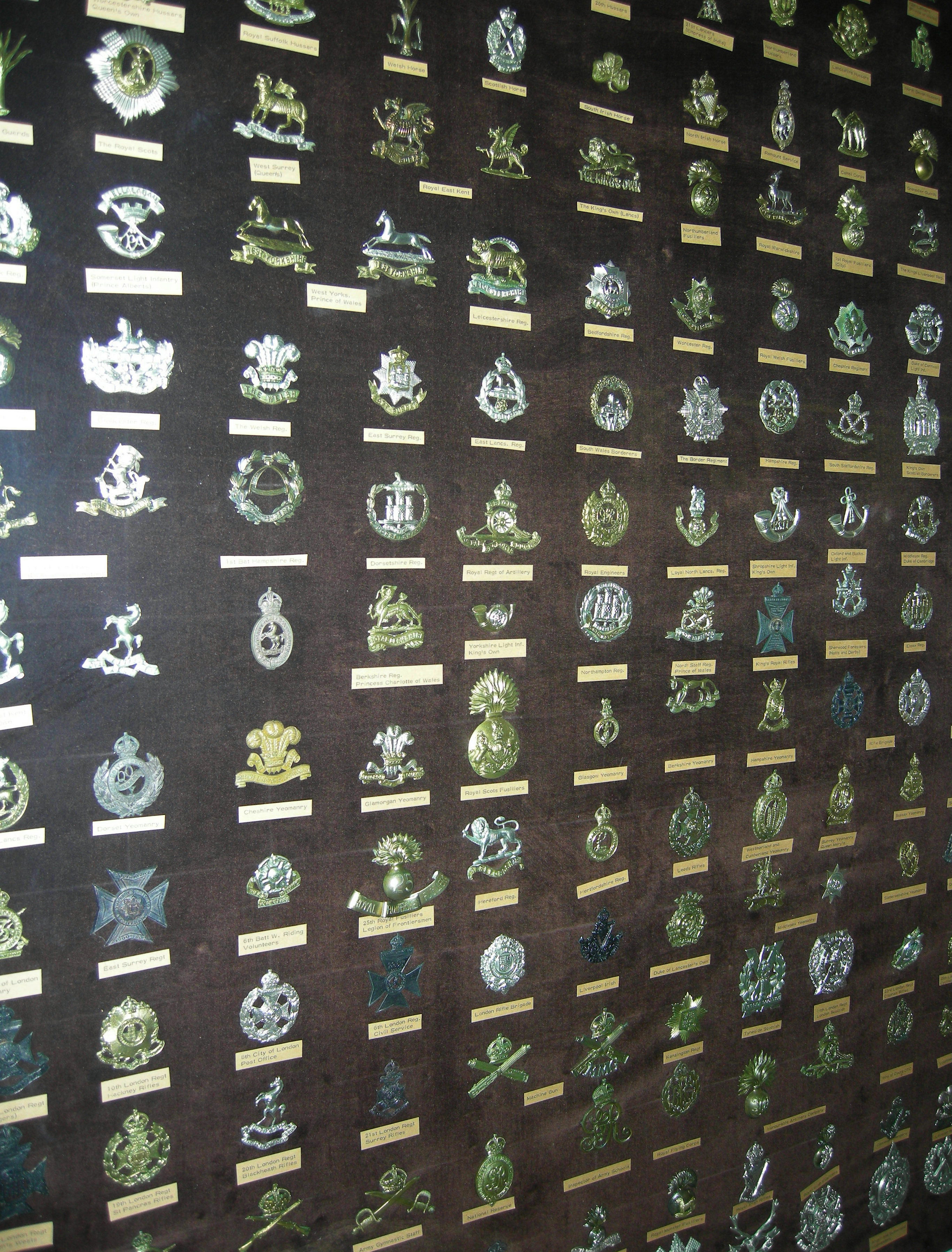
A cap badge, also known as head badge or hat badge, is a badge worn on uniform headgear and distinguishes the wearer's nationality and/or organisation. The wearing of cap badges is a convention commonly found among military and police forces, as well as uniformed civilian groups such as the Scouting, Boy Scouts, civil defence organisations, ambulance services (e.g. the St. John Ambulance Brigade), customs services, fire services etc. Cap badges are a modern form of Heraldic badge, heraldry and their design generally incorporates highly symbolic devices. Some badges that contain images of lions or other cats are sometimes informally referred to as cat badges. Instances in military forces British armed forces The British Armed Forces utilise a variety of metal and cloth cap badges on their headdress, generally on caps and berets. They are also worn on Uniforms_of_the_British_Armed_Forces#Turbans, Sikh turbans. British Army In the British Army (as well as other Commonwealth o ... [...More Info...] [...Related Items...] OR: [Wikipedia] [Google] [Baidu] |
Pacific Islander
Pacific Islanders, Pasifika, Pasefika, Pacificans, or rarely Pacificers are the peoples of the list of islands in the Pacific Ocean, Pacific Islands. As an ethnic group, ethnic/race (human categorization), racial term, it is used to describe the original peoples—inhabitants and diasporas—of any of the three major subregions of Oceania (Melanesia, Micronesia, and Polynesia) or any other island located in the Pacific Ocean. Melanesians include the Fijians (Fiji), Kanak people, Kanaks (New Caledonia), Ni-Vanuatu (Vanuatu), Indigenous people of New Guinea, Papua New Guineans (Papua New Guinea), Solomon Islands#Ethnic groups, Solomon Islanders (Solomon Islands), Western New Guinea#Demographics, West Papuans (Indonesia's Western New Guinea, West Papua) and Moluccans (Indonesia's Maluku Islands). Micronesians include the Carolinian people, Carolinians (Caroline Islands), Chamorro people, Chamorros (Guam and Northern Mariana Islands), Chuukese people, Chuukese (Chuuk State, Chuuk), ... [...More Info...] [...Related Items...] OR: [Wikipedia] [Google] [Baidu] |
Ngāti Kahungunu
Ngāti Kahungunu is a Māori iwi (tribe) located along the eastern coast of the North Island of New Zealand. The iwi is traditionally centred in the Hawke's Bay and Wairārapa regions. The Kahungunu iwi also comprises 86 hapū (sub-tribes) and 90 marae (meeting grounds). The tribe is organised into six geographical and administrative divisions: ''Wairoa'', ''Te Whanganui-ā-Orotū'', ''Heretaunga'', ''Tamatea'', ''Tāmaki-nui-a Rua'' and ''Wairarapa''. It is the 4th largest iwi in New Zealand by population, with 82,239 people identifying as Ngāti Kahungunu in the 2018 census. Early history Pre-colonisation Ngāti Kahungunu trace their origins to the '' Tākitimu'' waka, one of the Māori migration canoes which arrived on New Zealand's North Island around 1100–1200 AD, according to Ngāti Kahungunu traditions. According to local legend, Tākitimu and its crew were completely '' tapu''. Its crew comprised men only: high chiefs, chiefs, tohunga and elite warriors. ... [...More Info...] [...Related Items...] OR: [Wikipedia] [Google] [Baidu] |
Ngata
Ngata is a Māori surname, most commonly found among members of the Ngāti Porou iwi. The name is also occasionally found in Tonga, where it was the name of a 17th-century leader, the first Tu'i Kanokupolu. Notable people with the surname include *Āpirana Ngata (1874–1950), New Zealand politician and lawyer * Arihia Ngata (1879–1829), New Zealand community leader, wife of Āpirana *Haloti Ngata (born 1984), American football player * Heremaia Ngata (born 1971), New Zealand association footballer *Hēnare Ngata (1917–2011), Māori leader and son of Āpirana and Arihia * Hōri Ngata (1919–1989), New Zealand lexicographer, grandson of Āpirana and Arihia * Joseph Ngata (born 2001), American football player * Linda Ngata (Ngāti Porou), a community leader in Christchurch * Paratene Ngata (c. 1849–1924), New Zealand tribal leader, farmer, and soldier *Whai Ngata Tanara Whairiri Kitawhiti "Whai" Ngata (c. 1942 Р3 April 2016) was a Māori broadcaster, journalist, ... [...More Info...] [...Related Items...] OR: [Wikipedia] [Google] [Baidu] |
Niue
Niue is a self-governing island country in free association with New Zealand. It is situated in the South Pacific Ocean and is part of Polynesia, and predominantly inhabited by Polynesians. One of the world's largest coral islands, Niue is commonly referred to as "The Rock", which comes from the traditional name "Rock of Polynesia". Niue's position is inside a triangle drawn between Tonga, Samoa, and the Cook Islands. It is northeast of New Zealand, and northeast of Tonga. Niue's land area is about and its population was 1,689 at the Census in 2022. The terrain of the island has two noticeable levels. The higher level is made up of a limestone cliff running along the coast, with a plateau in the centre of the island reaching approximately above sea level. The lower level is a coastal terrace approximately 0.5 km (0.3 miles) wide and about 25–27 metres (80–90 feet) high, which slopes down and meets the sea in small cliffs. A coral reef surrounds the island; the ... [...More Info...] [...Related Items...] OR: [Wikipedia] [Google] [Baidu] |
Cook Islands
The Cook Islands is an island country in Polynesia, part of Oceania in the South Pacific Ocean. It consists of 15 islands whose total land area is approximately . The Cook Islands' Exclusive Economic Zone (EEZ) covers of ocean. Avarua is its capital. The Cook Islands is self-governing while in free association with New Zealand. Since the start of the 21st century, the Cook Islands conducts its own independent foreign and defence policy, and also has its own customs regulations. Like most members of the Pacific Islands Forum, it has no armed forces, but the Cook Islands Police Service owns a Guardian Class Patrol Boat, , provided by Australia, in order to police its waters. In recent decades, the Cook Islands have adopted an increasingly assertive and distinct foreign policy, and a Cook Islander, Henry Puna, served as Secretary General of the Pacific Islands Forum from 2021 to 2024. Most Cook Islanders are also citizens of New Zealand, but they also have the status of Coo ... [...More Info...] [...Related Items...] OR: [Wikipedia] [Google] [Baidu] |
Ngāti Porou
Ngāti Porou is a Māori iwi traditionally located in the East Cape and Gisborne regions of the North Island of New Zealand. It has the second-largest affiliation of any iwi, behind Ngāpuhi, with an estimated 102,480 people according to the 2023 census. The traditional rohe or tribal area of Ngāti Porou extends from Pōtikirua and Lottin Point in the north to Te Toka-a-Taiau (a rock that used to sit in the mouth of Gisborne harbour) in the south. The Ngāti Porou iwi comprises 58 hapū (sub-tribes) and 48 mārae (meeting grounds). Mount Hikurangi features prominently in Ngāti Porou traditions as a symbol of endurance and strength, and holds tapu status. In these traditions, Hikurangi is often personified. Ngāti Porou traditions indicate that Hikurangi was the first point to surface when Māui fished up the North Island from beneath the ocean. His canoe, the '' Nuku-tai-memeha'', is said to have been wrecked there. The Waiapu River also features in Ngāti Porou traditio ... [...More Info...] [...Related Items...] OR: [Wikipedia] [Google] [Baidu] |
Ngāti Maniapoto
Ngāti Maniapoto is an iwi (tribe) based in the Waikato-Waitomo region of New Zealand's North Island. It is part of the Tainui confederation, the members of which trace their whakapapa (genealogy) back to people who arrived in New Zealand on the waka (canoe) Tainui. The 2018 New Zealand census reports show an estimated population of 45,930 people who affiliated with Maniapoto, making it the 9th most-populous iwi in New Zealand. History Ngāti Maniapoto trace their lineage to their eponymous ancestor Maniapoto, an 11th generation descendant of the people who arrived on the ''Tainui'' waka and settled at the Kawhia Harbour. His brother Rereahu led the Tainui expansion to the interior of the Waikato region, and Maniapoto settled in the southern Waikato area. Maniapoto's older brother Te Ihinga-a-rangi settled at Maungatautari, forming the Ngāti Hauā and Ngāti Korokī Kahukura iwi. Hapū and marae There are many marae (area in front of a wharenui) in the Ngāti Maniapo ... [...More Info...] [...Related Items...] OR: [Wikipedia] [Google] [Baidu] |
Waikato
The Waikato () is a region of the upper North Island of New Zealand. It covers the Waikato District, Waipā District, Matamata-Piako District, South Waikato District and Hamilton City, as well as Hauraki, Coromandel Peninsula, the northern King Country, much of the Taupō District, and parts of the Rotorua Lakes District. It is governed by the Waikato Regional Council. The Waikato stretches from Coromandel Peninsula in the north, to the north-eastern slopes of Mount Ruapehu in the south, and spans the North Island from the west coast, through the Waikato and Hauraki to Coromandel Peninsula on the east coast. Broadly, the extent of the region is the Waikato River catchment. Other major catchments are those of the Waihou, Piako, Awakino and Mōkau rivers. The region is bounded by Auckland on the north, Bay of Plenty on the east, Hawke's Bay on the south-east, and Manawatū-Whanganui and Taranaki on the south. Waikato Region is the fourth largest region in the c ... [...More Info...] [...Related Items...] OR: [Wikipedia] [Google] [Baidu] |
Maui Pomare
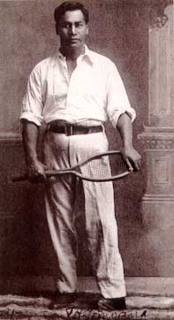
Maui (; Hawaiian language, Hawaiian: ) is the second largest island in the Hawaiian archipelago, at 727.2 square miles (1,883 km2). It is the List of islands of the United States by area, 17th-largest in the United States. Maui is one of Maui County, Hawaii, Maui County's five islands, along with Molokai, Molokai, Lanai, LƒÅnai, Kaho ªolawe, Kahoolawe, and Molokini. In 2020, Maui had a population of 168,307, the third-highest of the Hawaiian Islands, behind Oahu, Oahu and Hawaii (island), Hawaii Island. Kahului, Hawaii, Kahului is the largest census-designated place (CDP) on the island, with a 2020 population of 28,219. It is Maui's commercial and financial hub. Wailuku, Hawaii, Wailuku is the county seat and was the third-largest CDP . Other significant populated areas include Kihei, Hawaii, Kƒ´hei (including Wailea, Hawaii, Wailea and Makena, Hawaii, Makena in the Kihei Town CDP), Lahaina, Hawaii, LƒÅhainƒÅ (including Kaanapali, KƒÅanapali and Kapalua in the LƒÅhainƒÅ T ... [...More Info...] [...Related Items...] OR: [Wikipedia] [Google] [Baidu] |
Paraire Tomoana
Paraire "Friday" Henare Tomoana (died 15 April 1946) was a Māori political leader, journalist, historian, sportsman, and lyricist of the Ngāti Kahungunu and Ngāi Te Whatu-i-Āpiti tribes. Born either in Waipatu or Pakowhai near Hastings, he was the son of Henare Tomoana, the principal chief of the Heretaunga region and Member of Parliament for the Eastern Māori electorate. He was educated at Te Aute College and was a member of the Young Māori Party, an association of alumni from the college that dominated the Māori political landscape in the early 20th century. Tomoana was in favour of Māori enlistment in the First World War, and was a major fundraiser and organiser of recruitment drives for the New Zealand (Māori) Pioneer Battalion. Between 1921 and 1932 he was an editor of the Māori newspaper ''Te'' ''Toa Takitini,'' an Anglican periodical providing Māori commentary on current events and Māori history. Tomoana's musical compositions include ''E Pari Rā'' and ''I ... [...More Info...] [...Related Items...] OR: [Wikipedia] [Google] [Baidu] |
Āpirana Ngata
Sir Āpirana Turupa Ngata (3 July 1874 – 14 July 1950) was a prominent New Zealand statesman. He has often been described as the foremost Māori politician to have served in parliament in the mid-20th century, and is also known for his work in promoting and protecting Māori culture and language. His legacy is one of the most prominent of any New Zealand leader in the 20th century, and is commemorated by his depiction on the fifty-dollar note. Ngata practised as a lawyer before entering politics in 1897, when he established the Young Māori Party alongside numerous alumni of Te Aute College, including future fellow cabinet minister Māui Pōmare. Here he challenged the traditional views of his people, advocating the abandonment of some traditional practices and customary healing in favour of science and -style sanitation, which made him a controversial figure. In 1905, he was elected the Liberal Member of Parliament (MP) for Eastern Maori, retaining this seat for nearly 40 y ... [...More Info...] [...Related Items...] OR: [Wikipedia] [Google] [Baidu] |


