|
Monadhliath
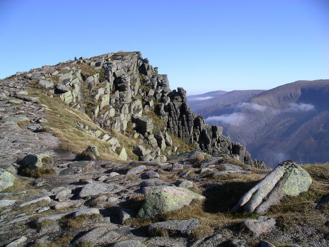
The Monadhliath Mountains , or Monadh Liath, are a range of mountains in Scotland. Monadh Liath is Scottish Gaelic, and means "grey mountain range". Running in a northeast to southwest direction, it lies on the western side of Strathspey, to the west of the Cairngorms and to the south east of Loch Ness. Its southwestern limit is usually taken to be Corrieyairack Pass (763m) but similar uplands continue to Glen Roy and Spean Bridge. The range is within the Highland council area, and the south and east fringes are within the Cairngorms National Park. The high point of the range is Càrn Dearg, at , located south of Inverness. This is one of four Munros in the Monadhliath, the others being A'Chailleach (), Geal Chàrn (), and Càrn Sgulain (). The Monadhliath Mountains are designated a Special Area of Conservation (SAC). The Monadh Liath differs greatly in character from the greater Highland mountains to the south and west, as an elevated moorland with no proper ridges. The f ... [...More Info...] [...Related Items...] OR: [Wikipedia] [Google] [Baidu] |
Cairngorms National Park
Cairngorms National Park ( gd, Pàirc Nàiseanta a' Mhonaidh Ruaidh) is a national park in northeast Scotland, established in 2003. It was the second of two national parks established by the Scottish Parliament, after Loch Lomond and The Trossachs National Park, which was set up in 2002. The park covers the Cairngorms range of mountains, and surrounding hills. Already the largest national park in the United Kingdom, in 2010 it was expanded into Perth and Kinross. Roughly 18,000 people reside within the 4,528 square kilometre national park. The largest communities are Aviemore, Ballater, Braemar, Grantown-on-Spey, Kingussie, Newtonmore, and Tomintoul. Tourism makes up about 80% of the economy. In 2018, 1.9 million tourism visits were recorded. The majority of visitors are domestic, with 25 per cent coming from elsewhere in the UK, and 21 per cent being from other countries. Geography The Cairngorms National Park covers an area of in the council areas of Aberdeenshire, Mora ... [...More Info...] [...Related Items...] OR: [Wikipedia] [Google] [Baidu] |
Cairngorms
The Cairngorms ( gd, Am Monadh Ruadh) are a mountain range in the eastern Highlands of Scotland closely associated with the mountain Cairn Gorm. The Cairngorms became part of Scotland's second national park (the Cairngorms National Park) on 1 September 2003. Although the Cairngorms give their name to, and are at the heart of, the Cairngorms National Park, they only form one part of the national park, alongside other hill ranges such as the Angus Glens and the Monadhliath, and lower areas like Strathspey. The Cairngorms consists of high plateaux at about above sea level, above which domed summits (the eroded stumps of once much higher mountains ) rise to around . Many of the summits have tors, free-standing rock outcrops that stand on top of the boulder-strewn landscape. In places, the edges of the plateau form steep cliffs of granite and they are excellent for skiing, rock climbing and ice climbing. The Cairngorms form an arctic-alpine mountain environment, with tundra-like ... [...More Info...] [...Related Items...] OR: [Wikipedia] [Google] [Baidu] |
Creag Mhor Loch Gynack 01
Cricket is a bat-and-ball game played between two teams of eleven players on a field at the centre of which is a pitch with a wicket at each end, each comprising two bails balanced on three stumps. The batting side scores runs by striking the ball bowled at one of the wickets with the bat and then running between the wickets, while the bowling and fielding side tries to prevent this (by preventing the ball from leaving the field, and getting the ball to either wicket) and dismiss each batter (so they are "out"). Means of dismissal include being bowled, when the ball hits the stumps and dislodges the bails, and by the fielding side either catching the ball after it is hit by the bat, but before it hits the ground, or hitting a wicket with the ball before a batter can cross the crease in front of the wicket. When ten batters have been dismissed, the innings ends and the teams swap roles. The game is adjudicated by two umpires, aided by a third umpire and match referee ... [...More Info...] [...Related Items...] OR: [Wikipedia] [Google] [Baidu] |
Munro
A Munro () is defined as a mountain in Scotland with a height over , and which is on the Scottish Mountaineering Club (SMC) official list of Munros; there is no explicit topographical prominence requirement. The best known Munro is Ben Nevis (Beinn Nibheis), the highest mountain in the British Isles at . Munros are named after Sir Hugh Munro, 4th Baronet (1856–1919), who produced the first list of such hills, known as ''Munro's Tables'', in 1891. Also included were what Munro considered lesser peaks, now known as Munro Tops, which are also over 3,000 feet but are lower than the nearby primary mountain. The publication of the original list is usually considered to be the epoch event of modern peak bagging. The list has been the subject of subsequent variation and as of 10 December 2020, the Scottish Mountaineering Club has listed 282 Munros and 226 Munro Tops. "Munro bagging" is the activity of climbing all the listed Munros. As of 31 December 2021, 7,098 people had re ... [...More Info...] [...Related Items...] OR: [Wikipedia] [Google] [Baidu] |
Great Glen
The Great Glen ( gd, An Gleann Mòr ), also known as Glen Albyn (from the Gaelic "Glen of Scotland" ) or Glen More (from the Gaelic ), is a glen in Scotland running for from Inverness on the edge of Moray Firth, in an approximately straight line to Fort William at the head of Loch Linnhe. It follows a geological fault known as the Great Glen Fault, and bisects the Scottish Highlands into the Grampian Mountains to the southeast and the Northwest Highlands to the northwest. The glen is a natural travelling route in the Highlands of Scotland, which is used by both the Caledonian Canal and the A82 road, which link the city of Inverness on the northeast coast with Fort William on the west coast. The Invergarry and Fort Augustus Railway was built in 1896 from the southern end of the glen to the southern end of Loch Ness, but was never extended to Inverness. The railway closed in 1947. In 2002, the Great Glen Way was opened. A long-distance route for cyclists, canoeists, and ... [...More Info...] [...Related Items...] OR: [Wikipedia] [Google] [Baidu] |
Special Area Of Conservation
A Special Area of Conservation (SAC) is defined in the European Union's Habitats Directive (92/43/EEC), also known as the ''Directive on the Conservation of Natural Habitats and of Wild Fauna and Flora''. They are to protect the 220 habitats and approximately 1,000 species listed in annex I and II of the directive which are considered to be of European interest following criteria given in the directive. They must be chosen from the Sites of Community Importance by the member states and designated SAC by an act assuring the conservation measures of the natural habitat. SACs complement Special Protection Areas and together form a network of protected sites across the European Union called Natura 2000. This, in turn, is part of the Emerald network of Areas of Special Conservation Interest (ASCIs) under the Berne Convention. Assessment methodology in the United Kingdom Prior to being designated as a Special Area of Conservation (SAC), sites have been assessed under a two-stage pro ... [...More Info...] [...Related Items...] OR: [Wikipedia] [Google] [Baidu] |
Càrn Dearg (Monadh Liath)
{{DEFAULTSORT:Carn De ...
Carn Dearg (Gaelic for ''red cairn'') is the name of several mountains in Scotland: * Càrn Dearg, a peak NW of Ben Nevis * Càrn Dearg (Ben Alder), a Munro north of Ben Alder * Càrn Dearg, a peak SW of Ben Nevis * Càrn Dearg (Monadh Liath), a Munro, the highest point in the Monadh Liath * Càrn Dearg (Corrour), a Munro southeast of Loch Ossian * Càrn Dearg (East of Glen Roy), an Corbett east of Glen Roy * Càrn Dearg (North of Gleann Eachach), an Corbett north of Gleann Eachach, and north of Glen Roy * Càrn Dearg (South of Gleann Eachach), a Corbett south of Gleann Eachach, and north of Glen Roy * Càrn Dearg (Oban), a Marilyn near Oban See also * Càrn Dearg Mòr *Càrn Mòr Dearg Càrn Mòr Dearg () is the ninth-highest mountain in Scotland and the British Isles, with a height of . It stands a short distance northeast of Ben Nevis, the highest mountain in Britain, to which it is linked by the 'Càrn Mòr Dearg arête'. ... [...More Info...] [...Related Items...] OR: [Wikipedia] [Google] [Baidu] |
Inverness
Inverness (; from the gd, Inbhir Nis , meaning "Mouth of the River Ness"; sco, Innerness) is a city in the Scottish Highlands. It is the administrative centre for The Highland Council and is regarded as the capital of the Highlands. Historically it served as the county town of the county of Inverness-shire. Inverness lies near two important battle sites: the 11th-century battle of Blàr nam Fèinne against Norway which took place on the Aird, and the 18th century Battle of Culloden which took place on Culloden Moor. It is the northernmost city in the United Kingdom and lies within the Great Glen (Gleann Mòr) at its northeastern extremity where the River Ness enters the Beauly Firth. At the latest, a settlement was established by the 6th century with the first royal charter being granted by Dabíd mac Maíl Choluim (King David I) in the 12th century. Inverness and Inverness-shire are closely linked to various influential clans, including Clan Mackintosh, Clan Fraser an ... [...More Info...] [...Related Items...] OR: [Wikipedia] [Google] [Baidu] |
Scotland
Scotland (, ) is a Countries of the United Kingdom, country that is part of the United Kingdom. Covering the northern third of the island of Great Britain, mainland Scotland has a Anglo-Scottish border, border with England to the southeast and is otherwise surrounded by the Atlantic Ocean to the north and west, the North Sea to the northeast and east, and the Irish Sea to the south. It also contains more than 790 Islands of Scotland, islands, principally in the archipelagos of the Hebrides and the Northern Isles. Most of the population, including the capital Edinburgh, is concentrated in the Central Belt—the plain between the Scottish Highlands and the Southern Uplands—in the Scottish Lowlands. Scotland is divided into 32 Subdivisions of Scotland, administrative subdivisions or local authorities, known as council areas. Glasgow, Glasgow City is the largest council area in terms of population, with Highland (council area), Highland being the largest in terms of area. Limi ... [...More Info...] [...Related Items...] OR: [Wikipedia] [Google] [Baidu] |


