|
Maßbach
Maßbach is a market town and municipality in the district of Bad Kissingen in Bavaria in Germany. Geography Maßbach lies between the biosphere reserve of the Bavarian Rhön Mountains and Haßberge. Neighboring municipalities *Münnerstadt * Thundorf *Üchtelhausen in the district of Schweinfurt * Rannungen Divisions of the municipality The following towns belong to the municipality: *Maßbach *Rannungen *Thundorf (including the Theinfeld und Rothhausen) Maßbach includes the following villages: *Poppenlauer *Volkershausen *Weichtungen History The town was first documented in 770. Beginning in the mid-19th century many residents of Massbach and the surrounding area emigrated to the United States and settled in Jo Daviess County, Illinois. They named their settlement in Derinda Township "Massbach" after their home village. Coat of arms A red and silver shield divided into alternating stripes emanating from a point at the top. Sister cities *Bretteville-sur-Laize, near Caen ... [...More Info...] [...Related Items...] OR: [Wikipedia] [Google] [Baidu] |
Bundesautobahn 71
is an Autobahn in Germany. It connects the A 38 and Erfurt to the A 70 near Schweinfurt. A further northern extension to the A 14 near Plötzkau has been proposed by the state government of Sachsen-Anhalt. (page 56; German; PDF; 223 kB) Construction on the A 71, supervised by , began in 1996, most parts were being opened by December 2005. The project was completed in September 2015. The section through the |
Rannungen
Rannungen is a municipality in the district of Bad Kissingen in Bavaria in Germany Germany,, officially the Federal Republic of Germany, is a country in Central Europe. It is the second most populous country in Europe after Russia, and the most populous member state of the European Union. Germany is situated betwe .... References Bad Kissingen (district) {{BadKissingendistrict-geo-stub ... [...More Info...] [...Related Items...] OR: [Wikipedia] [Google] [Baidu] |
Bad Kissingen (district)
Bad Kissingen is a ''Landkreis'' (district) in Bavaria, Germany. It is bounded by (from the northwest and clockwise) the district Main-Kinzig and Fulda in Hesse, and the districts of Rhön-Grabfeld, Schweinfurt and Main-Spessart. History The district was established in 1972 by merging the former districts of Bad Kissingen, Bad Brückenau and Hammelburg. Geography The district is located in the southern portion of the Rhön Mountains. The Fränkische Saale river (an affluent of the Main Main may refer to: Geography * Main River (other) **Most commonly the Main (river) in Germany * Main, Iran, a village in Fars Province *"Spanish Main", the Caribbean coasts of mainland Spanish territories in the 16th and 17th centuries ...) enters the district in the north and leaves to the southwest. Coat of arms The coat of arms displays: * top: three icons symbolising the three spas of the district * left: the eagle as well as the red and white pattern are from the arms ... [...More Info...] [...Related Items...] OR: [Wikipedia] [Google] [Baidu] |
Bretteville-sur-Laize
Bretteville-sur-Laize () is a commune in the Calvados department in the Normandy region in northwestern France. The scene of heavy fighting following the Normandy landings, much of the town is of post-World War II construction. Population International relations Bretteville-sur-Laize is twinned with: * Maßbach, Germany (since 1989) * Chagford, England (since 1975, but twinning activity lapsed in the 1990s) See also * Communes of the Calvados department * Bretteville-sur-Laize Canadian War Cemetery * Château des Riffets The Château des Riffets is a château in the village of Bretteville-sur-Laize, Calvados department, Normandy, northwestern France. History The château was built around 1880; the nearby farm dates from the 18th century. It was built on the ruins ... References Communes of Calvados (department) Calvados communes articles needing translation from French Wikipedia {{Calvados-geo-stub ... [...More Info...] [...Related Items...] OR: [Wikipedia] [Google] [Baidu] |
Münnerstadt
Münnerstadt is a town in the district of Bad Kissingen in Bavaria, Germany. It has a population of around 7,600. Geography It borders on the towns of Burglauer, Bad Bocklet, Nüdlingen, Maßbach, Großbardorf, and Strahlungen. The municipal territory covers an area of 95 km². The town is located in the southern portion of the ''Mittelgebirge'' Rhön. The Lauer river (a tributary of the Franconian Saale) flows directly through the town. History The area around Münnerstadt has been inhabited at least since approximately 2100 BC. Early Celtic settlers farmed in the area of Grosswenkheim, Maria Bildhausen and Althausen (all villages within the municipal boundaries). Around the 1st century AD, Thuringian and soon after, Franconian settlers moved into the area and used the surrounding hills (Michelsberg) and forests for protection in times of danger. By the 5th century AD a village existed in the area where the base of Michelsberg meets the Lauer river. Middle Ages On 28 Dec ... [...More Info...] [...Related Items...] OR: [Wikipedia] [Google] [Baidu] |
Thundorf In Unterfranken
Thundorf is a municipality in the district of Bad Kissingen in Bavaria in Germany Germany,, officially the Federal Republic of Germany, is a country in Central Europe. It is the second most populous country in Europe after Russia, and the most populous member state of the European Union. Germany is situated betwe .... References Bad Kissingen (district) {{BadKissingendistrict-geo-stub ... [...More Info...] [...Related Items...] OR: [Wikipedia] [Google] [Baidu] |
Erfurt
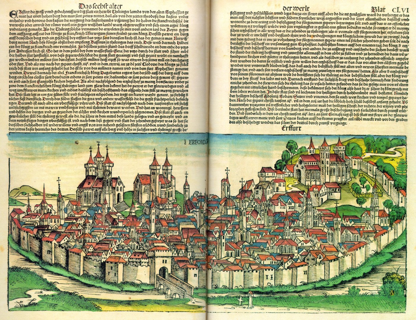
Erfurt () is the capital and largest city in the Central German state of Thuringia. It is located in the wide valley of the Gera river (progression: ), in the southern part of the Thuringian Basin, north of the Thuringian Forest. It sits in the middle of an almost straight line of cities consisting of the six largest Thuringian cities forming the central metropolitan corridor of the state, the "Thuringian City Chain" ('' Thüringer Städtekette'') with more than 500,000 inhabitants, stretching from Eisenach in the west, via Gotha, Erfurt, Weimar and Jena, to Gera in the east. Erfurt and the city of Göttingen in southern Lower Saxony are the two cities with more than 100,000 inhabitants closest to the geographic center of Germany. Erfurt is located south-west of Leipzig, north-east of Frankfurt, south-west of Berlin and north of Munich. Erfurt's old town is one of the best preserved medieval city centres in Germany. Tourist attractions include the Merchants' Bridge (''K ... [...More Info...] [...Related Items...] OR: [Wikipedia] [Google] [Baidu] |
Bad Neustadt
Bad Neustadt an der Saale, officially Bad Neustadt a. d. Saale and often simply called Bad Neustadt, is a town in northern Bavaria, Germany. It is the capital of the Rhön-Grabfeld district in Lower Franconia. It is situated on the rivers Fränkische Saale and Brend, near the Rhön Mountains, 30 km north of Schweinfurt, and 47 km southeast of Fulda. Town structure Between 1972 and 1978 some originally separate villages were gathered together administratively and became part of Bad Neustadt. So today Bad Neustadt has the following ''Stadtteile'' (parts of the town): *Old town of Bad Neustadt (1,858) *Western part of Bad Neustadt (2,515) *Gartenstadt (2,235) *Brendlorenzen (4,390) * Dürrnhof (291) * Herschfeld (2,716) * Lebenhan (492) * Löhrieth (288) *Mühlbach (972) ''(Number of inhabitants in brackets)'' History The church ''St. Martin'' in Brendlorenzen (part of the town Bad Neustadt) was first mentioned in 742 when the Bishopric of Würzburg was founded. T ... [...More Info...] [...Related Items...] OR: [Wikipedia] [Google] [Baidu] |
Bad Kissingen
Bad Kissingen is a German spa town in the Bavarian region of Lower Franconia and seat of the district Bad Kissingen. Situated to the south of the Rhön Mountains on the Franconian Saale river, it is one of the health resorts, which became famous as a "Weltbad" in the 19th century. In 2021, the town became part of the transnational UNESCO World Heritage Site under the name "Great Spa Towns of Europe", because of its famous mineral springs and its architecture exemplifying the popularity of spa resorts in Europe during the 18th through 20th centuries. History The town was first documented in the year 801 under the name ''chizzicha'' and was renowned above all for its mineral springs, which are recorded from as early as 823. At that time, Kissingen was under the domination of Fulda Abbey, later it fell to the Counts of Henneberg and was sold to the bishops of Würzburg in the 14th century. Kissingen was first mentioned as "oppidum" (town) in 1279. The town developed to ... [...More Info...] [...Related Items...] OR: [Wikipedia] [Google] [Baidu] |
Schweinfurt
Schweinfurt ( , ; ) is a city in the district of Lower Franconia in Bavaria, Germany. It is the administrative centre of the surrounding district (''Landkreis'') of Schweinfurt and a major industrial, cultural and educational hub. The urban agglomeration has 100,200 (2018) and the city's catchment area, including the Main-Rhön region and parts of South Thuringia, 759,000 inhabitants. Schweinfurt was first documented in 791 and is one of the oldest cities in Bavaria. Around 1000 the Margraves of Schweinfurt controlled large parts of northern Bavaria. From the 12th century until 1802 Schweinfurt was a Free imperial city within the Holy Roman Empire, around 1700 a humanistic centre and in 1770 began the 250-year industrial history. During World War II, the Americans suffered their biggest air defeat over Schweinfurt in the Second Raid on Schweinfurt ''(Black Thursday)''. On 11 April 1945, the US Army invaded the city. During the Cold ... [...More Info...] [...Related Items...] OR: [Wikipedia] [Google] [Baidu] |
Caen
Caen (, ; nrf, Kaem) is a commune in northwestern France. It is the prefecture of the department of Calvados. The city proper has 105,512 inhabitants (), while its functional urban area has 470,000,Comparateur de territoire INSEE, retrieved 20 June 2022. making Caen the second largest urban area in and the 19th largest in France. It is also the third largest commune in all of Normandy after and Rouen. It is located inland ... [...More Info...] [...Related Items...] OR: [Wikipedia] [Google] [Baidu] |
United States
The United States of America (U.S.A. or USA), commonly known as the United States (U.S. or US) or America, is a country primarily located in North America. It consists of 50 states, a federal district, five major unincorporated territories, nine Minor Outlying Islands, and 326 Indian reservations. The United States is also in free association with three Pacific Island sovereign states: the Federated States of Micronesia, the Marshall Islands, and the Republic of Palau. It is the world's third-largest country by both land and total area. It shares land borders with Canada to its north and with Mexico to its south and has maritime borders with the Bahamas, Cuba, Russia, and other nations. With a population of over 333 million, it is the most populous country in the Americas and the third most populous in the world. The national capital of the United States is Washington, D.C. and its most populous city and principal financial center is New York City. Paleo-Americ ... [...More Info...] [...Related Items...] OR: [Wikipedia] [Google] [Baidu] |


