|
Massachusetts Route 38
Route 38 is a state highway in the U.S. state of Massachusetts, traveling from Route 28 in Somerville north via Lowell to the New Hampshire state line in Dracut, where it continues as New Hampshire Route 38 in Pelham, New Hampshire. Although its southern terminus is at Route 28, some signage indicates that Route 38 continues south towards Sullivan Square in Boston. History The majority of Route 38 was originally designated as Route 6B in the New England road marking system, an alternate to New England Interstate Route 6. It began at Route 6 somewhere in Cambridge and made its way to present Route 38 in Somerville, running north on much the same alignment as is followed now, with the only real differences in Medford (where it used High Street ( Route 60) rather than the Mystic Valley Parkway) and in Winchester center (where it ran via the rotary). In Lowell, Route 6B turned west on current Route 110, ending at the corner of Appleton Street and Gorham St ... [...More Info...] [...Related Items...] OR: [Wikipedia] [Google] [Baidu] |
Sullivan Square
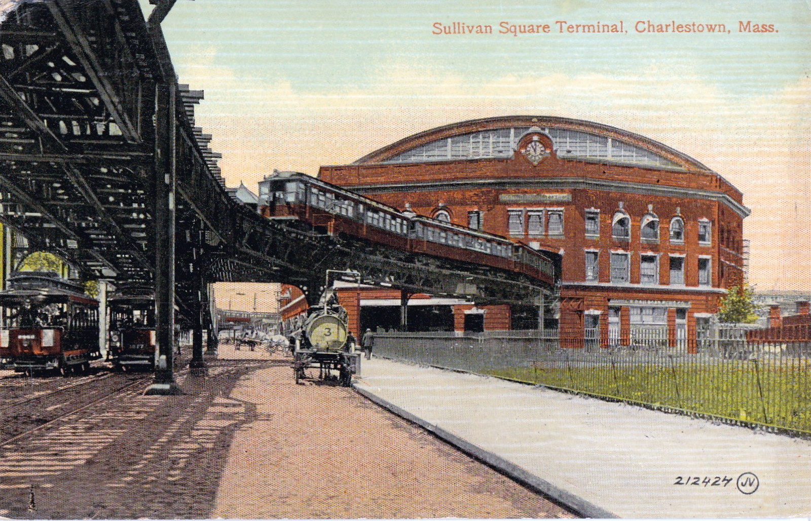
Sullivan Square is a traffic circle located at the north end of the Charlestown neighborhood of Boston, Massachusetts. It is named after James Sullivan, an early 19th-century Governor of Massachusetts. Sullivan Square station on the MBTA Orange Line is located just west of the square. History Prior to the 19th century, Mishawum (later Charlestown) was only connected to the mainland (now Somerville) by an isthmus called "the neck". Roads to Everett (previously a ferry), Medford, and Cambridge and Somerville fanned out from the Charlestown Neck. An extension of the Middlesex Canal from Medford to a millpond at the neck was authorized in 1795 and completed in 1803, with the canal running through where the traffic circle now stands. The junction was eventually named Sullivan Square after James Sullivan, an early 19th-century Governor of Massachusetts who was among the organizers of the canal. The Boston and Lowell Railroad opened in 1835, followed by the Boston and Maine Rai ... [...More Info...] [...Related Items...] OR: [Wikipedia] [Google] [Baidu] |
Memorial Drive (Cambridge)
Memorial Drive (colloquially referred to as Mem Drive) is a parkway along the north bank of the Charles River in Cambridge, Massachusetts, United States. It runs parallel to two major Boston parkways - Soldiers Field Road and Storrow Drive - which lie on the south bank of the river. The western terminus is in West Cambridge at Greenough Boulevard and Fresh Pond Parkway. The eastern terminus is at Main Street and the Longfellow Bridge near Kendall Square. Memorial Drive is designated as U.S. Route 3 for most of its length, except the easternmost which are designated as Massachusetts Route 3 (US 3 and Route 3 connect end-to-end and are treated as one continuous route by the state). Route 2 is cosigned with US 3 on Memorial Drive between the western terminus and the Boston University Bridge. History Formerly known as Charles River Road, the road was officially renamed "Memorial Drive" in 1923, when Charles River Park was taken over by the Metropolitan District Commission. It is n ... [...More Info...] [...Related Items...] OR: [Wikipedia] [Google] [Baidu] |
Charles River
The Charles River ( Massachusett: ''Quinobequin)'' (sometimes called the River Charles or simply the Charles) is an river in eastern Massachusetts. It flows northeast from Hopkinton to Boston along a highly meandering route, that doubles back on itself several times and travels through 23 cities and towns before reaching the Atlantic Ocean. The indigenous Massachusett named it ''Quinobequin'', meaning "meandering". Hydrography The Charles River is fed by approximately 80 streams and several major aquifers as it flows , starting at Teresa Road just north of Echo Lake () in Hopkinton, passing through 23 cities and towns in eastern Massachusetts before emptying into Boston Harbor Boston Harbor is a natural harbor and estuary of Massachusetts Bay, and is located adjacent to the city of Boston, Massachusetts. It is home to the Port of Boston, a major shipping facility in the northeastern United States. History .... Thirty-three lakes and ponds and 35 munic ... [...More Info...] [...Related Items...] OR: [Wikipedia] [Google] [Baidu] |
Boston University Bridge
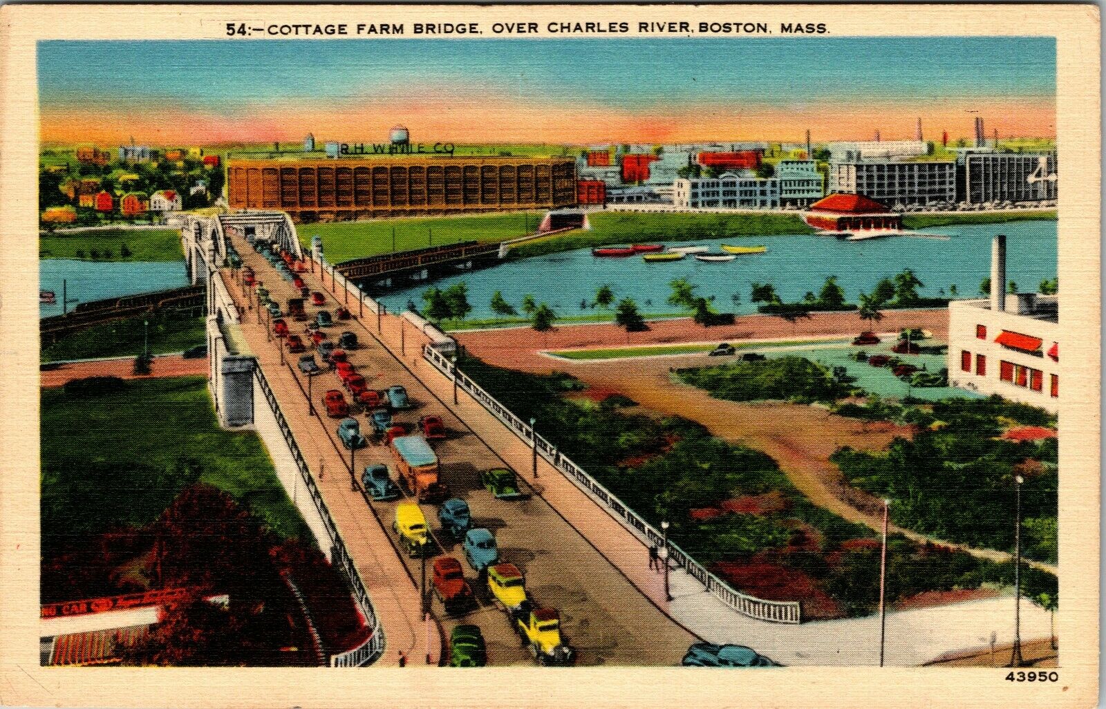
The Boston University Bridge, originally the Cottage Farm Bridge and commonly referred to as the BU Bridge, is a steel truss through arch bridge with a suspended deck carrying Route 2 over the Charles River, connecting the Boston University campus to Cambridge, Massachusetts. The bridge, with the Grand Junction Railroad Bridge directly underneath it, is incorrectly rumored to be the only place in the world where a boat can sail under a train driving under a car driving under an airplane. Other such places include the Steel Bridge in Portland, Oregon, and the 25 de Abril Bridge in Lisbon, although both those bridges are on the same span. In this case the rail and road traffic are on separate bridges. History The Boston University Bridge was designed by Andrew Canzanelli and built by The Phoenix Bridge Company in 1927, replacing an 1850s drawbridge known as the Brookline Bridge. Canzanelli also designed the Weeks footbridge and the first shell constructed on the Esplana ... [...More Info...] [...Related Items...] OR: [Wikipedia] [Google] [Baidu] |
Cambridge, Massachusetts
Cambridge ( ) is a city in Middlesex County, Massachusetts, United States. As part of the Boston metropolitan area, the cities population of the 2020 U.S. census was 118,403, making it the fourth most populous city in the state, behind Boston, Worcester, and Springfield. It is one of two de jure county seats of Middlesex County, although the county's executive government was abolished in 1997. Situated directly north of Boston, across the Charles River, it was named in honor of the University of Cambridge in England, once also an important center of the Puritan theology embraced by the town's founders. Harvard University, the Massachusetts Institute of Technology (MIT), Lesley University, and Hult International Business School are in Cambridge, as was Radcliffe College before it merged with Harvard. Kendall Square in Cambridge has been called "the most innovative square mile on the planet" owing to the high concentration of successful startups that have emerged in th ... [...More Info...] [...Related Items...] OR: [Wikipedia] [Google] [Baidu] |
Massachusetts Route 110
Route 110 is a southwest–northeast state route in the U.S. state of Massachusetts. Route 110’s western terminus is at a concurrency of Route 12 and Route 140 in West Boylston, and its eastern terminus is at the junction of U.S. 1 and Route 1A in Sailsbury, a few miles from the Atlantic Ocean. Route 110 provides an alternate route for the northern part (section after Route 2) of I-495. Route description Route 110 begins at Route 12 in West Boylston, just north of the Wachusett Reservoir and the border with Worcester. The route follows north of the reservoir, passing through Sterling before entering Clinton. In Clinton, Route 110 shares a quarter-mile concurrency with Route 62 and Route 70 before heading northward, crossing the Nashua River and passing through Lancaster. The route continues into Bolton, crossing Route 117 and passing the Bolton Flats before entering the town of Harvard. Route 110 continues through the village of Still River, wrapping around Bare ... [...More Info...] [...Related Items...] OR: [Wikipedia] [Google] [Baidu] |
Rotary (intersection)
A roundabout is a type of circular intersection or junction in which road traffic is permitted to flow in one direction around a central island, and priority is typically given to traffic already in the junction.''The New Shorter Oxford English Dictionary,'' Volume 2, Clarendon Press, Oxford (1993), page 2632 Engineers use the term modern roundabout to refer to junctions installed after 1960 that incorporate various design rules to increase safety. Both modern and non-modern roundabouts, however, may bear street names or be identified colloquially by local names such as rotary or traffic circle. Compared to stop signs, traffic signals, and earlier forms of roundabouts, modern roundabouts reduce the likelihood and severity of collisions greatly by reducing traffic speeds and minimizing T-bone and head-on collisions. Variations on the basic concept include integration with tram or train lines, two-way flow, higher speeds and many others. For pedestrians, traffic exiting the ... [...More Info...] [...Related Items...] OR: [Wikipedia] [Google] [Baidu] |
Winchester, Massachusetts
Winchester is a town in Middlesex County, Massachusetts, located 8.2 miles (13.2 km) north of downtown Boston as part of the Greater Boston metropolitan area. It is also one of the wealthiest municipalities in Massachusetts. The population was 22,970 at the 2020 United States Census. History Native Americans inhabited the area that would become Winchester for thousands of years prior to European colonization of the Americas. At the time of contact, the area was inhabited by the Naumkeag people, from whom the land that would become Winchester was purchased for the settlement of Charlestown in 1639. From the 17th century until the middle of the 19th century, parts of Arlington, Medford, Cambridge, and Woburn comprised what is now Winchester. In the early years of the settlement, the area was known informally as Waterfield, a reference to its many ponds and to the river which bisected the central village. In its second century, the area was referred to as Black Horse Villa ... [...More Info...] [...Related Items...] OR: [Wikipedia] [Google] [Baidu] |
Mystic Valley Parkway
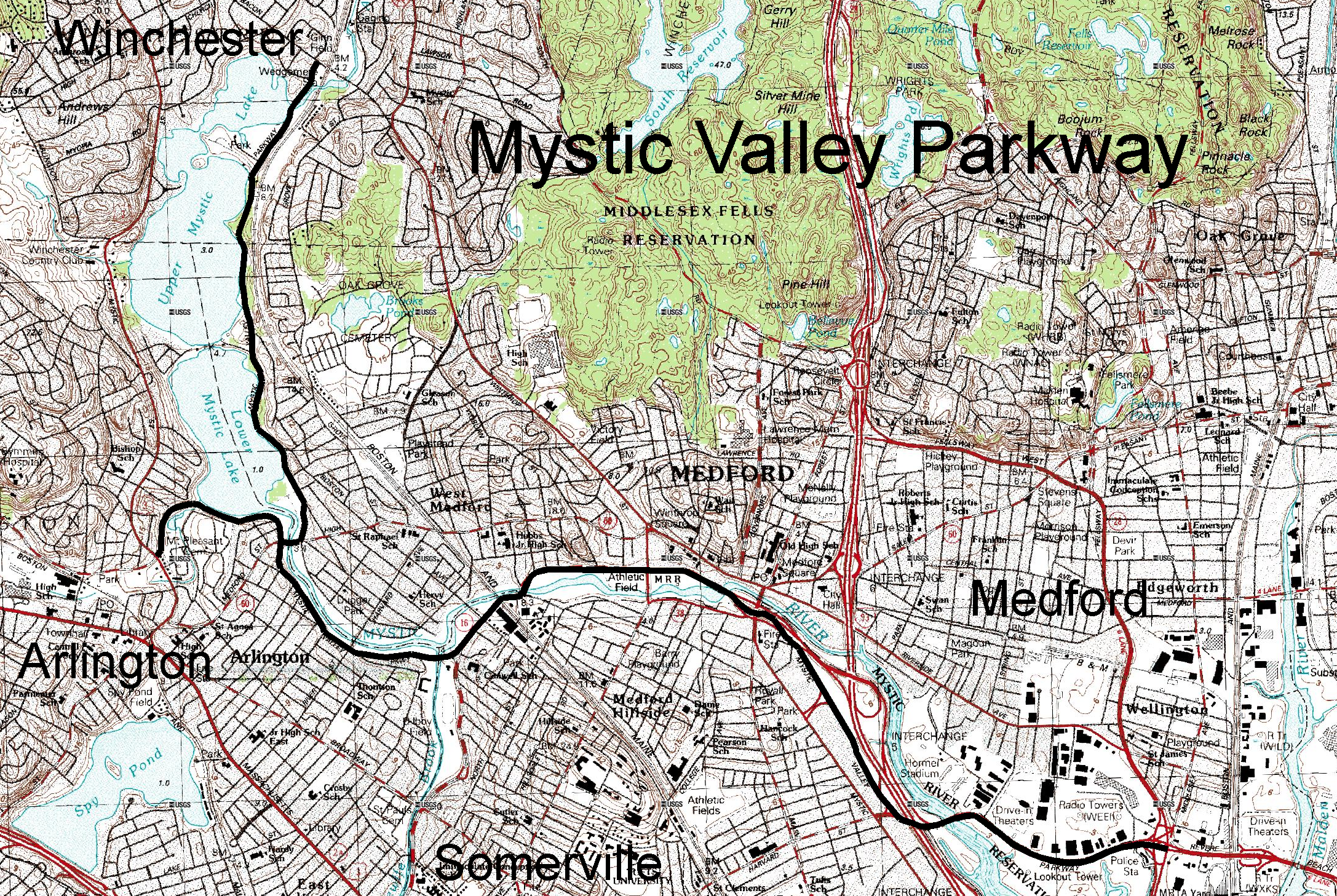
Mystic Valley Parkway is a parkway in Arlington, Medford, Somerville, and Winchester, Massachusetts. It is listed on the National Register of Historic Places, and forms part of Route 16. Route description The parkway runs roughly north–south from the Middlesex Fells in Winchester, down the Aberjona River valley, and along the east side of the Mystic Lakes into Medford. This section follows the path of the old Middlesex Canal. It then crosses the Mystic River into Arlington (sharing a bridge with Massachusetts Route 60), and curves to follow the river as it runs east–west through Arlington. A short branch also runs along the southern shore of the Lower Mystic Lake from Route 60 where it ends at a junction with U.S. Route 3 and Massachusetts Route 2A. It meets Alewife Brook Parkway (and joins with Massachusetts Route 16) at a rotary near where Alewife Brook empties into the Mystic, and then continues to generally follow the course of the Mystic River downstream, crossin ... [...More Info...] [...Related Items...] OR: [Wikipedia] [Google] [Baidu] |
Massachusetts Route 60
Route 60 is a east–west state highway running through the northern suburbs of Boston. Its western terminus is at U.S. Route 20 (US 20) in Waltham and its eastern terminus is at Route 1A and Route 16 in Revere. Route description Route 60 begins at U.S. Route 20 in Waltham, just east of downtown. It then heads eastward, passing through the center of Belmont before intersecting in Arlington with Route 2 at that route's Exit 59 eastbound, continuing as Pleasant Street. From there, Route 60 joins U.S. Route 3 and Route 2A for a brief concurrency, starting at Massachusetts Avenue. It then turns eastward off of that route, crossing the Mystic River into Medford. In Medford it passes the West Medford commuter rail station before intersecting Route 38 at Winthrop Square. From there Route 60 heads into downtown Medford, splitting at Main Street (just north of the Mystic Valley Parkway and Route 16) before rejoining at Medford City Hall to pass under Interstate 93 ... [...More Info...] [...Related Items...] OR: [Wikipedia] [Google] [Baidu] |
Cambridge (MA)
Cambridge ( ) is a city in Middlesex County, Massachusetts, United States. As part of the Boston metropolitan area, the cities population of the 2020 U.S. census was 118,403, making it the fourth most populous city in the state, behind Boston, Worcester, and Springfield. It is one of two de jure county seats of Middlesex County, although the county's executive government was abolished in 1997. Situated directly north of Boston, across the Charles River, it was named in honor of the University of Cambridge in England, once also an important center of the Puritan theology embraced by the town's founders. Harvard University, the Massachusetts Institute of Technology (MIT), Lesley University, and Hult International Business School are in Cambridge, as was Radcliffe College before it merged with Harvard. Kendall Square in Cambridge has been called "the most innovative square mile on the planet" owing to the high concentration of successful startups that have emerged in the vicinity ... [...More Info...] [...Related Items...] OR: [Wikipedia] [Google] [Baidu] |

.jpg)


_map.jpg)