|
Maros
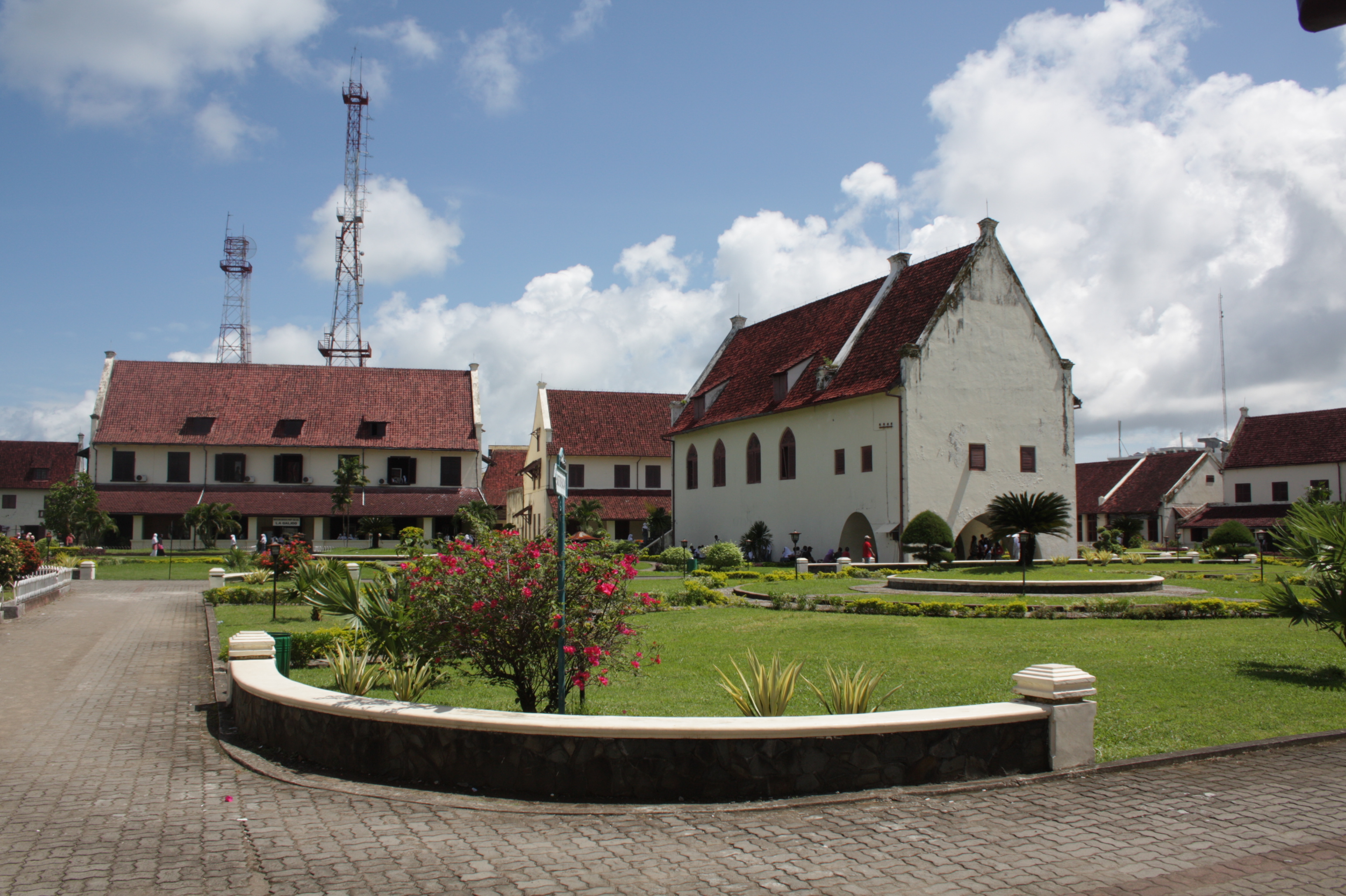
Maros is a town in the South Sulawesi province of Indonesia close to the provincial capital of Makassar. It is the capital of the Maros Regency. Maros is the location of the Indonesian Cereals Research Institute, a branch of the Indonesian Agency for Agricultural Research and Development. In 2012, regional cement producer PT Semen Bosowa Maros began construction in Maros of a new clinker plant estimated to cost over $300 million. The clinker plant was expected to help the cement company increase production in the region in response to the growing demand for cement to support construction activities. Maros Water Park is in Maros. Rock art in caves Nearby to Maros, in the area of the Maros Regency to the north of Makassar, are Pettakere cave and other prehistoric cave A cave or cavern is a natural void in the ground, specifically a space large enough for a human to enter. Caves often form by the weathering of rock and often extend deep underground. The word ''cav ... [...More Info...] [...Related Items...] OR: [Wikipedia] [Google] [Baidu] |
Maros Regency
Maros Regency ( mak, ᨆᨑᨘᨔᨘ, Màrusu’, ) is a regency of South Sulawesi province of Indonesia. It covers an area of 1,619.12 sq.km, and had a population of 319,002 at the 2010 Census and 391,774 at the Census of 2020. The official estimate for mid 2021 was 396,924. Almost all of the regency lies within the official metropolitan area of the city of Makassar. The capital town of the regency is Maros. Administrative division The Regency is divided into fourteen districts ( id, kecamatan), tabulated below with their areas and population totals from the 2010 Census and the 2020 Census, together with the official estimate as at mid 2021. The table also includes the number of administrative villages (rural ''desa'' and urban ''kelurahan'') in each district, and its postal codes. Twelve of the fourteen districts tabulated above lie within the official metropolitan area of the city of Makassar; the remaining two districts (''Camba'' and ''Mallawa''), which together form the n ... [...More Info...] [...Related Items...] OR: [Wikipedia] [Google] [Baidu] |
Makassar
Makassar (, mak, ᨆᨀᨔᨑ, Mangkasara’, ) is the capital of the Indonesian province of South Sulawesi. It is the largest city in the region of Eastern Indonesia and the country's fifth-largest urban center after Jakarta, Surabaya, Medan, and Bandung.Ministry of Internal AffairsRegistration Book for Area Code and Data of 2013/ref> The city is located on the southwest coast of the island of Sulawesi, facing the Makassar Strait. Throughout its history, Makassar has been an important trading port, hosting the center of the Gowa Sultanate and a Portuguese naval base before its conquest by the Dutch East India Company in the 17th century. It remained an important port in the Dutch East Indies, serving Eastern Indonesian regions with Makassarese fishers going as far south as the Australian coast. For a brief period after Indonesian independence, Makassar became the capital of the State of East Indonesia, during which an uprising occurred. The city's area is , and it had ... [...More Info...] [...Related Items...] OR: [Wikipedia] [Google] [Baidu] |
Pettakere Cave
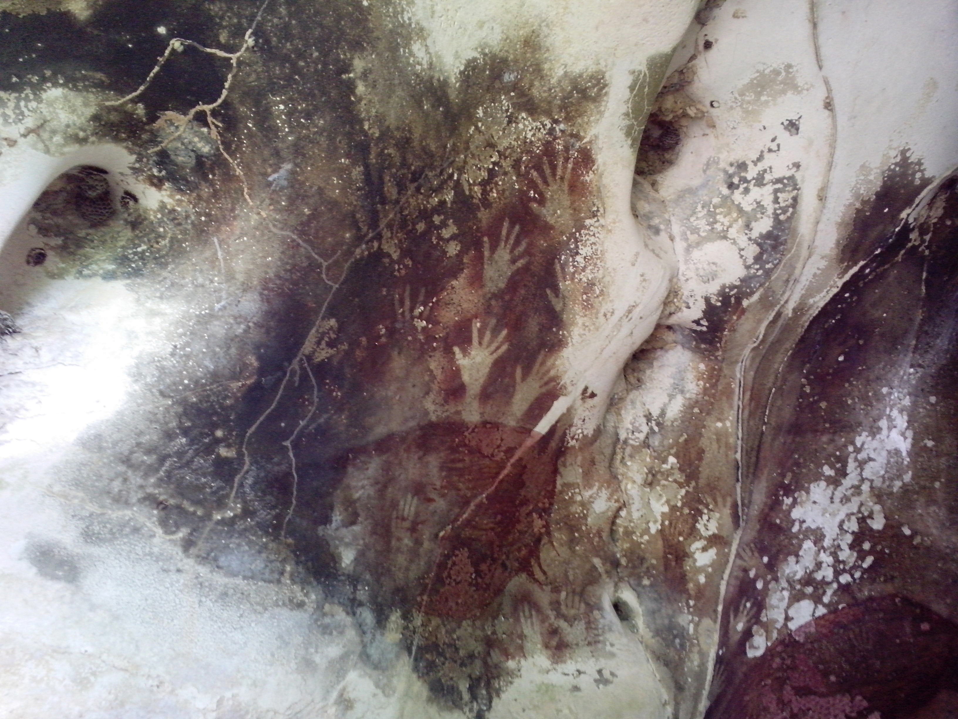
The caves in the Maros-Pangkep karst are situated in South Sulawesi, Indonesia, and contain paintings from the Paleolithic considered to be the earliest figurative art in the world, dated to at least 43,900 years ago. Description The caves in the Maros-Pangkep karst are a cave complex, where prehistoric finds were made. The whole complex is also called "Prehistoric place Leang-Leang" – the name stems from the Makassarese language. The various caves - named Pettae, Jane, Saripa, Jarie, Karrasa, and so on - consist of limestone. They are located from the town of Maros and from the city of Makassar. The entrance to the caves is located above a rice field, accessible by ladder. A hand stencil in the Leang Tempuseng cave was dated to at least 39,900 years old in a 2014 study. The depiction of a babirusa is also located in this cave. It is estimated to be 35,400 years old. The art works were examined with the help of the Uranium-Thorium method of the sintering on the painti ... [...More Info...] [...Related Items...] OR: [Wikipedia] [Google] [Baidu] |
South Sulawesi
South Sulawesi ( id, Sulawesi Selatan) is a province in the southern peninsula of Sulawesi. The Selayar Islands archipelago to the south of Sulawesi is also part of the province. The capital is Makassar. The province is bordered by Central Sulawesi and West Sulawesi to the north, the Gulf of Bone and Southeast Sulawesi to the east, Makassar Strait to the west, and Flores Sea to the south. The 2010 census estimated the population as 8,032,551 which makes South Sulawesi the most populous province on the island (46% of the population of Sulawesi is in South Sulawesi), and the sixth most populous province in Indonesia. At the 2020 Census this had risen to 9,073,509,Badan Pusat Statistik, Jakarta, 2021. and the official estimate as at mid 2021 was 9,139,531. The main ethnic groups in South Sulawesi are the Buginese, Makassarese, Toraja, and Mandar. The economy of the province is based on agriculture, fishing, and mining of gold, magnesium, iron and other metals. The pinisi, ... [...More Info...] [...Related Items...] OR: [Wikipedia] [Google] [Baidu] |
Maros Water Park
Maros Water Park is one of water park existing in Maros district, South Sulawesi and was built and ready to soft launch in October 2009. It is planned to be opened in January 2013. It contains outbound area, cottages, restaurant, mini water park, semi olympic pool and body slide. It is surrounded with natural hills, fresh water on site, and with a couple of caves. References {{coord missing, Indonesia Water parks in Indonesia Buildings and structures in South Sulawesi Tourist attractions in South Sulawesi 2009 establishments in Indonesia ... [...More Info...] [...Related Items...] OR: [Wikipedia] [Google] [Baidu] |
Indonesia
Indonesia, officially the Republic of Indonesia, is a country in Southeast Asia and Oceania between the Indian and Pacific oceans. It consists of over 17,000 islands, including Sumatra, Java, Sulawesi, and parts of Borneo and New Guinea. Indonesia is the world's largest archipelagic state and the 14th-largest country by area, at . With over 275 million people, Indonesia is the world's fourth-most populous country and the most populous Muslim-majority country. Java, the world's most populous island, is home to more than half of the country's population. Indonesia is a presidential republic with an elected legislature. It has 38 provinces, of which nine have special status. The country's capital, Jakarta, is the world's second-most populous urban area. Indonesia shares land borders with Papua New Guinea, East Timor, and the eastern part of Malaysia, as well as maritime borders with Singapore, Vietnam, Thailand, the Philippines, Australia, Palau, and India ... [...More Info...] [...Related Items...] OR: [Wikipedia] [Google] [Baidu] |
Clinker (cement)
200px, Typical clinker nodules 200px, Hot clinker Cement clinker is a solid material produced in the manufacture of Portland cement as an intermediary product. Clinker occurs as lumps or nodules, usually to in diameter. It is produced by sintering (fusing together without melting to the point of liquefaction) limestone and aluminosilicate materials such as clay during the cement kiln stage. Composition and preparation The Portland clinker essentially consists of four mineral phases: two calcium silicates, alite (Ca3Si) and belite (Ca2Si), along with tricalcium aluminate (Ca3Al) and calcium aluminoferrite (Ca4AlFe). These main mineral phases are produced by heating at high temperature clays and limestone. Portland cement clinker is made by heating a homogeneous mixture of raw materials in a rotary kiln at high temperature. The products of the chemical reaction aggregate together at their sintering temperature, about . Aluminium oxide and iron oxide are present only as a f ... [...More Info...] [...Related Items...] OR: [Wikipedia] [Google] [Baidu] |
Prehistoric
Prehistory, also known as pre-literary history, is the period of human history between the use of the first stone tools by hominins 3.3 million years ago and the beginning of recorded history with the invention of writing systems. The use of symbols, marks, and images appears very early among humans, but the earliest known writing systems appeared 5000 years ago. It took thousands of years for writing systems to be widely adopted, with writing spreading to almost all cultures by the 19th century. The end of prehistory therefore came at very different times in different places, and the term is less often used in discussing societies where prehistory ended relatively recently. In the early Bronze Age, Sumer in Mesopotamia, the Indus Valley Civilisation, and ancient Egypt were the first civilizations to develop their own scripts and to keep historical records, with their neighbors following. Most other civilizations reached the end of prehistory during the following Ir ... [...More Info...] [...Related Items...] OR: [Wikipedia] [Google] [Baidu] |
Cave
A cave or cavern is a natural void in the ground, specifically a space large enough for a human to enter. Caves often form by the weathering of rock and often extend deep underground. The word ''cave'' can refer to smaller openings such as sea caves, rock shelters, and grottos, that extend a relatively short distance into the rock and they are called ''exogene'' caves. Caves which extend further underground than the opening is wide are called ''endogene'' caves. Speleology is the science of exploration and study of all aspects of caves and the cave environment. Visiting or exploring caves for recreation may be called ''caving'', ''potholing'', or ''spelunking''. Formation types The formation and development of caves is known as ''speleogenesis''; it can occur over the course of millions of years. Caves can range widely in size, and are formed by various geological processes. These may involve a combination of chemical processes, erosion by water, tectonic forces, microorgani ... [...More Info...] [...Related Items...] OR: [Wikipedia] [Google] [Baidu] |


