|
Marienlyst Park
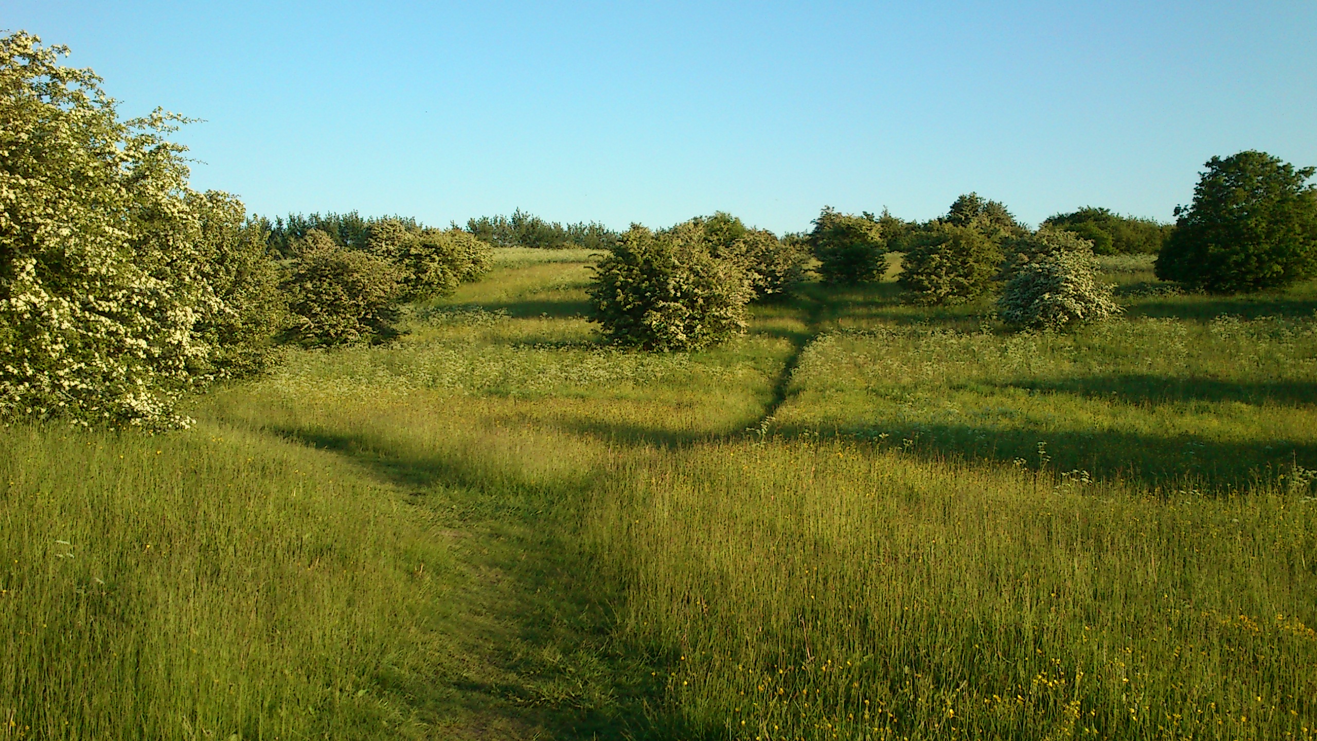
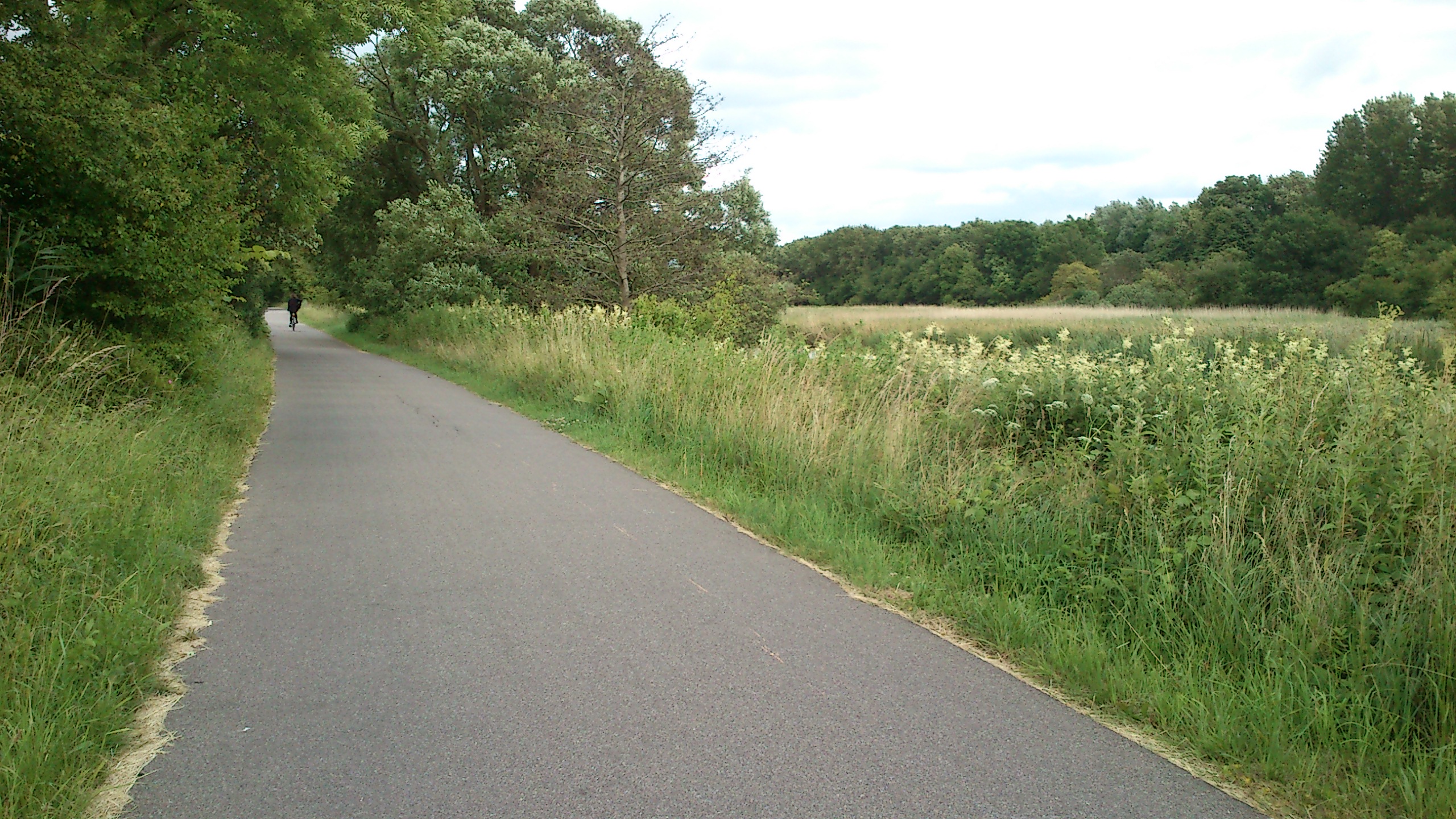
Marienlyst Park (Danish language, Danish: Marienlystparken) is a public park in Hasle, Aarhus, Hasle in the Aarhus V district, north-west Aarhus, Denmark. The park is situated west of the ''Herredsvang'' neighborhood along the street ''Fjældevænget Busvej'' to the south and Brendstrup Forest to the west. Marienlyst Park is one of the largest parks in Aarhus and features both landscaped lawns and artificial forested hills. Facilities include an amphitheatre, soccer fields, playgrounds and a 6-hole golf course. Marienlyst Park was established in connection with the development of western Hasle, Aarhus, Hasle in the 1970s and today forms part of a green corridor extending from Vestereng to Brabrand Lake. The park is owned by Aarhus Municipality and is managed by the municipal department ''Natur og Miljø'' (Nature and Environment). Marienlyst Park can be rented for public events. The largest areas in Marienlyst Park are landscaped and managed, such as grass lawns and soccer fields, ... [...More Info...] [...Related Items...] OR: [Wikipedia] [Google] [Baidu] |
Urban Park
An urban park or metropolitan park, also known as a municipal park (North America) or a public park, public open space, or municipal gardens ( UK), is a park in cities and other incorporated places that offer recreation and green space to residents of, and visitors to, the municipality. The design, operation, and maintenance is usually done by government agencies, typically on the local level, but may occasionally be contracted out to a park conservancy, "friends of" group, or private sector company. Common features of municipal parks include playgrounds, gardens, hiking, running and fitness trails or paths, bridle paths, sports fields and courts, public restrooms, boat ramps, and/or picnic facilities, depending on the budget and natural features available. Park advocates claim that having parks near urban residents, including within a 10-minute walk, provide multiple benefits. History A park is an area of open space provided for recreational use, usually owned and mai ... [...More Info...] [...Related Items...] OR: [Wikipedia] [Google] [Baidu] |
Aarhus
Aarhus (, , ; officially spelled Århus from 1948 until 1 January 2011) is the second-largest city in Denmark and the seat of Aarhus Municipality. It is located on the eastern shore of Jutland in the Kattegat sea and approximately northwest of Copenhagen. The largest city in Jutland, Aarhus anchors the Central Denmark Region and the statistical region ' (''LØ'') (lit.: Province East Jutland). The LØ is the second most populous statistical region in Denmark with an estimated population of 903,974 (). Aarhus Municipality defines the greater Aarhus area as itself and eight adjacent municipalities totalling 952,824 inhabitants () which is roughly analogous to the municipal and commercial collaboration Business Region Aarhus. The city proper, with an estimated population of 285,273 inhabitants (), ranks as the 2nd-largest city in Denmark. Aarhus dates back to at least the late 8th century and is among the oldest cities in Denmark. It was founded as a harbour settlement at t ... [...More Info...] [...Related Items...] OR: [Wikipedia] [Google] [Baidu] |
Denmark
) , song = ( en, "King Christian stood by the lofty mast") , song_type = National and royal anthem , image_map = EU-Denmark.svg , map_caption = , subdivision_type = Sovereign state , subdivision_name = Kingdom of Denmark , established_title = Consolidation , established_date = 8th century , established_title2 = Christianization , established_date2 = 965 , established_title3 = , established_date3 = 5 June 1849 , established_title4 = Faroese home rule , established_date4 = 24 March 1948 , established_title5 = EEC accession , established_date5 = 1 January 1973 , established_title6 = Greenlandic home rule , established_date6 = 1 May 1979 , official_languages = Danish , languages_type = Regional languages , languages_sub = yes , languages = GermanGerman is recognised as a protected minority language in the South Jutland area of Denmark. , demonym = , capital = Copenhagen , largest_city = capital , coordinates = , ethnic_groups = , ethnic_g ... [...More Info...] [...Related Items...] OR: [Wikipedia] [Google] [Baidu] |
Aarhus Municipality
Aarhus Municipality ( da, Aarhus Kommune), known as Århus Municipality ( da, Århus Kommune) until 2011, is a municipality in Central Denmark Region, on the east coast of the Jutland peninsula in central Denmark. The municipality covers an area of , and has a population of 349,983 as of 2020. The main town and the site of its municipal council is the city of Aarhus. Neighbouring municipalities are Syddjurs to the north, Favrskov to the northwest, Skanderborg to the southwest, and Odder to the south. Aarhus Municipality was not merged with other municipalities in the nationwide ''Kommunalreformen'' ("The Municipal Reform" of 2007) due to its already relatively large size and population. The municipality is part of Business Region Aarhus and of the East Jutland metropolitan area, which had a total population of 1.378 million in 2016. Politics Aarhus City Council (''Aarhus Byråd'') is also the municipal government. The city council consists of 31 members elected for fou ... [...More Info...] [...Related Items...] OR: [Wikipedia] [Google] [Baidu] |
Danish Language
Danish (; , ) is a North Germanic language spoken by about six million people, principally in and around Denmark. Communities of Danish speakers are also found in Greenland, the Faroe Islands, and the northern German region of Southern Schleswig, where it has minority language status. Minor Danish-speaking communities are also found in Norway, Sweden, the United States, Canada, Brazil, and Argentina. Along with the other North Germanic languages, Danish is a descendant of Old Norse, the common language of the Germanic peoples who lived in Scandinavia during the Viking Era. Danish, together with Swedish, derives from the ''East Norse'' dialect group, while the Middle Norwegian language (before the influence of Danish) and Norwegian Bokmål are classified as ''West Norse'' along with Faroese and Icelandic. A more recent classification based on mutual intelligibility separates modern spoken Danish, Norwegian, and Swedish as "mainland (or ''continental'') Scandinavian", wh ... [...More Info...] [...Related Items...] OR: [Wikipedia] [Google] [Baidu] |
Hasle, Aarhus
Hasle is a large neighbourhood of Aarhus in Denmark. It is located 3 km north-west of the Aarhus city centre and is part of postal district Aarhus V. Geography and history Hasle is situated in a hilly moranial plateau with a maximum natural height of 78 meters above sealevel. Hasle was an independent village to the east of Aarhus, but in the 20th century the two towns gradually merged and it was incorporated as a neighborhood of Aarhus. The neighborhood contains a church that dates back to the 12th century. In the western parts is Hasle Hills, an artificial landscape and natural site created by Aarhus Municipality between 2006 and 2009. It consists of three artificial landmark hills (''Spiralen'', ''Bjergkammen'' and ''Plateauet'') that can be seen from all over Aarhus. Bjergkammen is the highest point at 105 meters. In Aarhus Municipality, only Jelshøj in Højbjerg is higher. To the west, across the ring road Ring 2, lies the neighbourhood of Gellerup in the Brabrand B ... [...More Info...] [...Related Items...] OR: [Wikipedia] [Google] [Baidu] |
Aarhus V
Aarhus Vest (lit.: Aarhus West) or Aarhus V, is a postal district in the city of Aarhus, consisting of Hasle, Herredsvang, Møllevangen and Frydenlund. Quarters and neighborhoods Møllevangen Built primarily in the 1940s, Møllevangen has many four-storey apartment blocks in red or yellow brick, but also larger detached house areas and several townhouses. The area is situated close to Aarhus Botanical Gardens and the shopping mall of Storcenter Nord. Møllevangen has two churches, a school and a nursing and retirement center. Charlottehøj The skyline of Møllevangen, is dominated by one of the only brick-constructed highrises in the country; a 16-story red apartment block in the neighbourhood of Charlottehøj. In the northwest, lies the residential area of Finnebyen; a well defined neighbourhood of 122 colourful wooden houses from Finland, established in 1947-48 to address the increased housing needs after World War II. Finnebyen will perhaps be granted a local conservation st ... [...More Info...] [...Related Items...] OR: [Wikipedia] [Google] [Baidu] |
Brendstrup Forest
Thorald Brendstrup (25 May 1812, Sengeløse, near Taastrup – 4 May 1883, Copenhagen) was one of Denmark's Golden Age painters. Although he is not particularly well known, he is credited above all with many well-proportioned landscapes."Thorald Brendstrup" ''Kunstindeks Danmark & Weilbachs Kunstnerleksikon''. Retrieved 1 August 2012. Biography Brendstrup studied decorative painting at the and porcelain painting at the[...More Info...] [...Related Items...] OR: [Wikipedia] [Google] [Baidu] |
Amphitheatre
An amphitheatre (British English) or amphitheater (American English; both ) is an open-air venue used for entertainment, performances, and sports. The term derives from the ancient Greek ('), from ('), meaning "on both sides" or "around" and ('), meaning "place for viewing". Ancient Roman amphitheatres were oval or circular in plan, with seating tiers that surrounded the central performance area, like a modern open-air stadium. In contrast, both ancient Greek and ancient Roman theatres were built in a semicircle, with tiered seating rising on one side of the performance area. Modern parlance uses "amphitheatre" for any structure with sloping seating, including theatre-style stages with spectator seating on only one side, theatres in the round, and stadia. They can be indoor or outdoor. Natural formations of similar shape are sometimes known as natural amphitheatres. Roman amphitheatres About 230 Roman amphitheatres have been found across the area of the Roman Empire. ... [...More Info...] [...Related Items...] OR: [Wikipedia] [Google] [Baidu] |
Soccer Field
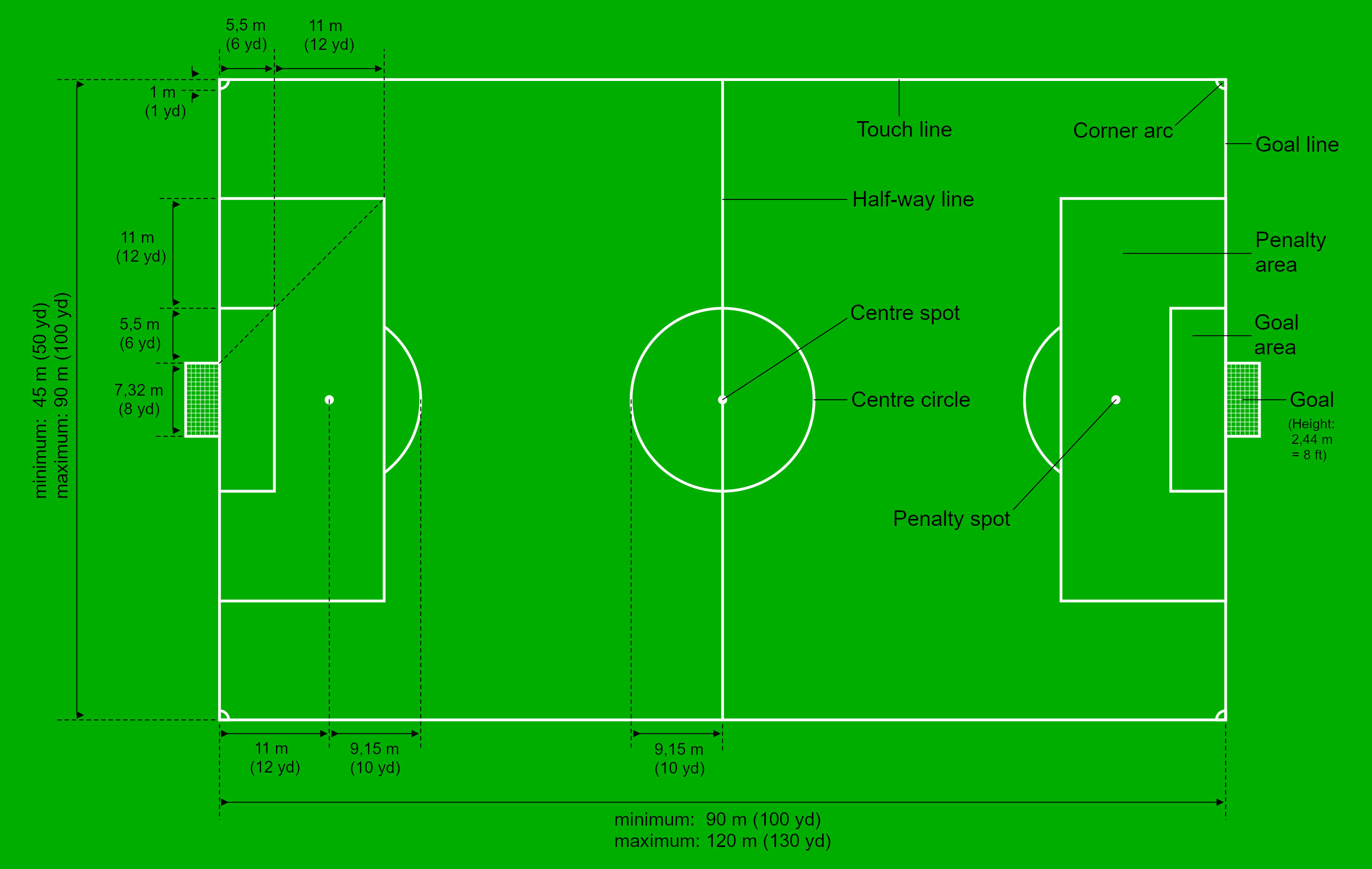
A football pitch (also known as soccer field) is the playing surface for the game of association football. Its dimensions and markings are defined by Law 1 of the Laws of the Game, "The Field of Play". The pitch is typically made of natural turf or artificial turf, although amateur and recreational teams often play on dirt fields. Artificial surfaces are allowed only to be green in colour. All line markings on the pitch form part of the area which they define. For example, a ball on or above the touchline is still on the field of play, and a foul committed over the line bounding the penalty area results in a penalty. Therefore, a ball has to completely cross the touchline to be out of play, and a ball has to wholly cross the goal line (between the goal posts) in order for a goal to be scored; if any part of the ball is still on or above the line, a goal is not scored and the ball is still in play. The field descriptions that apply to adult matches are described below. Becau ... [...More Info...] [...Related Items...] OR: [Wikipedia] [Google] [Baidu] |
Vestereng
Vestereng is a nature site in the environs of northern Aarhus and the suburb of Skejby. The name literally translates as 'westward meadow'. The Municipality of Aarhus took ownership in 1939. The area has a lively history of recent times and is now used extensively by several civil groups and organizations. The most prevalent groups as of 2013, being Aarhus Beach Volley Club, the roleplaying club Einherjerne, Aarhus Dirt Jump Park and Aarhus civil dog handling Association. History Vestereng was used by the German occupational forces as ammunition storage for the Kriegsmarine during the Second World War. They constructed a total of 14 concrete bunkers; 10 as storage facilities and 4 for machinegun defence and the bunkers are still here today, as a historical testimony to the occupation. After the liberation in 1945, the Danish military forces took over and Vestereng was used as a shooting range and training ground for several decades. From 1978-87 the Danish Home Guard took ... [...More Info...] [...Related Items...] OR: [Wikipedia] [Google] [Baidu] |
Brabrand Lake
Brabrand Lake ( da, Brabrand-søen or Brabrand Sø) is a lake in the district of Brabrand (Gellerup), west of Aarhus city, Denmark. The Aarhus River passes through Brabrand Lake and it is possible to canoe all the way to the inner city from here. The lake is oblong-shaped. Since 2003, Brabrand Lake has been steadily extended 3–4 km further west, with the new lake of Årslev Engsø (lit.: Årslev meadow-lake). In 2001–2, it was politically decided to abandon the artificial draining of the meadows and as of 2013, Årslev meadow lake has a surface area of around . The total area including adjoining meadows and reed beds totals . It is hoped that Eurasian bittern and otter will find themselves a new home here with time. In everyday parlance, "Brabrand Lake" is a general term including the surroundings as well, indicating a total area of around with for the lake alone. A special Natura2000 protected area under the European Union, Brabrand Lake is home to a large varie ... [...More Info...] [...Related Items...] OR: [Wikipedia] [Google] [Baidu] |


