|
Mainkreis (Bavaria)
The Mainkreis (German: iverMain Circle) was one of the 15 administrative districts (german: Regierungsbezirke) of the Kingdom of Bavaria between 1806 and 1837. The district was named after its main river Main and renamed ''Obermainkreis'' (Upper Main Circle) in 1817. It was the predecessor of the ''Regierungsbezirk Oberfranken'' (Administrative Regional District of Upper Franconia). Independent cities * Bamberg * Bayreuth (since 1812) * Hof an der Saale (since 1812) * Schweinfurt (since 1810) Subdivisions The district was divided in the following judicial districts ('' Landgerichte'' = LG), according to the original borders of the districts of the former territories (''Herrschaftsgerichte'' = HG): * Bamberg I * Bamberg II * Banz LG (since 1813 HG) * Burgebrach * Ebermannstadt * Ebnath HG (since 1816) * Ebrach * Eschenbach (since 1810) * Gefrees (since 1812) * Gleusdorf * Hallstadt * Heinersreuth HG (since 1816) * Höchstadt (since 1810) * Hof an der Saale (until 1812) * Ho ... [...More Info...] [...Related Items...] OR: [Wikipedia] [Google] [Baidu] |
Regierungsbezirk
A ' () means "governmental district" and is a type of administrative division in Germany. Four of sixteen ' ( states of Germany) are split into '. Beneath these are rural and urban districts. Saxony has ' (directorate districts) with more responsibilities shifted from the state parliament. The cities of Bremen, Hamburg and Berlin – the city states – have a different system. ' serve as regional mid-level local government units in four of Germany's sixteen federal states: Baden-Württemberg, Bavaria, Hesse and North Rhine-Westphalia. Each of the nineteen ' features a non-legislative governing body called a ' (governing presidium) or ' (district government) headed by a '' Regierungspräsident'' (governing president), concerned mostly with administrative decisions on a local level for districts within its jurisdiction. Translations ' is a German term variously translated into English as "governmental district", "administrative district" or "province",Shapiro, Henry ... [...More Info...] [...Related Items...] OR: [Wikipedia] [Google] [Baidu] |
Heinersreuth
Heinersreuth is a municipality in the district of Bayreuth in Bavaria in Germany Germany,, officially the Federal Republic of Germany, is a country in Central Europe. It is the second most populous country in Europe after Russia, and the most populous member state of the European Union. Germany is situated betwe .... References Bayreuth (district) {{Bayreuthdistrict-geo-stub ... [...More Info...] [...Related Items...] OR: [Wikipedia] [Google] [Baidu] |
Pegnitz (town)
Pegnitz () is a town in the Bayreuth district in Upper Franconia, Bavaria, Germany, with a population of approximately 15,000 inhabitants. It is also the source of the river Pegnitz. The city Bayreuth is about 27 km to the north. The villages ''(Ortsteile)'' in Pegnitz are: Annual events are the Christmas market, the Open-Air Rock Festival ''Waldstock'', and above all, the seasonal A season is a division of the year based on changes in weather, ecology, and the number of daylight hours in a given region. On Earth, seasons are the result of the axial parallelism of Earth's tilted orbit around the Sun. In temperate and po ... strong-beer festival called ''Flinderer''. References Bayreuth (district) {{Bayreuthdistrict-geo-stub ... [...More Info...] [...Related Items...] OR: [Wikipedia] [Google] [Baidu] |
Neustadt An Der Waldnaab
Neustadt an der Waldnaab ( Bavarian: ''Neistodt an da Woidnaab'') is a municipality in Bavaria, Germany, and county seat of the district Neustadt an der Waldnaab. Sister cities Neustadt an der Waldnaab has one sister city: * Hays, Kansas Hays is a city in and the county seat of Ellis County, Kansas, United States. The largest city in northwestern Kansas, it is the economic and cultural center of the region. As of the 2020 census, the population of the city was 21,116. It is ..., US References Neustadt an der Waldnaab (district) {{NeustadtWaldnaabdistrict-geo-stub ... [...More Info...] [...Related Items...] OR: [Wikipedia] [Google] [Baidu] |
Naila
Naila is a town in the Frankenwald hills, in the Hof district of Bavaria. Naila is from the larger city of Hof, on both banks of the Selbitz river. History The earliest documentation of Naila dates at 9 January 1343. The first settlements in the area around Naila probably happened between the 12th and 14th century. The name Naila first appeared as "Neulins" (and variations thereof), has its origins most likely in the meaning "Small new settlement". In 1454, Naila was awarded a coat of arms by its overlord, Margrave John. After a brief episode under Prussian reign (1792–1810), Naila was included into the newly-established Kingdom of Bavaria. In 1818, it was awarded town privileges and in 1886, a railroad station was opened in Naila. After World War II, the Iron Curtain, just north of Naila, cut off a large part of the market for the local industries. The town was the seat of the then district of Naila until this was merged into Hof district in 1972, and had to give up t ... [...More Info...] [...Related Items...] OR: [Wikipedia] [Google] [Baidu] |
Münchberg
Münchberg is a small town in Upper Franconia (Bavaria), Germany. It is sometimes referred to as the ''Textile Town of Bavaria''. Its sister city is Jefferson City, Missouri, United States. Geography The town districts History The first settlement of the area around Münchberg probably dates back to the 10th century. The original name probably read 'Monk Mountain', as the first settlers were monks. The name changed itself in the course of time and documents first mentioned Münchberg in around 1224. Between 1938 and 1978, Münchberg was district town of the district of the same name. Sport The town's association football club, FC Münchberg, experienced its greatest success in the late sixties when it spent a season in the third division Bayernliga The Bayernliga (English: Bavarian league) is the highest amateur football league and the second highest football league (under the Regionalliga Bayern) in the state of Bavaria (german: Bayern) and the Bavarian football league ... [...More Info...] [...Related Items...] OR: [Wikipedia] [Google] [Baidu] |
Mitwitz
Mitwitz is a municipality in the district of Kronach in Bavaria in Germany. It lies on the Steinach river and the Föritz (which flows into the Steinach), on the edge of the Frankenwald on the route between Kronach and Coburg Coburg () is a town located on the Itz river in the Upper Franconia region of Bavaria, Germany. Long part of one of the Thuringian states of the Wettin line, it joined Bavaria by popular vote only in 1920. Until the revolution of 1918, it was ....Mitwitz Atlas of Bavaria References Kronach (district) {{Kronachdistrict-geo-stub ...[...More Info...] [...Related Items...] OR: [Wikipedia] [Google] [Baidu] |
Lichtenfels, Bavaria
Lichtenfels is a town in the Upper Franconian region of Bavaria, Germany, the administrative seat of Lichtenfels district. It is chiefly known as the German "Basket City". Geography It is situated on the upper course of the river Main, about southeast of Coburg, and northeast of Bamberg. The hilly landscape is called ''Gottesgarten am Obermain'' ("God's garden on the upper Main"), referring to the Basilica of the Fourteen Holy Helpers and Banz Abbey. The Maintal (valley of the Main) goes from East to West. The most important cities of the district are Burgkunstadt, Bad Staffelstein and the district city of Lichtenfels. The Rodach river, a tributary of the Main, runs through the area and reaches its greatest width in the northern part between Hochstadt am Main and Lichtenfels. The district of Lichtenfels lies in the western part of the government region (''Regierungsbezirk'') of Oberfranken (Upper Franconia). It is surrounded by (from the north and clockwise) the districts o ... [...More Info...] [...Related Items...] OR: [Wikipedia] [Google] [Baidu] |
Ludwigsstadt
Ludwigsstadt is a town in the district of Kronach, in the Upper Franconian region of Bavaria, Germany. Geography It is situated in the valley of the Loquitz River, a tributary of the Saale, in the Thuringian-Franconian Highlands of the Thuringian Slate Mountains and the Franconian Forest mountain ranges. Located north of Kronach, the Bavarian border with the state of Thuringia runs about north of the town centre, with Thuringian Saalfeld in a distance of c. down the Loquitz. Ludwigsstadt is the only municipality of the State of Bavaria located north of the Rennsteig ridge. History The settlement in the Landgraviate of Thuringia was first mentioned in a 1269 deed as ''Ludwichsdorf'', probably named after a local ''Vogt'' official of the Counts of Weimar-Orlamünde. In 1427 the area around historic Lauenstein Castle was acquired by the Hohenzollern Elector Frederick I of Brandenburg, who added it as a northern exclave to his Franconian Principality of Kulmbach. Ludwigsstadt ... [...More Info...] [...Related Items...] OR: [Wikipedia] [Google] [Baidu] |
Kulmbach
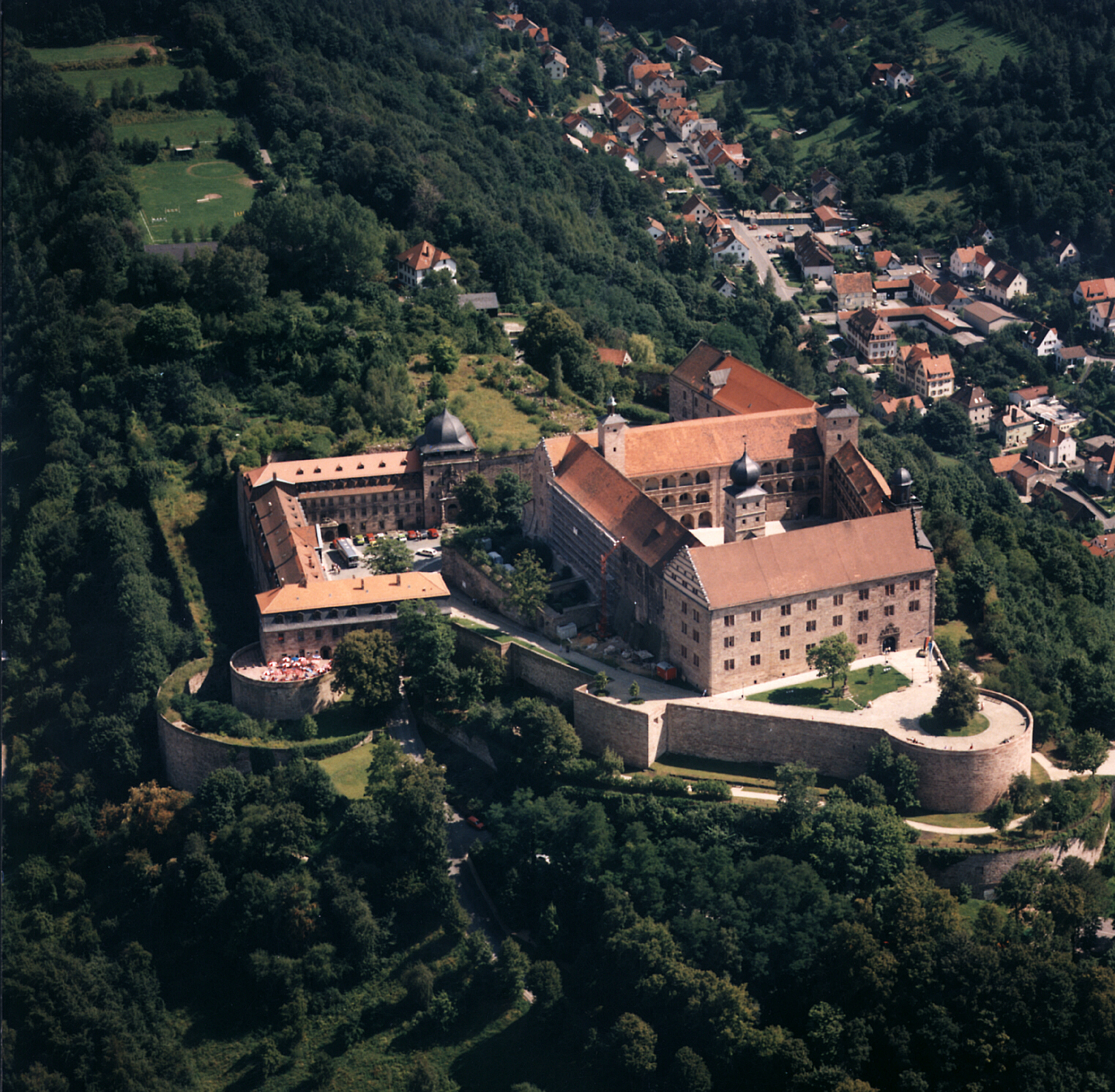
Kulmbach () is the capital of the district of Kulmbach in Bavaria in Germany. The town is famous for Plassenburg Castle, which houses the largest tin soldier museum in the world, and for its sausages, or ''Bratwürste''. Geography Location Kulmbach is located in the middle of the Bavarian province of Upper Franconia, about northwest of the city of Bayreuth. To the south of Kulmbach, the River Main begins at the confluence of its headstreams, the White Main and Red Main. Town districts Kulmbach is divided into the following districts (with population in brackets): History From about 900 AD there was a small settlement in what is now the district of Spiegel, which consisted of a forest lodge and a fortified tenant farm (''Fronhof'') to protect the river Main crossing at Grünwehr. The area later passed into the hands of the Count of Schweinfurt, whose power was usually exercised through the office of the . Kulmbach was first mentioned as ''Kulma'' in a deed of gift ... [...More Info...] [...Related Items...] OR: [Wikipedia] [Google] [Baidu] |
Kronach
Kronach (East Franconian: ''Gronich'') is a town in Upper Franconia, Germany, located in the Frankenwald area. It is the capital of the district Kronach. Kronach is the birthplace of Lucas Cranach the Elder and Maximilian von Welsch, as well as Johann Kaspar Zeuss and bishop Josef Stangl. The town is equipped with a nearly complete city wall and Germany's biggest and most complete early modern fortress, Rosenberg Fortress. The headquarters of German television and AV equipment manufacturer, Loewe, is located there. Geography Location Kronach is located at the southwestern edge of the Franconian Forest. The rivers Haßlach, Kronach and Rodach unite in Kronach. Town districts Kronach is divided into the following districts: * Bernsroth * Birkach * Blumau * Dennach * Dörfles * Fischbach * Friesen * Gehülz * Glosberg * Gundelsdorf * Höfles * Kestel * Knellendorf * Kreuzberg * Krugsberg * Neuses * Ruppen * Seelabach * Seelach * Stübental * Vogtendorf * Vonz ... [...More Info...] [...Related Items...] OR: [Wikipedia] [Google] [Baidu] |
Kirchenlamitz
Kirchenlamitz () is a town in the district of Wunsiedel, in Bavaria, Germany. It is situated in the Fichtelgebirge, 13 km northwest of Wunsiedel (; Northern Bavarian: ''Wåuṉsieḏl'' or ''Wousigl'') is the seat of the Upper Franconian district of in northeast Bavaria, Germany. The town is the birthplace of poet Jean Paul. It also became known for its annual Festival and the Rudol ... and 19 km south of Hof. References Wunsiedel (district) {{Wunsiedeldistrict-geo-stub ... [...More Info...] [...Related Items...] OR: [Wikipedia] [Google] [Baidu] |


