|
Madura, Western Australia
Madura is a small roadhouse community located on the Eyre Highway in Western Australia, on the Roe Plains. It is from Perth. It is at the foot of the escarpment next to the Madura Pass down from the Nullarbor Plain. UTC+8:45 is the local time zone in use. History Madura was settled in 1876 as a place to breed quality cavalry horses for the British Indian Army for use in the Northwest Frontier region of India (now part of Pakistan). The horses were shipped from the coast at Eucla. (Cervantes, north of Perth, was also used for breeding.) The site was chosen as it was one of the few with free flowing bore water in the area. The surrounding area is part of Madura Station, currently a sheep station, but previously used to graze cattle, horses and camels. Present day Like other locations in the Nullarbor Plain area, the area consists of little more than a roadhouse, open 06:00 to 21:00 each day. Two kilometres west of Madura is a scenic lookout with sweeping views of t ... [...More Info...] [...Related Items...] OR: [Wikipedia] [Google] [Baidu] |
Perth
Perth is the capital and largest city of the Australian state of Western Australia. It is the fourth most populous city in Australia and Oceania, with a population of 2.1 million (80% of the state) living in Greater Perth in 2020. Perth is part of the South West Land Division of Western Australia, with most of the metropolitan area on the Swan Coastal Plain between the Indian Ocean and the Darling Scarp. The city has expanded outward from the original British settlements on the Swan River, upon which the city's central business district and port of Fremantle are situated. Perth is located on the traditional lands of the Whadjuk Noongar people, where Aboriginal Australians have lived for at least 45,000 years. Captain James Stirling founded Perth in 1829 as the administrative centre of the Swan River Colony. It was named after the city of Perth in Scotland, due to the influence of Stirling's patron Sir George Murray, who had connections with the area. It gained c ... [...More Info...] [...Related Items...] OR: [Wikipedia] [Google] [Baidu] |
Madura Station
Madura Station also known as Madura Plains is a pastoral lease and sheep station located about east south east of Kalgoorlie in the Goldfields-Esperance region of Western Australia. It is within the locality of Madura and the Eyre Highway runs along the boundary of the station. Description The station occupies an area of approximately or 1.75 million acres – making it larger than the nation of Brunei – in the remote south east of Western Australia. It is the second largest sheep station in Australia, after Rawlinna and is currently owned by CC Cooper & Co. In 1927, the extent of the Madura Station was reported as two million acres. The station has a carrying capacity of 58,000 sheep, which are merinos raised for their wool. The company employed eight staff in 2012 working under the supervision of the station manager, Matt Haines. The land is mostly gently undulating calcareous plains with eucalypt– melaleuca–myall woodlands and chenopod shrubland interspers ... [...More Info...] [...Related Items...] OR: [Wikipedia] [Google] [Baidu] |
Shire Of Dundas
The Shire of Dundas is a local government area in the Goldfields-Esperance region of Western Australia. The shire covers an area of and its seat of government is the town of Norseman. Its territory lies between Norseman and the border with South Australia (including much of the Eyre Highway), and is between east of the state capital, Perth. History The shire was first established as the second Dundas Road District on 21 June 1929, when the Norseman Road District was abolished and replaced by a re-established Dundas board. (An earlier Dundas Road District had existed from 1895 to 1918 before amalgamating to form the Norseman district.) It was declared a shire and named the Shire of Dundas with effect from 1 July 1961 following the passage of the ''Local Government Act 1960'', which reformed all remaining road districts into shires. Towns * Norseman * Balladonia * Caiguna * Cocklebiddy * Dundas * Eucla * Madura * Mundrabilla * Princess Royal Notable councillors * Em ... [...More Info...] [...Related Items...] OR: [Wikipedia] [Google] [Baidu] |
Towns In Western Australia
A town is a human settlement. Towns are generally larger than villages and smaller than cities, though the criteria to distinguish between them vary considerably in different parts of the world. Origin and use The word "town" shares an origin with the German word , the Dutch word , and the Old Norse . The original Proto-Germanic word, *''tūnan'', is thought to be an early borrowing from Proto-Celtic *''dūnom'' (cf. Old Irish , Welsh ). The original sense of the word in both Germanic and Celtic was that of a fortress or an enclosure. Cognates of ''town'' in many modern Germanic languages designate a fence or a hedge. In English and Dutch, the meaning of the word took on the sense of the space which these fences enclosed, and through which a track must run. In England, a town was a small community that could not afford or was not allowed to build walls or other larger fortifications, and built a palisade or stockade instead. In the Netherlands, this space was a garden, more ... [...More Info...] [...Related Items...] OR: [Wikipedia] [Google] [Baidu] |
Geothermal Gradient
Geothermal gradient is the rate of temperature change with respect to increasing depth in Earth's interior. As a general rule, the crust temperature rises with depth due to the heat flow from the much hotter mantle; away from tectonic plate boundaries, temperature rises in about 25–30 °C/km (72–87 °F/mi) of depth near the surface in most of the world. However, in some cases the temperature may drop with increasing depth, especially near the surface, a phenomenon known as ''inverse'' or ''negative'' geothermal gradient. The effects of weather, sun, and season only reach a depth of approximately 10-20 metres. Strictly speaking, ''geo''-thermal necessarily refers to Earth but the concept may be applied to other planets. In SI units, the geothermal gradient is expressed as °C/km, K/km, or mK/m. These are all equivalent. Earth's internal heat comes from a combination of residual heat from planetary accretion, heat produced through radioactive decay, latent heat f ... [...More Info...] [...Related Items...] OR: [Wikipedia] [Google] [Baidu] |
Crude Oil
Petroleum, also known as crude oil, or simply oil, is a naturally occurring yellowish-black liquid mixture of mainly hydrocarbons, and is found in geological formations. The name ''petroleum'' covers both naturally occurring unprocessed crude oil and petroleum products that consist of refined crude oil. A fossil fuel, petroleum is formed when large quantities of dead organisms, mostly zooplankton and algae, are buried underneath sedimentary rock and subjected to both prolonged heat and pressure. Petroleum is primarily recovered by oil drilling. Drilling is carried out after studies of structural geology, sedimentary basin analysis, and reservoir characterisation. Recent developments in technologies have also led to exploitation of other unconventional reserves such as oil sands and oil shale. Once extracted, oil is refined and separated, most easily by distillation, into innumerable products for direct use or use in manufacturing. Products include fuels such as gasoli ... [...More Info...] [...Related Items...] OR: [Wikipedia] [Google] [Baidu] |
Bight Basin , a unit of digital information in computing and telecommunications
{{disambiguation ...
The word is derived from Old English ''byht'' (“bend, angle, corner; bay, bight”). In modern English, bight may refer to: * Bight (geography), recess of a coast, bay, or other curved feature * Bight (knot), a curved section, slack part, or loop in rope (used in the terminology of knot-tying) See also * * Canto Bight, a fictional city in '' Star Wars: The Last Jedi'' * Bite (other) * Byte (other) * Byte The byte is a unit of digital information that most commonly consists of eight bits. Historically, the byte was the number of bits used to encode a single character of text in a computer and for this reason it is the smallest addressable uni ... [...More Info...] [...Related Items...] OR: [Wikipedia] [Google] [Baidu] |
Sedimentary Rock
Sedimentary rocks are types of rock that are formed by the accumulation or deposition of mineral or organic particles at Earth's surface, followed by cementation. Sedimentation is the collective name for processes that cause these particles to settle in place. The particles that form a sedimentary rock are called sediment, and may be composed of geological detritus (minerals) or biological detritus (organic matter). The geological detritus originated from weathering and erosion of existing rocks, or from the solidification of molten lava blobs erupted by volcanoes. The geological detritus is transported to the place of deposition by water, wind, ice or mass movement, which are called agents of denudation. Biological detritus was formed by bodies and parts (mainly shells) of dead aquatic organisms, as well as their fecal mass, suspended in water and slowly piling up on the floor of water bodies (marine snow). Sedimentation may also occur as dissolved minerals precipitate from ... [...More Info...] [...Related Items...] OR: [Wikipedia] [Google] [Baidu] |
Madura Shelf
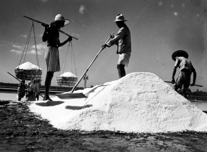
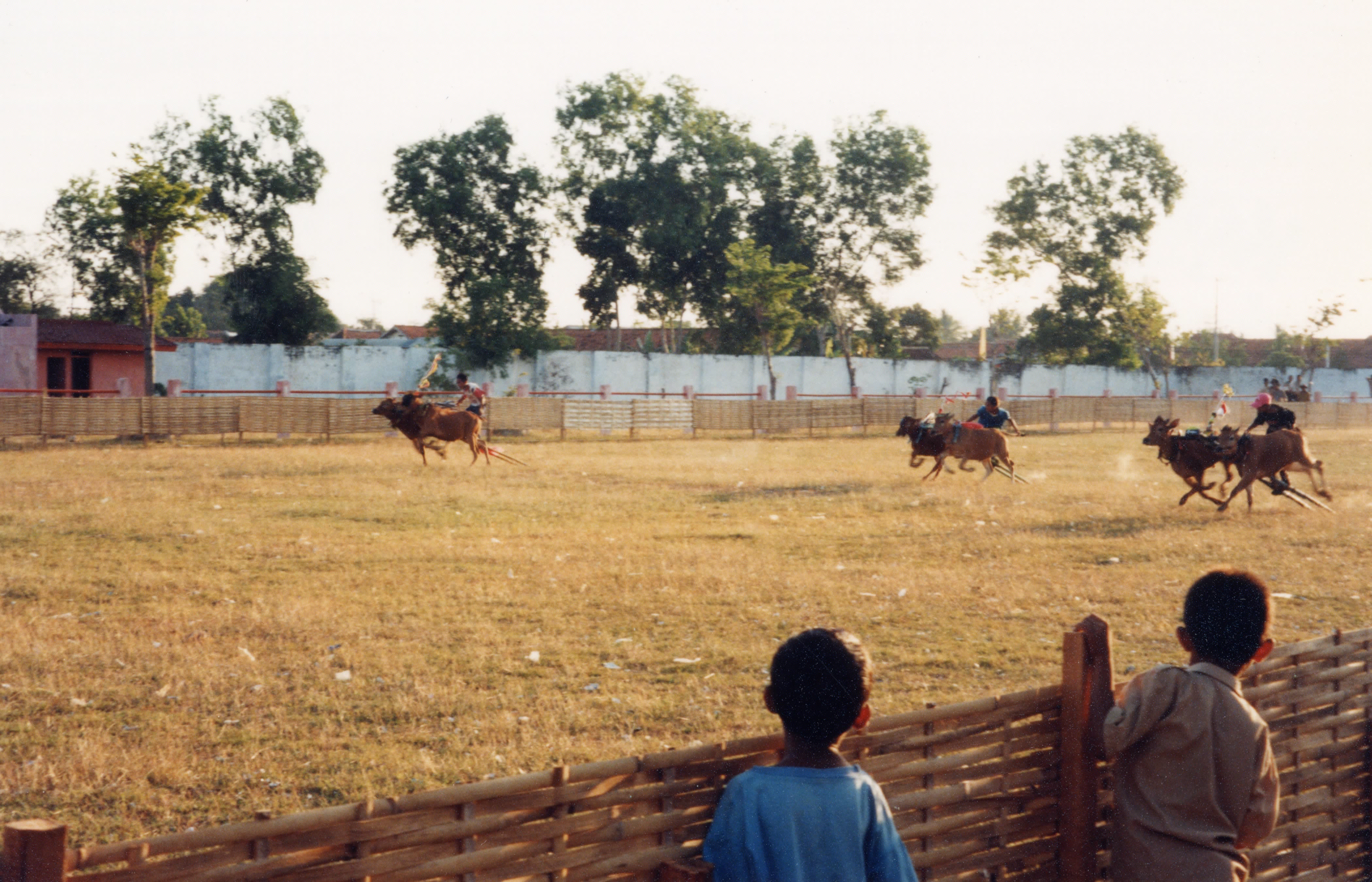
Madura Island is an Indonesian island off the northeastern coast of Java. The island comprises an area of approximately (administratively 5,379.33 km2 including various smaller islands to the east, southeast and north that are administratively part of Madura's four regencies). Administratively, Madura is part of the province of East Java. It is separated from Java by the narrow Madura Strait. The administered area has a density of 744 people per km2 while main island has a somewhat higher figure of 826 per km2 in 2020. Etymology The name of Madura island is of Hindu origin. The origin of the island's name lies in the legend that the island is in the realm of Hindu deity Baladewa. The name ''Madura'' itself is derived from the word ''"Mathura"'' - a word in Indian-origin language Sanskrit for the native home of Baladewa "Baladeva". The corrupted form of Sanskrit word ''Mathura'' became the ''Madura''.Ed. Emma Helen Blair and James Alexander Robertson, 1903-09The Philip ... [...More Info...] [...Related Items...] OR: [Wikipedia] [Google] [Baidu] |
Blowhole (geology)
In geology, a blowhole or marine geyser is formed as sea caves grow landwards and upwards into vertical shafts and expose themselves towards the surface, which can result in hydraulic compression of sea water that is released through a port from the top of the blowhole. The geometry of the cave and blowhole along with tide levels and swell conditions determine the height of the spray. Mechanics Blowholes are likely to occur in areas where there are crevices, such as lava tubes, in rock along the coast. These areas are often located along fault lines and on islands. As powerful waves hit the coast, water rushes into these crevices and bursts out in a high pressured release. It is often accompanied by a loud noise and wide spray, and for this reason, blowholes are often sites of tourism. Marine erosion on rocky coastlines produce blowholes that are found throughout the world. They are found at intersecting faults and on the windward sides of a coastline where they receive ... [...More Info...] [...Related Items...] OR: [Wikipedia] [Google] [Baidu] |
Roadhouse (facility)
A roadhouse (Australia and the United States) or stopping house (Canada) is a small mixed-use premises typically built on or near a major road in a sparsely populated area or an isolated desert region that services the passing travellers, providing food, drinks, accommodation, fuel, and parking spaces to the guests and their vehicles. The premises generally consist of just a single dwelling, permanently occupied by a nuclear family, usually between two and five family members. In Australia, a roadhouse is often considered to be the smallest type of human settlement. In Britain, the term was often a synonym for an advanced motel, but roadside pub-restaurant or hotel, depending on use, is more common today. A hotel resembling and having a public house (pub) is widely, nationally, called an inn. The word's meaning varies slightly by country. The historical equivalent was often known as a coaching inn, providing food, drinks, and rest to people and horses. North America The ... [...More Info...] [...Related Items...] OR: [Wikipedia] [Google] [Baidu] |
Madura Pass, 2017 (05)
Madura Island is an Indonesian island off the northeastern coast of Java. The island comprises an area of approximately (administratively 5,379.33 km2 including various smaller islands to the east, southeast and north that are administratively part of Madura's four regencies). Administratively, Madura is part of the province of East Java. It is separated from Java by the narrow Madura Strait. The administered area has a density of 744 people per km2 while main island has a somewhat higher figure of 826 per km2 in 2020. Etymology The name of Madura island is of Hindu origin. The origin of the island's name lies in the legend that the island is in the realm of Hindu deity Baladewa. The name ''Madura'' itself is derived from the word ''"Mathura"'' - a word in Indian-origin language Sanskrit for the native home of Baladewa "Baladeva". The corrupted form of Sanskrit word ''Mathura'' became the ''Madura''.Ed. Emma Helen Blair and James Alexander Robertson, 1903-09The Philip ... [...More Info...] [...Related Items...] OR: [Wikipedia] [Google] [Baidu] |
.jpg)
.jpg)


.jpg)
