|
Mühlendamm
Mühlendamm (Mill Dam) is a major thoroughfare in the central Mitte (locality), Mitte district of Berlin, Germany. It runs from the historic Cölln and Fischerinsel quarters to the Molkenmarkt square of Alt-Berlin via the Mühlendammbrücke (Mill Dam Bridge) crossing the Spree (river), Spree river. Named after several watermills at the site, a historic causeway was first laid out at this location about 1200 and became the nucleus of the late medieval History of Berlin, city foundation. The current prestressed concrete bridge was built in 1968. It is part of an east–west road link to Berlin's city centre and the Bundesstraße 1 highway. Location The bridge links Gertraudenstraße, Spittelmarkt and Leipziger Straße in the southwest with the Alexanderplatz area in the northeast. It thereby is part of the main east–west road connection in Berlin's historic city centre, beside the parallel route of Unter den Linden, Schloßplatz (Berlin), Schloßplatz and Karl-Liebknecht-Straße in ... [...More Info...] [...Related Items...] OR: [Wikipedia] [Google] [Baidu] |
Teltow (region)
Teltow () is both a geological plateau and also a historical region in the German states of Brandenburg and Berlin. As an historical region, the Teltow was one of the eight territories out of which the March of Brandenburg was formed in the 12th and 13th centuries. As a result of the (1239–1245) the question of territorial lordship of the newly created heart of the expanding march (territory), march was finally decided here. Between 1835 and 1952 there was also a county, ; in addition a town immediately south of Berlin, in the present-day county of Potsdam-Mittelmark, bears the name Teltow. Geography and geology Boundary The Teltow is not a unified region, either from a historical or a landscape perspective. The present-day term is defined by an ice age plateau that consists mainly of ground moraine elements. Its natural northern border is defined by the range of the Tempelhofer Berge, among them the Kreuzberg (Tempelhofer Berge), Kreuzberg rising to , along the southern ... [...More Info...] [...Related Items...] OR: [Wikipedia] [Google] [Baidu] |
Cölln
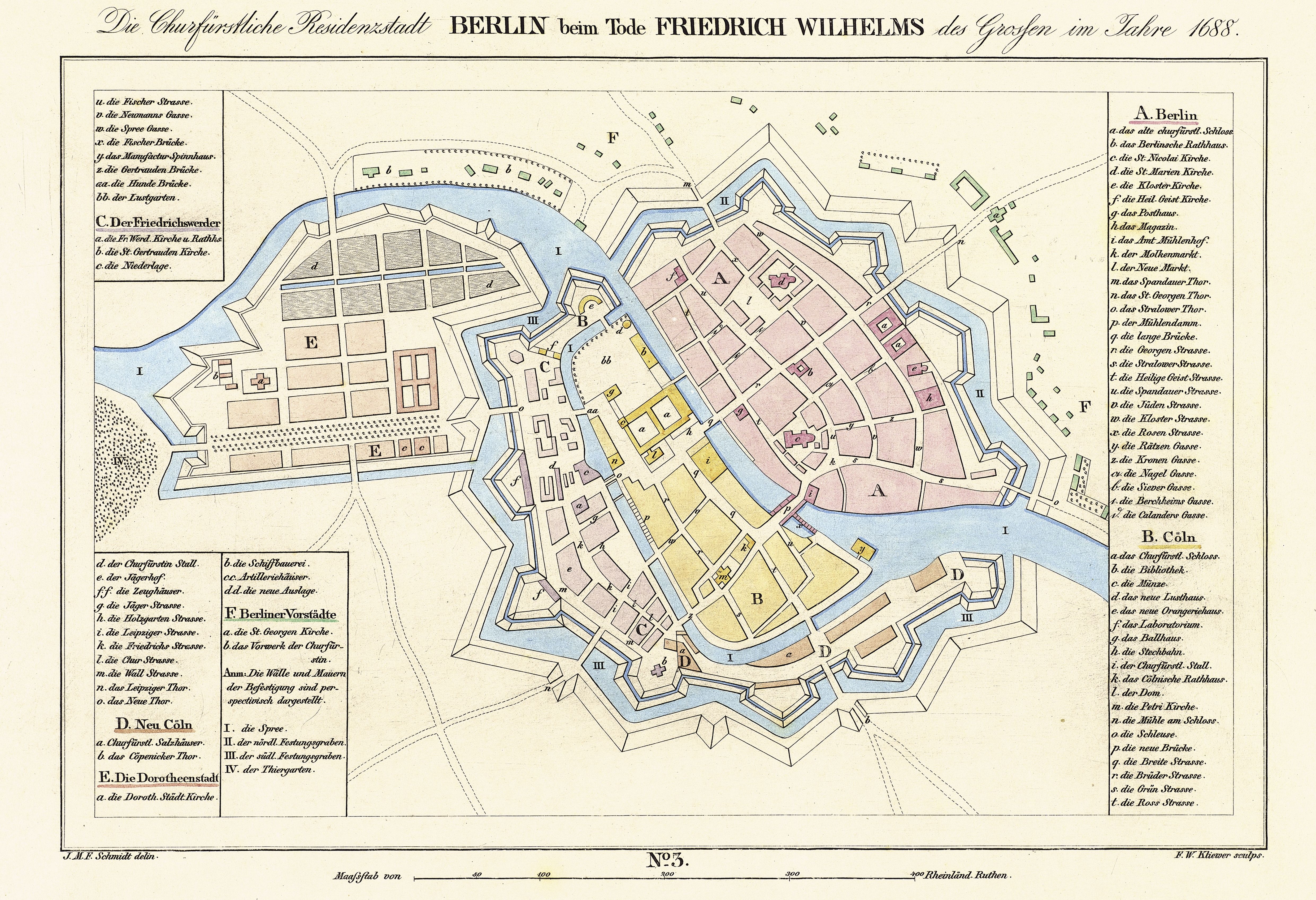
Cölln () was the Twin cities, twin city of Old Berlin (Alt-Berlin) from the 13th century to the 18th century. Cölln was located on the Fischerinsel, Fisher Island section of Spree Island, opposite Altberlin on the western bank of the River Spree, until the cities were merged by Frederick I of Prussia to form Berlin in 1710. Today, the former site of Cölln is the historic core of the modern Mitte (locality), Mitte locality of the Berlin-Mitte borough in central Berlin. History Cölln is first mentioned in a 1237 deed, denoting a Priesthood (Catholic Church), priest Symeon of Cölln's (Symeon de Colonia) Saint Peter's Church as a witness. This date is commonly regarded as the origin of Berlin, though Altberlin on the eastern bank of the Spree river was not mentioned before 1244 and parts of modern Greater Berlin Act, Greater Berlin, such as Spandau and Köpenick, are even older. Cölln and Altberlin were separated only by the river Spree, linked by the ''Mühlendamm'' cause ... [...More Info...] [...Related Items...] OR: [Wikipedia] [Google] [Baidu] |
Molkenmarkt
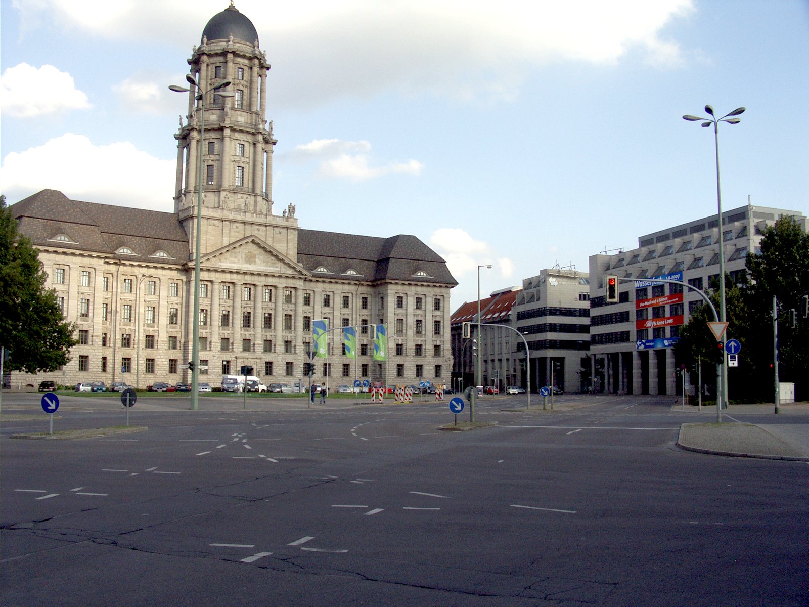
Molkenmarkt (literally: "whey market") is the oldest square in Berlin. It is located in the Alt-Berlin quarter of the Mitte district, in the historic centre of the city. With approximately in size, it is today a major traffic junction, dominated by the large Altes Stadthaus administrative building on its southeastern side. History During the initial settlement around the Mühlendamm causeway across the Spree river about 1200 AD, the site developed as the central trading place. In the late 13th century, however, the venue became too small and a new marketplace beneath St. Mary's Church arose, which soon became more popular. The former site was thereafter known as ''Olde Markt'' or ''Alter Markt'' (Old Market) until 1685, when it was renamed to ''Mulkenmarkt'', later to change to ''Molkenmarkt'',Olde Markt Berlingeschichte.de, |
Bundesstraße 1
The Bundesstraße 1 (abbr. B1) is a German federal highway running in an east-west direction from the Dutch border near Aachen to the Polish border at Küstrin-Kietz on the Oder River. History The road developed from an ancient east-western trade route connecting the shore of the North Sea at Bruges with the area of Novgorod. A trade and military road was already mentioned in Ptolemy's ''Geography'' about 150 AD, parts of it formed the medieval Westphalian Hellweg trade route, vital for the transport of salt and crops, and the course of the Via Regia, the Ottonian "royal road" through the Holy Roman Empire from Aachen to Magdeburg. From the late 18th century onwards, parts of the route were rebuilt as a chaussee, mainly in the area between Aachen and Jülich as well as on the nearby territory of the County of Mark, promoted by the Brandenburg-Prussian administration under Heinrich Friedrich Karl vom und zum Stein. Stein also concluded an agreement to extend the road ... [...More Info...] [...Related Items...] OR: [Wikipedia] [Google] [Baidu] |
Wittenberg
Wittenberg, officially Lutherstadt Wittenberg, is the fourth-largest town in the state of Saxony-Anhalt, in the Germany, Federal Republic of Germany. It is situated on the River Elbe, north of Leipzig and south-west of the reunified German federal capital city of Berlin, and has a population of 46,008 (2018). Wittenberg has close connections with Martin Luther (1483–1546) and the 16th century religious / theological movement of Protestantism begun here in the Reformation, and the large branch of Western Christianity started here of Lutheranism, Evangelical Lutheranism, for which it received the honorific title ''Lutherstadt'' and has been called the "cradle of the Reformation" and "cradle of Protestantism". Several of Wittenberg's buildings are associated with the historical / religious events, including a preserved part of the Augustinians, Augustinian monastery of the local community of the world-wide Catholic Church, Roman Catholic Order of St. Augustine in which Luth ... [...More Info...] [...Related Items...] OR: [Wikipedia] [Google] [Baidu] |
Berlin Und Cölln Um 1250
Berlin ( ; ) is the Capital of Germany, capital and largest city of Germany, by both area and List of cities in Germany by population, population. With 3.7 million inhabitants, it has the List of cities in the European Union by population within city limits, highest population within its city limits of any city in the European Union. The city is also one of the states of Germany, being the List of German states by area, third smallest state in the country by area. Berlin is surrounded by the state of Brandenburg, and Brandenburg's capital Potsdam is nearby. The urban area of Berlin has a population of over 4.6 million and is therefore the most populous urban area in Germany. The Berlin/Brandenburg Metropolitan Region, Berlin-Brandenburg capital region has around 6.2 million inhabitants and is Germany's second-largest metropolitan region after the Rhine-Ruhr region, as well as the List of EU metropolitan areas by GDP, fifth-biggest metropolitan region by GDP in the European Union. ... [...More Info...] [...Related Items...] OR: [Wikipedia] [Google] [Baidu] |


