|
Mpigi–Kabulasoke–Maddu–Sembabule Road
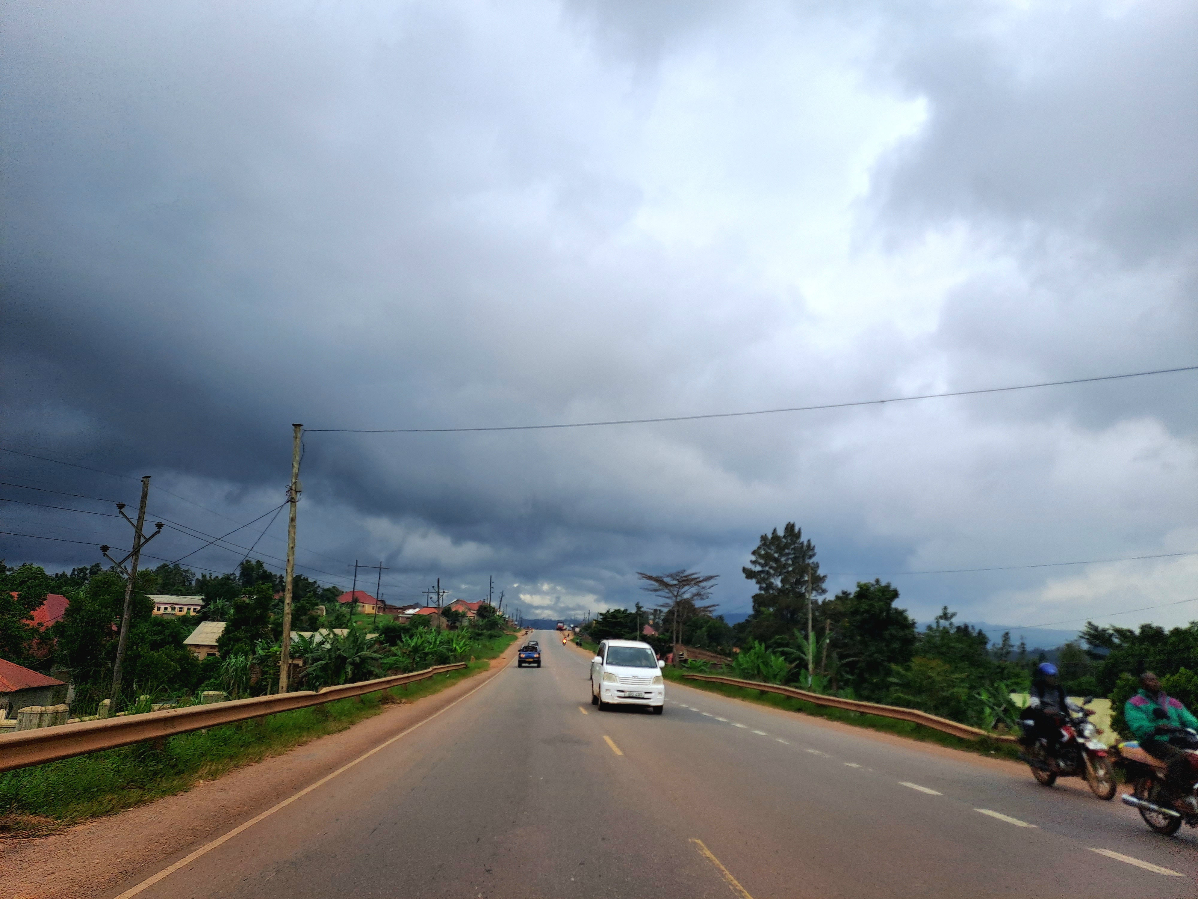
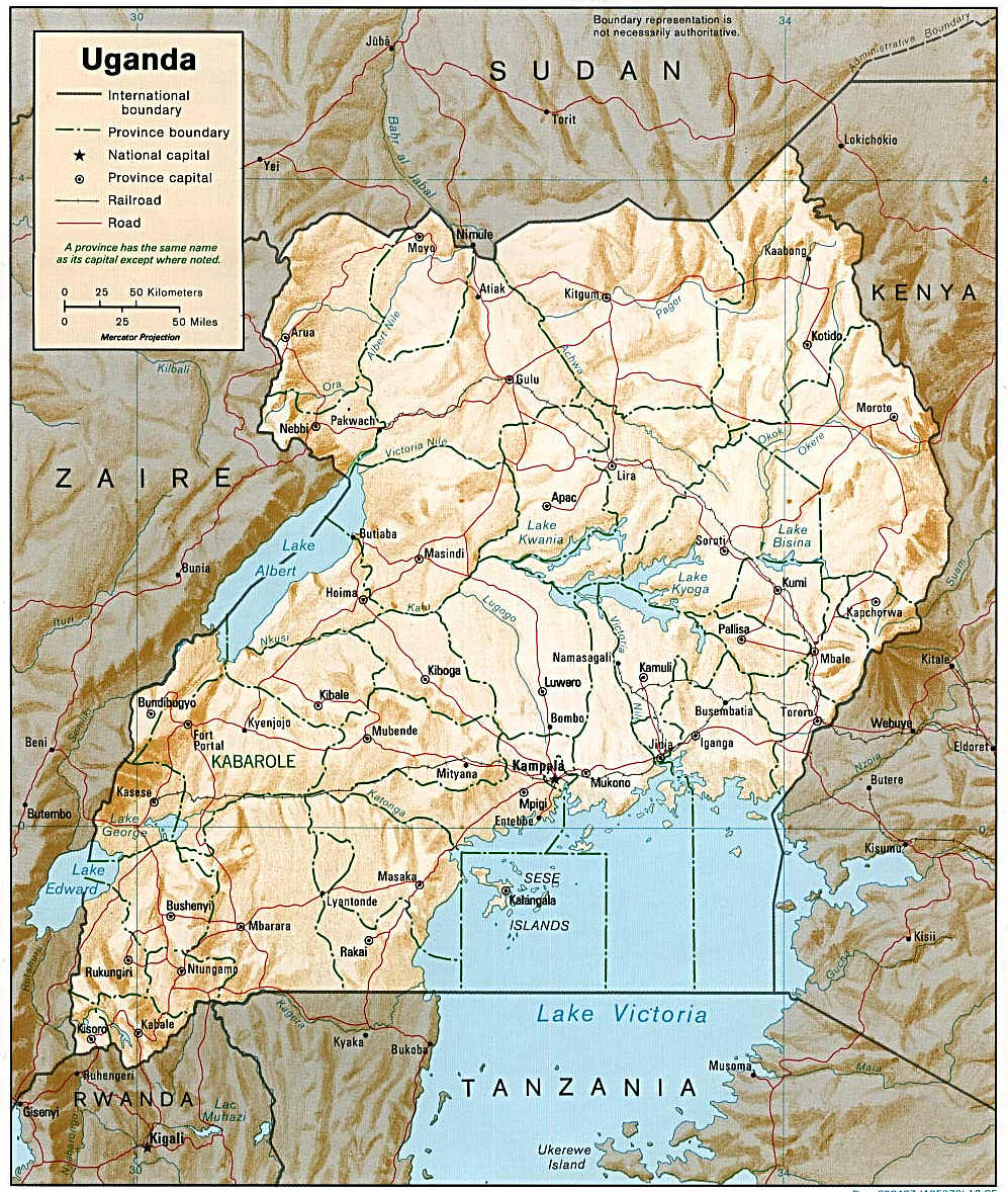
Mpigi–Kabulasoke–Maddu–Sembabule Road is a road in the Central Region of Uganda, connecting the towns of Mpigi in Mpigi District to Gombe in Butambala District, Kabulasoke and Maddu in Gomba District and Sembabule in Sembabule District. Location The road starts at Mpigi, a town of 44,274, about , southwest of Kampala, the capital of Uganda and the largest city in that country. The road continues through four central Ugandan districts to end at Ssembabule, a total distance of about . The coordinates of the road near Kanoni are 0°10'26.0"N, 31°55'27.0"E (Latitude:0.173889; Longitude:31.924167). Upgrading to bitumen In October 2010, Uganda National Roads Authority, a parastatal, publicly announced that in 2011, it would begin upgrading of 32 different national roads in the country, from unsealed gravel surface to class II bitumen. This road was one of the roads on that list. The road was divided into two sections; (a) Mpigi–Kanoni Road and (b) Kanoni–Sembabule R ... [...More Info...] [...Related Items...] OR: [Wikipedia] [Google] [Baidu] |
Mpigi
Mpigi is a town in Mawokota County, Mpigi District, in Central Uganda. Mpigi is the municipal, administrative and commercial headquarters of Mpigi District. The district is named after the town. Location Mpigi is an important transit town located approximately southwest of Kampala, Uganda's capital and largest city, along the Kampala–Masaka Road. The location of Mpigi town makes it an access point to the districts of Mpigi, Wakiso, Butambala, Gomba, Mityana, Kalungu and Kalangala, through various fishing landing sites on the shores of Lake Victoria. On Mbale Hill, which lies within the town, resides one of Buganda's most renowned traditional gods; Kibuuka Omumbaale. This hill is the ancestral home of the "Ndiga" (sheep) clan. The geographical coordinates of the town are 0°13'48.0"N 32°19'48.0"E (Latitude:0.2300, Longitude:32.3300). Mpigi Town Council sits at an average elevation of above mean sea level. Population At the 2002 national census, the population of M ... [...More Info...] [...Related Items...] OR: [Wikipedia] [Google] [Baidu] |
Parastatal
A state-owned enterprise (SOE) is a business entity created or owned by a national or local government, either through an executive order or legislation. SOEs aim to generate profit for the government, prevent private sector monopolies, provide goods at lower prices, implement government policies, or serve remote areas where private businesses are scarce. The government typically holds full or majority ownership and oversees operations. SOEs have a distinct legal structure, with financial and developmental goals, like making services more accessible while earning profit (such as a state railway). They can be considered as government-affiliated entities designed to meet commercial and state capitalist objectives. Terminology The terminology around the term state-owned enterprise is murky. All three words in the term are challenged and subject to interpretation. First, it is debatable what the term "state" implies (e.g., it is unclear whether municipally owned corporations and ente ... [...More Info...] [...Related Items...] OR: [Wikipedia] [Google] [Baidu] |
Gomba District
Gomba is a district in Central Uganda. Location Gomba District is bordered by Mubende District to the west and north, Mityana District to the northeast and Butambala District to the east. Kalungu District, Bukomansimbi District and Sembabule District lie to the south of Gomba District. Kanoni, where the district headquarters are located, lies approximately , by road, southwest of Kampala, the capital of Uganda and the largest city in that country. This location is approximately , by road, west of Mpigi, the nearest large metropolitan area. The coordinates of the district are:00 11N, 31 55E. (Latitude:0.1750; Longitude:31.9100). Overview Gomba District was created in 2010 by an Act of Parliament, when Mpigi District was split into Gomba District, Butambala District and Mpigi District. The town of Kanoni was selected to be the district headquarters. The district became operational on 1 July 2010. Generally, Gomba District is a rural district which receives lower precipitation ... [...More Info...] [...Related Items...] OR: [Wikipedia] [Google] [Baidu] |
Butambala District
Butambala District is a district in the Central Region of Uganda. Location This district is bordered by Gomba District to the west and north-west, Mityana District to the north-east, Mpigi District to the east and south, and Kalungu District to the south-west. The district headquarters at Gombe are approximately , by road, west of the town of Mpigi, the largest metropolitan area in the sub-region. This is approximately , by road, south-west of Kampala, Uganda's capital and largest city. History Created by an act of parliament, the district became operational on 1 July 2010, having been split off of Mpigi District, together with neighboring Gomba District. Before becoming district, the area was Butambala County, one of the eighteen counties that constitute the Kingdom of Buganda. Population The national population census in 1991 estimated the district population at 74,100. The 2002 census put the population at about 86,800. In 2012, the population was estimated a 99,400. Economi ... [...More Info...] [...Related Items...] OR: [Wikipedia] [Google] [Baidu] |
Mpigi District
Mpigi District is a district in Central Uganda. Like most other Ugandan districts, it is named after its 'main town', Mpigi. Location Mpigi District is bordered by Wakiso District to the north and east, Kalangala District to the south, Kalungu District to the southwest, Butambala District to the west and Mityana District to the northwest. The town of Mpigi, where the district headquarters are located, lies approximately west of Kampala, Uganda's capital and largest city. The coordinates of the district are:00 14N, 32 20E. Overview In the 1970s, Mpigi District comprised the Buganda Kingdom counties of ''Kyaddondo'', ''Busiro'', ''Mawokota'', ''Butambala'' and ''Gomba''. During the 1990s, ''Kyaddondo'' and ''Busiro'' were peeled off to form Wakiso District. In 2010, ''Gomba'' split off to form Gomba District and ''Butambala'' became Butambala District. ''Mawokota'' remained as the sole constituent of Mpigi District. Population In 1991, the district population was estimated ... [...More Info...] [...Related Items...] OR: [Wikipedia] [Google] [Baidu] |
Roads In Uganda
Transport in Uganda refers to the transportation structure in Uganda. The country has an extensive network of paved and unpaved roads. Roadways As of 2017, according to the Ministry of Works and Transport (Uganda), Uganda Ministry of Works and Transport, Uganda had about of roads, with approximately (4 percent) paved. Most paved roads radiate from Kampala, the country's capital and largest city. International highways The Lagos-Mombasa Highway, part of the Trans-African Highway network, Trans-Africa Highway and aiming to link East Africa and West Africa, passes through Uganda. This is complete only eastwards from the Uganda–DR Congo border to Mombasa, linking the African Great Lakes region to the sea. In East Africa, this roadway is part of the Northern Corridor. It cannot be used to reach West Africa because the route westwards across DR Congo to Bangui in the Central African Republic (CAR) is impassable after the Second Congo War and requires reconstruction. An altern ... [...More Info...] [...Related Items...] OR: [Wikipedia] [Google] [Baidu] |
Economy Of Uganda
The Economy of Uganda has great potential and appears poised for rapid growth and development. Uganda is endowed with significant natural resources, including ample fertile land, regular rainfall, and mineral deposits. Chronic political instability and erratic economic management since the implementation of self-rule has produced a record of persistent economic decline that has left Uganda among of the world's poorest and least-developed countries. The informal economy, which is predominantly female, is broadly defined as a group of vulnerable individuals without protections in regards to their work. Women face a plethora of barriers specific to gender when attempting to access the formal economy of Uganda, and research revealed prejudice against lending to women in the informal sector. The national energy needs have historically exceeded the domestic energy generation, though large petroleum reserves have been found in the country's west. After the turmoil of the Amin peri ... [...More Info...] [...Related Items...] OR: [Wikipedia] [Google] [Baidu] |
List Of Roads In Uganda
The following is a list of the national roads in Uganda, which are under the jurisdiction of the Uganda National Roads Authority. The list is not exhaustive. National roads See also * Economy of Uganda * Transport in Uganda * Kinshasa Highway References {{reflist, 2 External linksUNRA, World Bank in talks to resume road funding * Roads
[...More Info...] [...Related Items...] OR: [Wikipedia] [Google] [Baidu] |
New Vision
The ''New Vision'' is a Ugandan English-language daily newspaper. It was established in its current form in 1986 by the Government of Uganda. It is the flagship newspaper of the state-owned Vision Group, a multimedia conglomerate. Along with its privately-owned competitor, the ''Daily Monitor'', the ''New Vision'' is one of the two largest national newspapers in Uganda. History The ''New Vision'' traces its origins to the colonial era. Its institutional predecessor, the ''Uganda Argus'', was founded in 1955 as a British colonial government publication. Following Uganda's independence in 1962, the government of President Milton Obote retained the ''Uganda Argus'' as its official paper. After the 1971 coup, the government of Idi Amin renamed the paper the ''Voice of Uganda''. When Amin was overthrown in 1979, the succeeding government named it the ''Uganda Times''. When the National Resistance Movement (NRM) came to power in 1986, the publication was rebranded as the ''New ... [...More Info...] [...Related Items...] OR: [Wikipedia] [Google] [Baidu] |
Uganda National Roads Authority
The Uganda National Roads Authority (UNRA) was a government agency mandated to develop and maintain the national roads network, advise the government on general roads policy, contribute to the addressing of national transport concerns, and perform certain other functions. UNRA is charged with, among other things, the selection of contractors, the supervision of construction, the scheduling of maintenance, and the prioritization of national road works. Headquarters The headquarters of UNRA were located in the UAP Nakawa Business Park, at 3-5 New Port Bell Road, in the Nakawa Division of Kampala, Uganda's capital and largest city. The geographical coordinates of UNRA's headquarters are:0°19'40.0"N, 32°36'46.0"E (Longitude:0.327778; Latitude:32.612778). Overview UNRA was established in 2006 by parliamentary enactment of the Uganda National Roads Authority Act. UNRA became fully operational on 1 July 2008. UNRA closed on 23 December 2024 after president museveni signed the Repeal ... [...More Info...] [...Related Items...] OR: [Wikipedia] [Google] [Baidu] |
Gombe, Butambala
Gombe, Butambala, often referred to simply as Gombe, is a municipality in Butambala District in the Central Region of Uganda. It is the main municipal, administrative, and commercial center of the district and the site of the district headquarters. Location Gombe is located approximately , by road, south-west of Kampala, the capital and largest city of Uganda. This is approximately , by road, west of the town of Mpigi, the largest metropolitan area in the sub-region. The coordinates of Gombe, Butambala are 0°10'52.0"N, 32°06'51.0"E (Latitude:0.181111; Longitude:32.114167). Population In August 2014, the national population census put Gombe's population at 15,196. Points of interest The following additional points of interest lie within or near the town: * headquarters of Gombe Town Council * Gombe central market * Gombe Secondary School * Gombe General Hospital, a 100-bed public hospital administered by the Uganda Ministry of Health * Mpigi–Kabulasoke–Maddu–Sembab ... [...More Info...] [...Related Items...] OR: [Wikipedia] [Google] [Baidu] |


