|
Mount Pleasant, New Zealand
Mount Pleasant (Tauhinukorokio) is a coastal suburb of Christchurch, New Zealand. The suburb is located on the northern flank of the mountain Tauhinukorokio/Mount Pleasant in the Port Hills. It takes its name from the English version of the mountain's name. The area was originally administered by the borough of Sumner. A petition in September 1920, by 57 of the suburb's 66 ratepayers, asked for it to be included as a riding of the Heathcote County. At the time of the petition, the area was mostly farmland, with 21 dwelling houses and an estimated population of 80. Whilst the mayor of Sumner, John Barr, submitted against the petition, it was granted and took effect on 1 April 1921. As a result of the 1989 local government reforms, Heathcote County was amalgamated with and became part of Christchurch City Council. The suburb and its houses were extensively damaged in the 2011 Christchurch earthquake. Demographics Mount Pleasant covers . It had an estimated population of a ... [...More Info...] [...Related Items...] OR: [Wikipedia] [Google] [Baidu] |
Christchurch
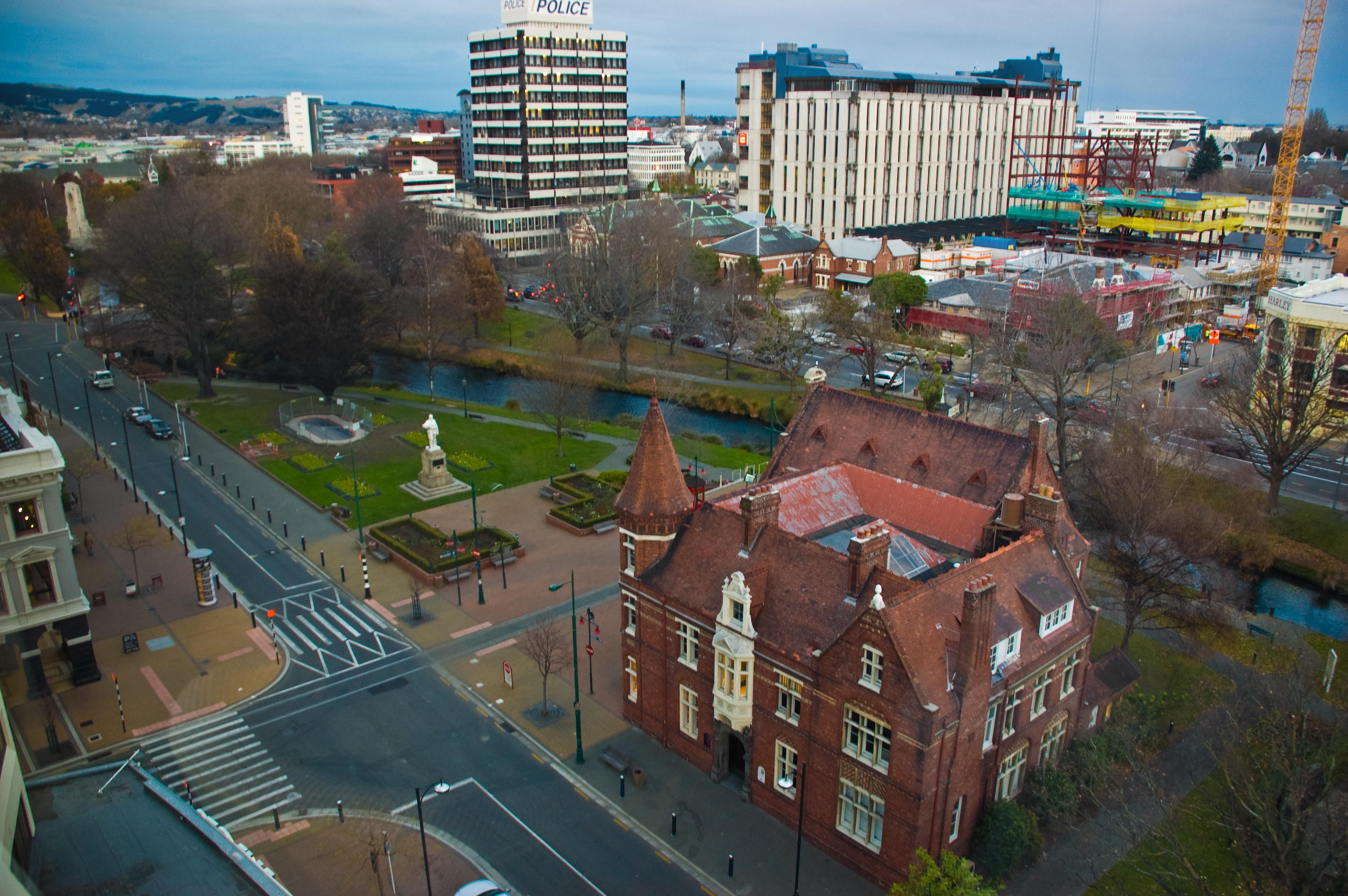
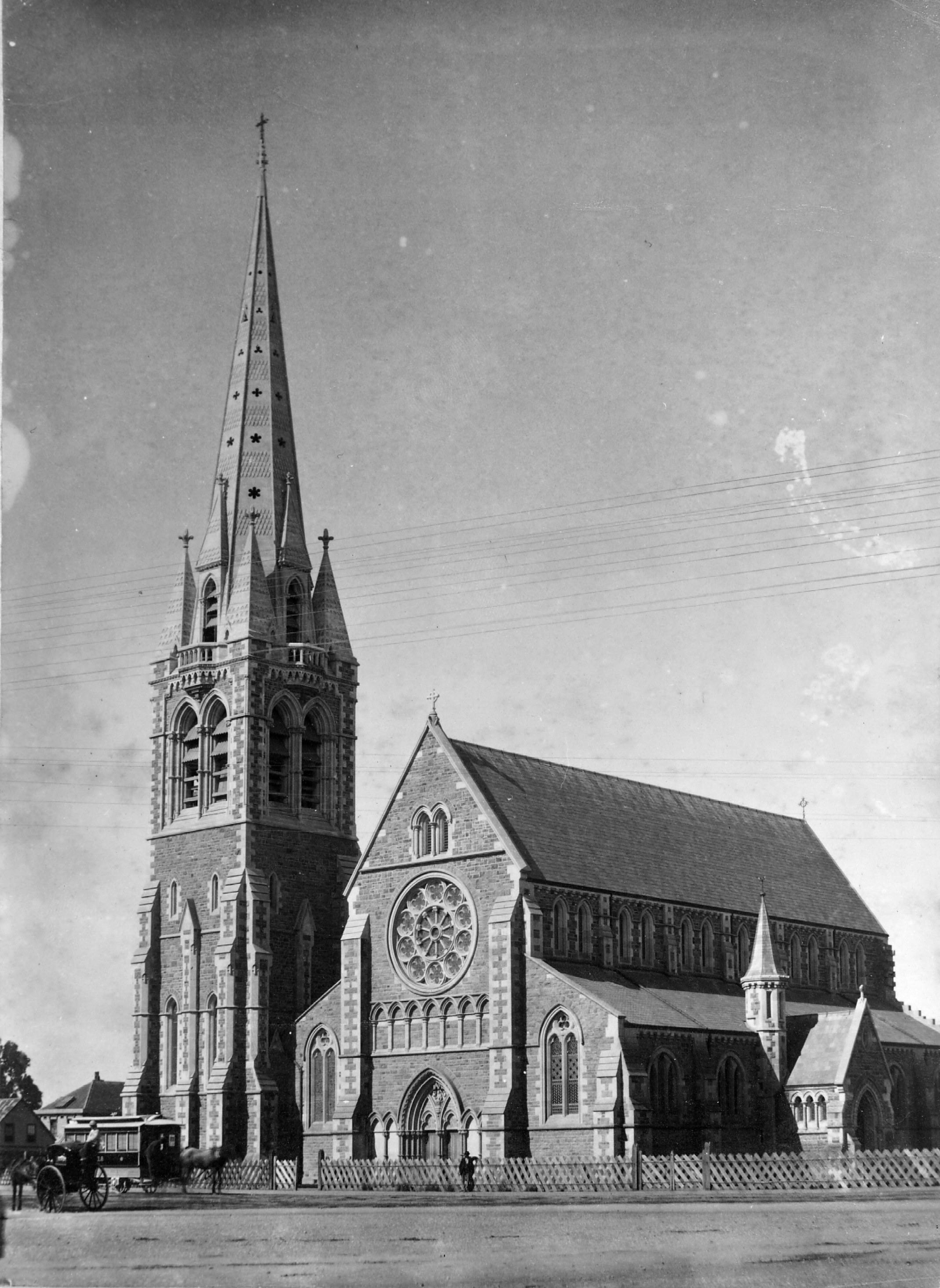
Christchurch ( ; mi, Ōtautahi) is the largest city in the South Island of New Zealand and the seat of the Canterbury Region. Christchurch lies on the South Island's east coast, just north of Banks Peninsula on Pegasus Bay. The Avon River / Ōtākaro flows through the centre of the city, with an urban park along its banks. The city's territorial authority population is people, and includes a number of smaller urban areas as well as rural areas. The population of the urban area is people. Christchurch is the second-largest city by urban area population in New Zealand, after Auckland. It is the major urban area of an emerging sub-region known informally as Greater Christchurch. Notable smaller urban areas within this sub-region include Rangiora and Kaiapoi in Waimakariri District, north of the Waimakariri River, and Rolleston and Lincoln in Selwyn District to the south. The first inhabitants migrated to the area sometime between 1000 and 1250 AD. They hunted moa, ... [...More Info...] [...Related Items...] OR: [Wikipedia] [Google] [Baidu] |
Riding (country Subdivision)
A riding is an administrative jurisdiction or electoral district, particularly in several current or former Commonwealth countries. Etymology The word ''riding'' is descended from late Old English or (recorded only in Latin contexts or forms, e.g., , , , with Latin initial ''t'' here representing the Old English letter thorn). It came into Old English as a loanword from Old Norse , meaning a third part (especially of a county) – the original "ridings", in the English counties of Yorkshire and Lincolnshire, were in each case a set of three, though once the term was adopted elsewhere it was used for other numbers (compare to farthings). The modern form ''riding'' was the result of the initial ''th'' being absorbed in the final ''th'' or ''t'' of the words ''north'', ''south'', ''east'' and ''west'', by which it was normally preceded. [...More Info...] [...Related Items...] OR: [Wikipedia] [Google] [Baidu] |
2013 New Zealand Census
The 2013 New Zealand census was the thirty-third national census. "The National Census Day" used for the census was on Tuesday, 5 March 2013. The population of New Zealand was counted as 4,242,048, – an increase of 214,101 or 5.3% over the 2006 census. The 2013 census forms were the same as the forms developed for the 2011 census which was cancelled due to the February 2011 major earthquake in Christchurch. There were no new topics or questions. New Zealand's next census was conducted in March 2018. Collection methods The results from the post-enumeration survey showed that the 2013 census recorded 97.6 percent of the residents in New Zealand on census night. However, the overall response rate was 92.9 percent, with a non-response rate of 7.1 percent made up of the net undercount and people who were counted in the census but had not received a form. Results Population and dwellings Population counts for New Zealand regions. Note: All figures are for the census usually ... [...More Info...] [...Related Items...] OR: [Wikipedia] [Google] [Baidu] |
2018 New Zealand Census
Eighteen or 18 may refer to: * 18 (number), the natural number following 17 and preceding 19 * one of the years 18 BC, AD 18, 1918, 2018 Film, television and entertainment * ''18'' (film), a 1993 Taiwanese experimental film based on the short story ''God's Dice'' * ''Eighteen'' (film), a 2005 Canadian dramatic feature film * 18 (British Board of Film Classification), a film rating in the United Kingdom, also used in Ireland by the Irish Film Classification Office * 18 (''Dragon Ball''), a character in the ''Dragon Ball'' franchise * "Eighteen", a 2006 episode of the animated television series '' 12 oz. Mouse'' Music Albums * ''18'' (Moby album), 2002 * ''18'' (Nana Kitade album), 2005 * '' 18...'', 2009 debut album by G.E.M. Songs * "18" (5 Seconds of Summer song), from their 2014 eponymous debut album * "18" (One Direction song), from their 2014 studio album ''Four'' * "18", by Anarbor from their 2013 studio album ''Burnout'' * "I'm Eighteen", by Alice Cooper comm ... [...More Info...] [...Related Items...] OR: [Wikipedia] [Google] [Baidu] |
2011 Christchurch Earthquake
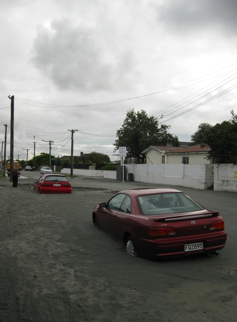
A major earthquake occurred in Christchurch on Tuesday 22 February 2011 at 12:51 p.m. local time (23:51 UTC, 21 February). The () earthquake struck the entire of the Canterbury region in the South Island, centred south-east of the central business district. It caused widespread damage across Christchurch, killing 185 people, in New Zealand's fifth-deadliest disaster. Christchurch's central city and eastern suburbs were badly affected, with damage to buildings and infrastructure already weakened by the magnitude 7.1 Canterbury earthquake of 4 September 2010 and its aftershocks. Significant liquefaction affected the eastern suburbs, producing around 400,000 tonnes of silt. The earthquake was felt across the South Island and parts of the lower and central North Island. While the initial quake only lasted for approximately 10 seconds, the damage was severe because of the location and shallowness of the earthquake's focus in relation to Christchurch as well ... [...More Info...] [...Related Items...] OR: [Wikipedia] [Google] [Baidu] |
1989 Local Government Reforms
The 1989 New Zealand local government reform was the most significant reform of local government in New Zealand in over a century. Some 850 local bodies were amalgamated into 86 local authorities, made up of regional and territorial levels. Background The last major local government reform was carried out through the abolition of provincial government. With effect of 1 January 1877, local government was vested in elected borough and county councils. The Counties Bill of 1876 created 63 counties out of the rural parts of the former provinces. Over the years, many new bodies were set up. Some of these bodies were multi-purpose, whilst others (for example harbour boards) were single-purpose. The Local Government Act 1974 consolidated the previous law relating to local government that applied to territorial local authorities, regional and district council bodies. It enabled the establishment of regional councils, but these were not established until the 1989 reform. History The L ... [...More Info...] [...Related Items...] OR: [Wikipedia] [Google] [Baidu] |
John Barr (New Zealand Politician)
John Barr (1 January 1867 – 7 December 1930) was a New Zealand politician representing labour interests. A stonemason by trade, he was involved in many organisations, was a community leader in Redcliffs and became Mayor of Sumner Sumner may refer to: Places Antarctica * Mount Sumner, a mountain in the Rare Range, Antarctica * Sumner Glacier, southern Graham Land, Antarctica Australia * Sumner, Queensland, suburb of Brisbane New Zealand * Sumner, New Zealand, seaside sub .... The establishment of Redcliffs School is credited to him. He was a Member of the Legislative Council for 23 years, where he held the role of Chairman of Committees for the years before his death. Biography Early life and career Barr was born in Paisley, Scotland, in 1867, and attended a public school at Pollokshaws. His parents were John Barr and Mary Brown. His first job was in a weaving factory in Glasgow. He became interested in social reform in Scotland and advocated for unions and temperan ... [...More Info...] [...Related Items...] OR: [Wikipedia] [Google] [Baidu] |
Heathcote County
Heathcote County was one of the former counties of New Zealand. It covered the southern parts of Christchurch. History Heathcote County was preceded by the Heathcote Road Board, which had its first meeting on 27 January 1864. An 1863 ordinance from the Canterbury Provincial Council established three road boards along the Heathcote River: East, Central, and South Heathcote. The Roads Ordinance was amended in 1864, and East Heathcote became the Heathcote Road Board, Central Heathcote became the Spreydon Road Board, and South Heathcote became the Halswell Road Board. Heathcote became a county in 1911. The county was abolished through the 1989 local government reforms The 1989 New Zealand local government reform was the most significant reform of local government in New Zealand in over a century. Some 850 local bodies were amalgamated into 86 local authorities, made up of regional and territorial levels. Backg .... Chairmen Road Board The Road Board had 19 chairmen between 1864 ... [...More Info...] [...Related Items...] OR: [Wikipedia] [Google] [Baidu] |
Sumner, New Zealand
Sumner is a coastal seaside suburb of Christchurch, New Zealand and was surveyed and named in 1849 in honour of John Bird Sumner, the then newly appointed Archbishop of Canterbury and president of the Canterbury Association. Originally a separate borough, it was amalgamated with the city of Christchurch as communications improved and the economies of scale made small town boroughs uneconomic to operate. Toponymy Captain Thomas named the settlement for Bishop John Bird Sumner, one of the leading members of the Canterbury Association. The Ngāi Tahu name for the beach between Cave Rock (''Tuawera'') and Scarborough is ''Matuku Tako Tako''. This name has been used by both the state primary school and the city libraries. A. W. Reed gives the Māori name for is ''Ohikaparuparu'' ("o" means place of; "hika" means rubbing, kindling, or planting; "paruparu" means dirt, deeply laden, or a preparation of fermented cockles). However, J. F Menzies indicates this name is associated with ... [...More Info...] [...Related Items...] OR: [Wikipedia] [Google] [Baidu] |
Christchurch City Council
The Christchurch City Council is the local government authority for Christchurch in New Zealand. It is a territorial authority elected to represent the people of Christchurch. Since October 2022, the Mayor of Christchurch is Phil Mauger, who succeeded after the retirement of Lianne Dalziel. The council currently consists of 16 councillors elected from sixteen wards, and is presided over by the mayor, who is elected at large. The number of elected members and ward boundaries changed prior during the 2016 election. History As a result of the 1989 local government reforms, on 1 November 1989 Christchurch City Council took over the functions of the former Christchurch City Council, Heathcote County Council, Riccarton Borough Council, Waimairi District Council, part of Paparua County Council, and the Christchurch Drainage Board. On 6 March 2006, Banks Peninsula District Council merged with Christchurch City Council. Councillor Yani Johanson campaigned since 2010 to live-stre ... [...More Info...] [...Related Items...] OR: [Wikipedia] [Google] [Baidu] |
Mount Pleasant (New Zealand)
/ Mount Pleasant ( mi, Tauhinu Korokio), also known just as either Mount Pleasant or Tauhinukorokio individually, is the highest elevation in the eastern Port Hills in Christchurch, New Zealand. It once held a Māori pā, but there was little left of it when European settlers first arrived in the 1840s. The hill was first used as a sheep run, and became the base trig station for the survey of Canterbury. It was also used as a signal station to make residents aware of ships coming into Lyttelton Harbour / Whakaraupō. During World War II, an extensive heavy anti-aircraft artillery (HAA) battery was built near the summit, and the foundations of those buildings still exist. Geography Mount Pleasant / Tauhinukorokio is located in the Port Hills and is high. On its northern slope is the Christchurch suburb of Mount Pleasant, and on its southern side is Lyttelton Harbour / Whakaraupō. Etymology The Māori name of the hill is Tauhinu Korokio, which refers to two native plants. The f ... [...More Info...] [...Related Items...] OR: [Wikipedia] [Google] [Baidu] |
Christchurch 360 Trail 013
Christchurch ( ; mi, Ōtautahi) is the largest city in the South Island of New Zealand and the seat of the Canterbury Region. Christchurch lies on the South Island's east coast, just north of Banks Peninsula on Pegasus Bay. The Avon River / Ōtākaro flows through the centre of the city, with an urban park along its banks. The city's territorial authority population is people, and includes a number of smaller urban areas as well as rural areas. The population of the urban area is people. Christchurch is the second-largest city by urban area population in New Zealand, after Auckland. It is the major urban area of an emerging sub-region known informally as Greater Christchurch. Notable smaller urban areas within this sub-region include Rangiora and Kaiapoi in Waimakariri District, north of the Waimakariri River, and Rolleston and Lincoln in Selwyn District to the south. The first inhabitants migrated to the area sometime between 1000 and 1250 AD. They hunted moa, which led t ... [...More Info...] [...Related Items...] OR: [Wikipedia] [Google] [Baidu] |


.jpg)


