|
Mount Aire
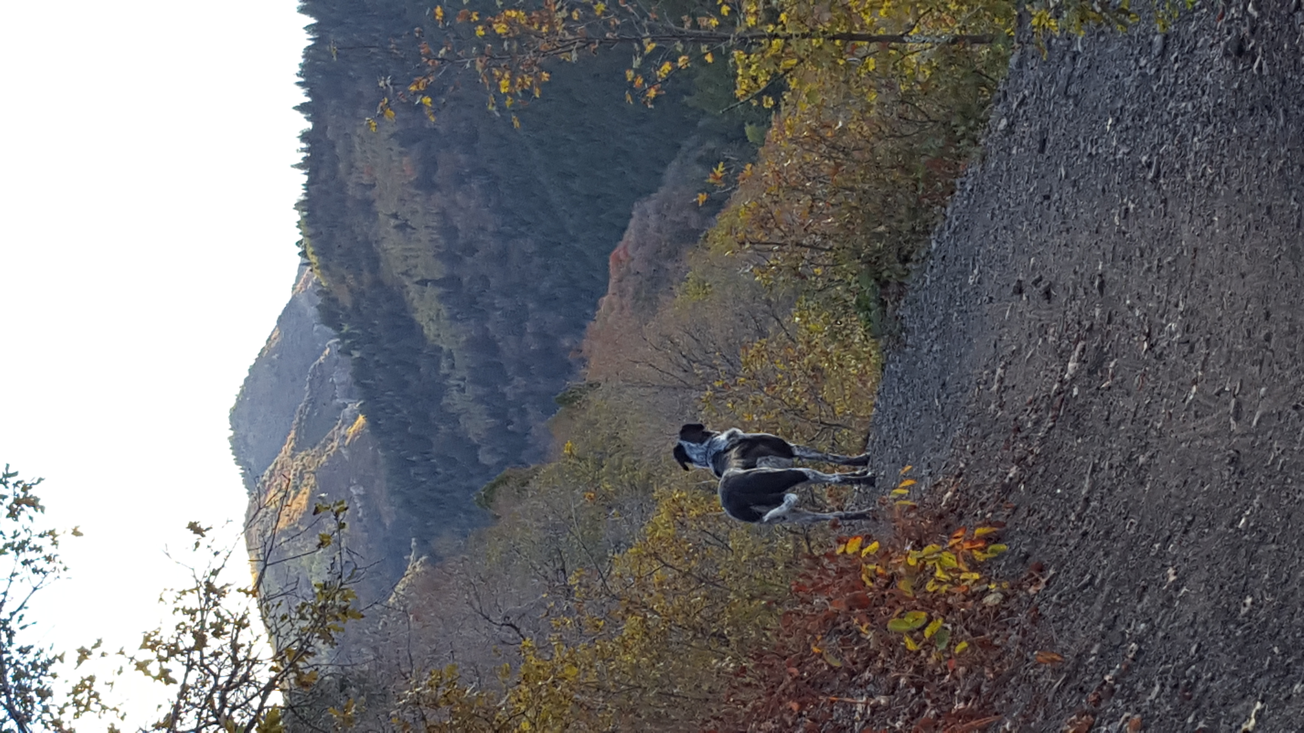
Mount Aire is an mountain summit located in Salt Lake County, Utah, United States. Description Mount Aire is located east-southeast of downtown Salt Lake City on land managed by Wasatch National Forest. The peak is set in the Wasatch Range which is a subset of the Rocky Mountains. Precipitation runoff from the mountain's south slope drains to Mill Creek, whereas the other slopes drain to Parleys Creek. Topographic relief is significant as the summit rises over above Parleys Canyon in 1.5 mile (2.4 km). Reaching the top involves 3.8 miles (round-trip) of trail hiking with 1,987 feet of elevation gain, and the summit provides excellent views of the surrounding mountains.Greg Witt, ''60 Hikes Within 60 Miles: Salt Lake City'', Menasha Ridge Press, 2012, , p. 89. This mountain's toponym has been officially adopted by the United States Board on Geographic Names The United States Board on Geographic Names (BGN) is a Federal government of the United States, federal bod ... [...More Info...] [...Related Items...] OR: [Wikipedia] [Google] [Baidu] |
Utah
Utah is a landlocked state in the Mountain states, Mountain West subregion of the Western United States. It is one of the Four Corners states, sharing a border with Arizona, Colorado, and New Mexico. It also borders Wyoming to the northeast, Idaho to the north, and Nevada to the west. In comparison to all the U.S. states and territories, Utah, with a population of just over three million, is the List of U.S. states and territories by area, 13th largest by area, the List of U.S. states and territories by population, 30th most populous, and the List of U.S. states by population density, 11th least densely populated. Urban development is mostly concentrated in two regions: the Wasatch Front in the north-central part of the state, which includes the state capital, Salt Lake City, and is home to roughly two-thirds of the population; and Washington County, Utah, Washington County in the southwest, which has approximately 180,000 residents. Most of the western half of Utah lies in ... [...More Info...] [...Related Items...] OR: [Wikipedia] [Google] [Baidu] |
Parleys Canyon
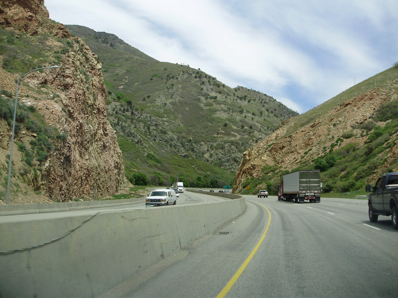
Parleys Canyon is a canyon located in the U.S. state of Utah. The canyon provides the route of Interstate 80 (I-80) (and previously the Lincoln Highway, U.S. Route 40, and a railroad) up the western slope of the Wasatch Mountains and is a relatively wide, straight canyon other than near its mouth. The mountain pass at the top of the canyon is known as Parleys Summit. With an elevation of , the pass is the highest point along I-80 in the state of Utah. Both features are named for Parley P. Pratt, an early settler of the Salt Lake Valley and leader of the Church of Jesus Christ of Latter-day Saints who surveyed the area to find a better transportation route through the Wasatch Mountains than the previous route which traversed Emigration Canyon. Description Parleys Canyon begins where I-215 merges into I-80 in Salt Lake City and ends at Parleys Summit. The lower part of the canyon is relatively twisty and narrow and had to be dynamited to make way for I-80. Despite this, the i ... [...More Info...] [...Related Items...] OR: [Wikipedia] [Google] [Baidu] |
Two-thousanders Of The United States
Two-thousanders are mountains that have a height of at least 2,000 metres above sea level, but less than 3,000 metres. The term is used in Alpine circles, especially in Europe (e.g. German: ''Zweitausender''). The two photographs show two typical two-thousanders in the Alps that illustrate different types of mountain. The Säuling (top) is a prominent, individual peak, whereas the Schneeberg (bottom) is an elongated limestone massif. In ranges like the Allgäu Alps, the Gesäuse or the Styrian-Lower Austrian Limestone Alps the mountain tour descriptions for mountaineers or hikers commonly include the two-thousanders, especially in areas where only a few summits exceed this level. Examples from these regions of the Eastern Alps are: * the striking Nebelhorn (2,224 m) near Oberstdorf or the Säuling (2,047 m) near Neuschwanstein, * the Admonter Reichenstein (2,251 m), Eisenerzer Reichenstein (2,165 m), Großer Pyhrgas (2,244 m) or Hochtor (2,3 ... [...More Info...] [...Related Items...] OR: [Wikipedia] [Google] [Baidu] |
Mountains Of Salt Lake County, Utah
A mountain is an elevated portion of the Earth's crust, generally with steep sides that show significant exposed bedrock. Although definitions vary, a mountain may differ from a plateau in having a limited summit area, and is usually higher than a hill, typically rising at least above the surrounding land. A few mountains are isolated summits, but most occur in mountain ranges. Mountains are formed through tectonic forces, erosion, or volcanism, which act on time scales of up to tens of millions of years. Once mountain building ceases, mountains are slowly leveled through the action of weathering, through slumping and other forms of mass wasting, as well as through erosion by rivers and glaciers. High elevations on mountains produce colder climates than at sea level at similar latitude. These colder climates strongly affect the ecosystems of mountains: different elevations have different plants and animals. Because of the less hospitable terrain and climate, mountai ... [...More Info...] [...Related Items...] OR: [Wikipedia] [Google] [Baidu] |
Mountains Of Utah
A mountain is an elevated portion of the Earth's crust, generally with steep sides that show significant exposed bedrock. Although definitions vary, a mountain may differ from a plateau in having a limited summit area, and is usually higher than a hill, typically rising at least above the surrounding land. A few mountains are inselberg, isolated summits, but most occur in mountain ranges. mountain formation, Mountains are formed through tectonic plate, tectonic forces, erosion, or volcanism, which act on time scales of up to tens of millions of years. Once mountain building ceases, mountains are slowly leveled through the action of weathering, through Slump (geology), slumping and other forms of mass wasting, as well as through erosion by rivers and glaciers. High elevations on mountains produce Alpine climate, colder climates than at sea level at similar latitude. These colder climates strongly affect the Montane ecosystems, ecosystems of mountains: different elevations hav ... [...More Info...] [...Related Items...] OR: [Wikipedia] [Google] [Baidu] |
Grandeur Peak
Grandeur Peak is an mountain summit in the Wasatch Range in Salt Lake County, Utah, United States. Description Grandeur Peak is located southeast of downtown Salt Lake City on land managed by Uinta-Wasatch-Cache National Foreste. The peak is part of the Wasatch Range, which is a subset of the Rocky Mountains. Precipitation runoff from the mountain's north slope drains to Parleys Creek, whereas the south slope drains to Mill Creek. Topographic relief is significant as the summit rises above Parleys Canyon in 1.25 mile (2 km) and above Millcreek Canyon in one mile (1.6 km). The peak is prominent on the Wasatch skyline, and it is the most accessible as well as easiest climb of the major peaks rising above the Salt Lake Valley.John Veranth, ''Hiking the Wasatch: A Hiking and Natural History Guide to the Central Wasatch'', 1988, Wasatch Mountain Club, , p. 73. Reaching the top involves 3.4 miles of trail hiking with 2,300 feet of elevation gain, and the summit p ... [...More Info...] [...Related Items...] OR: [Wikipedia] [Google] [Baidu] |
Millcreek Canyon (Salt Lake County, Utah)
Millcreek Canyon (also Mill Creek Canyon) ( Shoshoni: Tempin-Tekkoappah, “rock trap”) is a canyon in the Wasatch Mountains and part of Millcreek City on the east side of the Salt Lake Valley, Utah. It is a popular recreation area both in the summer and in the winter. It was named by Brigham Young on August 22, 1847, before all of the mills that were built in and below the densely forested canyon. It is home to two restaurants and six Boy Scout Day Camps. Millcreek Canyon is next to Parley's Canyon on the north and Big Cottonwood Canyon on the south. Though perhaps the most accessible canyon to Salt Lake City, its upper reaches are much less visited than neighboring canyons. Recreation Biking The upper trails in Millcreek Canyon (those above the winter gate, which is located at the Maple Grove picnic area) are open to biking on even-numbered days only. Bikes are allowed on the lower trails on all days. When riding on the road, bicycles are subject to the same laws as moto ... [...More Info...] [...Related Items...] OR: [Wikipedia] [Google] [Baidu] |
Interstate 80 In Utah
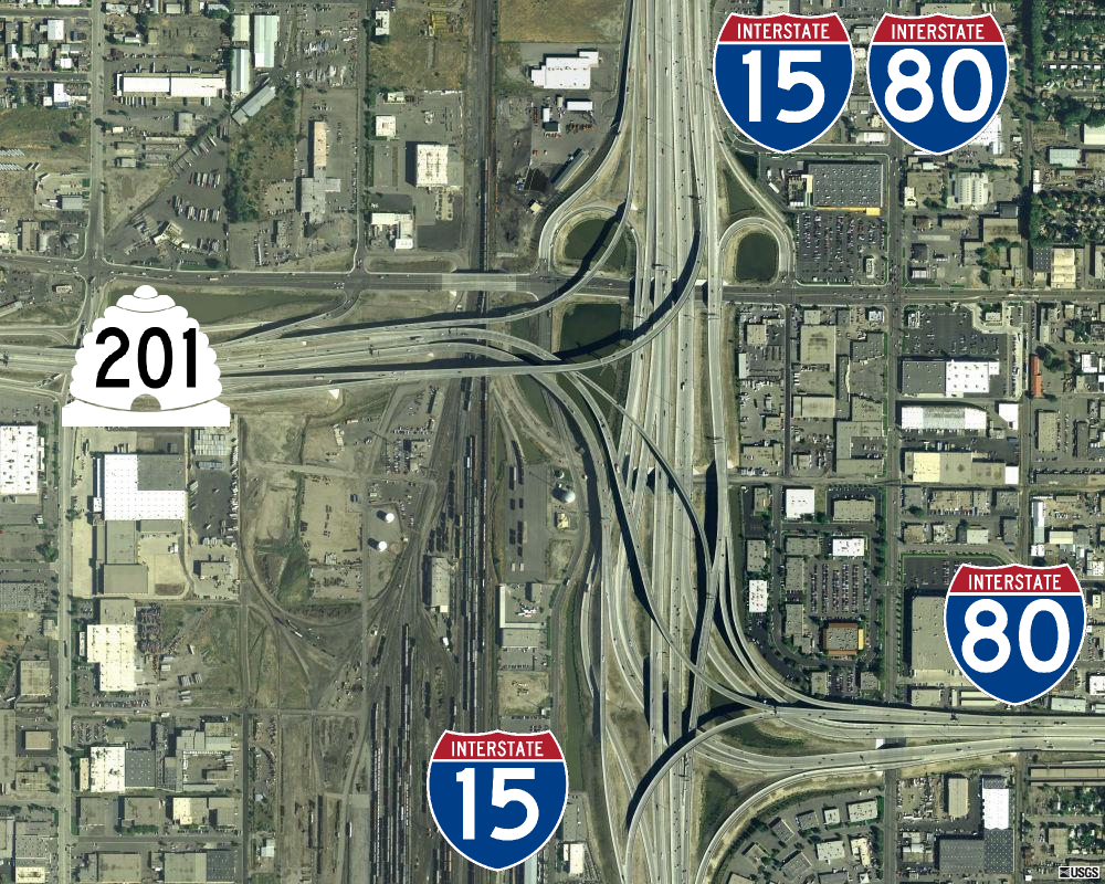
Interstate 80 (I-80) is a part of the Interstate Highway System that runs from San Francisco, California, to Teaneck, New Jersey. The portion of the highway in the US state of Utah is long through the northern part of the state. From west to east, I-80 crosses the state line from Nevada in Tooele County and traverses the Bonneville Salt Flats—which are a part of the larger Great Salt Lake Desert. It continues alongside the Wendover Cut-off—the corridor of the former Victory Highway— US Route 40 (US-40) and the Western Pacific Railroad Feather River Route. After passing the Oquirrh Mountains, I-80 enters the Salt Lake Valley and Salt Lake County. A short portion of the freeway is concurrent with I-15 through Downtown Salt Lake City. At the Spaghetti Bowl, I-80 turns east again into the mouth of Parleys Canyon and Summit County, travels through the mountain range, and intersects the eastern end of I-84 near Echo Reservoir before turning northeast toward ... [...More Info...] [...Related Items...] OR: [Wikipedia] [Google] [Baidu] |
Mount Aire Se
Mount is often used as part of the name of specific mountains, e.g. Mount Everest. Mount or Mounts may also refer to: Places * Mount, Cornwall, a village in Warleggan parish, England * Mount, Perranzabuloe, a hamlet in Perranzabuloe parish, Cornwall, England People * Mount (surname) * William L. Mounts (1862–1929), American lawyer and politician Computing and software * Mount (computing), the process of making a file system accessible * Mount (Unix), the utility in Unix-like operating systems which mounts file systems Books * ''Mount!'', a 2016 novel by Jilly Cooper Displays and equipment * Mount, a fixed point for attaching equipment, such as a hardpoint on an airframe * Mounting board, in picture framing * Mount, a hanging scroll for mounting paintings * Mount, to display an item on a heavy backing such as foamcore, e.g.: ** To pin a biological specimen, on a heavy backing in a stretched stable position for ease of dissection or display ** To prepare dead animal ... [...More Info...] [...Related Items...] OR: [Wikipedia] [Google] [Baidu] |
United States Board On Geographic Names
The United States Board on Geographic Names (BGN) is a Federal government of the United States, federal body operating under the United States Secretary of the Interior. The purpose of the board is to establish and maintain uniform usage of geography, geographic names throughout the federal government of the United States. History Following the American Civil War, more and more American pioneer, American settlers began moving westward, prompting the Federal government of the United States, U.S. federal government to pursue some sort of consistency for referencing landmarks on maps and in official documents. As such, on January 8, 1890, Thomas Corwin Mendenhall, superintendent of the United States Coast and Geodetic Survey Office, wrote to 10 noted geographers "to suggest the organization of a Board made up of representatives from the different Government services interested, to which may be referred any disputed question of geographical orthography." President Benjamin Harrison si ... [...More Info...] [...Related Items...] OR: [Wikipedia] [Google] [Baidu] |
Topographic Relief
Terrain (), alternatively relief or topographical relief, is the dimension and shape of a given surface of land. In physical geography, terrain is the lay of the land. This is usually expressed in terms of the elevation, slope, and orientation of terrain features. Terrain affects surface water flow and distribution. Over a large area, it can affect weather and climate patterns. Bathymetry is the study of underwater relief, while hypsometry studies terrain relative to sea level. Importance The understanding of terrain is critical for many reasons: * The terrain of a region largely determines its suitability for human settlement: flatter alluvial plains tend to have better farming soils than steeper, rockier uplands. * In terms of environmental quality, agriculture, hydrology and other interdisciplinary sciences; understanding the terrain of an area assists the understanding of watershed boundaries, drainage characteristics, drainage systems, groundwater systems, water ... [...More Info...] [...Related Items...] OR: [Wikipedia] [Google] [Baidu] |
Salt Lake County, Utah
Salt Lake County is located in the U.S. state of Utah. As of the 2020 United States census, the population was 1,185,238, making it the most populous county in Utah. Its county seat and largest city is Salt Lake City, the List of capitals in the United States, state capital. The county was created in 1850. Salt Lake County is the 37th most populated county in the United States and is one of four counties in the Rocky Mountains to make it into the top 100. (Others being Denver, Denver County and El Paso County, Colorado, El Paso County, Colorado and Clark County, Nevada.) Salt Lake County has been the only county of the first class in Utah – under the Utah Code (Title 17, Chapter 50, Part 5) is a county with a population of 1,000,000 or greater. Salt Lake County occupies the Salt Lake Valley, as well as parts of the surrounding mountains, the Oquirrh Mountains to the west and the Wasatch Range to the east (essentially the entire Jordan River (Utah)#Watershed, Jordan River water ... [...More Info...] [...Related Items...] OR: [Wikipedia] [Google] [Baidu] |


