|
Moshava
A moshava (, plural: ''moshavot'' , ''colony'' or ''village'') was a form of agricultural Jewish settlement in the Palestine (region), region of Palestine (now Israel), established by the members of the Old Yishuv beginning in the late 1870s and during the first two waves of Jewish Zionism, Zionist immigration – the First Aliyah, First and Second Aliyah. History In a moshava, as opposed to later communal settlements like the kibbutz and the moshav (plural ''moshavim''), all the land and property are privately owned. The first moshavot were established by the members of the Old Yishuv, Jewish community already living in, and by pioneers of the arriving to, Ottoman Syria. The economy of the early moshavot was based on agriculture and resembled the grain-growing villages of eastern Europe in layout. Farms were established along both sides of a broad main street. Petah Tikva, known as the "Mother of the Moshavot" (''Em HaMoshavot''), was founded in 1878 by members of the Old ... [...More Info...] [...Related Items...] OR: [Wikipedia] [Google] [Baidu] |
Mishmar HaYarden (moshava)
Mishmar HaYarden was a moshava (Jewish settlement) that was established in the Upper Galilee in northern Israel during the First Aliyah. It was destroyed during the 1948 Arab–Israeli war in 1948. Its Hebrew name meant ''Guardian of the Jordan''. The village was re-established as new Mishmar HaYarden. History The moshava was located on the road connecting Safed with Damascus (today Highway 91 (Israel), Highway 91) west of the Bnot Ya'akov Bridge. It was first founded in 1884 as a private farm named "Shoshanat HaYarden" (Rose of the Jordan) by Mordecai Isaac Lubowsky. After he realized that he could not maintain the isolated farm, he sold a portion to Jews who settled the land with financial support from Hovevei Zion. They established the moshava "Mishmar HaYarden" in September 1890. In 1898 the moshava expanded to include the moshava of Jewish Colonization Association, Hevrat Yaka, which added land and inhabitants. Most inhabitants supported the Revisionist Zionism, revisionist ... [...More Info...] [...Related Items...] OR: [Wikipedia] [Google] [Baidu] |
Yavneel
Yavne'el (, ) is a moshava and local council in the Northern District of Israel. Founded in 1901, it is one of the oldest rural Jewish communities in the country. According to the Israel Central Bureau of Statistics (CBS), in it had a population of . In 2008 the population had been 3,100, with a growth rate of 1.4%. History Archaeology: Bronze Age to Mamluk period Remains from the Late Bronze Age,, cited in Iron Age I–II, Persian, Hellenistic, Roman, Late Byzantine, Early Muslim and Mamluk periods have been found here. A residential building constructed in the Umayyad period that continued to be inhabited during the Abbasid period (eighth–tenth centuries CE) has been excavated here. Ottoman period Arab village During the Ottoman period, the Muslim village in the area was known as ''Yemma''. The village was mentioned in the Ottoman defter for the year 1555-6, located in the ''Nahiya'' of Tabariyya of the '' Liwa'' of Safad, with its land designated as ''timar''. A ma ... [...More Info...] [...Related Items...] OR: [Wikipedia] [Google] [Baidu] |
Rishon LeZion
Rishon LeZion ( , "First to Zion") is a city in Israel, located along the central Israeli coastal plain south of Tel Aviv. It is part of the Gush Dan metropolitan area. Founded in 1882 by Jewish immigrants from the Russian Empire who were part of the First Aliyah, it was the first settlement founded in Israel by the New Yishuv and the second Jewish farm settlement established in Ottoman Syria in the 19th century, after Petah Tikva. As of 2017, it was the fourth-largest city in Israel, with a population of . The city is a member of Forum 15, which is an association of fiscally autonomous cities in Israel that do not depend on national balancing or development grants. Etymology The name Rishon LeZion is derived from a verse from the Tanakh: "First to Zion are they, and I shall give herald to Jerusalem" ( Isaiah 41:27) and literally translates as "First to Zion". History Ottoman period (1882–1900) Rishon LeZion was founded on 31 July 1882, by ten Hovevei Zion pione ... [...More Info...] [...Related Items...] OR: [Wikipedia] [Google] [Baidu] |
Rehovot
Rehovot (, / ) is a city in the Central District (Israel), Central District of Israel, about south of Tel Aviv. In it had a population of . Etymology Israel Belkind, founder of the Bilu (movement), Bilu movement, proposed the name "Rehovot" () based on Book of Genesis, Genesis 26:22: "And he called the name of it ''Rehoboth''; and he said: 'For now the Lord hath made room for us, and we shall be fruitful in the land'." This Bible verse is also inscribed in the city's logo. The biblical town of ''Rehoboth (Bible), Rehoboth'' was located in the Negev, Negev Desert. History Rehovot was established in 1890 by pioneers of the First Aliyah on the coastal plain near a site called ''Khirbat Deiran'', an "abandoned or sparsely populated" estate, which now lies in the center of the built-up area of the city. According to Marom, Deiran offered "a convenient launching pad for early land purchase initiatives which shaped the pattern of Jewish settlement until the beginning of the Brit ... [...More Info...] [...Related Items...] OR: [Wikipedia] [Google] [Baidu] |
Rosh Pinna
Rosh Pinna () or Rosh Pina, is a town in the Korazim Plateau in the Upper Galilee on the eastern slopes of Mount Kna'an in the Northern District of Israel. It was established as Gei Oni in 1878 by local Jews from Tzfat but was nearly abandoned, except for the families of Yosef Friedman, Aharon Keller, and possibly a few others. In 1882, thirty Jewish families who had emigrated from Romania reestablished the settlement as a ''moshava'' called Rosh Pina. The town is one of the oldest Zionist settlements in Israel. In it had a population of . Geography Rosh Pinna is located north of the Sea of Galilee, on the eastern slopes of Mount Kna'an, approximately east of the city of Safed, above sea level, latitude north 32° 58', longitude east 35° 31'. North of Rosh Pina is Lake Hula, which was a swamp area drained in the 1950s. History In the spring of 1878, the Arab village of al-Ja'una sold half its lands, about 2,500 dunum, to Jews from Safed in order to fund the emigratio ... [...More Info...] [...Related Items...] OR: [Wikipedia] [Google] [Baidu] |
Yesud HaMa'ala
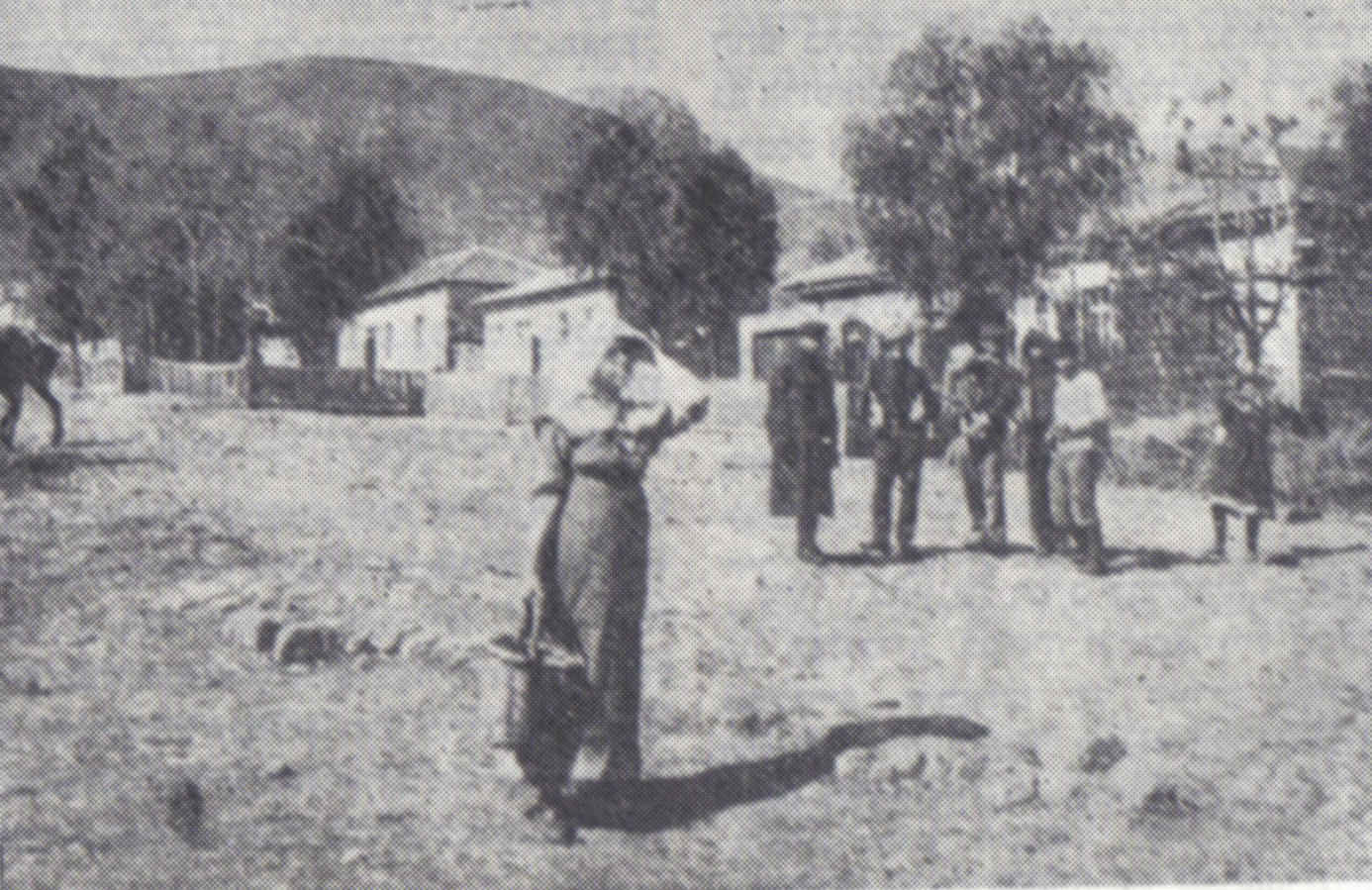
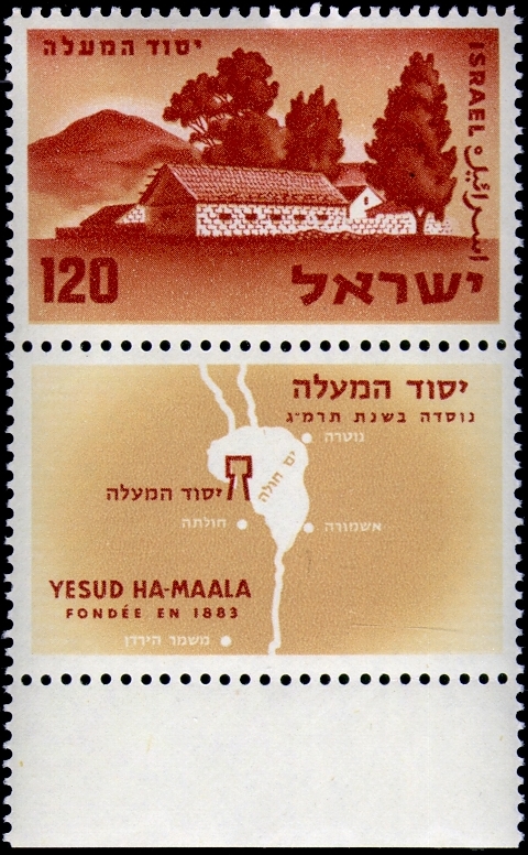
Yesud HaMa'ala () is a moshava and local council in northern Israel. The moshava was the first modern Jewish community in the Hula Valley. Built in 1883, the community was among a series of agricultural settlements founded during the First Aliyah. Jewish Agency In it had a population of . Etymology The name of the village was taken from a sentence in the : "He () determined to go up." (), which was connected to the |
First Aliyah
The First Aliyah (), also known as the agriculture Aliyah, was a major wave of Jewish immigration (''aliyah'') to History of Israel#Ottoman period , Ottoman Palestine (region) , Palestine between 1881 and 1903. Jews who migrated in this wave came mostly from Eastern Europe and from Yemen, stimulated by pogroms and violence against the Jewish communities in those areas. An estimated 25,000 Jews immigrated. Many of the European Jewish immigrants during the late 19th-early 20th century period gave up after a few months and went back to their country of origin, often suffering from hunger and disease.Joel BrinkleyAs Jerusalem Labors to Settle Soviet Jews, Native Israelis Slip Quietly Away The New York Times, 11 February 1990. Quote: "In the late 19th and early 20th century many of the European Jews who set up religious settlements in Palestine gave up after a few months and returned home, often hungry and diseased.". Accessed 4 May 2020. During the first Aliyah, agricultural settleme ... [...More Info...] [...Related Items...] OR: [Wikipedia] [Google] [Baidu] |
Hovevei Zion
The Lovers of Zion, also ''Hovevei Zion'' () or ''Hibbat Zion'' (, ), were a variety of proto-Zionist organizations founded in 1881 in response to the anti-Jewish pogroms in the Russian Empire and were officially constituted as a group at a conference led by Leon Pinsker in 1884. The organizations are now considered the forerunners and foundation-builders of modern Zionism. Many of the first groups were established in Eastern European countries in the early 1880s with the aim to promote Jewish immigration to Palestine, and advance Jewish settlement there, particularly agricultural. Most of them stayed away from politics. History 19th century Palestine was inhabited by Muslims, Armenians, Christians, and Jews. As early as 1840 Moses Montefiore advocated for the Jews in the Ottoman Empire, which controlled the areas of Palestine, meeting with British consul Henry John Temple, 3rd Viscount Palmerston to get Muhammad Ali of Egypt and Abdülmecid I, sultan of the Ottoman Empir ... [...More Info...] [...Related Items...] OR: [Wikipedia] [Google] [Baidu] |
Ness Ziona
Ness Ziona (, ''Nes Tziyona'') is a city in Central District (Israel), Central District, Israel. In it had a population of , and its jurisdiction was 15,579 dunams (). Identification Lying within Ness Ziona's city bounds is the ruin of the Arab village of Sarafand al-Kharab, which was depopulated in 1948. Some scholars believe that this is the site that the medieval Jewish traveller Ishtori Haparchi identified as the Talmudic ''Tzrifin'', but other scholars believe Haparchi was referring to Sarafand al-Amar, 5 km distant. However, neither site has revealed archaeological remains from Talmudic times. On the basis of excavations at Sarafand al-Kharab, it is believed to have been founded no earlier than the late Byzantine period. History Wadi Chanin/Nahalat Reuben German farm (1878–1883) In 1878, the Germany, German Templers (religious believers), Templer Gustav Reisler purchased lands in Wadi Hunayn, planted an orchard, and lived there with his family. The name "Wadi-Chan ... [...More Info...] [...Related Items...] OR: [Wikipedia] [Google] [Baidu] |
Gedera2 (before 1899)
Gedera, or less commonly known as Gdera (), is a town in the southern part of the Shfela region in the Central District of Israel founded in 1884. It is south of Rehovot. In , it had a population of . History Gedera is in the Book of Chronicles I 4:23 and the Book of Joshua 15:36 as a town in the territory of Judah. Its identification with the site of modern Gedera was proposed by Victor Guérin in the 19th century, but was dismissed as "impossible" by William F. Albright who preferred to identify it with al-Judeira. Biblical Gedera is now identified with Khirbet Judraya, south of Bayt Nattif. Tel Qatra, which lies at the northern edge of Gedera, is usually identified with Kedron, a place fortified by the Seleucids against the Hasmonaeans (1 Macc. 15:39–41, 16:9). It has also been identified with Gedrus, a large village in the time of Eusebius (fourth century). Eusebius identified Gedrus with biblical Gedor, which is a name also appearing on the Madaba map, but seve ... [...More Info...] [...Related Items...] OR: [Wikipedia] [Google] [Baidu] |
Bat Shlomo
Bat Shlomo () is a moshav in northern Israel. Located on the southern slopes of Mount Carmel near Binyamina and Zikhron Ya'akov, it originally was built on 8,068 dunams of land. It falls under the jurisdiction of Hof HaCarmel Regional Council and had a population of in . History The village was established in 1889 as a daughter-settlement of Zichron Ya'akov, funded by Baron Rothschild, on land purchased from the Arab village of Umm al-Tut. It was named after Betty von Rothschild, the daughter of Salomon Mayer von Rothschild (the Baron's uncle and grandfather).Hareuveni, Imanuel (2010). Eretz Israel Lexicon' (in Hebrew). Matach. p. 166. According to a census conducted in 1922 by the British Mandate authorities, Bat Shlomo had a population of 66 inhabitants, consisting of 53 Jews and 13 Muslims. By 1947 it had a population of 100. In 1951 a moshav was established by Transylvanian and Yemenite immigrants adjacent to the original village. Economy The moshav was a major grape su ... [...More Info...] [...Related Items...] OR: [Wikipedia] [Google] [Baidu] |
Old Yishuv
The Old Yishuv (, ''haYishuv haYashan'') were the Jewish communities of the Land of Israel during the Ottoman period, up to the onset of Zionist aliyah waves, and the consolidation of the new Yishuv by the end of World War I. Unlike the new Yishuv, characterized by secular and Zionist ideologies promoting labor and self-sufficiency, the Old Yishuv primarily consisted of religious Jews who relied on external donations ('' halukka'') for support. The Old Yishuv evolved following a significant decline in Jewish communities across the region during late antiquity and the early Middle Ages, and was composed of three clusters. Firstly, Ladino-speaking Sephardic Jewish communities settled in the region during the late Mamluk and early Ottoman periods, alongside Arabic-speaking ''Musta'arabi'' communities, who had already been living there since before the coming of Islam and had been culturally and linguistically Arabized. Secondly, Ashkenazi Jews emigrated from Europe in the 18th ... [...More Info...] [...Related Items...] OR: [Wikipedia] [Google] [Baidu] |


